
This Scenic Massachusetts Rail Trail Crosses The Connecticut River And Follows A Historic Canal
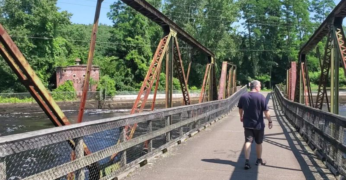
What if one easy trail could deliver river views, old bridges, canal history, and a peaceful ride all in the same afternoon?
This scenic Massachusetts route follows a former railroad corridor through a landscape shaped by industry and water.
One stretch runs beside a historic canal, while another carries visitors across the Connecticut River with broad views in every direction.
The path is paved and mostly level, making it a comfortable choice for cyclists, walkers, families, and anyone craving a relaxed outdoor escape. Old mill buildings and industrial landmarks add character without taking attention away from the scenery.
There is always something new around the next bend. A quiet section beside the water can suddenly open onto a bridge, a river crossing, or another reminder of the area’s working past.
It is short enough for an easy outing but interesting enough to make every mile feel worthwhile.
The Historic Bridge That Spans The Connecticut River
Few bridges in Massachusetts carry as much history as the one at the heart of this trail.
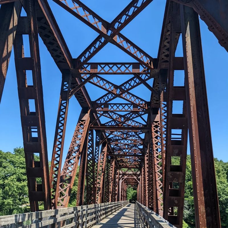
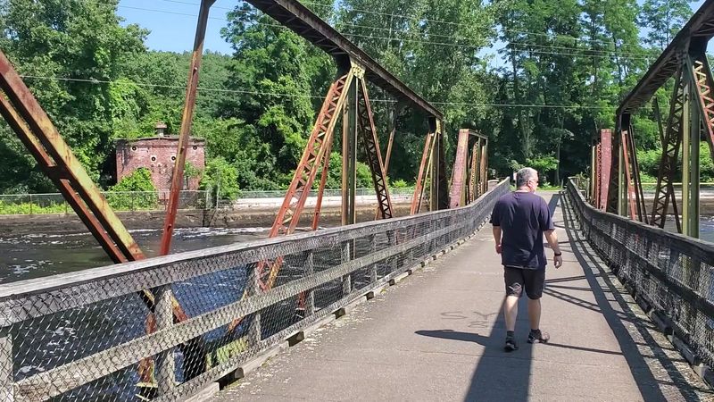
The Canalside Rail Trail Bridge, originally constructed in 1880 by the Keystone Bridge Company, once served the New York, New Haven and Hartford Railroad on its Turners Falls Branch.
That alone makes it worth crossing slowly.
Two of its three spans were rebuilt in 1936 after flood damage, but one original span still stands. That surviving piece of ironwork is recognized as the oldest remaining span across the Connecticut River.
The bridge was refurbished in 2006 to become part of the rail trail and now appears on the Massachusetts Historic Bridge Inventory.
Walking across it, the scale of the river becomes clear. The Connecticut stretches wide below, and the surrounding landscape opens up in a way that feels almost cinematic.
The bridge connects the trail across a waterway that has shaped this region for centuries. It is not just a crossing.
It is a conversation between the present and a well-worn industrial past that refuses to be forgotten.
Two Miles Of Trail Running Alongside A Canal Built In The 1860s
Colonel Alvah Crocker had a vision in the 1860s. He oversaw the construction of a canal in Turners Falls that would power the mills and factories rising along its banks.
More than 150 years later, that same canal still flows, and the trail runs beside it for roughly two miles of the route.
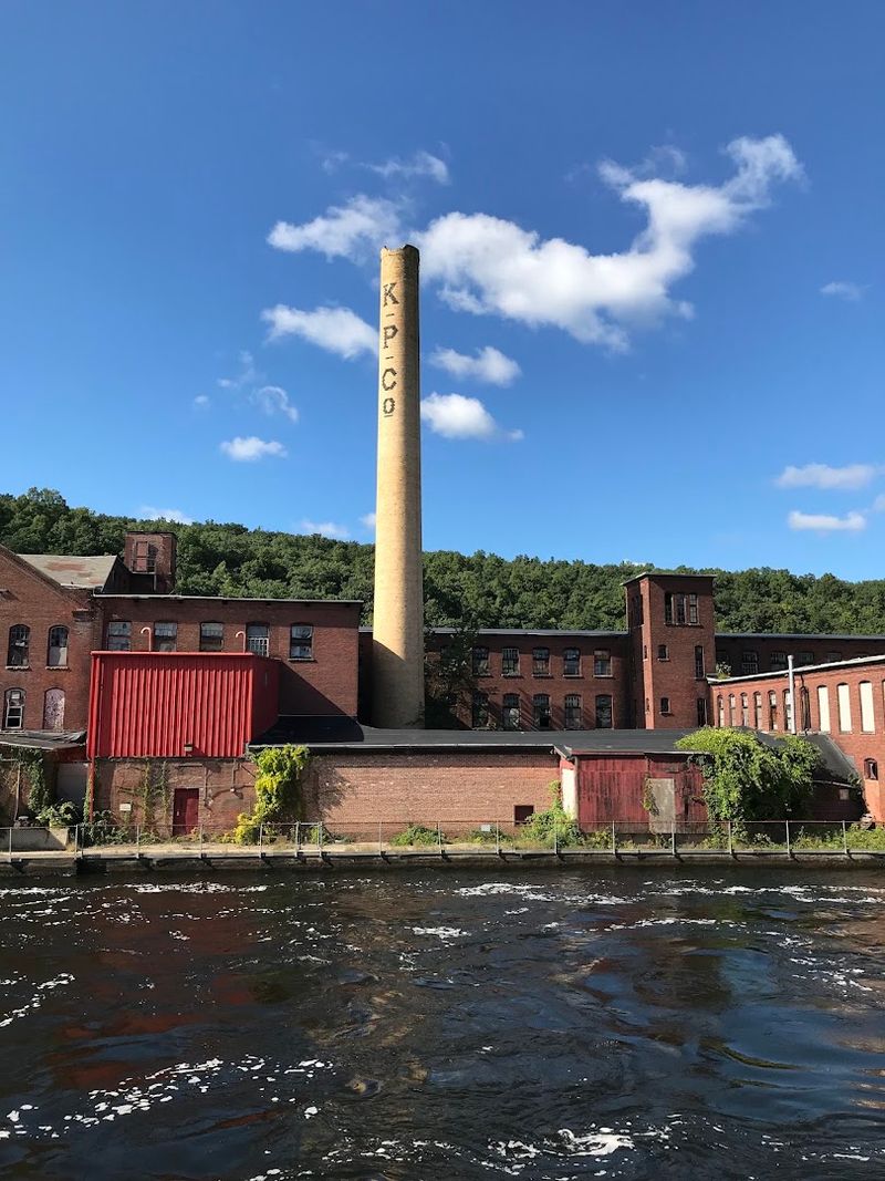
This stretch is the kind of path that rewards a slow pace. The canal water is calm and reflective, and the brick facades of old factories line the opposite bank with a quiet dignity.
Small trestle bridges appear along the way, adding texture and character to the walk or ride.
Wildlife is a steady presence here. Swans, herons, cormorants, ducks, geese, and swallows all make regular appearances along the canal.
Some days the water is still enough to mirror the sky perfectly. The trail is paved and easy to follow, making it accessible for cyclists, walkers, and inline skaters alike.
This segment is what gives the trail its name and its identity. The canal is not just scenery here.
It is the spine of the entire experience, holding the history and the natural world in the same unhurried frame.
The Full Route From East Deerfield To Unity Park In Turners Falls
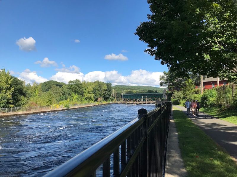
The trail covers approximately 3.7 to 3.8 miles in total, running from McClelland Farm Road in Deerfield at the southern end to Unity Park on Barton’s Cove at the northern terminus in Turners Falls.
That makes a round trip of just over seven miles, which is manageable for most fitness levels in a single outing.
The route follows a former rail bed, which means the grade is almost entirely flat. That consistent surface makes it welcoming for people who prefer a steady, uninterrupted rhythm.
Biking, running, walking, and even rollerblading all work well here.
The landscape shifts as the trail progresses. Near the southern end, agricultural land spreads out on either side, giving the path an open, rural quality.
Moving north, the canal and its surrounding mill buildings take over the scenery. Then comes the bridge, the river views, and finally Unity Park and Barton’s Cove.
Dogs are welcome on leash, and parking is available at both trailheads. The trail is part of the Connecticut River Greenway State Park and is generally open from sunrise to sunset, with official hours running from 7 AM to 6 PM daily.
Unity Park And Barton’s Cove At The Northern Trailhead
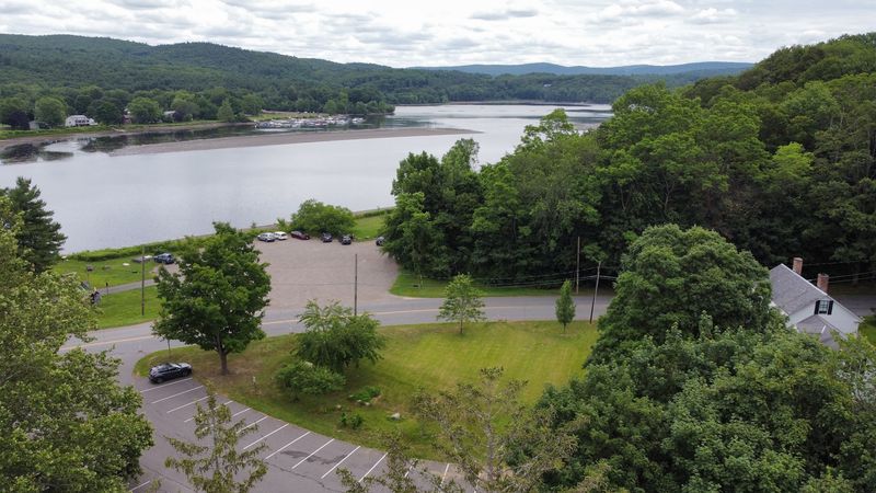
Barton’s Cove is a widened section of the Connecticut River, and Unity Park sits right at its edge.
This is where the northern end of the Canalside Rail Trail lands, and it makes for a satisfying destination whether you have walked the full length or simply started here for a shorter outing.
The park has space for picnicking along the water, and recreational facilities are available on the grounds. The cove itself is broad and calm, with a different atmosphere than the river views from the bridge.
Here, the water feels approachable rather than dramatic.
Starting the trail from Unity Park also means you get the canal and bridge experience ahead of you as you move south, which is an equally rewarding direction.
The area around the northern trailhead also puts you close to the Great Falls Discovery Center, which houses exhibits on the natural and industrial history of the Connecticut River valley.
For anyone curious about what shaped this part of Massachusetts, that combination of outdoor trail and indoor learning makes the northern end of the route a natural anchor point for an afternoon well spent in Turners Falls.
The Turners Falls Fishway And Its Underwater Viewing Windows
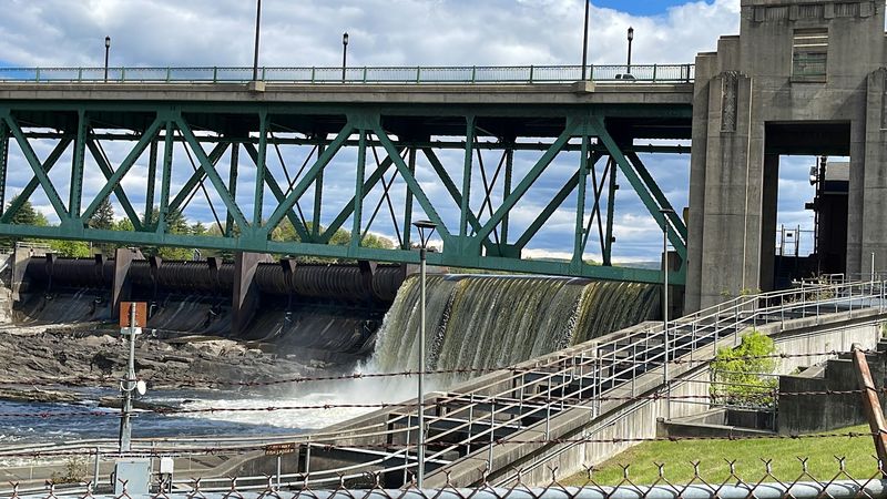
Every spring, something remarkable happens near the Turners Falls Dam.
Migratory fish including Atlantic salmon and American shad begin their journey upstream, and the Turners Falls Fishway gives them a way to get past the dam through three fish ladders.
It also gives curious onlookers a front-row seat.
Underwater viewing windows are open to the public during migration season, which typically runs from early May through early June. Watching fish move through those windows is one of those experiences that is hard to describe but easy to remember.
The scale of the migration, seen up close through glass, carries a kind of quiet drama.
The fishway is located near the northern section of the trail, making it a natural stop on any walk or ride along the route.
It connects the trail experience to the broader ecological story of the Connecticut River, a waterway that has been the subject of significant conservation efforts over the decades.
For younger trail users especially, the fishway offers something tangible and memorable.
It is one of those details that elevates the Canalside Rail Trail, 2 Avenue A, Turners Falls, from a pleasant path into something genuinely educational and worth planning a visit around during the right season.
Views Of The Connecticut River Reservoir And Turners Falls Dam
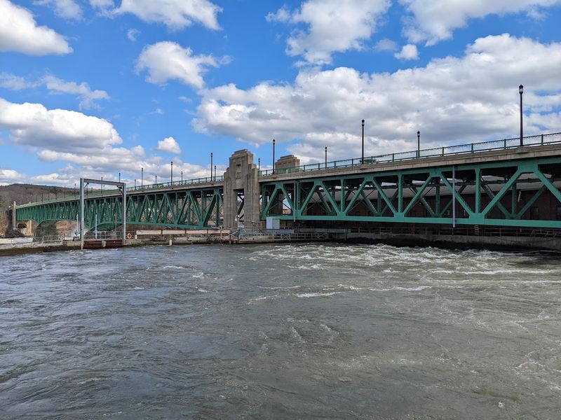
There is a particular moment on the trail, somewhere near the bridge, where the Turners Falls Dam comes into full view. The reservoir stretches behind it, wide and still, while the river continues below.
It is one of those views that makes you stop walking without quite deciding to.
The dam has shaped this stretch of the Connecticut River for well over a century. Its presence explains the canal, the mills, the fishway, and much of the industrial character that defines Turners Falls as a town.
From the trail, it reads as both an engineering landmark and a natural dividing line in the river’s geography.
Photographers who come to the trail often target this area, especially in the late afternoon when the light falls across the water at a low angle. The reservoir adds a sense of scale that the canal section does not offer.
Both have their appeal, but the dam and reservoir view brings a kind of grandeur to the experience that balances the quieter, more intimate atmosphere of the canal walk.
It is the kind of scenery that stays with you after the trail ends and the drive home begins.
The East Deerfield Rail Yard Near The Southern Terminus
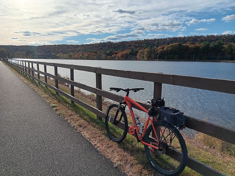
Rail enthusiasts have a reason to pay extra attention near the southern end of the trail.
The active East Deerfield Yard sits close to the McClelland Farm Road trailhead, and on the right day, you can watch locomotives and freight cars moving through one of New England’s busiest classification yards.
It is an unexpected bonus at the end of a trail already full of character.
The yard operates around the clock, so the chances of catching some activity are reasonably good. There is something satisfying about a trail that began on a historic railroad bridge and ends within sight of a working rail operation.
The connection between past and present feels deliberate, even if it is purely geographical.
The surrounding area near the southern terminus also transitions into agricultural land, which provides a strong visual contrast to the brick and water of the canal section.
Open fields replace factory facades, and the trail feels wider and airier as it approaches Deerfield.
For anyone who appreciates industrial history alongside natural scenery, this end of the route delivers a different kind of reward. It is quieter, more rural, and grounded in the everyday working landscape of western Massachusetts.
Wildlife Along The Canal And River Throughout The Seasons
The canal has a way of drawing birds in. Swans move along its surface with complete indifference to passing trail users.
Herons stand motionless at the water’s edge, scanning for movement below. Cormorants dry their wings on old stonework, and swallows cut low arcs over the water on summer evenings.
The variety is consistent enough that bringing a pair of binoculars is genuinely worthwhile.
Geese and ducks are year-round regulars, but the canal’s wildlife calendar shifts with the seasons. Spring brings the fish migration and the activity around the fishway.
Summer fills the trees with songbirds. Autumn changes the light and the foliage along the banks, turning the canal stretch into something almost painterly.
The Connecticut River itself adds another layer of wildlife interest. Barton’s Cove, at the northern end, is known as a gathering point for bald eagles during certain times of year.
The river corridor functions as a migration route for birds moving through the region, which means the trail offers different rewards depending on when you walk it. Nature here is not a backdrop.
It is an active participant in the experience, and it does not stay still long enough to be taken for granted.