
This Scenic Nevada Byway Gets Even More Beautiful When The Leaves Change
Cool air spills downhill while the desert floor keeps baking below. A Nevada byway climbs straight into another world just past the city lights.
Temperatures drop twenty degrees in a handful of miles. Leaves ignite in gold and rust, turning a quiet drive into a color show.
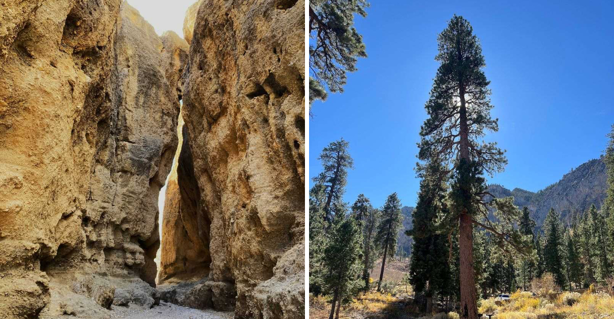
Around every bend waits a surprise, from a narrow slot canyon to a shaded picnic spot.
Eagles ride the thermals while foxes vanish before the camera can focus.
One curve reveals a sweeping valley, and the next hides a narrow passage carved by centuries of water.
This Nevada escape rewards anyone willing to slow the car down. Pack a jacket, grab a camera, and leave room for one more stop.
The gold will not last forever, so plan that drive soon.
The Climb That Changes Everything
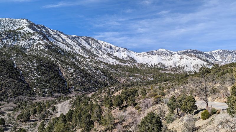
Five thousand feet of elevation gain does wonderful things to a thermometer. Kyle Canyon Road, officially State Route 157, starts near U.S.
Highway 95 and lifts drivers into the heights of Mount Charleston in Clark County, Nevada.
Summit temperatures often run twenty to thirty degrees cooler than the valley floor. That single fact explains why locals treat this road as a pressure-release valve.
The ecosystems shift as fast as the temperature. Creosote bush and Mojave yucca give way to ponderosa pine and white fir within a handful of miles.
Pullouts appear regularly, so photographers rarely feel rushed. Sweeping views stretch toward bare peaks standing above the treeline.
Cell service can thin out on the upper stretches. Downloading maps before leaving pavement-level Las Vegas saves frustration later.
The road is maintained highway, not a rough track, and it sits in the Spring Mountains National Recreation Area of Nevada. Look for it heading west off Highway 95, roughly 36.2773, -115.4831.
Few short drives rearrange a landscape so completely.
Aspens Putting On A Gold Show
Gold against evergreen is the reason people set alarms in October. Aspen stands along the canyon shift from green to yellow and light orange, painting bold streaks across the hillsides.
The change generally begins around mid-September at higher elevations. Peak color often falls in the first ten days of October, though weather can nudge that window either direction.
Contrast makes the display work. Dark conifers frame the bright leaves, and the effect intensifies when afternoon sun hits the slopes sideways.
Roadside picnic areas double as viewing platforms. Several sit close enough to aspen groves that leaves crunch underfoot while lunch gets unpacked.
Weekends fill quickly during color season. Arriving early means better parking and softer light for photos.
Wind and early storms can strip branches fast, so flexibility beats rigid planning. Checking recent color reports before driving up helps set expectations.
Bring a jacket. The same breeze that shakes the aspens tends to sneak right through a t-shirt.
Start At The Spring Mountains Visitor Gateway
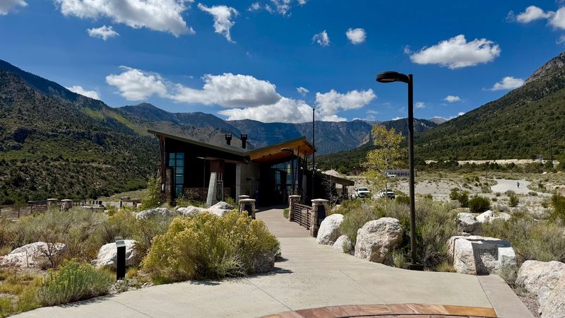
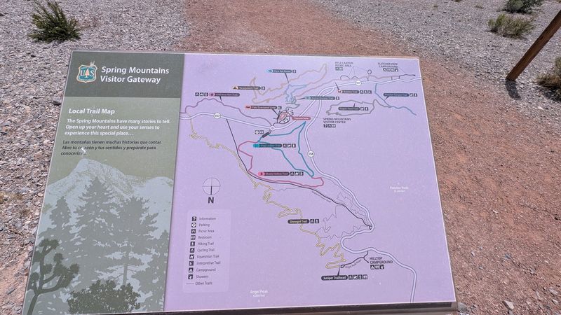
Ninety acres of orientation space is a generous welcome mat. The Spring Mountains Visitor Gateway sits along the byway and works as the natural first stop for anyone heading uphill.
Facilities include a visitor center, an education building, and several group picnic areas. Two amphitheaters host programs and gatherings throughout the year.
Benches line open viewing areas, and the panoramas justify the pause. Kyle Canyon spreads out below while Charleston Peak looms above.
Seven Stones Plaza adds meaning to the scenery. The installation honors seven Paiute tribes who regard this range as a sacred creation site.
Interpretive displays explain the mountain’s plants, animals, and geology in plain language. Kids tend to linger longer here than parents expect.
Restrooms and water make this a smart place to prepare before longer stretches without services. Trail maps and current condition updates are usually available too.
Skipping it saves twenty minutes. Stopping in usually makes the rest of the day smarter.
Narrow Walls At Kyle Canyon Slots Trailhead
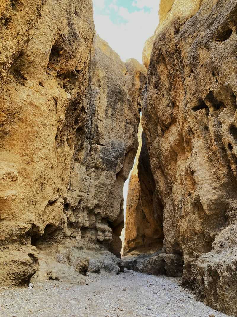
Slot canyons in the Mount Charleston area surprise almost everyone. The Kyle Canyon Slots Trailhead hides off the main byway, reached by turning onto Harris Springs Road a short distance west of Highway 95.
The route threads through a series of narrow passages. Conglomerate rock walls, shaped by long stretches of erosion, twist into odd and appealing formations.
Distance is modest. A roughly 0.4-mile round trip delivers a solid taste of the geology, while longer options continue for hikers wanting more.
Shade keeps the passages cool. Birdsong bounces off the rock, which makes the whole walk feel unexpectedly quiet.
Footing includes loose gravel and small rock steps. Closed-toe shoes handle it far better than sandals.
Weather awareness matters in any slot canyon. Skipping the trip when storms threaten is simply good sense.
Photographers should aim for midday, when light drops into the narrows. Later hours leave the walls flat and shadowed.
Short trail, long memory.
Rugged Ground Around Harris Springs
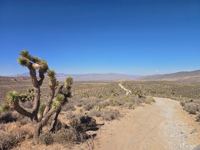
Prefer scenery without amenities? Harris Springs Recreation Area answers that request directly.
The expansive area lies within Red Rock Canyon National Conservation Area and links up with the Spring Mountains National Recreation Area. It also functions as an important watershed, moving water toward the northwest Las Vegas Valley.
Camping here is primitive and dispersed. No facilities exist, which puts the pack-in, pack-out rule front and center.
Off-road drivers have regained access to Harris Springs and Harris Mountain Roads. Conditions vary, so high clearance and a cautious mindset both help.
Quiet is the main attraction. Nights feel enormous once the last vehicle rumbles away.
Water, extra fuel, and a paper map belong in the vehicle. Assistance is not close by if something goes sideways.
Fire restrictions can change with the seasons, and checking current rules before arriving is essential. Autumn brings comfortable daytime temperatures and cold overnight lows.
Compared with the developed canyon above, this stretch feels refreshingly unpolished.
Trailheads For Every Kind Of Hiker
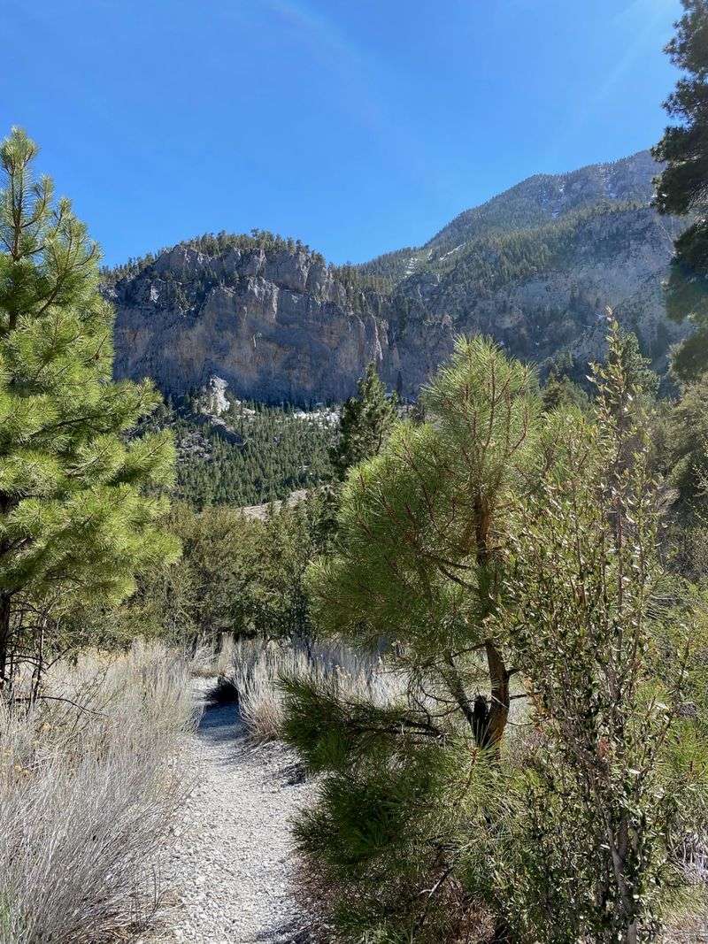
Ten steps or ten miles, the canyon accommodates both. Kyle Canyon opens directly onto some of the best-known trailheads in the Mount Charleston Wilderness.
Fletcher Canyon, South Loop, and Trail Canyon rank among the popular starting points. Each one climbs into forest quickly.
Accessibility gets real attention here. The Acastus Trail offers a wheelchair-accessible route, while ambitious hikers aim for Charleston Peak at 11,916 feet.
Autumn ranks among the finest hiking seasons on the mountain. Cooler air and yellow aspens improve nearly every mile.
Altitude deserves respect. Visitors arriving from lower desert elevations often feel short of breath sooner than expected.
Water needs jump at elevation, and shade disappears on exposed switchbacks. Carrying more than planned is rarely regretted.
Temporary closures happen for maintenance, storms, or fire recovery. Checking trail status before driving up prevents a wasted morning.
Turning around early counts as a successful hike too, especially with light fading behind the ridgeline.
Wildlife Watching Along The Bends
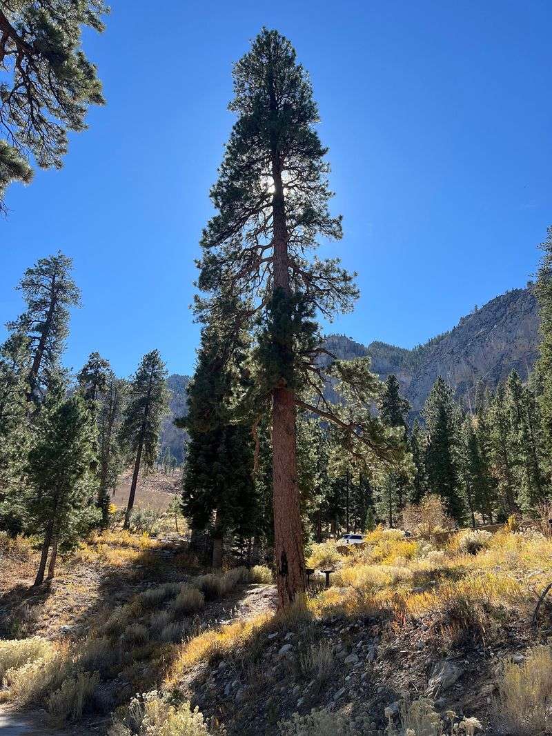
Eyes up, phone down. Different life zones along the byway support a surprisingly wide cast of animals.
Golden eagles sometimes ride thermals overhead. Owls and hawks perch in taller conifers, often spotted only after a second look.
Ground-level sightings reward patience. Foxes slip through underbrush, deer graze in clearings, and wild horses occasionally wander into view.
The range shelters an impressive number of endemic species. The Mount Charleston Blue Butterfly stands out as one of the most fragile.
Dawn and dusk bring the most activity. Midday tends to be quiet, especially in warmer stretches of the season.
Keeping distance protects both parties. Feeding wildlife creates problems that outlast any single visit.
Binoculars turn a decent drive into a rewarding one. A zoom lens beats stepping off-trail for a closer frame.
Drivers should watch the shoulders carefully, since animals cross without warning on curves. Slower speeds protect fur, feathers, and fenders alike.
Picnic Tables And Cozy Mountain Stays
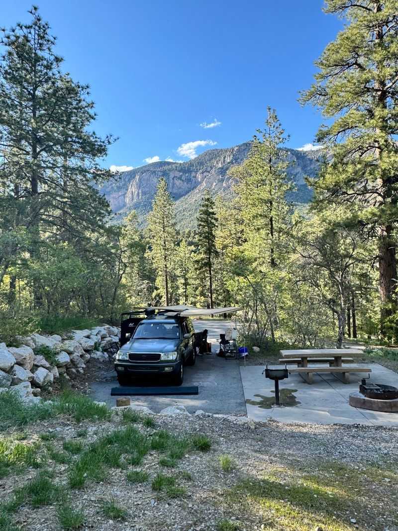
Sandwiches taste better at 7,000 feet. Numerous picnic areas line the byway and cluster near the Spring Mountains Visitor Gateway.
Shade comes standard, courtesy of tall pines. Some sites suit big group gatherings while others fit a two-person breakfast.
Upper Kyle Canyon holds Charleston Village, where a handful of lodging options operate. The Retreat on Charleston Peak and Mount Charleston Lodge both give visitors a base close to the trails.
Staying overnight changes the pace entirely. Morning light on the aspens rewards anyone who skips the drive home.
Autumn weekends draw crowds, so reservations well ahead are wise. Availability tightens fast during peak color.
Packing layers helps, since evenings cool quickly once the sun drops behind the ridge. A warm hat feels absurd in the valley and perfect up here.
Trash bins fill up during busy stretches, so hauling refuse out keeps the picnic areas pleasant. Small habit, big difference for the next group.
Nights Under Pines And Stars
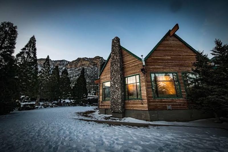
Ever fallen asleep to wind moving through pine needles? Campgrounds scattered across the Mount Charleston landscape make that easy.
Kyle Canyon Campground provides designated sites for overnight stays. Options range from primitive spots to sites near restrooms, so comfort levels vary by preference.
Elevation delivers cool nights, and autumn amplifies the effect. Sleeping bags rated warmer than expected earn their keep.
Dark skies open up once the campfires die down. Star visibility here beats anything available closer to the city glow.
Waking to crisp mountain air resets a person. Coffee outdoors at this altitude feels like a small ceremony.
Campgrounds often operate seasonally, and availability shifts with weather and staffing. Confirming status before loading the car avoids disappointment.
Food storage discipline matters, since wildlife investigates unattended coolers. Sealed containers inside the vehicle solve most issues.
Backpackers heading deeper should study permit rules and current fire restrictions carefully. Preparation is what turns a cold night into a great story.
Extending The Drive Toward Lee Canyon
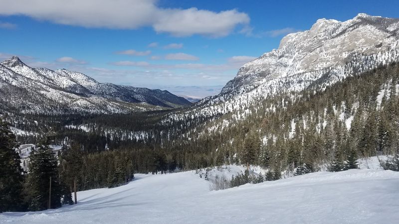
One canyon rarely satisfies a curious driver. Deer Creek Road, State Route 158, connects across the mountains toward Lee Canyon and turns a there-and-back trip into a loop.
New angles appear constantly. Limestone ridges, pine slopes, and distant valley views trade places around each curve.
The Spring Mountains National Recreation Area contains multiple scenic byways. They provide straightforward access to recreation sites inside the Humboldt-Toiyabe National Forest.
Driving the loop without long hikes can be done in under three hours. That leaves plenty of margin for photo stops and snack breaks.
Winter conditions change the equation. Snow and ice occasionally close higher sections, so checking road status is smart in colder months.
Fuel up before leaving the valley in Nevada, since services on the mountain are limited. A full tank removes one worry entirely.
Traffic thickens on autumn weekends, especially near popular overlooks. Weekday mornings feel calmer, quieter, and considerably easier on the nerves.