This Unassuming Texas Landmark Has A Backstory That Will Surprise You
Most visitors to the Texas Panhandle drive past endless flatlands without realizing an enormous chasm waits just beyond the horizon. Palo Duro Canyon drops 800 feet below the surrounding plains, creating a landscape so dramatic it seems impossible in this part of the country.
The canyon holds stories of ancient peoples, military conflicts, and cultural traditions that transformed a geological wonder into a Texas treasure with layers of history as deep as its colorful rock walls.
The Second-Largest Canyon In The United States
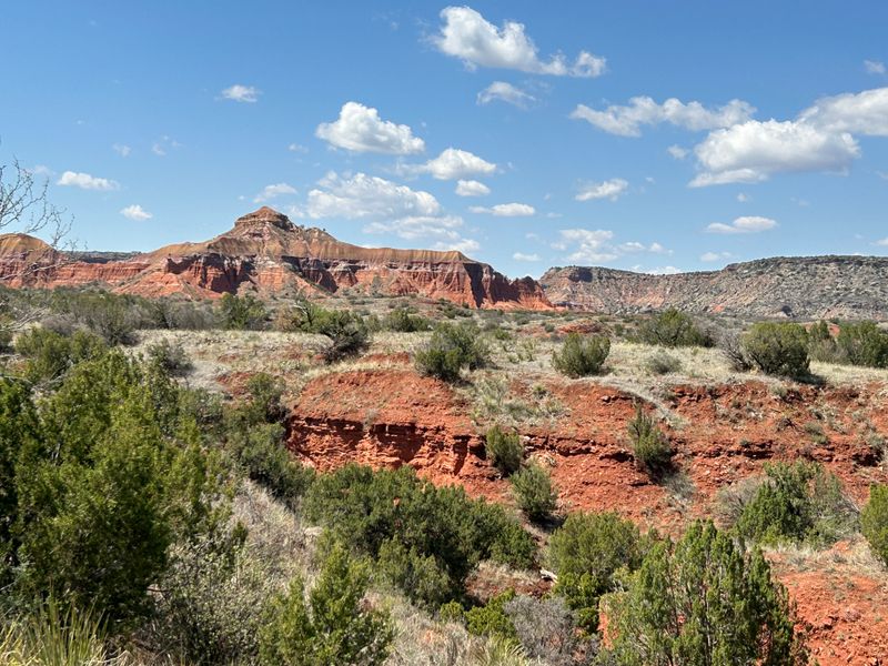
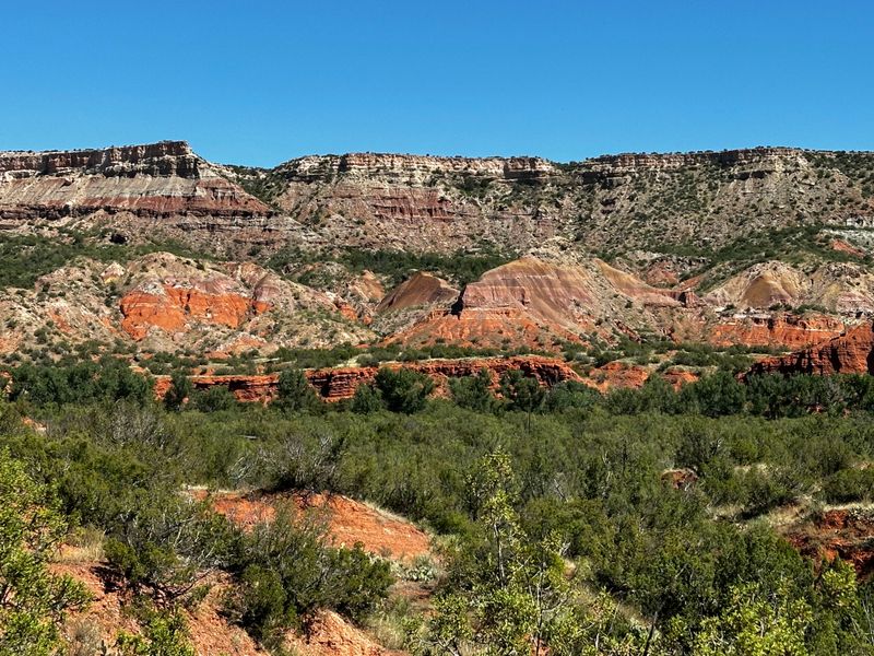
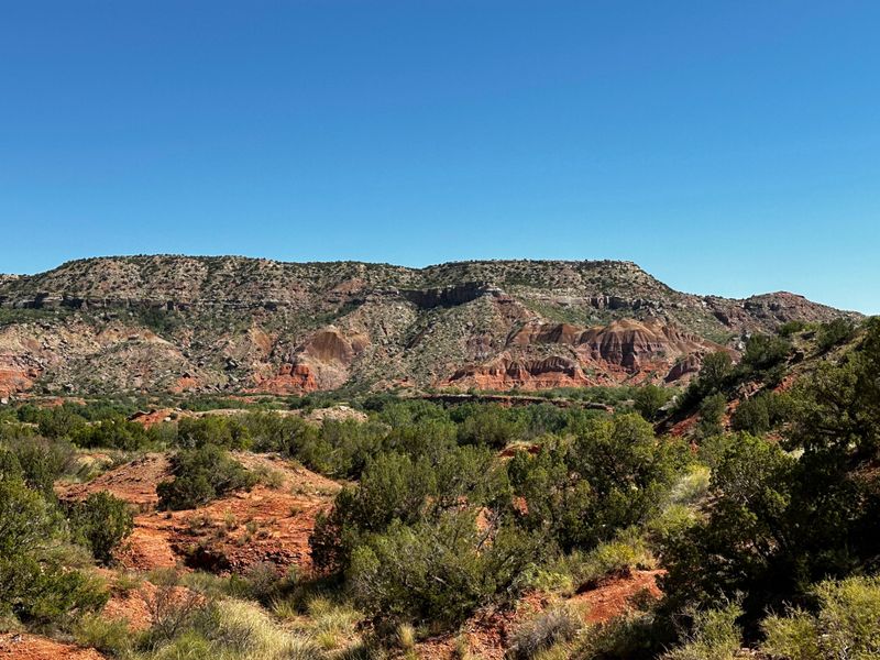
Palo Duro Canyon stretches 120 miles long and plunges 800 feet deep into the Texas Panhandle, earning its rank as the second-largest canyon system in America. Only the Grand Canyon surpasses it in size, yet Palo Duro remains surprisingly unknown outside the region.
The canyon carved itself over millions of years as the Prairie Dog Town Fork of the Red River cut through layers of sandstone, siltstone, shale, and mudstone.
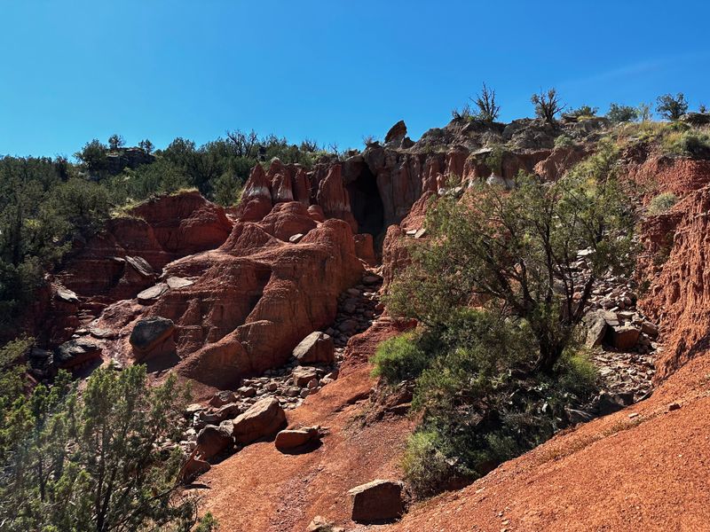
Visitors descending into the canyon pass through distinct geological layers that reveal 250 million years of Earth’s history in vibrant reds, oranges, and purples. The Spanish explorers who discovered it in 1541 named it Palo Duro, meaning hard wood, after the juniper trees growing along the canyon floor.
The sheer scale becomes apparent only when you drive the winding road from rim to bottom, watching the landscape transform from flat grassland to a sculpted wonderland of towering formations and hidden valleys that seem to belong in Arizona rather than Texas.
Indigenous Tribes Lived In The Canyon For Thousands Of Years
Archaeological evidence confirms human presence in Palo Duro Canyon dating back at least 12,000 years, making it one of the longest continuously inhabited regions in North America. The canyon provided everything ancient peoples needed: reliable water, shelter from harsh weather, abundant game, and natural defenses against enemies.
Apache and Comanche tribes established seasonal camps here, using the protected environment to survive brutal winters and scorching summers on the High Plains.
The canyon walls still bear traces of these early inhabitants through stone tools, pottery fragments, and rock art that archaeologists continue to study. Later groups developed sophisticated hunting techniques, driving bison over cliff edges or trapping them in narrow box canyons.
The natural amphitheater created ideal conditions for communities to thrive generation after generation.
Modern trails often follow paths worn smooth by centuries of indigenous footsteps, connecting water sources and seasonal campsites that remain strategically valuable today for hikers exploring the same terrain.
The Canyon Played A Key Role In The Red River War
September 28, 1874, marked a turning point in Texas history when Colonel Ranald Mackenzie led the Fourth Cavalry down the canyon walls in a surprise dawn attack against Comanche, Kiowa, and Cheyenne encampments. The Battle of Palo Duro Canyon became the decisive engagement of the Red River War, though it resulted in few casualties.
Mackenzie’s strategy focused not on killing warriors but on destroying their ability to resist: his troops burned over 1,400 lodges, captured food supplies, and seized more than 1,400 horses.
The colonel ordered most of the horses shot to prevent recapture, effectively ending the tribes’ mobile way of life on the Southern Plains. Within months, the surviving bands surrendered and moved to reservations in Indian Territory, now Oklahoma.
The battle transformed the canyon from a haven of indigenous resistance into a symbol of westward expansion.
Visitors today can hike near the battle site, though few markers commemorate the event that forever changed the region’s human landscape.
Early Explorers Struggled To Cross Its Rugged Terrain
Francisco Coronado’s expedition stumbled upon Palo Duro Canyon in 1541 while searching for the mythical cities of gold, becoming the first Europeans to witness its unexpected grandeur. The Spanish explorers found themselves trapped between the flat plains above and the seemingly impassable chasm below, forcing them to search for days to find safe routes down the canyon walls.
Their journals describe the shock of discovering such dramatic topography in a landscape that appeared completely featureless from a distance.
Later expeditions faced similar challenges navigating the maze of side canyons, seasonal flash floods, and crumbling rock faces that made wagon travel nearly impossible. The canyon served as a natural barrier that delayed settlement and protected indigenous populations from intrusion for centuries.
Even experienced frontiersmen struggled to map reliable crossings, with many routes becoming death traps during storms when normally dry arroyos transformed into raging torrents within minutes, sweeping away anyone caught in the narrow passages below.
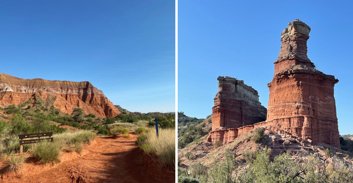
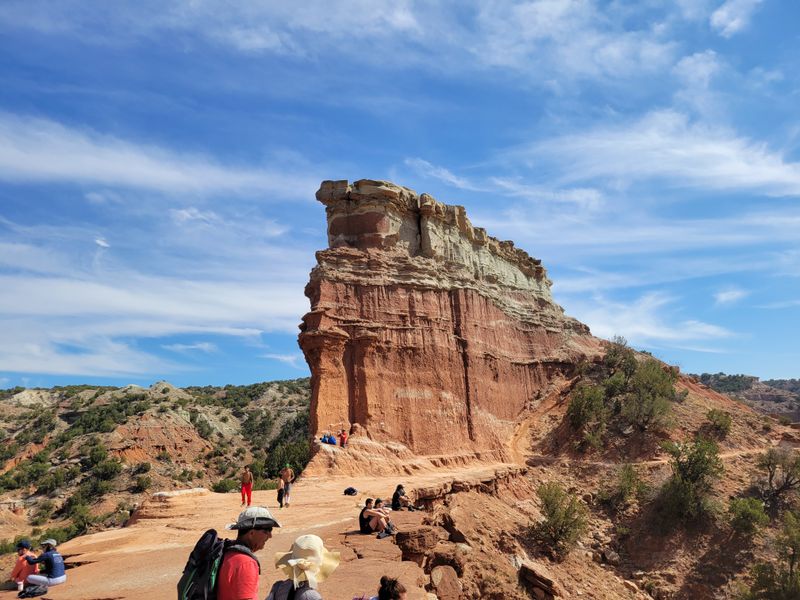
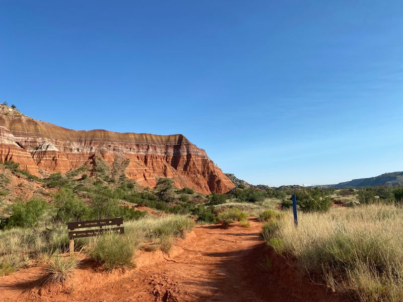
The Lighthouse Rock Formation Became A Texas Icon
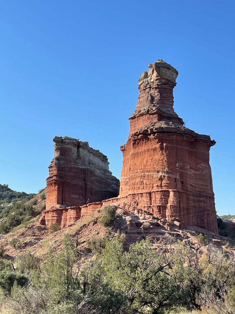
Standing 310 feet tall, the Lighthouse rock formation rises from the canyon floor as the park’s most photographed landmark and the destination of its most popular trail. The distinctive pillar earned its name from early settlers who used it as a navigation marker, visible from miles away across the broken landscape.
Erosion sculpted the formation over millions of years, leaving a cap of harder rock protecting the softer layers beneath from complete dissolution.
The 5.7-mile round-trip hike to reach the Lighthouse challenges visitors with elevation changes, rocky terrain, and Texas heat, but rewards them with close-up views of the towering spire. Geologists study the formation’s layers to understand how different sediments respond to weathering, creating the canyon’s signature hoodoos and balanced rocks.
Photographers time their visits for golden hour when the setting sun ignites the red rocks in brilliant orange and crimson hues. The Lighthouse appears on countless postcards, travel guides, and social media posts, serving as the visual ambassador for the entire park.
Ranching History Shaped The Canyon’s Identity
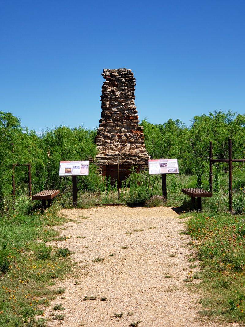
Charles Goodnight established the JA Ranch in Palo Duro Canyon in 1876, transforming the former battleground into one of the largest and most successful cattle operations in the American West. Goodnight recognized that the canyon’s natural shelter, permanent water, and abundant grass created perfect conditions for raising livestock year-round.
His partnership with John Adair brought capital that allowed the ranch to control over one million acres at its peak, running more than 100,000 head of cattle.
The rancher also preserved a small herd of bison when the species faced extinction, crossbreeding them with cattle to create cattalo, though the experiment ultimately failed. Ranch buildings, corrals, and line camps from this era still dot the canyon, with some structures incorporated into the state park infrastructure.
Goodnight’s conservation practices and land management techniques influenced ranching across the region for generations. The Texas State Bison Herd now grazes in the park, descendants of animals Goodnight helped save from complete disappearance.
The Outdoor Musical Texas Added Cultural Legacy
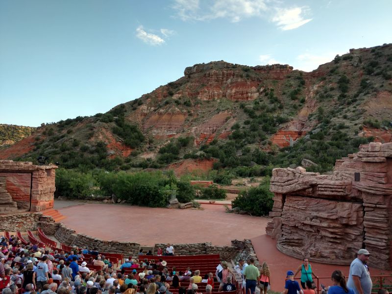
Since 1966, the outdoor musical Texas has performed nightly throughout summer in the Pioneer Amphitheater, carved into the canyon walls near Canyon, TX 79015. The production tells the story of Panhandle settlement through music, dance, and spectacular staging that incorporates the natural landscape as a backdrop.
Playwright Paul Green created the show to celebrate Texas history, and it quickly became a beloved regional tradition that has entertained over three million visitors across nearly six decades of continuous performances.
The amphitheater seats 1,700 people who gather as sunset paints the canyon walls in changing colors before the show begins. Professional actors, dancers, and singers bring frontier tales to life with energetic choreography, live horses, and pyrotechnic effects that echo off the ancient rocks.
The musical employs local residents and college students, creating economic impact and cultural continuity for the surrounding communities. Performances run from early June through mid-August, with the show’s longevity making it one of America’s oldest outdoor musical dramas still in production.
Archaeology Reveals Ancient Human Activity
Recent archaeological surveys have uncovered over 200 documented sites within the canyon containing artifacts from Paleoindian hunters to historic Apache camps, creating a timeline of human adaptation spanning 12 millennia. Researchers discovered Folsom and Clovis projectile points that prove ice-age hunters tracked mammoths and giant bison through these canyons when the climate supported entirely different ecosystems.
Stone tools, fire pits, and butchering sites reveal how ancient peoples processed game and gathered plant resources from the canyon’s microclimates.
Pottery fragments show trading networks that connected canyon inhabitants to cultures hundreds of miles away, exchanging goods and ideas across the plains. Some sites contain multiple occupation layers, proving certain locations remained valuable across thousands of years of environmental and cultural change.
Park regulations protect these archaeological treasures, making it illegal to disturb or collect artifacts, though visitors occasionally spot pottery shards or stone flakes eroding from canyon walls after heavy rains wash away protective sediments that concealed them for centuries.
The Civilian Conservation Corps Helped Create The State Park
During the Great Depression, Civilian Conservation Corps crews transformed Palo Duro Canyon from private ranch land into a public recreation area, building the infrastructure that still serves visitors today. Young men enrolled in the CCC program constructed roads, trails, cabins, and the park headquarters between 1933 and 1937, using local stone and timber to create structures that blend seamlessly with the natural environment.
The workers hand-cut the scenic drive that descends from the rim to the canyon floor, carefully routing it to showcase dramatic viewpoints while maintaining safe grades for automobile traffic.
Stone cabins built by CCC crews remain popular rental accommodations, prized for their rustic charm and historical significance. The corps also developed the park’s water system, campgrounds, and picnic areas using techniques that prevented erosion and protected sensitive habitats.
Many trails, including portions of the CCC Trail, follow routes these Depression-era workers carved into the landscape. Their craftsmanship created a model state park that opened in 1934 and continues operating largely as they designed it nearly 90 years ago.
Modern Trails Follow Historic Indigenous And Settler Paths
Today’s hiking and biking trails throughout Palo Duro Canyon trace routes established centuries ago by indigenous peoples and later adopted by ranchers, traders, and settlers moving through the region. The Givens, Spicer, and Lowry Trail connects water sources and natural shelters in the same logical progression that Apache and Comanche travelers followed, taking advantage of terrain features that make passage easier through otherwise difficult country.
Park managers designed modern trails to minimize environmental impact while preserving the historical pathways that represent thousands of years of human knowledge about navigating this landscape.
Mountain bikers now speed along routes where Comanche warriors once rode, while hikers pause at overlooks that served as lookout points for generations of canyon inhabitants. Trail markers and interpretive signs explain the historical significance of various locations, helping visitors understand they walk in footsteps worn smooth by countless previous journeys.
The park maintains over 30 miles of trails accommodating different skill levels, from easy canyon-floor walks to challenging rim routes that require scrambling over rocks and navigating steep elevation changes.