This Underrated 41-Mile Drive Starting In North Carolina Is Worth The Trip
GPS will tell you it is just a connector road between two points. GPS has clearly never been on it.
This is 41 miles of North Carolina mountain road that has absolutely no business being this good. No toll booths.
No traffic. No one is tailgating you because everyone here made a choice to slow down.
The views come at you before you are ready. Ridgeline after ridgeline, folding into each other like the mountains have been arranging themselves for your arrival.
Pull over once, and you will pull over six more times before you reach the end. Most people drive past the turnoff without a second thought.
The ones who don’t tend to come back. Not because they missed something the first time.
Because 41 miles was not enough.
Planning The Route And Key Stop Highlights
Start your planning in Robbinsville, North Carolina, where NC Highway 143 kicks off the Cherohala Skyway experience. The route runs 41 miles west before crossing into Tennessee.
Before you leave town, fill up on gas and grab food, because there are zero gas stations or restaurants along the entire stretch. Zero.
Plan accordingly.
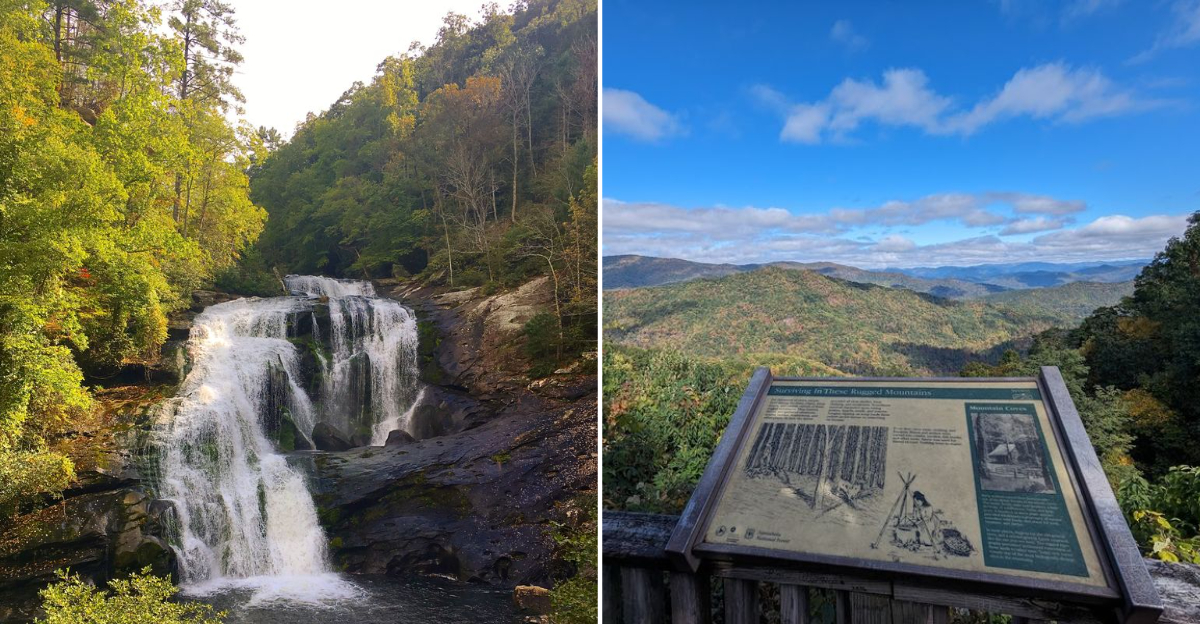
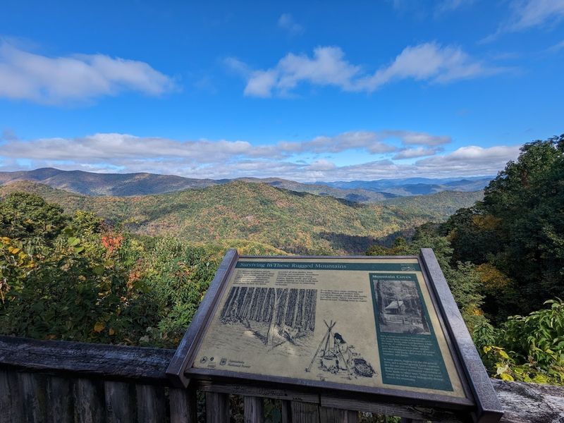
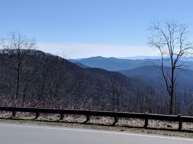
The North Carolina side climbs 18 miles through the Nantahala National Forest before reaching the state line. Along the way, stop at the Santeetlah Overlook, which sits at an elevation of 5,390 feet in elevation.
The views from there are genuinely jaw-dropping. You can see ridgeline after ridgeline disappearing into the horizon.
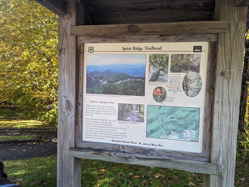
A short detour leads to the Joyce Kilmer Memorial Forest, one of the few remaining old-growth forests in the eastern United States. The trees there are enormous and ancient.
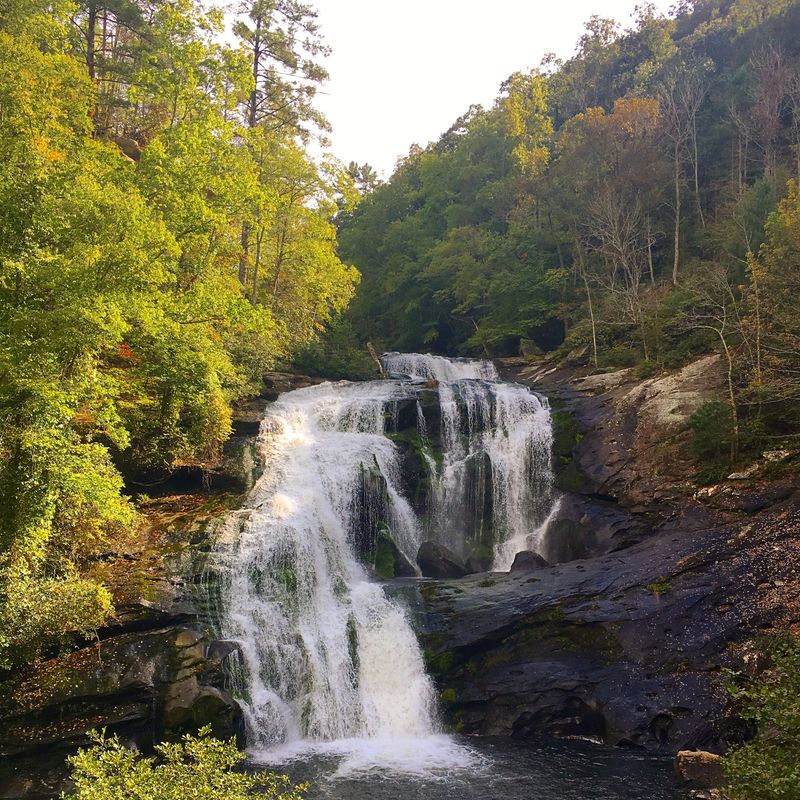
Another worthy side trip takes you toward Bald River Falls, a 100-foot waterfall that feels like a reward for the effort. Visitor centers in both Robbinsville and Tellico Plains offer free maps and current road conditions.
Wildlife And Flora Unique To The Region
The Nantahala National Forest along the Cherohala Skyway is alive in ways that will surprise you. Black bears roam these woods regularly, and white-tailed deer are spotted near the roadside more often than you might expect.
Wild turkey, red foxes, and a wide range of songbirds also call this corridor home. Keep your camera ready at all times.
Spring brings an explosion of wildflowers across the forest floor. Trillium, bleeding heart, and fire pink bloom in clusters along the lower elevations.
Higher up, the vegetation shifts to heath balds covered in rhododendron and mountain laurel. When those shrubs bloom in late spring and early summer, the hillsides look almost unreal.
The tree canopy itself is worth studying. You will find tulip poplar, red maple, American beech, and yellow birch all growing within close range of each other.
In the fall, that mix creates a color palette that photographers chase from hundreds of miles away. The biodiversity here reflects just how undisturbed and protected this landscape has remained.
It is one of the richest forest ecosystems in the entire Appalachian region.
Capturing Breathtaking Panoramic Views
Huckleberry Knob is the crown jewel of the Cherohala Skyway overlooks. It offers a full 360-degree view of the surrounding Appalachian ridges.
On a clear day, the visibility stretches for miles in every direction. It is the kind of view that makes you stand quietly for a few minutes before you even think about reaching for your phone.
The Santeetlah Overlook is another must-stop on the North Carolina side. It sits at one of the highest accessible points along the route and stunningly frames Santeetlah Lake below.
Early morning is the best time to catch the mist rolling through the valleys. That low fog between mountain layers looks like something out of a painting.
Photographers should bring a wide-angle lens and a tripod for golden-hour shots. The light shifts fast at elevation, especially near sunset.
Pull-offs along the route are frequent enough that you never have to rush past a great shot. Some of the best frames come from simply stopping at an unmarked pull-off and looking back toward where you started.
The Skyway rewards the patient and the curious equally.
Best Times Of Year For Ideal Driving Conditions
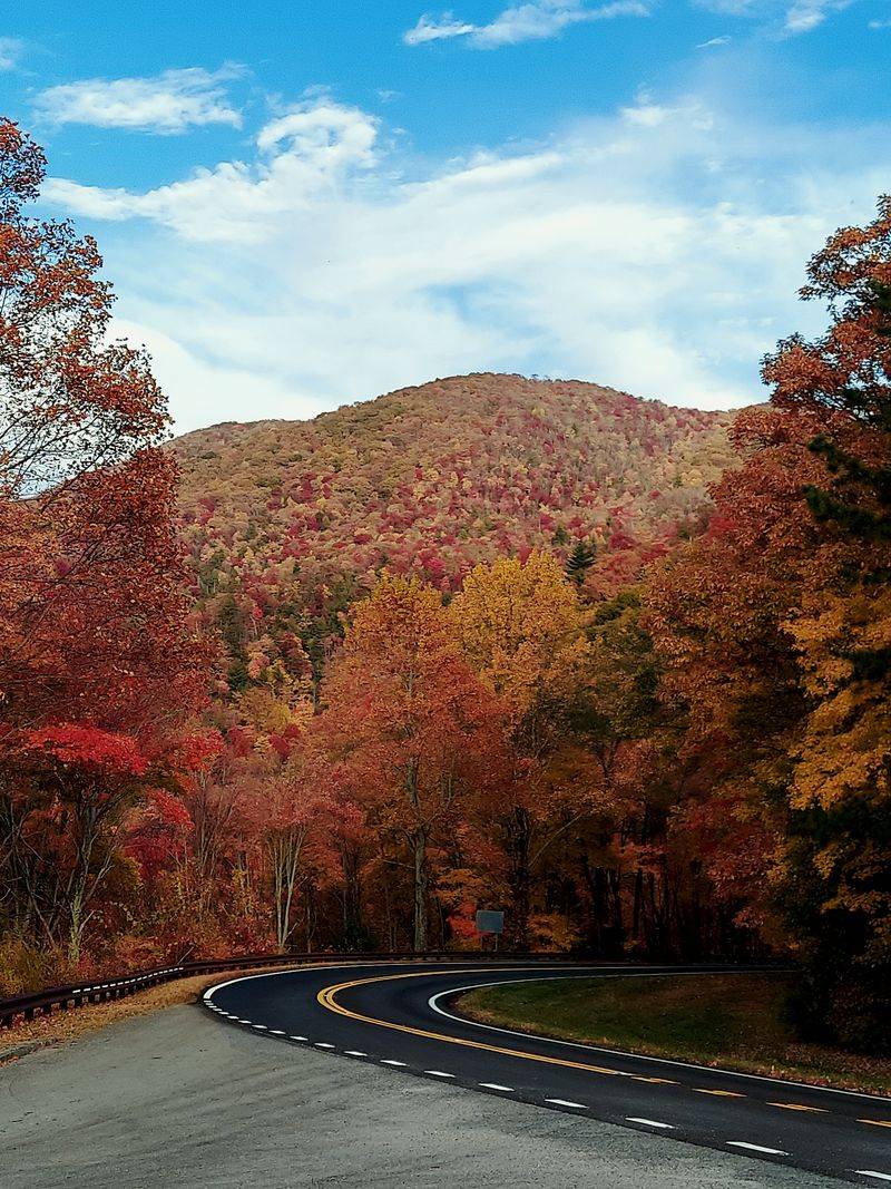
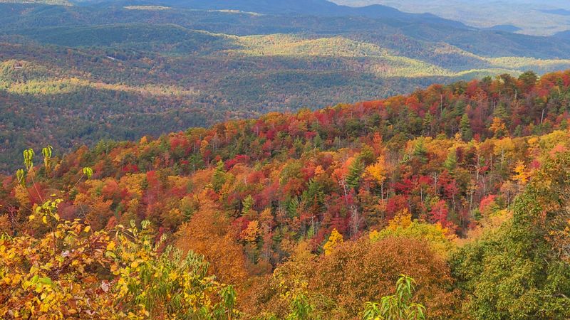
Fall is the undisputed peak season on the Cherohala Skyway. Mid-October through early November brings a full explosion of color across the Nantahala National Forest.
The elevation means the trees change earlier here than in the lowlands. You get reds, oranges, and yellows layered across ridgeline after ridgeline, and the effect is genuinely breathtaking.
Summer is the second-best option for most drivers. Temperatures at the higher elevations stay noticeably cooler than in the surrounding valleys.
Expect breezy, comfortable conditions even when it is hot elsewhere. Wildflowers are still going strong through early summer, and the forest is at its most lush and green.
Spring offers blooming rhododendron and mountain laurel, usually peaking in May and June. The roads are generally clear by April, though late frosts can still occur.
Winter is a different story entirely. Snow and ice make the Skyway extremely dangerous between December and March.
The road can close without much warning. If you do visit in winter, check road conditions with the Robbinsville Visitor Center before you go.
The Skyway is beautiful in the snow, but safety has to come first.
Safety Tips For Navigating Mountainous Terrain
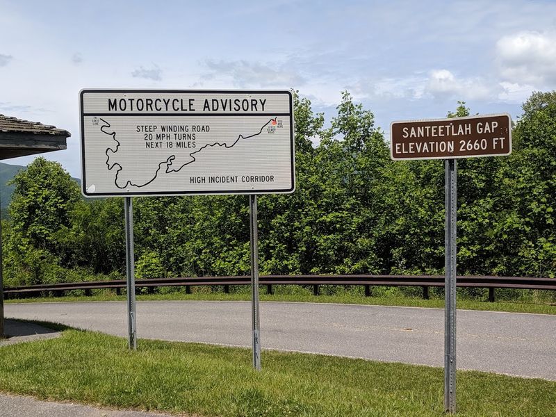
The Cherohala Skyway is not a road to drive distracted. The curves are long and sweeping, which makes them feel manageable at first.
But elevation changes are dramatic, and the drop-offs on certain sections are serious. Stay in your lane, keep your speed reasonable, and resist the urge to rubberneck at overlooks while still moving.
Motorcyclists love this road, and you will likely share it with quite a few of them. Give bikes plenty of space, especially on curves where sight lines are limited.
The road surface is generally well-maintained, but fallen leaves in autumn can make it slippery. Wet weather adds another layer of caution, particularly on the steeper descents.
Cell service along the Skyway is limited or nonexistent in many sections. Download offline maps before you leave.
Let someone know your planned route and expected arrival time. Carry a basic emergency kit in your vehicle, including a first aid kit, jumper cables, and a flashlight.
The Skyway is remote enough that help can take a while to arrive. A little preparation goes a long way when you are driving through one of the most isolated stretches of road in western North Carolina.
History And Cultural Significance Of The Area
The name Cherohala is a mashup of two national forests: the Cherokee National Forest in Tennessee and the Nantahala National Forest in North Carolina. That combination of names tells you something important about the road itself.
It belongs to two states, two forests, and two distinct cultural landscapes at once.
The Cherokee people have deep roots in this region. The town of Robbinsville sits within Graham County, which borders the Qualla Boundary, the home of the Eastern Band of Cherokee Indians.
The land around the Skyway was part of traditional Cherokee territory for centuries before European settlers arrived. That history is still present in the place names, the land management practices, and the community identity of the region.
The Skyway itself was completed in 1996 after nearly 40 years of planning and construction. It became North Carolina’s most expensive scenic highway, with a final price tag of $100 million.
The Joyce Kilmer Memorial Forest nearby honors the poet Alfred Joyce Kilmer, who wrote the famous poem about trees. The forest was dedicated to his memory after he was killed in World War I.
History runs deep on every mile of this drive.
Places To Picnic And Relax Along The Journey
Picnic spots along the Cherohala Skyway are genuinely well-placed. Several designated areas sit near overlooks, so you get a view with your lunch.
The Hooper Bald area offers open grassy spaces with mountain backdrops that feel completely removed from everyday life. Spread out a blanket, eat something good, and just stare at the mountains for a while.
The Joyce Kilmer Memorial Forest picnic area is one of the most atmospheric stops on or near the route. Giant trees surround the tables, and the forest feels cathedral-like.
It is quiet in a way that most outdoor spaces are not. Even on busy weekends, the size of the forest absorbs the crowd.
Santeetlah Lake is another excellent relaxation stop just off the main Skyway. The lake offers calm water views, and the surrounding area has spots for sitting and unwinding.
Pack your own food since there are no vendors or concessions along the route. A cooler with snacks, sandwiches, and cold drinks will make every stop more enjoyable.
The Skyway rewards travelers who slow down and actually use the rest spots rather than rushing through to the next overlook.
Recommended Gear And Supplies For The Drive
Packing smart for the Cherohala Skyway makes a real difference. Start with water.
Bring more than you think you need, especially if you plan to hike any of the trails off the main route. There are no water fountains or stores along the 41-mile stretch.
A reusable water bottle and a small cooler are your best friends on this drive.
Layers are essential regardless of the season. Temperatures drop significantly as you gain elevation.
Even on a warm summer day, the ridgeline can feel 15 to 20 degrees cooler than the valley below. A light jacket or fleece will be used.
In fall and spring, pack a warmer mid-layer just in case.
Offline navigation is a must since cell service disappears in many sections. Download the route on Google Maps or a dedicated hiking app before leaving Robbinsville.
A portable phone charger keeps your devices alive throughout the day. Comfortable walking shoes are worth having if you plan to explore the overlooks or short trails.
Sunscreen matters at high elevation, where UV exposure increases. Binoculars are a fun bonus for spotting wildlife and distant ridgelines.
A printed map from the Robbinsville Visitor Center rounds out a solid prep kit.