
Two Waterfalls And A Swinging Bridge Make This Tennessee Hike Worth Every Step
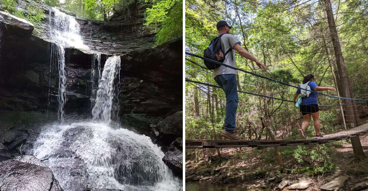
Some hikes give you one reward at the end. This one hands you several, one after another, almost like the trail cannot help but keep showing off.
Tennessee holds a short loop that packs in more scenery than most trails twice its length. Water crashes over rock in more than one spot along the way.
A suspension bridge sways gently underfoot, adding a small thrill before the trail dips back into the trees. Moss covers the boulders.
Sunlight filters through the canopy in patches, shifting with every step forward. This is not a long trek, but every turn seems to reveal something new.
Could two waterfalls and a swaying bridge really pack this much excitement into such a short distance? Absolutely.
Tennessee hikers who complete this loop often describe it as more rewarding than trails three times as long, and once you see it firsthand, you will understand exactly why.
This Forest Welcomes You With A Warm, Inviting Embrace
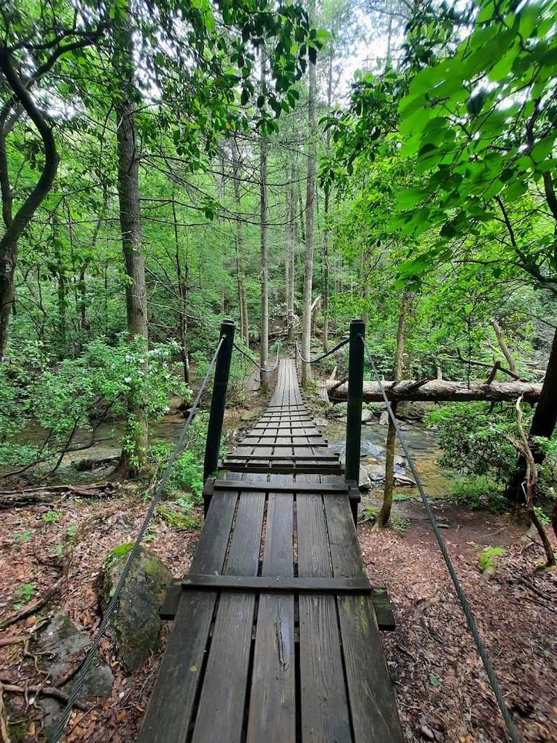
This forest feels like a private room, with every tree, shadow, and bend arranged to pull you deeper into the quiet.
The tree canopy overhead is a layered mix of oak, hemlock, poplar, maple, and pine, and the combined effect is a kind of cool, green shade that drops the temperature noticeably from the parking area.
The trail begins with a moderate rhythm. Exposed roots cross the path at irregular intervals, and flat rocks jut up from the soil in ways that ask you to pay attention.
This is not a trail you can walk while staring at your phone, which is honestly part of the appeal.
This stretch of South Cumberland State Park carries a quiet authority. The forest does not announce itself dramatically.
It simply surrounds you, and the sound of the outside world fades quickly. Birds move through the branches above, and the air carries a faint dampness that hints at water not far ahead.
Starting here, before the waterfalls appear, is a genuinely good part of the experience that many hikers rush past without fully appreciating.
The Gentle Cascade Of Upper Greeter
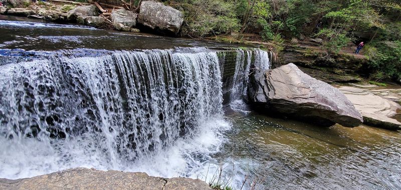
Upper Greeter Falls arrives before you expect it, which is one of its better qualities.
The waterfall spans a wide ledge and drops roughly 15 feet in a broad, flowing sheet of water that catches light in a way that makes you stop mid-stride.
It is not the tallest waterfall on the trail, and it does not pretend to be. What it offers instead is width and a certain calm authority.
The water spreads evenly across the rock face, and in spring or after heavy rain, the volume increases considerably, turning a pleasant cascade into something genuinely impressive.
Standing here for a few minutes before continuing is worth the pause. The sound is steady and low, more of a sustained rush than a roar, and the mist that rises from the base keeps the surrounding rocks and moss in a permanent state of vivid green.
Many hikers treat Upper Greeter as a brief checkpoint before pushing toward Lower Greeter Falls, but the upper cascade deserves its own moment of attention.
The trail continues from here with more elevation change, so taking a breath at this point is both practical and enjoyable.
Descending To The Greater Plunge
The spiral metal staircase is one of those trail features that earns its own conversation. It winds downward through a narrow gap in the sandstone, and the descent gives you a gradually expanding view of Lower Greeter Falls as you go.
Each turn of the staircase reveals a little more of the 50-foot drop below.
Lower Greeter Falls is the kind of waterfall that justifies the drive from wherever you started. The plunge pool at its base glows with a vivid blue-green color on sunny days, and the surrounding rock walls frame the scene in a way that feels almost deliberate.
Wooden steps follow the metal staircase and bring you right to the water’s edge.
On warmer days, swimmers make use of the pool, and the atmosphere near the base shifts from quiet observation to something livelier. The descent itself requires steady footing, as the steps can carry moisture from the mist and become slick.
Wearing shoes with grip is a straightforward recommendation that pays off here. The return climb back up the staircase is manageable for most people with moderate fitness, though it does remind your legs that you have been working.
Beneath The Roaring Curtain
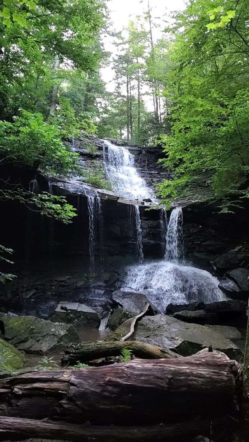
Reaching the base of Lower Greeter Falls is one of those moments that earns a long pause. The water drops 50 feet from a curved rock ledge above, and the sound at the bottom is full and encompassing.
You feel the mist on your face before you fully register where it is coming from.
The plunge pool itself is a striking shade of blue-green, fed continuously by the falls and framed on three sides by rock. In spring, when water flow peaks, the curtain of water is wide and forceful.
In late summer, the flow narrows but the pool retains its color and the visual effect remains strong.
People often linger here longer than they planned. The combination of sound, mist, and visual scale creates an atmosphere that is easy to settle into.
Sandstone cliffs rise on either side, draped in fern and moss, and the light filters down through the canopy in shifting patterns. Swimming is possible in warmer months, and the water temperature tends to run cold even in July.
It is one of those places that photographs reasonably well but genuinely exceeds what any image can communicate to someone who has not stood there in person.
There Is A Subtle Elegance To Boardtree Worth Slowing Down For
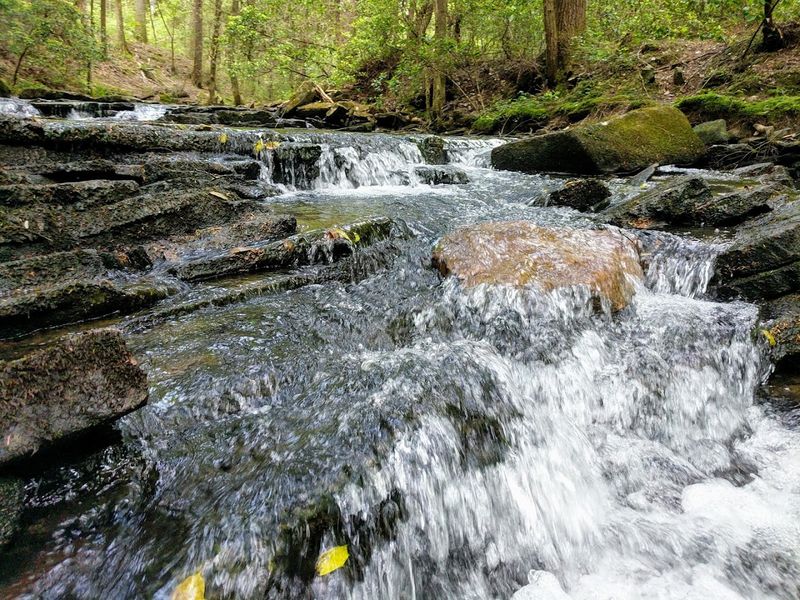
Boardtree Falls carries a different personality from the Greeter waterfalls, and that difference is part of what makes it worth the extra steps.
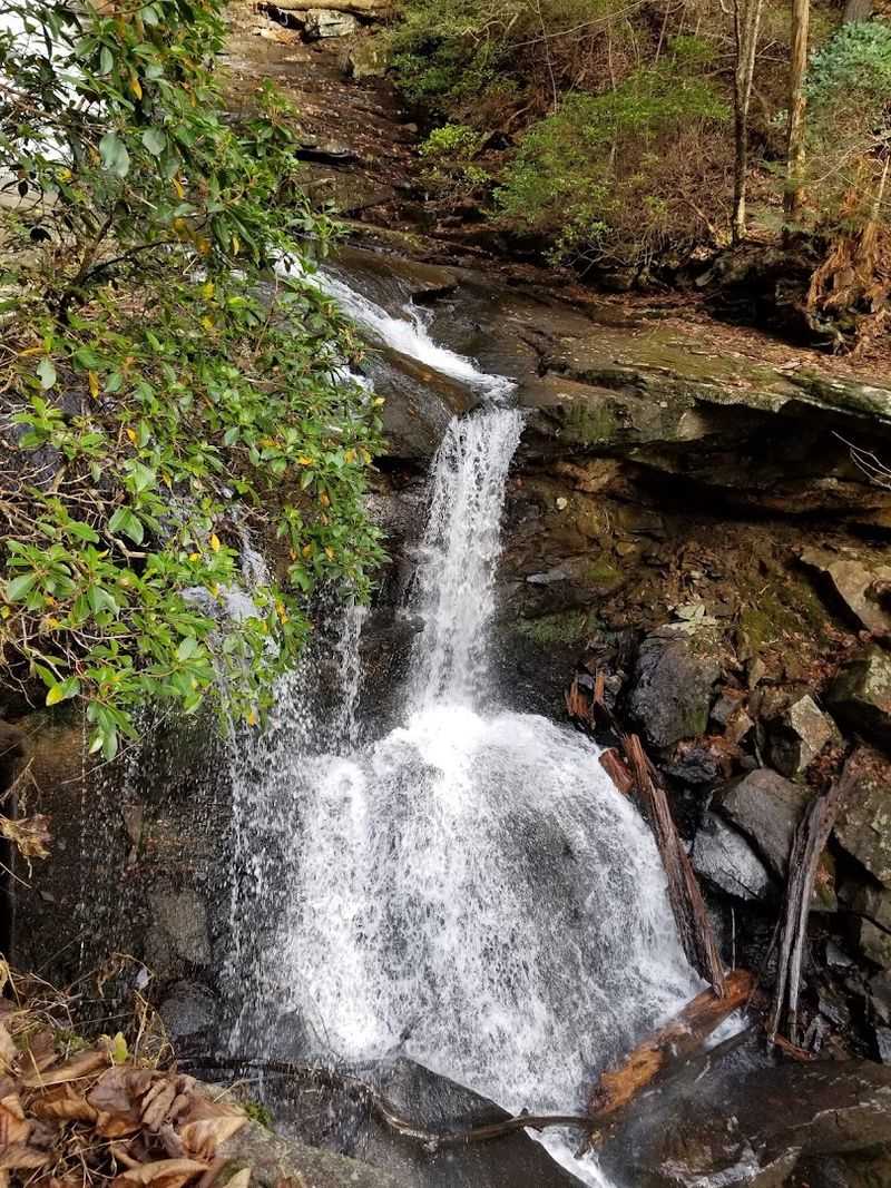
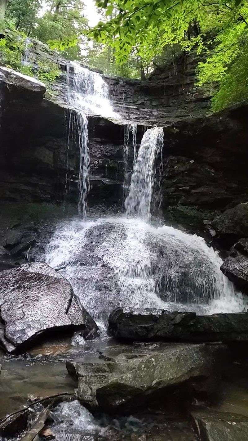
Rather than a single dramatic plunge, Boardtree descends in a cascade style, dropping roughly 45 to 50 feet across a series of rock tiers that give the water a layered, almost deliberate appearance.
Timing matters here more than at other points on the trail. Spring visits and days following significant rainfall reward hikers with a full, expressive cascade.
During drier periods in late summer or fall, the flow can thin considerably, which changes the experience without eliminating it. The rock face and surrounding vegetation remain visually interesting even when water volume is low.
Getting to the base requires navigating a short but steep and rocky path.
The footing demands attention, and a yellowjacket nest has been reported beneath one of the rocks along the descent, so moving carefully and watching where you step is genuinely useful advice.
The view from the top is accessible and rewarding on its own, and many visitors choose to appreciate Boardtree from above rather than making the full descent. Both perspectives offer something distinct, and neither feels like a compromise.
The Swaying Span Over The Creek
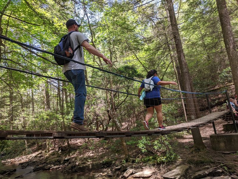
Just upstream from Boardtree Falls, a cable suspension bridge crosses Boardtree Creek, and it is exactly as enjoyable as it sounds. The bridge sways gently underfoot, and the movement is mild enough to be fun without being alarming for most people.
Children tend to love it. Adults tend to pretend they are not also enjoying it.
The bridge serves a practical function, connecting sections of the trail across the creek, but it also gives hikers a moment to stop and look downstream toward Boardtree Falls from a vantage point that is otherwise unavailable.
The creek below runs over smooth rocks, and in good water conditions, the sound of moving water accompanies the crossing from start to finish.
Structurally, the bridge is a cable design with a wooden plank surface, and it handles foot traffic reliably. Crossing one or two people at a time is the standard approach, and the slight bounce that results from each step adds to the character of the experience.
It is one of those small trail features that people mention afterward with genuine enthusiasm, often more than they expected to.
On the Greeter Trail, the swinging bridge functions as a natural pause between the intensity of the waterfalls and the quieter forest sections that follow.
This Trail Weaves Together A Tapestry Of Terrains
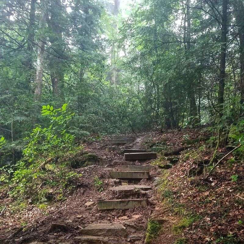
The Greeter Falls Loop Trail earns its moderate-to-strenuous rating through terrain variety rather than sheer distance. The full loop, including spur trails to Boardtree Falls and other features, runs between 2.0 and 2.2 miles.
That is not a long hike by most measures, but the ground underfoot changes frequently enough to keep your full attention throughout.
Sections of exposed root and rock alternate with smoother forest floor. Sandstone cliffs appear at intervals, and some portions of the trail require basic rock scrambling where hands may come into contact with the surface.
The elevation changes are real and cumulative, and by the time you complete the loop, your legs will have registered the effort even if the mileage did not suggest it.
For hikers bringing dogs, the terrain is manageable for animals in good condition, though some of the rockier sections and the staircase near Lower Greeter Falls require extra care.
Beginners should approach the trail with honest self-assessment rather than optimism alone.
Sturdy footwear is not optional here. Mud accumulates after rain, and certain rock surfaces become slick with moisture.
Carrying water and starting earlier in the day during warmer months are both practical choices that improve the overall experience considerably.
Reflections From The Savage Gulf
South Cumberland State Park, the broader system that contains the Greeter Falls area, covers a substantial portion of the Cumberland Plateau in Tennessee.
The Savage Gulf component of the park is one of its most dramatic sections, characterized by deep gorges, sandstone formations, and forest cover that shifts with the seasons in ways that change the character of every visit.
Spring brings the highest water flow and the most vivid green along the trail. Fall shifts the palette toward amber and rust, and while the waterfalls may run lower, the forest itself becomes the primary attraction.
Winter visits, when crowds thin considerably, offer a quieter version of the same landscape, and the waterfalls that do flow carry a sharp, clean quality that warmer months cannot replicate.
The trailhead and parking area sit off Greeter Falls Road, accessible via TN Highway 56 near Altamont, TN 37301. Parking fills on busy weekends, and arriving early is a straightforward way to avoid the frustration of a full lot.
No bathrooms are available at the trailhead, and cell service is limited throughout the area. Bringing what you need and planning accordingly is not overcaution.
It is simply what makes the difference between a good day on the trail and an uncomfortable one.