
Why This Hidden Canyon In Arizona Is A Breathtaking Natural Attraction Most Visitors Ignore
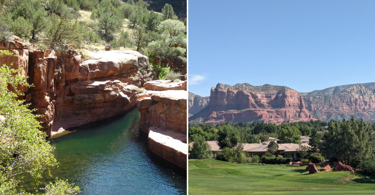
Arizona has a canyon that sits within driving distance of some of the most visited landscapes in the country and still manages to see a fraction of the foot traffic. The walls are just as dramatic.
The light does the same thing in the late afternoon. The crowd simply never found the turnoff, and their loss is considerable.
The canyon earns its silence. You drop in from the rim, and the temperature shifts immediately.
The walls rise on both sides, and the sky reduces itself to a narrow strip above, and everything that felt urgent an hour ago stops feeling that way.
The Arizona desert at this scale does something to a person that is difficult to articulate and impossible to forget. Outdoor people who have done the famous trails understand what crowds cost.
The constant negotiation for space on the path, waiting your turn at viewpoints, and the frustration of being somewhere spectacular while feeling like you’re sharing it with everyone you’ve ever met.
This canyon requires none of that negotiation. The turnoff is easy to miss.
That is the whole reason it is still worth finding.
Geological Features That Shape The Canyon
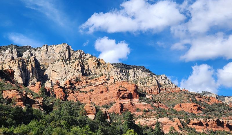
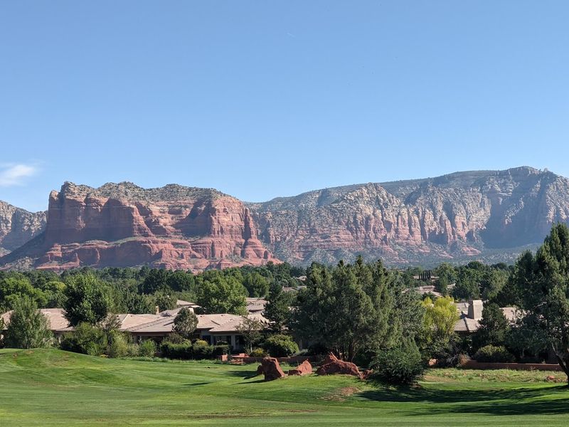
This area is basically a geology textbook brought to life. The canyon walls reveal layers of red sandstone, white limestone, and hardened brown lava.
Each layer tells a story millions of years in the making.
The canyon stretches 21 miles long and reaches up to 7 miles wide. That makes it Arizona’s second-largest canyon by size.
Most people have never even heard its name, which is honestly wild.
Carved by water, wind, and time, the formations here are striking. You will spot soaring pinnacles, natural arches, mesas, and dramatic buttes.
The variety of shapes keeps every trail section feeling completely different.
The red cliffs catch sunlight in a way that shifts color throughout the day. Morning light turns them amber.
Late afternoon pushes them toward deep copper and rust.
Sycamore Creek runs through the canyon floor as a perennial stream. It has carved those walls over thousands of years.
The creek still actively shapes the landscape today.
The Coconino National Forest headquarters is located at 1824 S Thompson St, Flagstaff, AZ 86001. That office is a great starting point for maps and trail conditions.
Rangers there know this canyon well.
Native Plant And Animal Life Of The Region
The wildlife situation inside Sycamore Canyon is no joke. Black bears, mountain lions, elk, and deer all call this place home.
Ring-tailed cats also roam here, which sounds made up but is absolutely real.
Rattlesnakes live in the canyon, too. They are not aggressive, but awareness matters on every trail.
Watch where you step, especially near rocky ledges and brush.
The riparian zone along Sycamore Creek is incredibly rich. Sycamore, walnut, and cottonwood trees line the creek banks.
Their canopy creates shaded corridors that feel worlds apart from the desert above.
Bird species here are diverse and plentiful. Raptors soar the thermals above the canyon rim.
Smaller songbirds fill the riparian corridor with constant sound.
Wildflowers bloom seasonally across the canyon floor. Spring brings bursts of color against the red rock backdrop.
The contrast is genuinely stunning and very photogenic.
Plant communities shift dramatically as elevation changes inside the canyon. Desert scrub near the lower reaches gives way to pine and juniper higher up.
That range of ecosystems packed into one canyon is rare anywhere in the country.
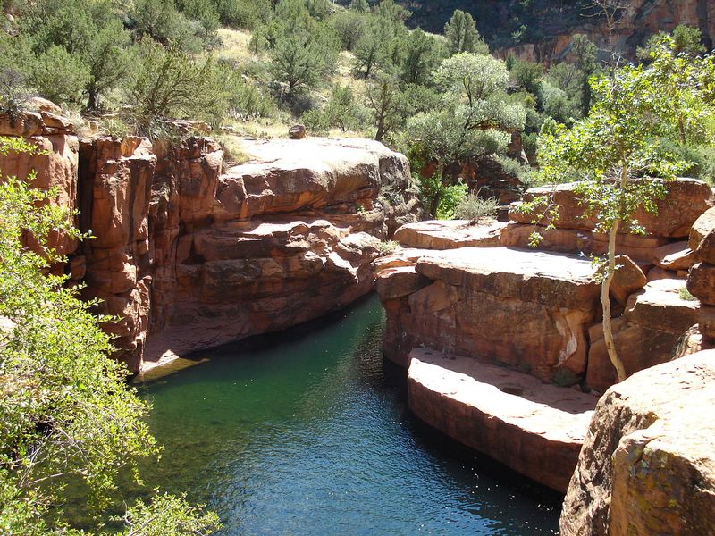
The sapphire-blue pools formed by Sycamore Creek attract both wildlife and visitors. Animals depend on these water sources year-round.
Protecting them means not disturbing the surrounding habitat.
Best Times To Visit For Optimal Viewing
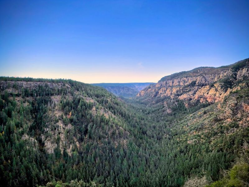
Timing your visit to Sycamore Canyon makes a massive difference. Spring and fall are the clear winners for comfort and scenery.
Summer temperatures can push past 100 degrees on the canyon floor.
April through June brings blooming wildflowers and flowing water in the creek. The canyon feels alive with color during this window.
Trail conditions are also at their most manageable.
Fall is honestly underrated here. October turns the cottonwood and sycamore trees into brilliant gold.
That warm color against the red canyon walls is one of Arizona’s best-kept visual secrets.
Winter visits are possible but require preparation. Snow occasionally dusts the upper rim trails.
Lower canyon trails remain accessible most winters, though creek crossings can be tricky.
Avoid mid-July through August if heat is a concern. Monsoon season also brings flash flood risk during those months.
The canyon funnels water fast when storms roll through.
Early morning starts are always smart in any season. Wildlife is most active at dawn and dusk.
You also avoid peak heat and get the best light for viewing canyon colors.
Wet years bring a special bonus. Sycamore Falls appears as an ephemeral waterfall during high water periods.
Catching it requires luck and good timing, but it is absolutely worth the effort.
Photography Tips For Capturing Natural Beauty
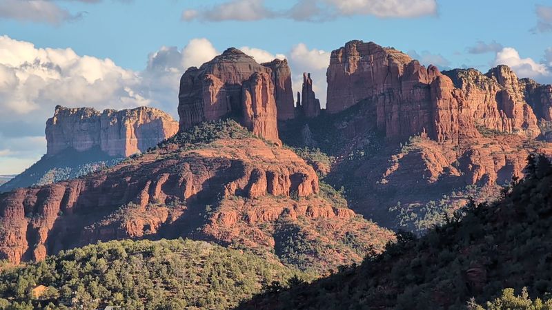
Sycamore Canyon rewards patient photographers in a big way. The canyon walls shift color dramatically depending on the time of day.
Golden hour here is genuinely on another level compared to more crowded spots.
Shoot during the first hour after sunrise for warm, soft light. The red sandstone glows amber during this window.
Shadows are long and add incredible depth to rock formation shots.
Blue pools along Sycamore Creek make for mirror-like reflections. A wide-angle lens captures both the water and the canyon walls together.
Polarizing filters help cut glare on the water surface.
Vertical compositions work especially well in the narrower canyon sections. The towering walls frame naturally.
Let the height of the cliffs dominate your frame for dramatic effect.
Wildlife photography here requires stillness and patience. Set up near the creek at dawn and wait quietly.
Animals approach the water regularly and ignore still observers.
Autumn cottonwood trees add foreground interest to canyon shots. Use them to frame distant red rock formations.
The color contrast between gold leaves and red walls is effortless to shoot.
Bring extra batteries and memory cards. There is no phone signal to back up images mid-trail.
The remoteness of the canyon means you are fully on your own out there, which is actually perfect for focused shooting.
Hiking Trails And Difficulty Levels
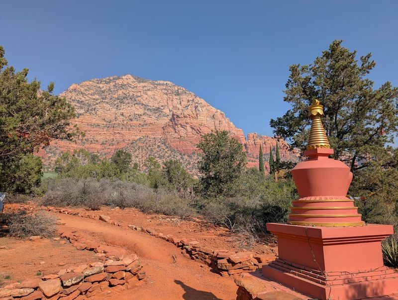
This canyon has trails for different experience levels, but none of them are exactly casual strolls. The terrain is rugged and remote throughout.
That is part of the appeal for people who want real backcountry hiking.
The Parsons Trail is the most popular entry point. It follows Sycamore Creek through the lower canyon for about 7.8 miles one way.
Creek crossings are required, so expect wet feet.
The Sycamore Rim Trail is an 11.1-mile loop along the canyon’s upper edge. It passes through pine forests and offers overlook views into the canyon below.
Difficulty is moderate with manageable elevation changes.
Reaching the canyon interior often involves unpaved dirt roads. High-clearance vehicles are strongly recommended for several trailheads.
Standard sedans will have a rough time on those approach roads.
Trail markers can be sparse in certain sections. Navigation skills and a downloaded offline map are genuinely necessary here.
Do not rely solely on cell service because there is none.
Backcountry camping is permitted in the wilderness area. Multi-day trips allow deeper canyon exploration beyond day hiker range.
A permit is not required, but Leave No Trace principles are strictly expected.
Physical fitness matters for this canyon. Heat, rocky terrain, and creek crossings combine to challenge even experienced hikers.
Start early, carry plenty of water, and know your limits before heading out.
Preservation Efforts And Environmental Impact
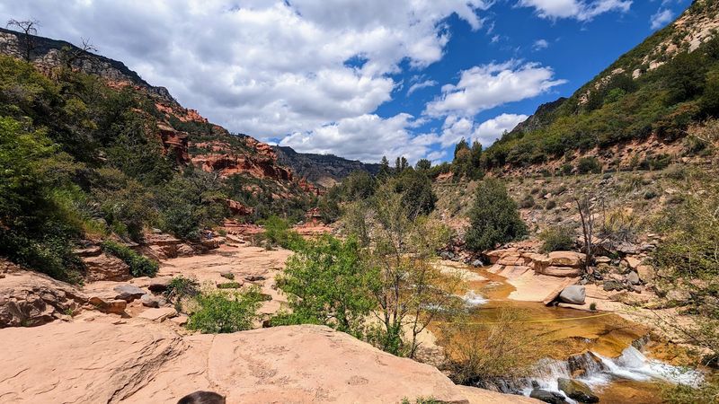
This landscape is designated as a federally protected Wilderness Area. That status restricts motorized vehicles and heavy development inside the canyon.
The designation is the main reason the area remains so pristine.
The Coconino, Kaibab, and Prescott National Forests jointly manage the wilderness. Coordination between three forest units keeps protection consistent across the full canyon area.
That shared management model is not common and reflects the canyon’s unique boundaries.
Visitor impact is a real concern even with low crowd numbers. Trampling vegetation near creek banks damages fragile riparian ecosystems.
Staying on established trails prevents erosion and habitat disruption.
Wildlife corridors inside the canyon are critical for large mammals. Black bears and mountain lions need undisturbed movement zones.
Human presence that strays off trail can fragment those corridors over time.
Invasive plant species pose a growing threat to native vegetation. Buffelgrass and other non-native plants spread quickly in disturbed soil.
Hikers unknowingly carry seeds on clothing and gear between locations.
Brush off boots and gear before entering wilderness trailheads. That simple action reduces invasive species spread significantly.
Many hikers skip this step without realizing the long-term damage it causes.
Fire management is active throughout the Coconino National Forest. Controlled burns reduce fuel loads and mimic natural fire cycles.
Healthy fire ecology supports the very plant communities that make Sycamore Canyon so visually striking.
Local Legends And Historical Significance
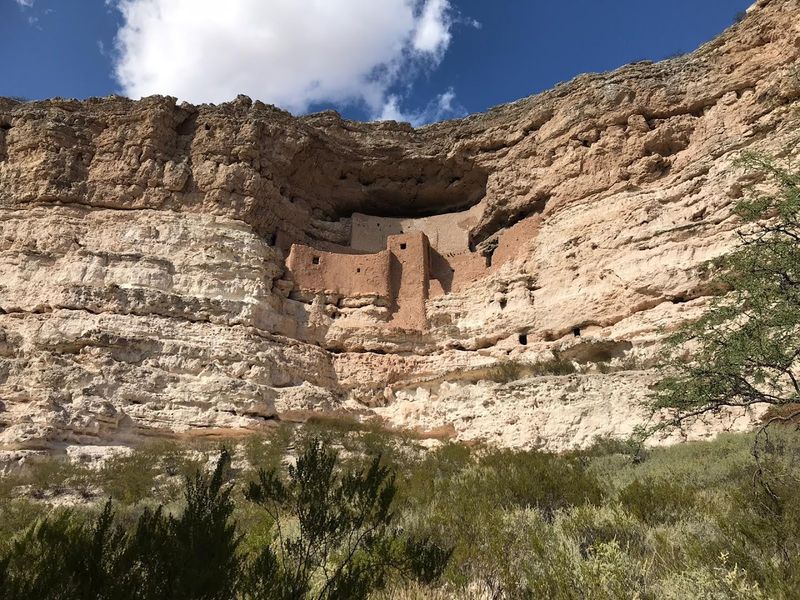
This area carries a deep human history that most visitors never learn about. Indigenous peoples lived in and around this canyon for thousands of years.
Their presence shaped how the land was used and understood long before modern trails existed.
The Sinagua people left significant traces throughout the Coconino National Forest region. Nearby Walnut Canyon National Monument preserves cliff dwellings dating back to A.D. 1150.
That context gives the entire forest area a layered cultural weight that goes far beyond scenery.
Yavapai and Apache communities hold traditional connections to Sycamore Canyon specifically. The canyon appears in oral histories and cultural narratives tied to the land.
Respecting that history means treating the wilderness with genuine care.
Early Anglo explorers documented the canyon in the late 1800s. They noted its dramatic scale and challenging terrain.
The same features that kept settlers away are what preserved it so well into the present day.
Local legends describe Sycamore Creek as a life-giving force in an otherwise dry landscape. Communities downstream historically depended on its seasonal flows.
That relationship between water and survival is woven into the canyon’s story.
Archaeological sites exist within the wilderness boundary. Artifacts and rock art have been documented in several locations.
Disturbing or removing anything from these sites is both illegal and deeply disrespectful to living cultural traditions.
Accessibility And Visitor Amenities
Getting to Sycamore Canyon requires some honest preparation. The main trailheads sit roughly 40 miles southwest of Flagstaff.
Several access roads are unpaved and can be rough depending on recent weather conditions.
High-clearance vehicles handle the dirt road approaches much better than standard cars. Four-wheel drive is recommended for certain trailhead routes.
Checking road conditions with the Coconino National Forest office before your trip is always a smart move.
Amenities inside the wilderness are minimal by design. There are no visitor centers, gift shops, or paved parking lots within the canyon.
Pit toilets exist at some trailheads, but do not count on much beyond that.
Cell service is essentially nonexistent once you leave the main highway. Download offline maps before you go.
Paper maps from the forest headquarters are also a reliable backup option.
Water sources exist along Sycamore Creek, but all water requires treatment before drinking. Carry a filter or purification tablets on every trip.
Do not assume creek water is safe to drink untreated.
Dogs are permitted in the wilderness area on leash. Keep pets under control near wildlife and water sources.
Some creek crossings can be challenging for smaller dogs during high water periods.
The Coconino National Forest headquarters at 1824 S Thompson St, Flagstaff, AZ 86001 provides permits, maps, and current trail updates. Stop there before heading out for the most current and accurate information available.