Winding Past Lighthouse Towns And Fishing Villages This Rhode Island Drive Deserves Far More Attention
Lighthouses keep watch over every curve of this Rhode Island coastline, and most drivers speed past them. Quiet harbors, fishing boats, and salt air turn this drive into something worth savoring.
Tiny villages line the route, each one quieter and more charming than the last. Beaches open up between them, long stretches of sand with barely anyone in sight.
Postcard-worthy lighthouse towers sit only steps from working docks, an unusual pairing that somehow makes sense up close. Art festivals, oyster farms, and colonial architecture show up too, each town adding its own flavor.
Rhode Island keeps most of this coastline quiet, away from the bigger crowds found elsewhere. A slower pace and a full tank of gas are all this drive really asks for.
Watch Hill And The Lighthouse That Started It All
Few drives begin with as much drama as this one. Watch Hill sits at the southwestern tip of Rhode Island, a refined coastal village where Victorian architecture lines the bluffs and the Atlantic stretches endlessly to the horizon.
The Watch Hill Lighthouse anchors the whole scene. Perched above the water at 14 Lighthouse Road, Westerly, RI 02891, it has guided mariners along this stretch of coast for well over a century.
The lighthouse grounds offer some of the most striking ocean views in the entire state.
Watch Hill itself moves at a slower pace than the rest of the world. Small boutique shops and a classic carousel draw visitors during warmer months.
The beaches here are wide and clean, with a calm that feels almost deliberate. Starting a drive on Route 1A from this village sets an immediate tone: this is a road that rewards patience, curiosity, and a willingness to pull over often and simply look around.
Victorian Westerly And Its Surprisingly Deep Roots
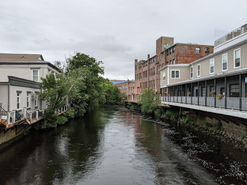
Westerly carries its history proudly. The town traces its founding back to 1661, making it one of the older settlements in Rhode Island and a place where layers of the past are visible in almost every building downtown.
The Victorian-era architecture here is worth slowing down for. Ornate facades, wraparound porches, and carefully maintained streetscapes give Westerly a storybook quality that feels authentic rather than staged.
This is not a town that was designed for tourists; it simply grew this way over centuries.
Family-friendly beaches sit within easy reach of the town center. The local community has a genuine pride in its surroundings that shows in well-kept parks and a lively main street.
Westerly also serves as the practical gateway to the rest of Route 1A, so grabbing supplies here before heading north makes good sense. Starting the journey with a walk through town adds welcome context to everything that follows along the coastal drive.
Charlestown’s Quiet Shoreline And Wildlife Refuge
Charlestown operates on a frequency that most busy travelers never tune into. This town prizes quiet above almost everything else, and the landscape reflects that perfectly with long stretches of undisturbed shoreline and open sky.
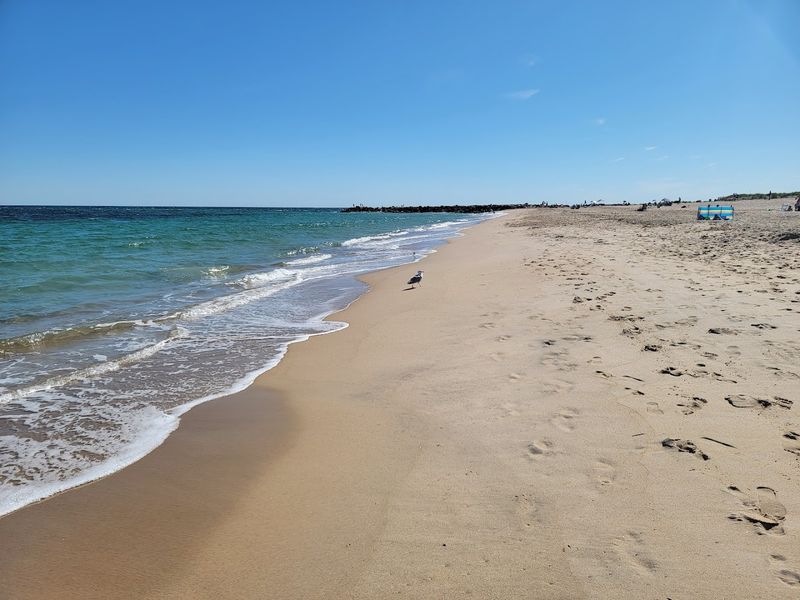
Charlestown Breachway State Beach, Charlestown Town Beach, and Green Hill Beach all sit within reach of Route 1A. Each offers a slightly different experience, from calm inlet waters to open surf, giving visitors real options depending on their mood.
The beaches here tend to feel less crowded than the more famous Rhode Island spots further north.
The Ninigret National Wildlife Refuge adds another dimension entirely. This protected area covers a significant stretch of coastal habitat and draws birdwatchers, hikers, and anyone who appreciates wild, unhurried nature.
Charlestown also hosts a beloved seafood and lobster festival that draws crowds each summer, proving that even the quietest towns know how to celebrate what the ocean provides. Plan extra time here.
South Kingstown’s Oyster Farms And Sandy Shores
Matunuck is the kind of village that food lovers stumble upon and never quite forget. Sitting within South Kingstown, this small community has built a quiet reputation around oyster farming, with local operations producing shellfish that end up on menus across New England.
South Kingstown Town Beach offers a wide, welcoming stretch of sand that draws families throughout the warmer months. The beach has a comfortable, unpretentious atmosphere that feels refreshingly local rather than touristy.
Nearby, the village of Wakefield serves as the main commercial hub, with shops and eateries that cater to both residents and passing travelers.
A historic grist mill stands as one of South Kingstown’s most tangible connections to its agricultural past. Rhode Island’s colonial-era economy relied heavily on mills like this one, and seeing it in context along the drive adds a grounding sense of history.
South Kingstown rewards travelers who resist the urge to rush and instead wander its back roads with genuine curiosity.
Narragansett Bay Views That Stop Traffic
Narragansett earns its summer crowds honestly. The town’s position along the bay delivers views that feel almost unfairly beautiful, with open water, rocky outcroppings, and a horizon that seems to go on forever.
The population here swells dramatically when warm weather arrives, and for good reason. Dramatic surf conditions attract surfers and wave-watchers alike, while calmer stretches of shoreline suit swimmers and paddlers.
The visual contrast between the rocky coast and the deep blue of Narragansett Bay gives this section of Route 1A its most photogenic mile markers.
Beyond the scenery, Narragansett carries a relaxed coastal confidence. The town does not try too hard to impress; it simply exists beautifully along the water and lets visitors draw their own conclusions.
Driving through in the early morning, before the summer crowds arrive, reveals a quieter version of this place that feels almost private. Catching the bay at sunrise from one of the roadside pullouts is an experience worth setting an early alarm for.
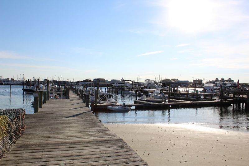
Galilee And The Real Working Life Of A Fishing Port
Galilee does not pretend to be anything other than what it is. This authentic fishing village within Narragansett hosts Rhode Island’s largest commercial fishing fleet, and the docks make that fact impossible to miss.
Lobster traps stacked along the piers, fishing vessels heading out before dawn, and the unmistakable smell of the sea at full strength define the atmosphere here. Fresh seafood is available in abundance, with no-frills eateries serving up catches that arrived hours earlier.
The food tastes different when the distance between ocean and plate is measured in minutes rather than days.
Galilee also serves as the departure point for the Point Judith ferry, connecting this stretch of the Rhode Island coast to Block Island. Even travelers who do not take the ferry will find the terminal area worth visiting for its views of boat traffic and the working harbor.
Galilee strips away any romantic gloss and shows the coast as a place of honest, daily labor. That authenticity is precisely what makes it memorable.
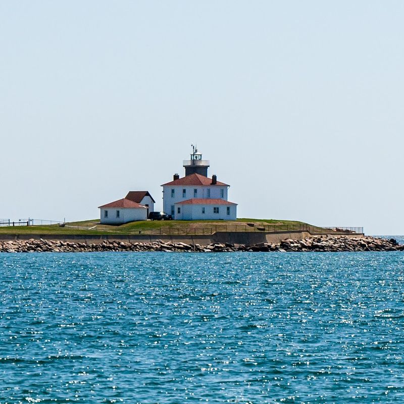
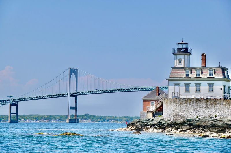
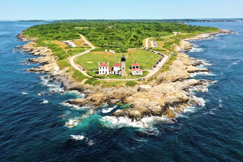
Point Judith Lighthouse And Its Enduring Lens
Point Judith Lighthouse stands as one of the most recognizable structures along the entire Route 1A corridor. Reachable by heading south on Route 108 from US Route 1, this lighthouse has marked the entrance to Narragansett Bay for generations of sailors.
The tower rises 51 feet and still operates with a Fresnel lens dating to 1857, a remarkable piece of optical engineering that remains in active service. The grounds around the lighthouse are open to visitors, offering close-up views of the structure and sweeping perspectives of the water.
The lighthouse itself and the adjoining Coast Guard station are restricted areas, but the surrounding landscape provides more than enough to reward a visit.
Point Judith occupies a historically significant position at the mouth of the bay, where shifting currents and unpredictable weather once made navigation genuinely hazardous. Standing at the point and watching the water move around the rocky shoreline makes that history feel immediate rather than distant.
This stop earns its place on any Route 1A itinerary without question.
Jerusalem Across The Harbor From Its Famous Neighbor
Jerusalem sits quietly across the harbor from Galilee, and that proximity tells most of the story. Where Galilee bustles with commercial fishing activity, Jerusalem offers a slightly slower, more contemplative version of coastal village life.
The two villages share the same general geography but carry different personalities. Jerusalem’s harbor views look directly across at Galilee’s working docks, creating an interesting visual dialogue between the two communities.
Watching the fishing boats move between the two sides of the harbor is one of those simple pleasures that somehow holds attention far longer than expected.
Rhode Island’s fishing culture runs deep in both villages, and Jerusalem preserves that heritage in its landscape and its pace. The harbor area rewards patient visitors who find a spot to sit and watch the water traffic without any particular agenda.
It is the kind of place that travel itineraries rarely include but that tends to become a highlight in hindsight. Quieter than its neighbor, Jerusalem offers a genuine slice of coastal character that feels completely unscripted.
Wickford Village And Its Centuries Of Coastal Charm
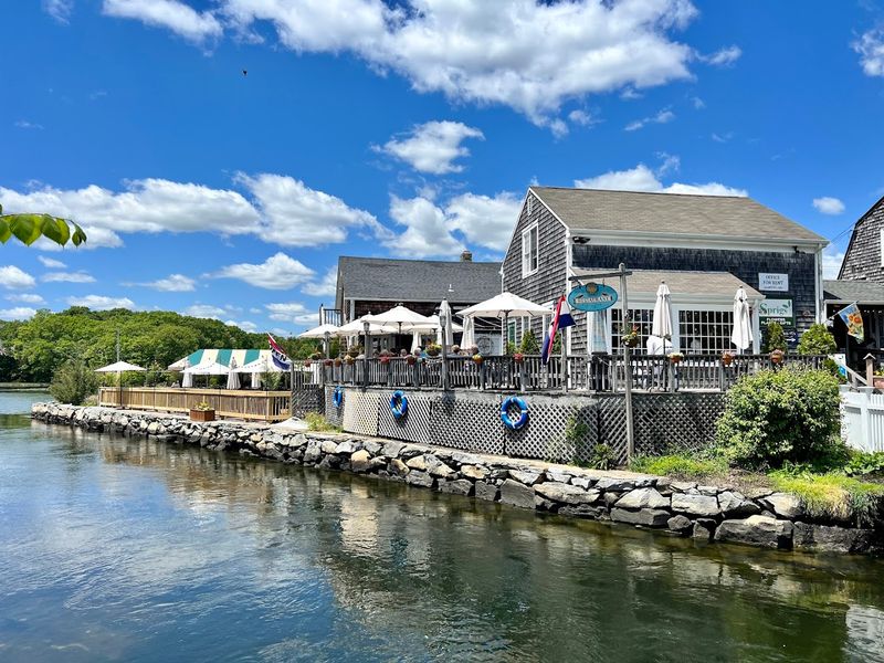
Wickford Village arrives near the northern end of Route 1A like a reward for everyone who made the full drive. This historic district within North Kingstown ranks among the best-preserved colonial villages in all of New England, and walking its narrow streets confirms why.
Quaint houses line the roads leading down to a small fishing port, where pleasure craft and working boats share the calm harbor waters. Independent shops occupy historic storefronts, and the overall scale of the village feels perfectly human.
Nothing here is oversized or overwhelming, which is exactly the point.
Wickford also hosts one of Rhode Island’s most celebrated art festivals each summer, drawing visitors who appreciate both the setting and the creativity it inspires. The village has a year-round community feel that distinguishes it from purely seasonal destinations.
Coming through on a weekday in the shoulder season reveals a side of Wickford that summer crowds obscure: unhurried, genuinely beautiful, and deeply connected to its maritime roots. It is a fitting final chapter for an extraordinary coastal drive.
Saunderstown’s Bay Views And A Birthplace Worth Finding
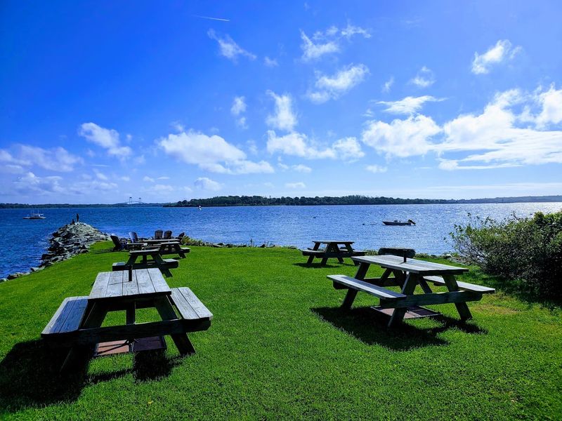
Saunderstown is the kind of place that appears on few travel lists but deserves a spot on all of them. This quiet village within North Kingstown offers expansive views of Narragansett Bay from a vantage point that feels genuinely off the beaten path.
The Gilbert Stuart Birthplace and Museum stands as the area’s most significant cultural landmark. Stuart, one of America’s most celebrated portrait painters, was born here, and the restored property offers a fascinating window into colonial-era life along the Rhode Island coast.
The surrounding landscape has changed relatively little since Stuart’s time, which gives the site an unusual sense of continuity.
Bay views from Saunderstown stretch wide and clear, particularly in the morning when the light sits low over the water. The village itself is small and residential, with little commercial development to interrupt the historic character of the area.
Stopping here adds genuine depth to the Route 1A experience, connecting the natural beauty of the drive to the artistic and cultural history that Rhode Island carries with quiet pride.
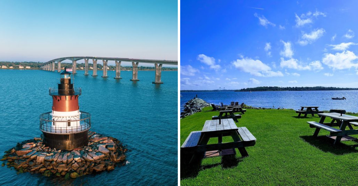
Plum Beach Lighthouse Seen From The Shore
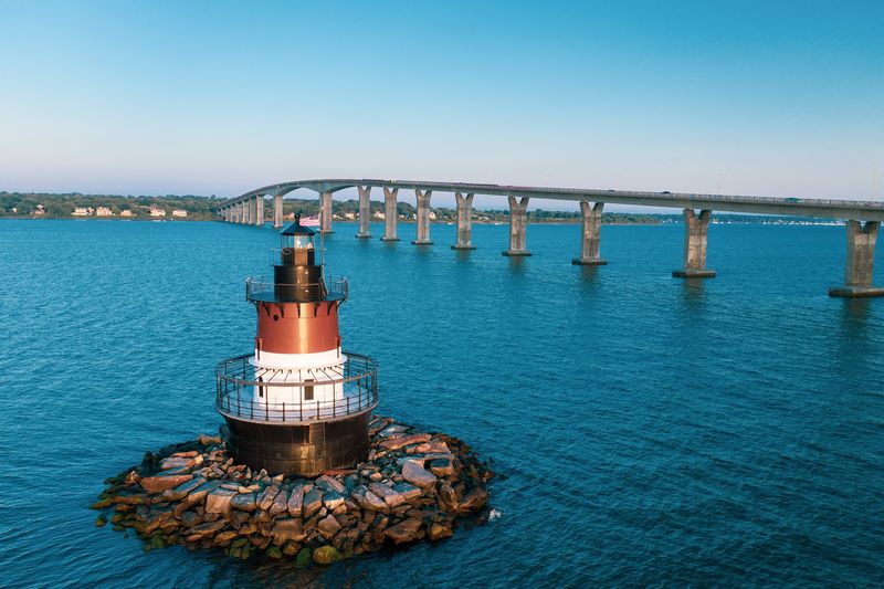
Not every lighthouse demands a long hike or a boat ride. Plum Beach Lighthouse earns its viewing from a comfortable distance, visible from the Jamestown Bridge as Route 1A reaches North Kingstown and connects to Route 138.
This distinctive structure belongs to the sparkplug lighthouse category, a design that places the entire structure on a single foundation rising directly from the water. The silhouette it cuts against the bay is immediately recognizable and surprisingly photogenic from the bridge vantage point.
Photographers and curious passersby tend to stop here longer than they planned.
The lighthouse was dark for decades after its original deactivation but now operates again as a private aid to navigation, its beacon relit after a careful restoration. Seeing it from the bridge provides a different kind of lighthouse experience than climbing to a keeper’s room or walking around a coastal headland.
Rhode Island’s maritime history is layered and complex, and Plum Beach Lighthouse represents a chapter of that story that played out quietly in open water rather than along a dramatic rocky shore. Worth the brief stop every time.
Why Scenic Route 1A Rewards The Unhurried Traveler
Speed is the enemy of this drive. Route 1A covers roughly 33 miles through Washington County, but treating those miles like a race misses everything that makes the route worth taking in the first place.
The real value of Scenic 1A lies in its accumulation of small moments. A lighthouse catching the morning light, a harbor full of working boats, an oyster farm visible from the road, a Victorian streetscape that has barely changed in a century.
None of these moments announce themselves loudly. They reward drivers who slow down, pull over, and actually look.
Rhode Island’s compact geography means that this entire drive fits comfortably into a single day, though two days allows for proper exploration of each town along the way. The route parallels busy US Route 1 for its entire length, meaning the faster highway is always nearby for anyone who needs it.
But choosing Route 1A means choosing something richer, slower, and considerably more memorable. That choice, it turns out, is the whole point of the drive.