
This Breathtaking Mountain Drive In North Carolina Is Completely Free And Surprisingly Underrated
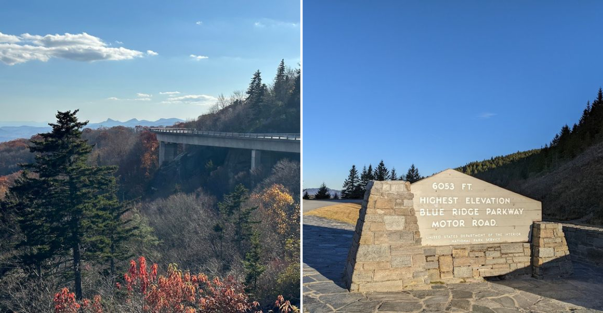
Not every remarkable experience carries a price tag. This mountain drive proves that better than almost anything else in the region.
The views open up gradually as the elevation climbs, rewarding every mile with something worth pulling over for.
Ridgelines stretch across the horizon, valleys drop sharply below the roadside, and the light hits differently up here depending on the season. Most drivers pass through without ever realizing what they are looking at.
That is exactly what keeps it underrated. North Carolina has spent years attracting visitors to its more obvious landmarks.
This drive quietly outperforms most of them at zero cost. No entrance fees, no reservations, and no crowds competing for the same overlook at the same time.
Just open road, clean mountain air, and scenery that genuinely earns the word breathtaking.
Natural Landscapes And Wildlife Along The Route
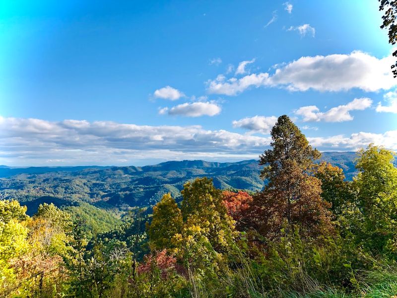
This spot does not ease you into its beauty. It hits you all at once.
Rolling mountain ridges stretch out in every direction, layered like waves frozen in time.
The forests along the route are dense and full of life. Hardwood trees crowd the slopes, and wildflowers pop up along the roadside depending on the season.
You will notice the landscape shifting as you gain elevation.
Wildlife sightings are genuinely common here. White-tailed deer often graze near the road at dawn and dusk.
Black bears have been spotted in several areas, so keep your eyes open and your snacks sealed.
The Appalachian Mountains form the backbone of this entire drive. The terrain changes from gentle meadows to rocky outcrops within just a few miles.
That variety is what makes every stretch feel like a discovery.
Streams and creeks run alongside parts of the road, adding sound to the scenery. The air feels noticeably cooler and cleaner at higher elevations.
It is the kind of place where you instinctively slow down, not just because the speed limit says 45 mph, but because you genuinely do not want to rush past it. Located in the United States, this route is one of the most rewarding free drives in the country.
Best Spots For Photography And Scenic Views
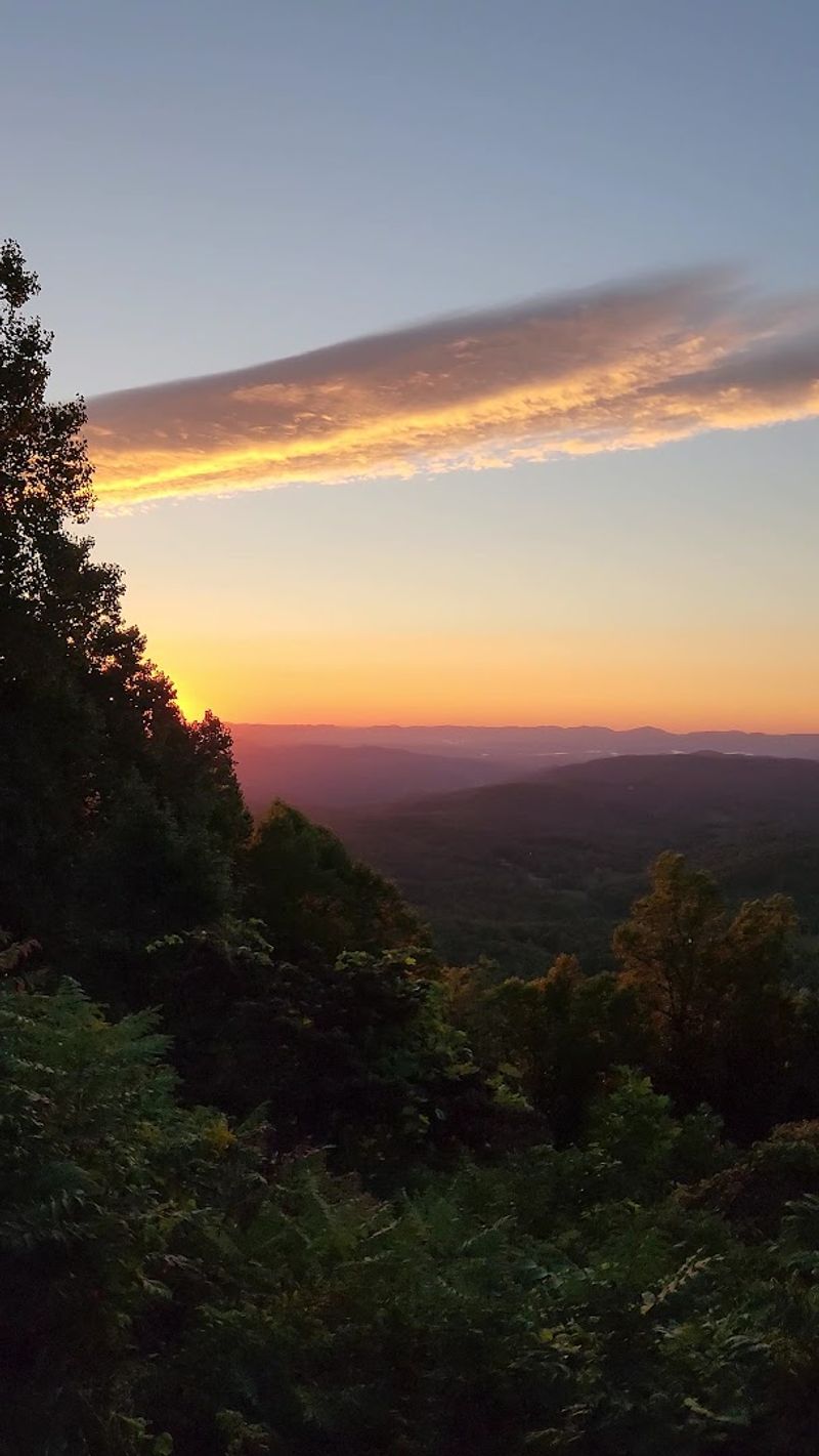
Photographers absolutely love this road, and honestly, it is easy to see why. The Parkway is lined with overlooks designed specifically to frame the mountains perfectly.
You do not need to hike far to get a stunning shot.
Linn Cove Viaduct at Milepost 304.4 is one of the most photographed spots on the entire Parkway. The bridge curves gracefully around Grandfather Mountain in a way that looks almost unreal.
Both the structure and the surrounding scenery photograph beautifully in any season.
Rough Ridge Overlook at Milepost 302.8 rewards hikers with 360-degree views. You can see Grandfather Mountain in one direction and rolling ridges in every other.
Sunrise here is worth the early alarm.
Waterrock Knob at Milepost 451.2 sits at high elevation and offers sweeping views of the Great Smoky Mountains. It is a top pick for sunset photography.
The colors the sky produces there on a clear evening are genuinely hard to describe.
Craggy Gardens at Milepost 364.4 offers panoramic views from the Craggy Pinnacle Trail. The rocky summit gives you an unobstructed look at the surrounding ridges.
Bring a wide-angle lens if you have one, because the scale of everything here is enormous and worth capturing properly.
Seasonal Changes And Their Impact On The Scenery
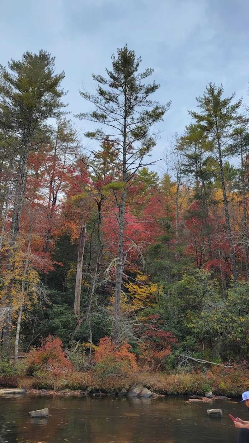
Every season on the Blue Ridge Parkway looks completely different, and that is not an exaggeration. The road transforms so dramatically that returning visitors often say it feels like a brand new experience each time.
That kind of variety keeps people coming back year after year.
Spring brings an explosion of wildflowers along the roadsides and overlooks. Serviceberry and redbud trees bloom early, followed by rhododendrons and mountain laurel later in the season.
Craggy Gardens in late spring is particularly stunning when the azaleas are in full bloom.
Summer keeps the mountains green and lush. Visibility can sometimes be limited by haze, but the forests are vibrant, and the temperatures at elevation stay noticeably cooler than the surrounding lowlands.
It is a great time to hike without overheating.
Fall is peak season, no question. The leaf color typically peaks between mid-October and early November, depending on elevation.
The higher sections turn first, so you can actually chase the color by adjusting where you drive.
Winter brings a quieter, more dramatic mood. Snow-dusted ridgelines and bare trees create stark, beautiful views.
Some sections close due to ice, so always check road conditions before heading out. The National Park Service posts closures online and updates them regularly.
Plan accordingly, and you will not be disappointed, no matter what month you visit.
Recreational Activities Available Near The Drive
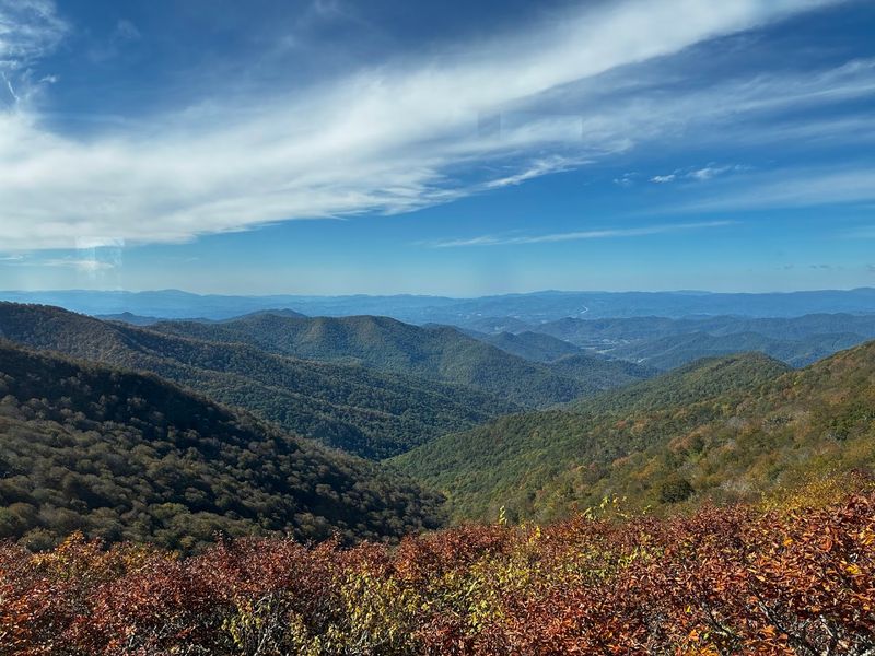
The Blue Ridge Parkway is not just a drive. It is a launchpad for an enormous variety of outdoor activities.
Over 200 miles of hiking trails branch off from the main road, covering everything from easy walks to serious summit climbs.
Linville Falls at Milepost 316.3 offers multiple trail options leading to views of a stunning triple waterfall. The Linville River drops into Linville Gorge in a dramatic cascade that rewards even the shortest hike.
It is one of the most visited natural attractions in North Carolina for good reason.
Graveyard Fields at Milepost 418.8 features a loop trail through high-elevation meadows with access to two waterfalls. The terrain is open and scenic, making it popular with families and casual hikers.
Rhododendron thickets line much of the path.
Cycling is also popular on the Parkway. The low traffic volume and smooth pavement make it appealing for road cyclists.
Just be prepared for significant elevation changes on most segments.
Fishing is available at several streams and rivers accessible from the road. Trout are common in the mountain waterways.
Picnic areas are scattered throughout the route, making it easy to stop and enjoy a meal outdoors. There are also carriage trails at Moses H.
Cone Memorial Park for walking or horseback riding. The options genuinely cover something for every type of outdoor person.
Historical Significance Of The Surrounding Area
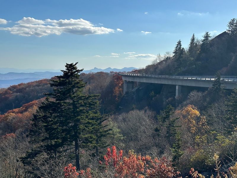
The Blue Ridge Parkway was not built overnight. Construction began in 1935 as part of a Depression-era effort to create jobs and connect two national parks.
It took over 52 years to complete the full route, with the Linn Cove Viaduct being the final piece finished in 1987.
The surrounding mountains hold centuries of Cherokee history. The Eastern Band of the Cherokee Nation has lived in these mountains long before the Parkway existed.
Their presence, culture, and connection to the land are woven into the identity of this entire region.
Moses H. Cone Memorial Park at Milepost 294.1 preserves a 1901 estate called Flat Top Manor.
Moses Cone was a textile magnate who built a mountain retreat here and developed the land with carriage trails that are still used today. The manor now houses a Southern Highland Craft Guild shop.
The Appalachian settlements along the route tell stories of self-sufficient mountain communities. Farming, craft-making, and music traditions developed in relative isolation for generations.
The Folk Art Center near Asheville celebrates this heritage and is open year-round at no charge.
The Parkway itself is a National Parkway and a Historic Landscape listed on the National Register of Historic Places. That designation recognizes not just the scenery but the human history embedded in every mile of this remarkable road.
Tips For Planning A Safe And Comfortable Journey
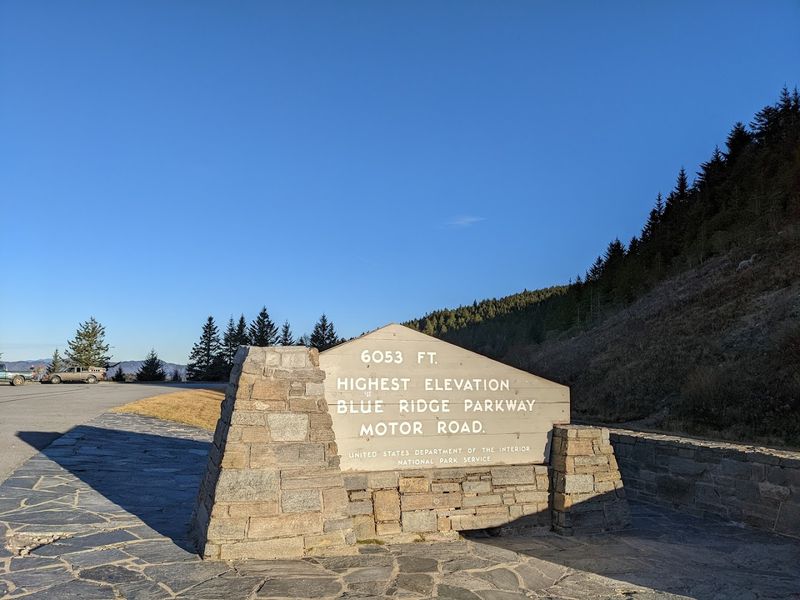
Planning makes a real difference on the Blue Ridge Parkway. The road has no gas stations, so fill up your tank before entering the route.
Running out of fuel on a mountain road with no cell service is not a fun situation.
The speed limit maxes out at 45 mph, and many sections drop lower due to curves and wildlife crossings. Treat it as a scenic route, not a highway.
Rushing through defeats the entire purpose of being there.
Check the National Park Service website before your trip. Sections of the Parkway close regularly due to weather, rockslides, or maintenance.
Closures can happen with little warning, especially in winter and early spring.
Pack layers regardless of the season. Temperatures at elevation can be significantly cooler than in the valleys below.
A sunny morning can turn into a cold, foggy afternoon faster than you expect.
Bring water and snacks for the road. Facilities are limited along most of the route, and the nearest towns are often several miles off the Parkway.
A basic first aid kit and a portable phone charger are also worth having in the car.
Start early if possible. Morning light is beautiful on the mountains, and popular overlooks can get crowded by midday during peak season.
An early start also gives you more time to explore without feeling rushed. Cell service is spotty, so download offline maps before you go.
Local Plants And Animals To Look Out For
The plant life along the Blue Ridge Parkway is genuinely diverse. The route passes through multiple ecological zones as it climbs and descends in elevation.
That shift in environment means you encounter very different plant communities within short distances.
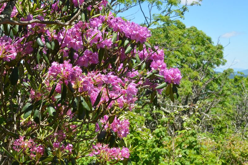
Rhododendrons are probably the most iconic plant on the Parkway. They bloom in late spring and early summer, covering entire hillsides in pink and purple.
Craggy Gardens is the most famous spot for this display, but you will see them throughout the route.
Mountain laurel also blooms in late spring and fills the understory with clusters of white and pink flowers. Flame azaleas add brilliant orange color at higher elevations.
Wildflowers, including trillium, bloodroot, and Jack-in-the-pulpit, appear along forest trails in spring.
On the animal side, white-tailed deer are the most commonly spotted mammals. Black bears are present throughout the corridor, especially in forested sections.
Keep a safe distance and never feed them.
Bird watchers have a lot to look forward to here. Warblers, ruffed grouse, and peregrine falcons have all been recorded along the Parkway.
The Dark-eyed Junco is practically a mascot of the high-elevation forests.
Salamanders thrive in the moist mountain streams and forest floors. The southern Appalachians are considered one of the most salamander-diverse regions in the world.
Keep an eye on rocky stream banks, and you might spot one without even trying.
Recommended Stops And Picnic Areas On The Drive
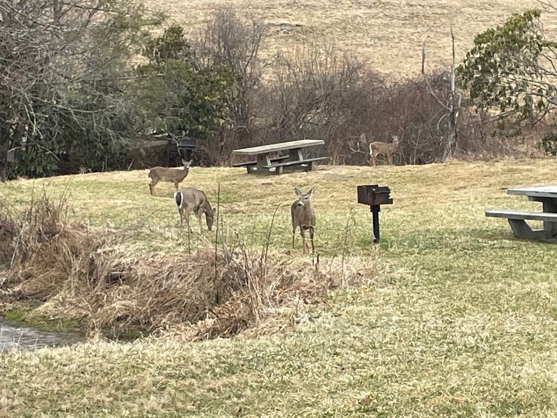
The Blue Ridge Parkway has plenty of places to stop, stretch, and eat without spending a dollar. Picnic areas are spread throughout the route, and most are free to use.
They are well-maintained and often positioned near great views or trailheads.
Crabtree Falls at Milepost 339.5 is a favorite stop for good reason. A woodland trail leads to a 60-foot waterfall, and the surrounding forest is full of wildflowers in spring.
There is a picnic area nearby that makes it easy to turn this into a half-day outing.
Linville Falls at Milepost 316.3 also has picnic facilities near the visitor center. After hiking to the falls, sitting down with a meal surrounded by those views feels like a proper reward.
It is one of the most complete stops on the entire North Carolina section.
Mount Pisgah at Milepost 407.6 offers a picnic area along with a moderately challenging hike to the summit. The views of Pisgah National Forest from the top are well worth the effort.
There is also a camp store nearby that sells basic supplies.
The Waterrock Knob area at Milepost 451.2 has a small parking area and a short trail to the summit. Sunset here draws visitors regularly.
Pack a simple meal and watch the light fade over the Great Smoky Mountains. It is one of the most memorable ways to end a day on the Parkway.