This Massachusetts Rail Trail Could Easily Be The Best Biking And Walking Path You Haven’t Tried Yet
Not every great trail makes the travel magazines. Some of the best ones just sit there quietly, waiting for the right person to show up and give them a chance.
This one stretches for miles through the heart of Massachusetts, cutting through small towns, farmland, and quiet stretches of countryside that most visitors never get to see. It feels less like a trail and more like a window into a side of the state that moves at a slower, easier pace.
You don’t need to be an avid cyclist to enjoy it. Walkers, joggers, and casual riders all find something worth coming back for.
The scenery changes as you go, the crowds stay manageable, and the whole experience costs next to nothing. If you’ve been looking for a reason to get outside this summer, this trail is a pretty convincing one.
A Trail With A Vision Bigger Than Most States Can Manage
When finished, this trail will stretch 104 miles from Northampton all the way to Boston, making it the longest developing rail trail in Massachusetts. That is not a small ambition.
Right now, 64 miles are open to the public, with 92 miles either accessible or protected for future development.
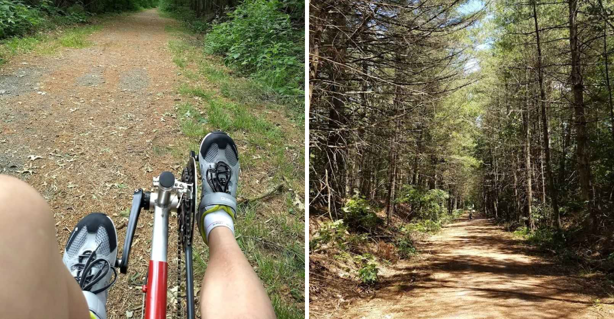
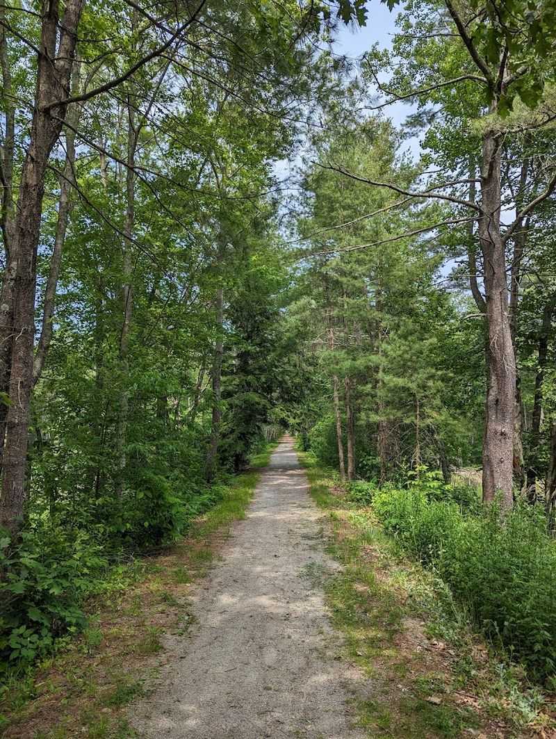
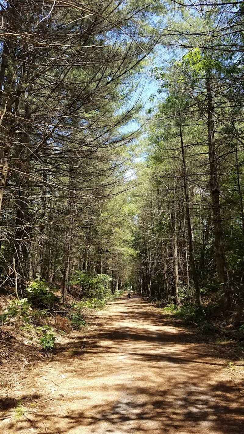
The trail follows the old railroad corridor that once carried passengers and freight across central Massachusetts. Because it was built on rail beds, the path stays remarkably flat throughout its entire length.
That flatness is one of the most appealing qualities for people who want a long, comfortable ride or walk without constantly fighting elevation changes.
The section near New Braintree, located at 1740 Hardwick Rd, gives visitors a solid taste of what the full trail will eventually offer. At 3.2 miles through Hardwick and New Braintree, it opened in October 2015 and is maintained by the East Quabbin Land Trust.
Even this shorter segment rewards visitors with scenery and history that longer, more famous trails sometimes fail to deliver.
The Hard-Packed Gravel Surface That Actually Works For Everyone
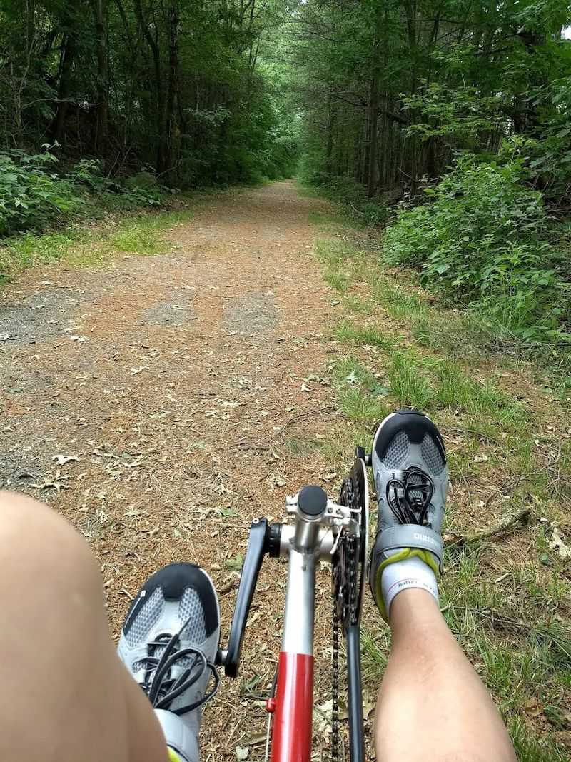
One of the first things visitors notice about this trail is the surface underfoot. The hard-packed gravel is firm enough for road bikes with wider tires, comfortable for walking shoes, and smooth enough for wheelchairs, walkers, and strollers.
That kind of versatility is harder to find than most people expect.
Many rail trails in New England suffer from loose gravel that shifts under wheels or becomes muddy after rain. One reviewer did note that the ground stays wet longer after rainfall, so timing your visit after a dry stretch makes for a better experience.
Still, the overall condition of the surface earns consistent praise from regular users.
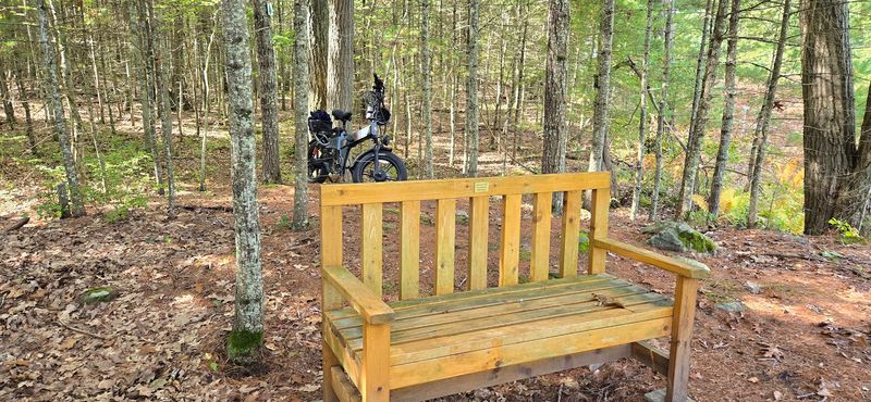
E-bikes are also welcome on this path, which opens the trail to older riders and people recovering from injuries who still want to cover meaningful distance.
The combination of a well-maintained surface and inclusive access policies makes this trail genuinely usable for a wide range of people, not just the athletically inclined.
Families with young children in strollers have reported comfortable outings here, which says a great deal about how thoughtfully this trail has been developed and maintained over the years.
Two Historic Bridges That Deserve More Attention Than They Get
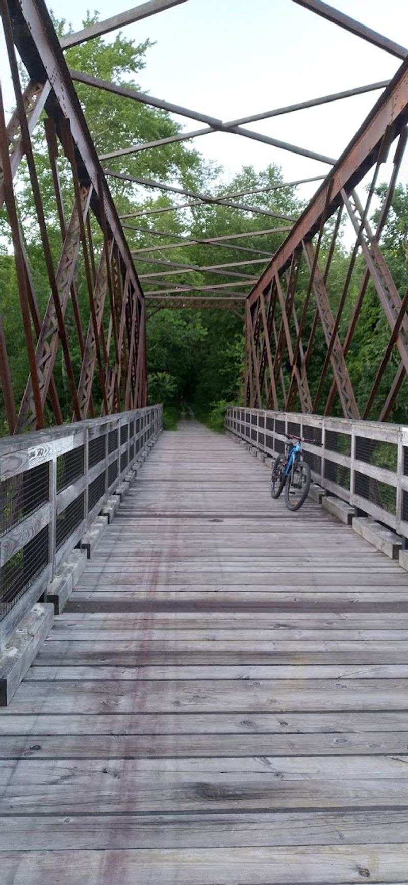
Crossing a bridge on a trail is usually a brief, forgettable moment. On this section of the Mass Central Rail Trail, it is one of the highlights of the entire outing.
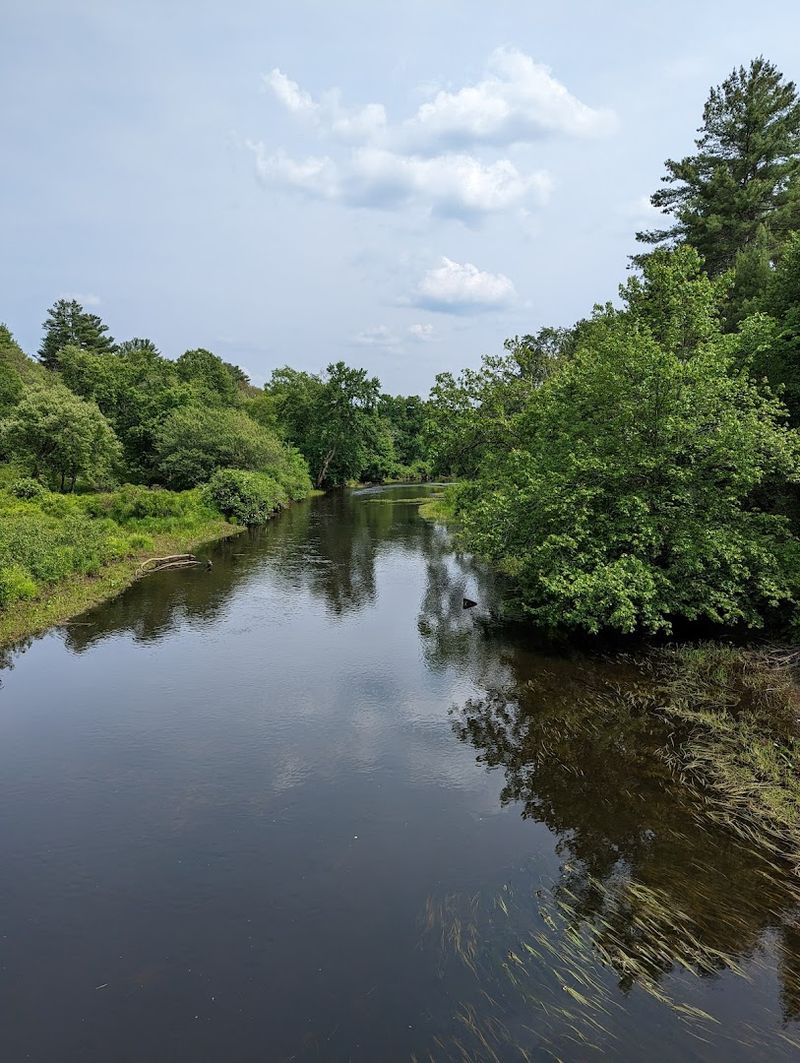
The trail crosses the Ware River twice, once on a lattice truss bridge and once on a pony truss bridge, both of which date back to the railroad era.
The lattice truss bridge sits roughly two miles west of the New Braintree parking area, near Creamery Road in Hardwick. The pony truss bridge is about one mile east, on the way toward Wheelwright.
Each bridge has its own structural character, and stopping in the middle to look down at the Ware River below is a moment worth planning for.
Historic railroad bridges of this type are increasingly rare in New England. Many have been demolished, replaced, or left to deteriorate beyond safe use.
The fact that these two remain intact and part of an active trail corridor is a genuine preservation success. Photographers, history enthusiasts, and casual walkers alike have noted the bridges as standout features of the trail.
They add a layer of depth to the experience that goes well beyond a simple walk through the woods.
You Will Spot More Wildlife Here Than You Ever Expected
Most trail visitors come expecting a pleasant walk. What they sometimes get is a bear sighting.
The Mass Central Rail Trail corridor near New Braintree runs through habitat that supports black bears, otters, deer, coyotes, and a broad range of bird species. Sightings are not guaranteed, but they happen often enough that paying attention to the treeline is worthwhile.
The Ware River valley, which the trail follows through this section, creates a natural wildlife corridor connecting larger forested areas on either side. Animals move through regularly, especially during early morning and late afternoon hours.
Birdwatchers have found the trail particularly rewarding during spring migration, when the forest canopy fills with activity.
Bringing binoculars is a practical idea rather than an overenthusiastic one. The trail is quiet enough that wildlife does not scatter before you arrive.
Because the surface is soft gravel rather than pavement, footsteps and tire sounds are muffled, which works in your favor when you are hoping to observe without disturbing.
Dogs are welcome on the trail but must remain leashed, which also helps preserve the quality of wildlife encounters for everyone sharing the path on any given day.
Parking And Access Points That Make Getting Started Easy
Finding a trail is one thing. Finding a place to park without frustration is another matter entirely.
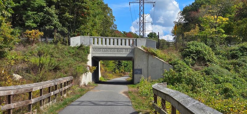
The Mass Central Rail Trail near New Braintree handles this well. The main parking area sits at the site of the former New Braintree train station, at the intersection of Hardwick and West Roads, close to the address at 1740 Hardwick Rd.
Additional parking is available off Creamery Road and Maple Street in Wheelwright, giving visitors options depending on which direction they plan to walk or ride.
Having multiple entry points is especially useful for people doing a one-way trip with a car shuttle, or for those who simply prefer starting from a different end of the trail.
One honest note from past visitors is that the entrance is not always easy to spot from the road. GPS directions have led some people slightly off course, so checking the East Quabbin Land Trust website before your first visit is a smart move.
Once you find the trailhead, the experience is consistently rewarding. The parking areas are well-maintained, and at least one portable restroom facility has been noted by visitors, which is a small but genuinely appreciated detail on any outdoor outing.
Why The Flat Terrain Is Actually A Feature, Not A Compromise
Rail trails carry a reputation for being easy, and some people interpret that as boring. That reading misses the point.
The flat, straight corridor of the Mass Central Rail Trail creates a specific kind of experience that hilly mountain trails simply cannot offer. You can settle into a rhythm, look around, and actually notice your surroundings.
For families with young children, older adults, or anyone coming back from an injury, flat terrain is not a consolation prize. It is the entire reason the outing is possible.
Several reviewers have specifically mentioned using this trail for leisurely walks, casual bike rides, and even speed walks, all on the same surface without conflict or crowding.
The railroad grade also means the trail runs through the landscape rather than over it.
You pass through forest corridors, alongside the Ware River, and across open rural countryside without significant changes in elevation. That creates a meditative quality to the experience that steeper trails rarely achieve.
One longtime visitor mentioned returning hundreds of times over the years, which is a reliable indicator that a trail offers something genuinely satisfying rather than just visually impressive on a first visit.
How This Trail Connects To A Much Larger Regional Network
The New Braintree section is just one piece of a much larger puzzle.
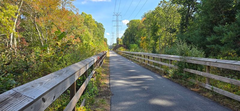
The Mass Central Rail Trail connects to several significant regional paths, including the Somerville Community Path, the Minuteman Bikeway, the Charles River Bike Path, the Bruce Freeman Rail Trail, and the Manhan Rail Trail.
That web of connections transforms a short local outing into a gateway for serious long-distance travel.
For cyclists planning multi-day trips across Massachusetts, the MCRT represents a central artery in the state’s growing off-road network.
As more sections open and gaps are filled, the trail will eventually allow people to travel from the Connecticut River valley to Boston almost entirely on protected paths. That is a meaningful shift in how people can experience the state without a car.
Even for visitors who are only interested in the New Braintree segment, understanding this broader context adds to the experience.
You are not just walking a short stretch of gravel. You are using a section of a developing statewide trail system that has been in progress for years and continues to expand.
The East Quabbin Land Trust and the broader MCRT coalition have been building something genuinely significant, one section at a time, for the benefit of everyone in the region.
Four Seasons Of Reasons To Come Back Again
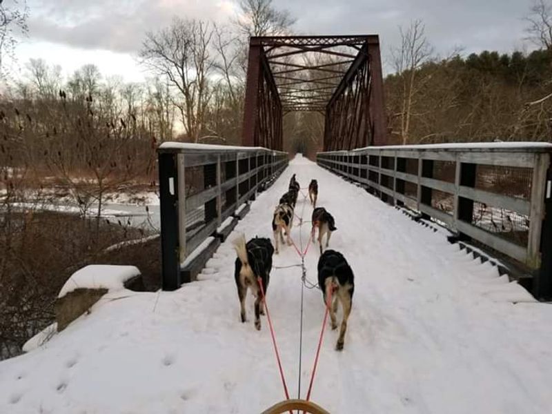
The Mass Central Rail Trail is not a warm-weather-only destination. The trail supports cross-country skiing in winter, and the flat corridor makes for a smooth glide through the forest when snow conditions cooperate.
One visitor even spotted a sled dog mushing team using the trail, which is not something most Massachusetts trails can claim.
Spring brings the Ware River to life, with high water levels and active wildlife making the bridge crossings especially scenic. Summer offers dense tree canopy that provides genuine shade along most of the corridor, keeping the trail noticeably cooler than open roads on hot afternoons.
Fall, predictably, turns the surrounding forest into the kind of display that draws people from across New England.
Each season changes the character of the trail enough to make repeat visits feel fresh rather than repetitive. The surface holds up reasonably well through seasonal transitions, though early spring can bring soft spots after snowmelt.
Planning visits around dry weather in shoulder seasons will generally give you the best surface conditions.
For anyone living within a reasonable drive of central Massachusetts, this trail rewards the habit of returning rather than treating it as a single-visit destination to check off a list.
Read This Before You Lace Up Your Shoes
A few straightforward preparations will make a real difference on this trail. Bring water, especially in warmer months.
The trail does not have water stations, and the 3.2-mile New Braintree section is long enough that you will want hydration, particularly if you are doing an out-and-back.
Bug spray is also worth packing, as one long-time visitor specifically called it out as a necessity for a comfortable walk.
Dogs are welcome and clearly popular on this trail, based on the number of reviews mentioning them. Leashes are required throughout, and visitors are asked to clean up after their pets and respect the private property that borders sections of the corridor.
These are simple courtesies that keep the trail pleasant for everyone who uses it.
The trail is managed by the East Quabbin Land Trust, and their website at masscentralrailtrail.org carries updated information on conditions, events, and future development. Phone contact is available at +1 413-575-2277 for specific questions.
If you are visiting for the first time, arriving with a downloaded map is a smart move, as on-site signage has been noted as limited in some areas. The trail itself is well worth the small amount of advance planning it takes to navigate it confidently.