The Wisconsin Forest With 2,000 Lakes And 800 Miles Of Trails That Most People Drive Right Past
Highways through northern Wisconsin make it easy to keep driving, but pulling over could change your entire trip. Beyond the pavement lies more than a million acres of pine forest, clear lakes, quiet wetlands, and trails that seem to keep going forever.
Hikers can follow rugged paths, paddlers can claim a peaceful stretch of water, and campers can fall asleep without hearing much beyond wind and wildlife. Five protected wilderness areas preserve an even wilder side, where roads disappear and nature sets the pace.
With thousands of lakes and hundreds of miles of trails, there is always another route waiting nearby. Strangely, many travelers pass without stopping, unaware that their next favorite Wisconsin adventure may be only minutes beyond the highway.
More Than 1.5 Million Acres Stretch Across Wisconsin’s Northwoods
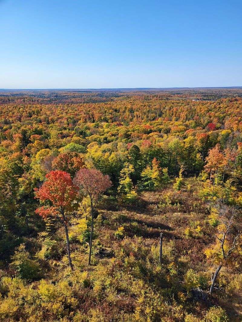
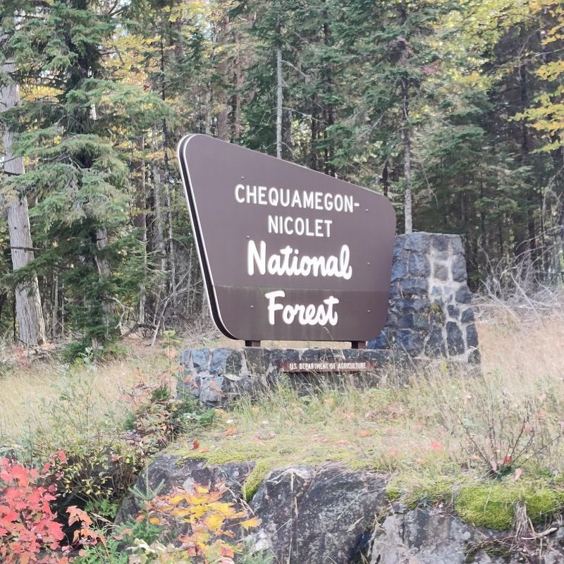
Chequamegon-Nicolet National Forest covers an area larger than the entire state of Delaware. The forest resulted from the merger of two separate national forests in 1993, creating one continuous public land that now ranks among the largest east of the Mississippi River.
Visitors can access the forest from multiple entry points along Highway 70 and other major roads. The administrative office sits at 1170 4th Ave S in Park Falls, though the forest itself has no entrance gates or admission fees.
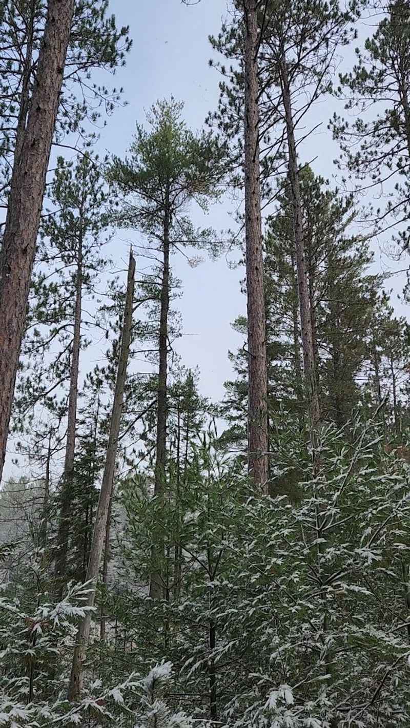
Dense stands of sugar maple, birch, aspen, and evergreens create a canopy that shifts dramatically with the seasons. Fall brings waves of color that draw photographers from across the Midwest, while winter transforms the same landscape into a silent world of snow-covered branches and frozen waterways.
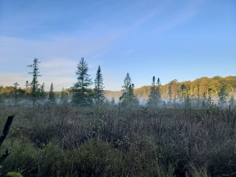
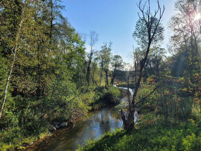
More Than 2,000 Lakes Create Endless Ways To Reach The Water
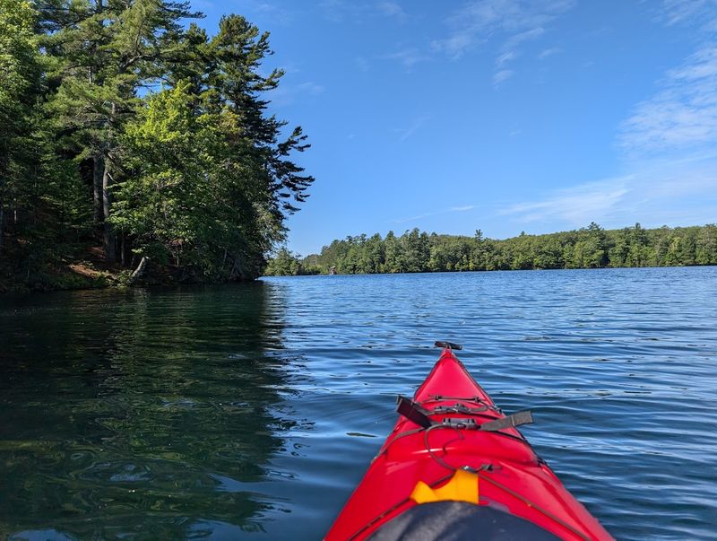
The sheer number of lakes within the forest boundaries means you can visit repeatedly and never see the same body of water twice. Some lakes span hundreds of acres with developed access points, while others remain small, hidden gems requiring a short hike to reach.
Water quality stays remarkably high across most of these lakes due to limited development and natural filtration through surrounding wetlands. Canthook Lake and Two Lakes campground offer particularly good fishing for bass and panfish, with clear water that lets you watch fish approach your lure.
Many lakes connect through streams and portages, creating opportunities for multi-day paddling adventures. The variety ranges from shallow, weedy bays perfect for spotting waterfowl to deep, cold lakes that hold trout year-round and freeze solid enough for ice fishing come January.
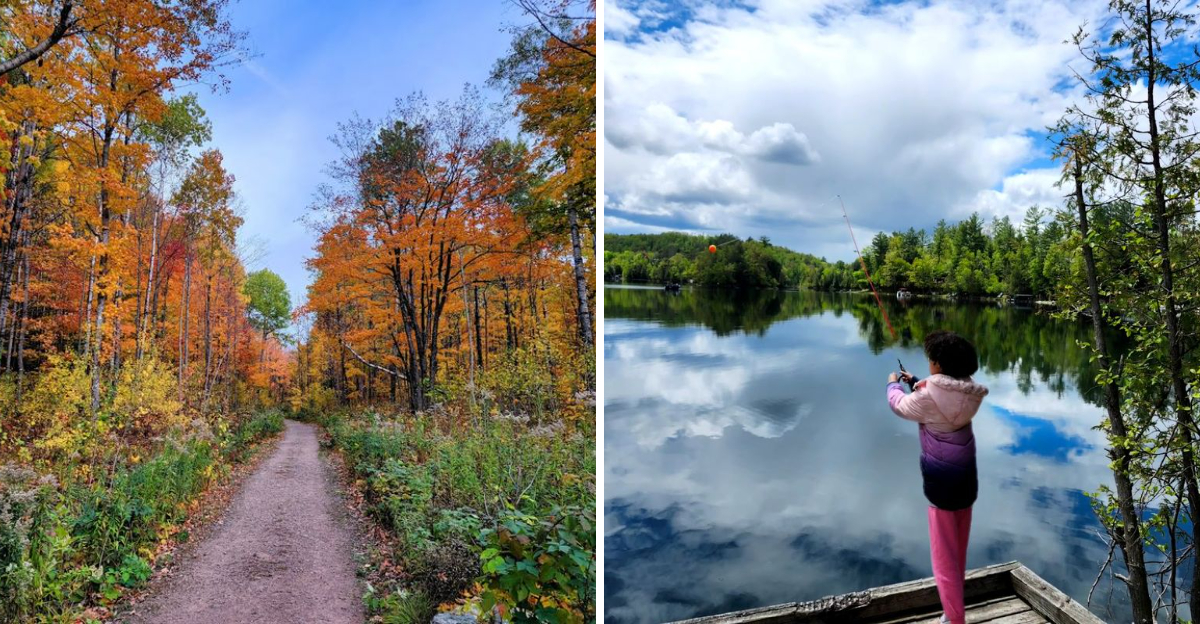
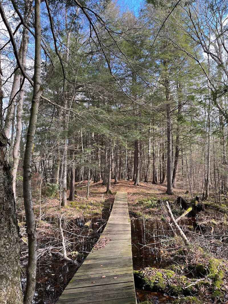
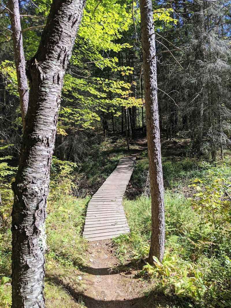
Over 800 Miles Of Trails Lead Through Forests And Wetlands
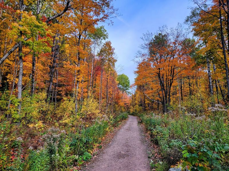
The trail system here accommodates every skill level and interest, from flat lakeside paths suitable for families to rugged backcountry routes that challenge experienced hikers. Trail surfaces vary from well-maintained gravel to narrow dirt tracks that disappear beneath fallen leaves.
Signage quality depends on the trail, with major routes like the North Country Trail marked clearly and lesser-used paths requiring map and compass skills. Spring mud season can make some trails temporarily impassable, while autumn offers the best footing and visibility through thinned-out undergrowth.
ATV and dual-sport motorcycle trails crisscross sections of the forest, creating a different kind of adventure for motorized recreation. Snowmobile trails activate in winter, connecting small towns and providing access to areas otherwise cut off by snow.
Five Wilderness Areas Protect The Forest’s Wildest Corners
Federal wilderness designation means these areas remain roadless and undeveloped by law. No vehicles, no bikes, no structures beyond the most basic trail markers.
Just forest, water, and whatever lives there naturally.
Porcupine Lake Wilderness draws backpackers looking for established campsites accessible via the Ice Age Trail, making it a solid choice for those new to wilderness camping. The Rainbow Lake Wilderness offers deeper solitude with fewer visitors and more challenging navigation through wetlands.
These protected zones require more preparation than standard camping. You need to pack everything in and out, navigate without clear trail markers in some sections, and accept that help sits hours away if something goes wrong.
The payoff comes in experiencing a landscape that functions on its own terms, not yours.
The North Country Trail Offers A True Long Distance Hiking Experience
This trail stretches over 4,600 miles from New York to North Dakota, and roughly 200 of those miles cut through Chequamegon-Nicolet. The Wisconsin sections feature rolling terrain, numerous lake crossings via road walks, and backcountry campsites spaced at reasonable intervals for thru-hikers.
Section hikers often tackle the forest portion over long weekends or week-long trips. The trail passes through varied ecosystems, from dry pine barrens to wet alder thickets, giving you a comprehensive view of northern Wisconsin ecology in just a few days of walking.
Trail maintenance comes from volunteer groups, so conditions fluctuate depending on recent work parties. Some stretches show heavy use and clear tread, while others grow over between maintenance cycles and require attention to navigation.
The Ice Age Trail Reveals A Landscape Shaped By Glaciers
Glaciers retreated from this region roughly 12,000 years ago, leaving behind the geological features that now define much of the forest. The Ice Age Trail follows the edge of the last glacial advance, highlighting kettles, moraines, and other landforms created by moving ice.
Walking this trail provides a geology lesson without the classroom. You can see where ice sheets pushed up ridges of debris, carved out depressions that became lakes, and deposited huge boulders called glacial erratics miles from their origin points.
The trail connects with the North Country Trail in several locations, allowing for loop hikes. Spring wildflowers bloom in abundance along sections that cross wetlands formed in glacial depressions, while fall foliage reaches peak intensity on the higher, drier ridgelines shaped by ancient ice.
More Than 100 Boat Ramps Make Lake Access Surprisingly Easy
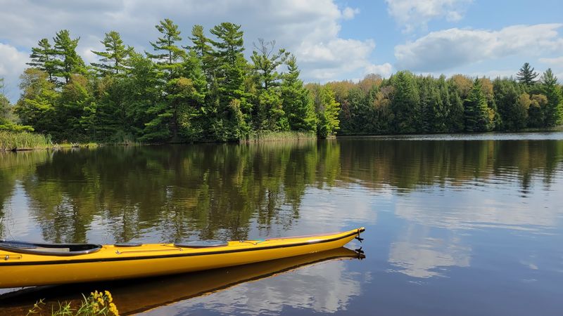
The forest maintains an extensive network of boat launches ranging from simple gravel slides suitable for canoes to improved concrete ramps that accommodate larger fishing boats and ski boats. Most launches include basic parking areas, though facilities vary widely from one site to another.
East Twin Lake features one of the more developed launches with paved parking and a courtesy dock. Smaller lakes might offer nothing more than a cleared path to the water and room for a few vehicles, which actually suits paddlers looking to avoid crowds.
Launch locations appear on forest maps available from ranger stations or online. Some require navigating miles of gravel forest roads, so high-clearance vehicles help though they’re not always necessary.
Early morning visits usually guarantee parking even at popular lakes during summer weekends.
Remote Walk In Trails Lead To Quieter Fishing Spots
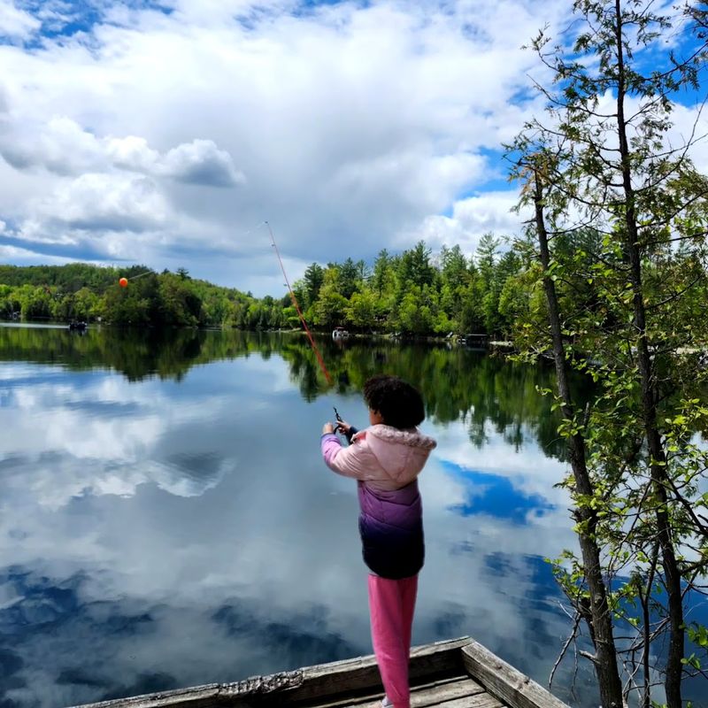
Some of the best fishing happens at lakes you can’t reach by vehicle. Walk-in trails ranging from a few hundred yards to several miles lead to waters that see a fraction of the pressure compared to drive-up locations.
Bass Lake near Two Lakes campground produces consistent action for anglers willing to carry gear along the access trail. The walk filters out casual visitors, leaving more fish per angler and a quieter experience overall.
Panfish populations thrive in these less-pressured waters, with bluegills and sunfish growing larger than in heavily fished lakes. You’ll need to carry everything including a landing net and tackle, but the payoff comes in quantity and quality of fish plus the absence of boat motors and crowds that define popular access points.
Old Growth Pines And Hemlocks Still Tower Around Tucker Lake
Most of Wisconsin’s original forests fell to logging between 1870 and 1920, but scattered pockets of old growth survived either by accident or inaccessibility. Tucker Lake harbors some of these ancient trees, with white pines and hemlocks that predate European settlement.
The difference between old growth and second growth becomes obvious when you stand among these giants. Trunks measure several feet across, bark shows deep furrows from centuries of growth, and the canopy towers so high that lower branches disappeared decades ago.
A trail loops around Tucker Lake, passing through sections of old growth and allowing close examination of trees that were already mature when Wisconsin became a state. The quiet under these towering evergreens feels different from younger forests, darker and more cathedral-like in atmosphere.
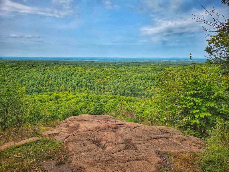
The Mountain Fire Lookout Tower Rewards Climbers With Panoramic Views
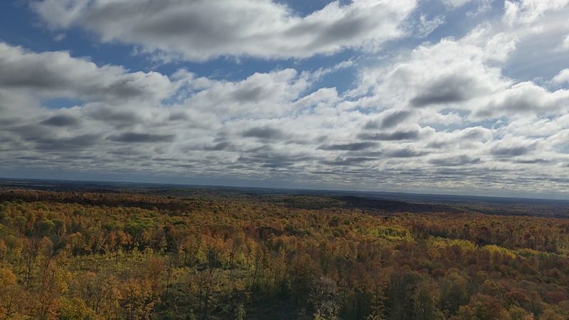
Fire lookout towers once dotted the forest, staffed by observers watching for smoke during dry periods. Most were decommissioned and removed, but Mountain Tower remains standing and open to visitors willing to climb the stairs.
The tower rises high enough above the surrounding trees to provide 360-degree views across miles of unbroken forest. On clear days you can pick out individual lakes glinting in the distance and watch weather systems move across the landscape.
Climbing the open metal stairs requires comfort with heights, as the structure sways slightly in wind. The observation deck at the top fits several people but feels exposed compared to ground level.
Sunrise and sunset visits offer the best light for photography and the most dramatic views of the forest stretching in every direction.
Campgrounds Range From Comfortable Lakefront Sites To Primitive Escapes
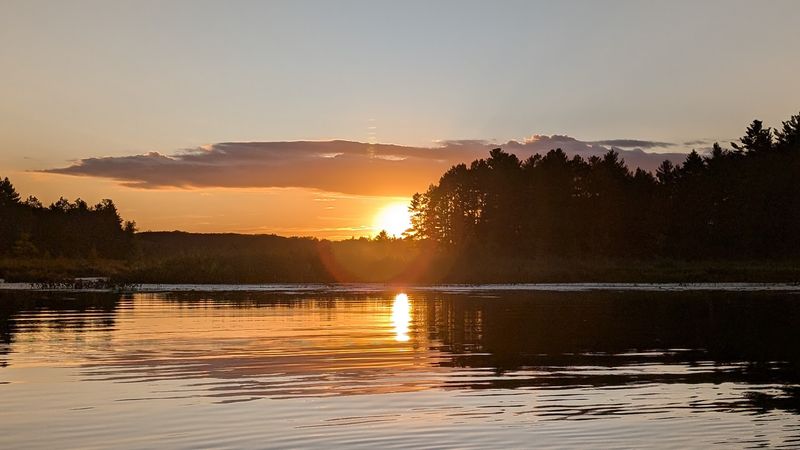
Two Lakes campground offers developed sites with picnic tables, fire rings, and vault toilets, plus electric hookups at some spots. Sites sit right on the water, providing sunrise views and easy fishing access without leaving camp.
Bagley River Rapids campground attracts visitors seeking a more rustic experience near moving water. The river provides constant background sound, and the campground host keeps vault toilets cleaner than you’d expect at remote forest locations.
Dispersed camping is permitted throughout most of the forest, allowing you to set up camp wherever you find suitable ground. This option costs nothing and provides maximum solitude, though you sacrifice amenities and need to follow Leave No Trace principles carefully to protect the resource.
Wildlife Sightings Add Excitement To Every Season
The forest supports healthy populations of white-tailed deer, black bears, coyotes, and smaller mammals including porcupines and fishers. Bird life ranges from common ravens and pileated woodpeckers to less common species like northern goshawks and spruce grouse in appropriate habitats.
Gray wolves returned to northern Wisconsin in recent decades, and the forest now holds several packs. Seeing a wolf requires luck and timing, but hearing them howl at night happens more frequently than most visitors expect, particularly in remote areas far from roads.
Spring brings migrating warblers and waterfowl, while fall concentrates raptors along ridgelines. Winter tracking in snow reveals the constant movement of animals that remain invisible during other seasons, from mouse tunnels to the distinctive dragging tail mark left by porcupines walking between feeding trees.
Mountain Bikers Can Follow Miles Of Rugged Northwoods Terrain
Designated mountain bike trails and multi-use paths provide excellent riding through varied terrain. Root-laced singletrack challenges technical skills, while smoother forest roads allow faster-paced riding and access to remote areas.
The CAMBA trail system connects with forest lands in some areas, expanding options for riders willing to explore beyond the most popular loops. Trail conditions change dramatically with weather, from fast and firm during dry periods to muddy and challenging after rain.
Fat bike riding has grown popular in winter, with groomed trails and unplowed forest roads creating new opportunities when the ground freezes. The experience differs completely from summer riding, requiring different gear but offering access to landscapes transformed by snow and the chance to ride across frozen lakes between shoreline trails.
The Forest Spans 11 Counties And 65 Townships
The forest’s boundaries create a patchwork pattern across northern Wisconsin rather than one continuous block. Private land, state forests, and small towns interrupt federal ownership, creating a complex map that requires attention when planning trips.
This scattered pattern means you might drive through several miles of private land between forest parcels. Some sections connect via designated routes, while others require returning to highways to reach the next access point.
The multi-county jurisdiction affects regulations and management, with slightly different rules applying in different areas. Checking current regulations for your specific location prevents confusion about camping restrictions, fire rules, and seasonal closures that might vary from one district to another within the same national forest system.