
8 Forgotten Ruins In Pennsylvania With Mysterious Histories You Will Want To Know
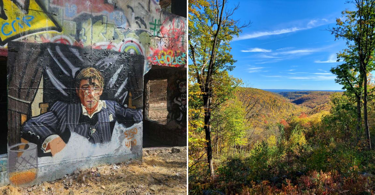
Legends get passed down from generation to generation, and people tend to remember them quickly. The line between myth and reality stays remarkably thin when it comes to these Pennsylvania ruins.
Stories surrounding these sites shift slightly depending on who tells them, though the core details rarely change much. Structures here date back further than most visitors expect, some barely recognizable after decades of decay.
Explorers who venture through often describe an atmosphere hard to explain once they’re actually standing there. Nature has reclaimed parts of these sites, blurring lines between what was built and what grew back naturally.
Local historians continue piecing together fragments of the true stories behind each location. These ruins proved that sometimes the mystery matters more than the facts ever could.
1. Austin Dam Memorial Park
Someone once called it the dam that could not break. Never say that out loud, apparently.
Built in 1909 to power the Bayless Paper Mill, the concrete wall held back Freeman Run above the little town of Austin. On September 30, 1911, it gave way after heavy rain and shoddy construction.
Nearly 400 million gallons roared down the valley. The town was flattened, damage stretched eight miles downstream, and at least 78 people lost their lives.
It remains Pennsylvania’s second-worst flood disaster and ranks sixth among dam failures in United States history. The wreckage was so shocking that it pushed the country toward real rules for dam design and inspection.
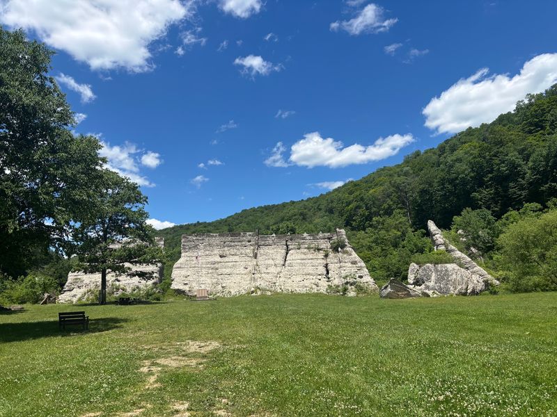
What surprises me most is how peaceful the place feels now. The broken slabs still stand in the grass like giant crooked teeth, some leaning, some split clean apart.
You can walk right up and put your hand on concrete that failed over a century ago. The scale is hard to process until you are standing next to it.
The 76-acre park wraps around the ruins with a grassy meadow and thick forest on the ridges. There is a monument for the people who lost their lives, plus a pavilion with historic photos so you can see exactly what the valley looked like before and after.
Trails run through the property, and the creek is good for fishing. Primitive camping is allowed if you want to stay after dark, which I recommend for the stars alone since Potter County has very little light pollution.
The site was added to the National Register of Historic Places in 1987. Go in late spring when the meadow is green, and the concrete looks even more out of place.
You will find it at 5384 PA-872, Austin, PA 16720.
2. Carrie Blast Furnaces
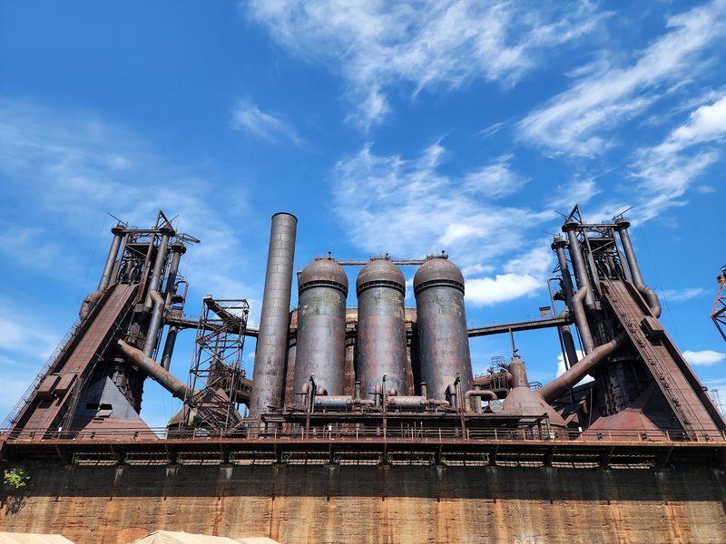
Rust the size of a cathedral. That is the best way I can describe walking up to these things.
Furnaces number 6 and 7 went up in 1906 as part of the Homestead Steel Works, a piece of Andrew Carnegie’s empire. They ran almost nonstop until 1978.
In their best years during the 1950s and 60s, each furnace turned out 1,250 tons of iron a day. Think about that number the next time you complain about your workload.
When the region’s steel industry collapsed, nearly every furnace in the valley was torn down. These two somehow survived, making them rare examples of pre-World War II iron-making technology still standing anywhere.
They rise between 92 and 140 feet, and the pipes overhead look like the plumbing of a sleeping giant. Trees now push up through the ironwork, and vines climb the ladders workers used to scramble up.
Graffiti artists have claimed much of the lower structure, which somehow suits the place rather than ruining it.
The quiet gets me every time. This was one of the loudest workplaces in America, full of heat and shouting and molten iron, and now you can hear birds.
Rivers of Steel runs guided tours, and I would take one rather than wander alone. The guides explain how ore, coke, and limestone moved through the process, and some of them worked in mills themselves.
The site is a National Historic Landmark, and there are art installations and events on the grounds throughout the year. Wear boots, because the ground is gravel and old rail bed.
Bring a camera with a wide lens. Nothing about this place fits in a normal photo frame.
The address is 801 Carrie Furnace Blvd, Pittsburgh, PA 15218.
3. Fricks Locks Village
An entire village emptied because of a nuclear power plant. Not an explosion, not a leak, just paperwork and a map line.
Settlement here started in the early 1800s, and a few of the buildings go back to Revolutionary War days. The village grew rich off the Schuylkill Canal, where boats stopped at the water locks, and travelers spent money.
Then railroads arrived, and canals became useless. Business dried up, but stubborn families stayed on for another century.
The real ending came in 1986. Limerick Nuclear Power Plant was built across the river, and the village landed inside the plant’s exclusion zone.
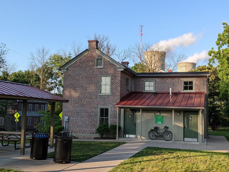
Everyone left. Around ten buildings still stand on the 18-acre property, including the old general store and a home called Box Wood Manor.
Vandals had years of fun before anyone stepped in, so some windows are gone, and some interiors are wrecked.
Restoration work has patched up a few structures, and the roofs on those look almost normal, which makes the ruined neighbors seem stranger.
Standing on the old road with cooling towers visible in the distance is a genuinely odd feeling. Two centuries of history parked next to atomic-age technology, staring at each other across the water.
Important detail here: the property is private, and you cannot just wander in. The East Coventry Historical Commission leads scheduled tours, and that is your legal way inside.
Book ahead, because the tours are not constant and they fill up. Guides share details about individual families who lived here, which turns the empty houses into something much more personal.
The village was added to the National Register of Historic Places in 2003. Find it at 500 Fricks Lck Rd, Pottstown, PA 19465.
4. Sideling Hill Tunnel
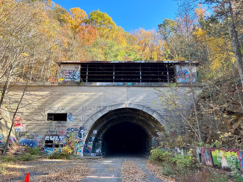
Imagine a highway that just stops. Then imagine a mile-long tunnel at the end of it, pitch black, with nobody around.
The story starts in the 1880s with the South Pennsylvania Railroad, a project backed by big money that ran out of steam and never got finished. The half-dug tunnel sat useless for decades.
In 1938 the Pennsylvania Turnpike Commission grabbed the old railway grade for its new toll road. When the Turnpike opened in 1940, Sideling Hill was the longest of its seven original tunnels.
Trouble showed up fast. One lane in each direction meant traffic backed up for miles, so a 13-mile bypass was cut over the hills instead.
The tunnel closed for good in 1968.
What is left is now called the Abandoned Pennsylvania Turnpike, or the Pike2Bike Trail. Weeds shove through cracks in the asphalt, and the lane markings are still faintly there.
The tunnel runs 6,782 feet, which feels much longer when you are inside it. Bring a real flashlight or headlamp, not your phone.
Sound behaves weirdly in there. Your footsteps echo forever, water drips somewhere ahead, and the far exit looks like a tiny white dot for an uncomfortably long time.
Graffiti covers the walls near both portals, layered on for decades. Outside, the remains of the Cove Valley Service Plaza sit quietly where families once stopped for restrooms and food.
Hikers and cyclists use the trail constantly, and bikes make the distance much easier. Watch your footing, since the pavement inside is uneven and puddles hide potholes.
Go with a friend. Solo tunnel walking is a great way to invent noises that are not there.
Find it at Abandoned Pennsylvania Tpke, Harrisonville, PA 17228.
5. Quehanna Wild Area
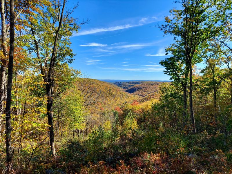
Two ruins, one enormous forest, and a plot twist involving nuclear jet engines. Central Pennsylvania keeps its weirdest secrets under the trees.
Deep in the woods sits Kunes Camp, a hunting cabin built in the early 1900s by a local family. The clever part is that they used two massive boulders as the side walls and framed the rest between them.
Families used it for decades until the mid-1950s, when the Curtiss-Wright Corporation bought up the land for secretive nuclear research. Hundreds of camp owners were evicted.
All four walls of Kunes Camp still stand after more than 60 years of neglect. The window and door frames are startlingly straight, which tells you those builders knew exactly what they were doing.
Trees grow up through the old floor now, and moss and ferns have coated the foundation. The chimney lies collapsed but mostly whole, right in the middle of the room.
The other stop is stranger. Between 1955 and 1960, bunkers here were used to test nuclear-powered jet engines under Eisenhower’s Atoms for Peace program.
The project was scrapped in 1960, and the bunkers were left behind. They are heavy concrete and steel with narrow slit windows that once held blast-resistant glass.
The northern one looks like a movie prop from a war film, complete with a steel door that creaks when the wind hits it. Graffiti covers the interior walls, and bats roost inside, so keep your distance and do not disturb them.
The access road is slowly disappearing under saplings. Bring a GPS or downloaded maps, because cell service out here is basically decorative.
6. Concrete City
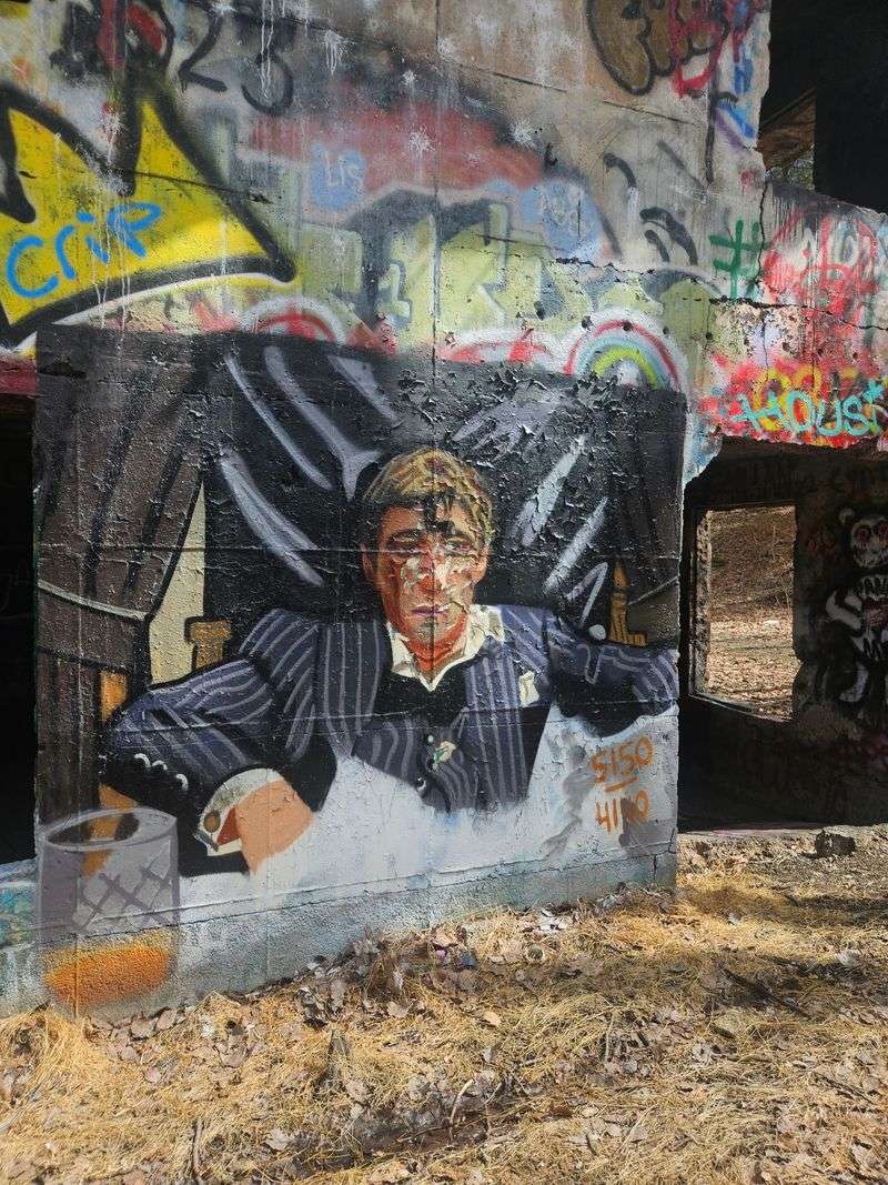
They tried to blow this place up. It refused.
The Delaware, Lackawanna and Western Railroad built it in 1911 as model housing for coal division foremen and select employees. Twenty-two concrete duplexes formed a square around a courtyard with tennis courts and a baseball field.
Marketing called it the Garden City of the Anthracite Region. Each seven-room house rented for eight dollars a month, which sounded like a bargain until winter arrived.
The walls were porous, so moisture soaked through and condensed indoors. Clothing reportedly froze solid inside closets.
The whole experiment lasted 13 years. In 1924, the owners refused to pay for a required sewer system and simply closed the community down.
Demolition crews later showed up with dynamite and barely scratched the buildings. So the company gave up and walked away, leaving the shells exactly where they stood.
Roofs are gone, and floors have crumbled, but the concrete frames are stubbornly upright over a century later. Every surface is now covered in graffiti, layer over layer, in colors bright enough to spot from the treeline.
The courtyard has filled in with brush and small trees, though you can still make out the rectangle where kids once played ball. Architecture nerds point out the early International Style lines, which is a fancy way of saying it looks like plain boxes.
Urban explorers, photographers, and spray-paint artists all pass through regularly. Police and fire crews use the buildings for training exercises too, so do not be shocked by activity.
Watch your step seriously here. Broken glass, rebar, and open floor holes are everywhere, and no one has fixed anything in a hundred years.
Park sensibly and look for it near 372 Davison Dr, Hanover, PA 18706.
7. Celestia
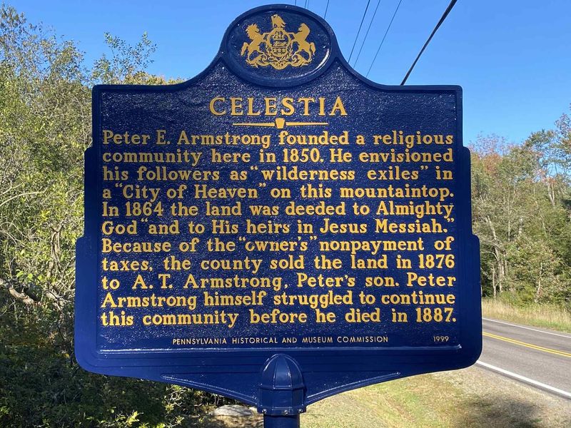
Here is a real estate transaction you will not forget. In 1864, a man legally deeded this land to Almighty God and His heirs in Jesus Messiah.
Peter E. Armstrong was a Millerite who believed Christ would return in 1844.
When that date passed quietly, he did not give up.
He founded Celestia on this Sullivan County mountaintop in 1850, planning a sacred city where believers could wait out the end times. He even had a dwelling built specifically for Christ to use upon arrival.
The deed made him briefly famous. There was, however, one hitch nobody had thought through.
The heavenly landowner never paid the property taxes. Sullivan County did what counties do, seized the land, and sold it off.
Armstrong passed away in 1887 with the settlement already nearly empty. Faith, it turns out, does not exempt you from the tax collector.
What you find today is mostly forest. Old foundations hide under leaves and ferns, low stone lines you could easily walk over without noticing.
There are no preserved buildings, no visitor center, no gift shop selling utopia mugs. A historical marker along Route 42 is the clearest sign you are in the right general area.
I think of it as a ghost idea rather than a ghost town. The dream was enormous, and the leftovers are almost nothing, which is exactly what makes standing there interesting.
Go in autumn when the leaves thin out and the stone lines become easier to spot. Bring a printed map or a local history reference, because the site is not marked with signs pointing at foundations.
Keep your voice down and take nothing.
8. Colonial Springs Bottling Plant
Root money paid for a piece of this one. Not a sentence I expected to write about Valley Forge.
The stone building went up in the late 1800s over a natural spring called Cold Spring. In 1908, the lease passed to the Colonial Springs Company, which bottled and sold the water locally.
Later, the property went to Charles Hires, the man behind Hires Root. He kept selling water from the site under the name Purock Spring Water.
Commercial bottling wound down around 1915 after the original owner, General Benjamin Franklin Fisher, passed away. Valley Forge State Park picked up the land in the 1930s and let the building fall apart.
Now it sits in the woods on Mount Misery, which has to be the least inviting hill name in Pennsylvania. The rocky Horse-Shoe Trail runs right past it.
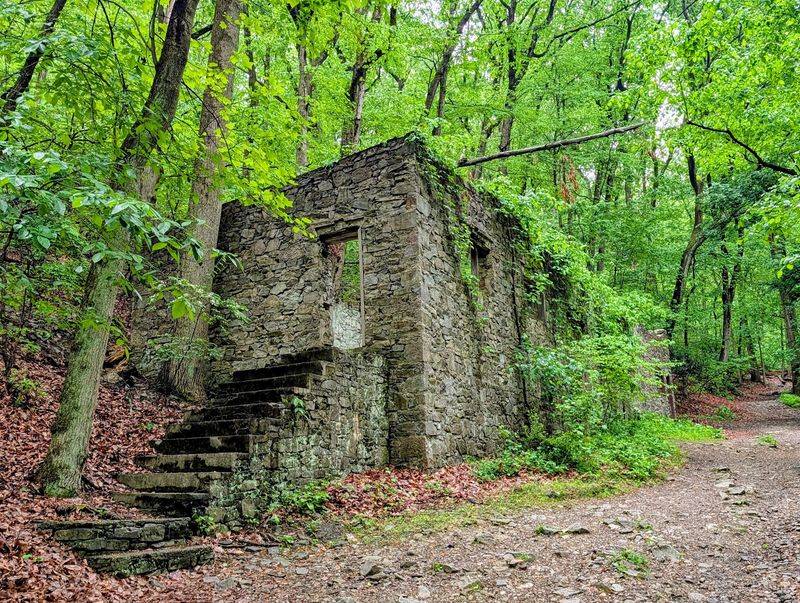
The ruins are two stories of handsome stonework, partly dismantled but stabilized by the National Park Service in 2017 so it stays standing and stays safe.
Ivy drapes across the walls in summer until the stone and the forest blur together. Stone steps climb to nowhere in particular, which is somehow the most fun part.
The spring still trickles out of the hillside exactly as it did over a century ago. Do not drink it, because the water is no longer tested or safe.
Most hikers walk up on this without knowing it exists, which is the best way to meet it. Wear shoes with grip, since the trail is loose rock and dirt and gets slick after rain.
Combine the walk with the rest of the park for a solid half day. Access it from the Horse-Shoe Trail, Phoenixville, PA 19460.