
9 Free Mississippi Nature Trails Where You Can Walk Past Historic Ruins, Wildflowers, And Old Foundations
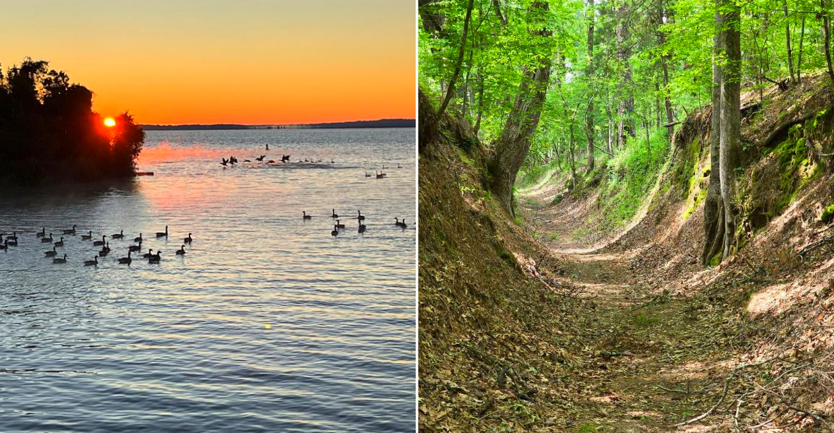
Crumbling church walls sit beside footpaths in Mississippi that centuries of travelers wore down into the ground. Wild orchids bloom next to old railroad beds. These trails do this, and every one of them costs nothing to walk.
History does not usually come with a workout attached. That is what makes these different from a museum and different from an ordinary hike.
Sunken paths mean somebody walked them enough to change the shape of the land, which is a strange thing to stand in once you notice it.
Fresh air on one side, a lesson on the other, and no admission gate anywhere. Lace up and bring water. The past is out there waiting to be met on foot, and it will not cost you a dollar to go find it.
1. Rocky Springs Trail – Natchez Trace Parkway
A whole town used to stand here, and now the forest has taken the keys back. Rocky Springs was a busy community until the 1930s, when the Civil War, yellow fever, and boll weevils emptied it out for good.
Walking the self-guided paths, you pass a standing Methodist church, a cistern, and a rusted safe left behind from the old post office.
The cemetery holds headstones dating to 1878, the year fever swept through. Reading those markers slows your pace in a way no trail sign ever could.
Access sits at Milepost 54.8 on the Natchez Trace Parkway, with the address listed as Rocky Springs Campground, Hermanville, MS 39086. The parkway charges no entrance fee, and the primitive campground works on a first-come, first-served basis.
Owens Creek Waterfall sits nearby and runs best after a good rain, so time your visit accordingly. Hardwoods shade most of the route, which keeps summer walks bearable.
Bring bug spray between May and September. The mosquitoes here have opinions, and they are not shy about sharing them with visitors. Rocky Springs once held around 2,600 residents before the land gave out.
Poor farming practices exhausted the soil, and the boll weevil finished what erosion started. Walking the old roadbed now, the only sound is birds. A town that size leaving almost nothing behind is a quiet argument about how fast places disappear.
2. Grand Village Of The Natchez Indians – Natchez
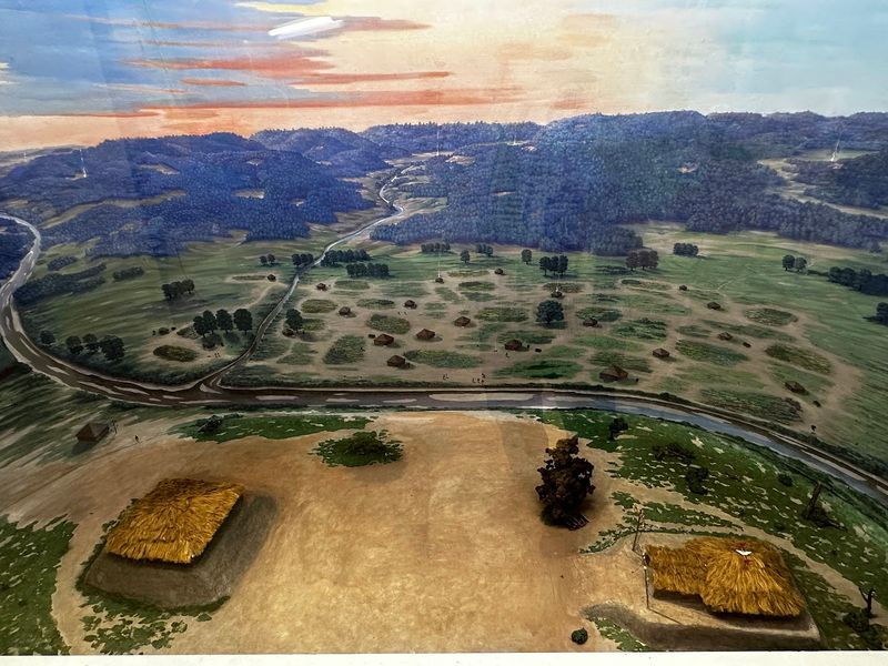
Three earthen mounds rise from a 128-acre green space, and they are older than almost anything else you will walk past in the state. Between 1682 and 1730, this ground served as the main ceremonial center for the Natchez people.
The Great Sun’s Mound and the Temple Mound have both been excavated and rebuilt to their original size and shape. A religious structure once stood on top of the Temple Mound, which gives the flat summit a different weight when you stand near it.
You will find the site at 400 Jefferson Davis Boulevard in Natchez, MS 39120, and both admission and parking cost nothing at all. A reconstructed Natchez house shows how daily life actually worked, right down to the roof construction.
A nature trail loops through the property for anyone who wants trees along with their history. Spring brings color to the edges of the mowed lawns.
Give yourself ninety minutes minimum. Rushing past thousand-year-old earthworks feels a little rude, and the shaded benches are genuinely comfortable.
The Natchez followed a rigid social order, with a ruler called the Great Sun whose feet reportedly never touched bare ground.
Conflict with French colonists ended the settlement in 1730. Standing on the plaza between the mounds, you occupy the exact ground where that whole society organized itself, which lands harder than any placard.
3. Tuxachanie National Hiking Trail – De Soto National Forest
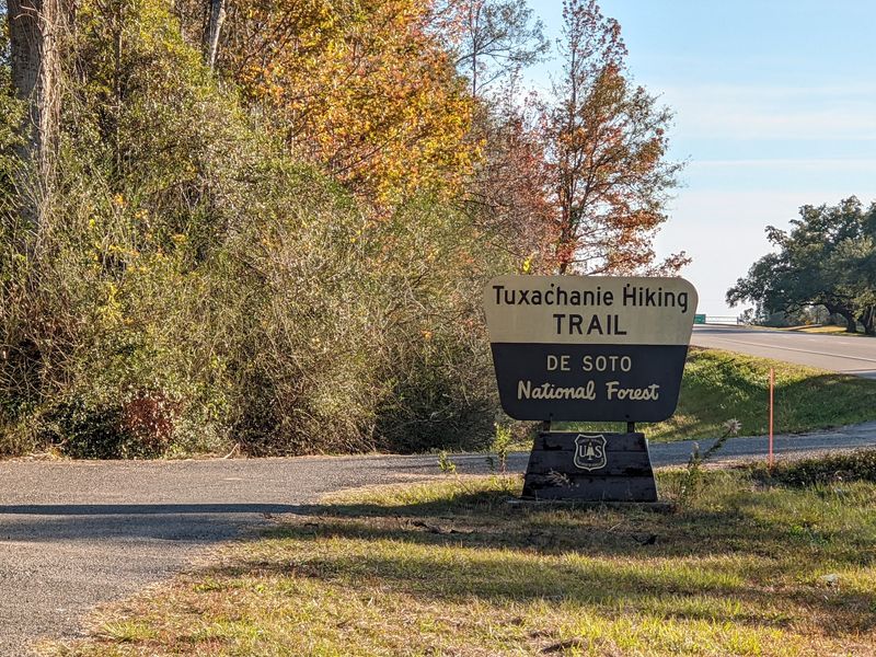
Irish immigrants built a logging railroad through these pines in the early 1900s, armed with hand tools and mule-drawn earthmovers. The first five miles of this 11.9-mile trail follow that abandoned rail bed, and the walking stays flat and forgiving.
Old trestle remains still poke out of the ground, along with pieces of the logging camp near the trailhead. Long rows of live oaks planted in 1935 mark the entrance like a green welcome committee.
March is the month wildflower fans circle on the calendar. Pitcher plants, wild orchids, star-anise, yellow jessamine, wild azalea, and a full cast of violets show up between mid and late month.
The main trailhead sits about 2.5 miles north of Saucier on the east side of Highway 49, with the address given as 26170 Highway 49, Saucier, MS 39574. No user fees apply.
Palmettos crowd the lower stretches, so long pants beat shorts. Sandy soil drains fast after rain, which makes this one of the better wet-season options in south Mississippi. Pitcher plants are the real draw here for botanists.
These carnivorous plants trap insects in tube shaped leaves, thriving in the wet, nutrient poor soil that most species avoid. The bogs along this trail support one of the better displays in south Mississippi, and March brings them out alongside everything else.
4. Longleaf Trace – Hattiesburg To Prentiss
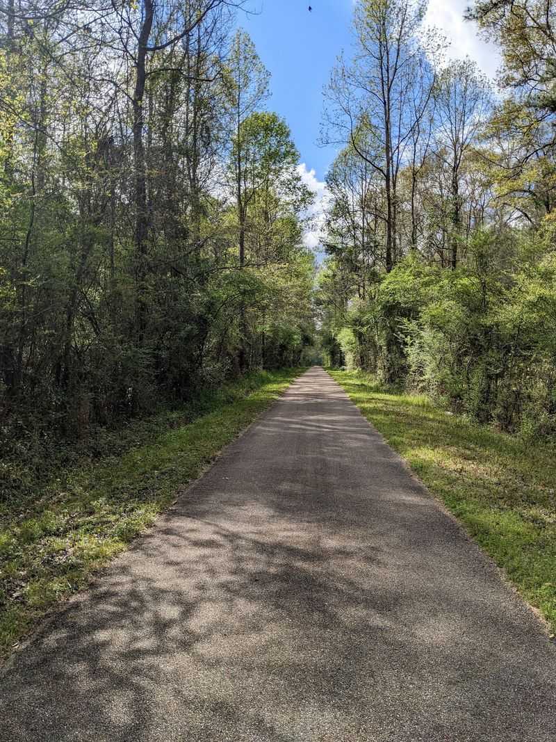
Forty-four paved miles stretch from Hattiesburg to Prentiss, and the whole thing used to carry freight. The route follows the abandoned Mississippi Central Railroad line, originally called the Pearl and Leaf Rivers Railroad.
Rest stops along the way sit where small-town depots and stations once stood, which keeps the railroad thread running through the entire walk. The trail is free to use, as rails-to-trails paths generally are.
Spring turns the corridor into a showcase. Flowering dogwood and magnolia trees bloom alongside honeysuckle and wisteria, and the scent carries surprisingly far on a warm morning.
Start at the James Lynn Cartlidge Gateway, 2895 West 4th Street, Hattiesburg, MS 39401, where parking and information are easy to find. The far western end reaches Front Street in Prentiss.
Cyclists share the pavement, so keep right and stay aware. A separate equestrian path runs parallel along part of the route, which cuts down on traffic jams.
Tackle a five-mile out-and-back if the full length sounds ambitious. Mississippi humidity has humbled tougher hikers than us. Longleaf pine once covered roughly ninety million acres across the South, and less than five percent of that original forest survives today.
The trail takes its name from those trees. Restoration efforts have brought some stands back along the corridor, so parts of the walk pass through what the whole region used to look like.
5. LeFleur’s Bluff State Park – Jackson
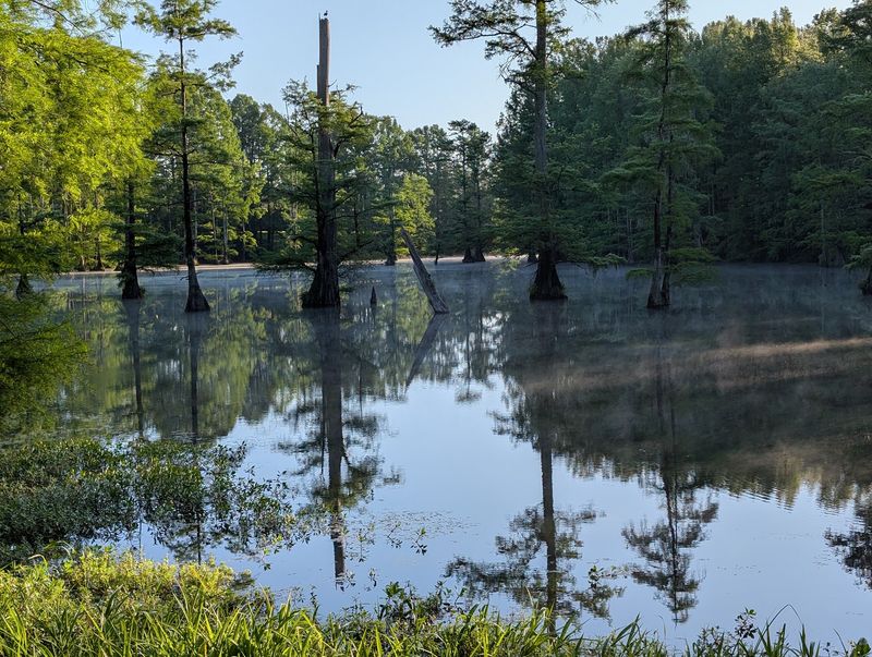
A French-Canadian trader named Louis LeFleur set up shop here in the late 1700s, and the city of Jackson went by LeFleur’s Bluff before it got its current name. Not bad for a park sitting inside a capital city.
The Spotter’s Adventure Trail and the museum walking trail at the LeFleur’s Bluff Education and Tourism Complex are both free and open to the public.
The Museum Trail itself is a greenway built on a decommissioned GM and O rail line, and it connects toward the Belhaven neighborhood.
Native plant gardens showcase swamp azalea, smooth phlox, and mountain laurel, which makes spring visits particularly rewarding. Other paths wander through woodlands, swamp edges, and along the Pearl River.
Find it at 3315 Lakeland Terrace, Jackson, MS 39216. The Mississippi Museum of Natural Science sits on the grounds and holds fossil collections worth a look.
Herons and turtles show up constantly near the water. Morning light through the cypress trees is the kind of thing you photograph and then stare at later.
Louis LeFleur’s son Greenwood married into Choctaw leadership and later became a Choctaw chief, with the town of Greenwood named for him.
That single family thread connects a trading post on this bluff to the naming of towns across the state. Walking the greenway, you are following a line that runs surprisingly deep into Mississippi history.
6. Tupelo Trail – Natchez Trace Parkway
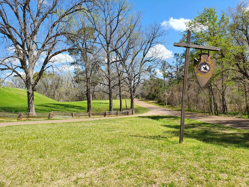
Concrete curbing in the grass marks where a Chickasaw fort once stood, and that simple outline says more than a museum case ever could. The Tupelo Trail runs straight through the Chickasaw Village Site on its way south.
Interpretive panels explain the layout of the settlement, including winter houses and summer houses. Standing inside those outlines gives you a real sense of scale.
The path forms part of the Natchez Trace National Scenic Trail, so access costs nothing. It runs from the Beech Springs car park at Milepost 266 south toward West Jackson Street in Tupelo.
Begin at the Parkway Visitor Center, 2680 Natchez Trace Parkway, Tupelo, MS 38804, where maps and clean restrooms await. Rangers there know current trail conditions better than any app.
Wildflowers pop up along the mowed edges and forest openings during spring and early summer. Songbirds treat the whole corridor like a concert hall.
Wear shoes you do not mind getting muddy. Low spots hold water for a day or two after storms roll through north Mississippi.
7. Ridgeland History Trail – Ridgeland

Twenty-two wayside exhibits turn an ordinary walk into a timeline covering more than 13,000 years. Ridgeland packed a remarkable amount of story into a fairly compact town.
Markers cover the 1896 Highland Colony Company office and hotel, historic churches including the original site of Wesley Chapel Methodist Church, and Jessamine Cemetery, where early families were laid to rest.
Another stretch follows portions of the original Natchez Trace along Old Agency Road.
Railroad history gets its due too, since the tracks shaped how the town grew. The route uses existing multi-use recreational trails, so the surface stays friendly for all ages.
Start at Marker Number 1 outside Ridgeland City Hall, 304 Highway 51, Ridgeland, MS 39157. Access is free and available year-round, with no gate hours to worry about.
Local flora fills in the green corridors between stops, which softens the pavement considerably. Shade is spotty in a few sections.
Download the marker list before you set out. Hunting for exhibit number fourteen turns the whole outing into a low-stakes scavenger hunt.
8. Chalk Mine Hollow – Iuka
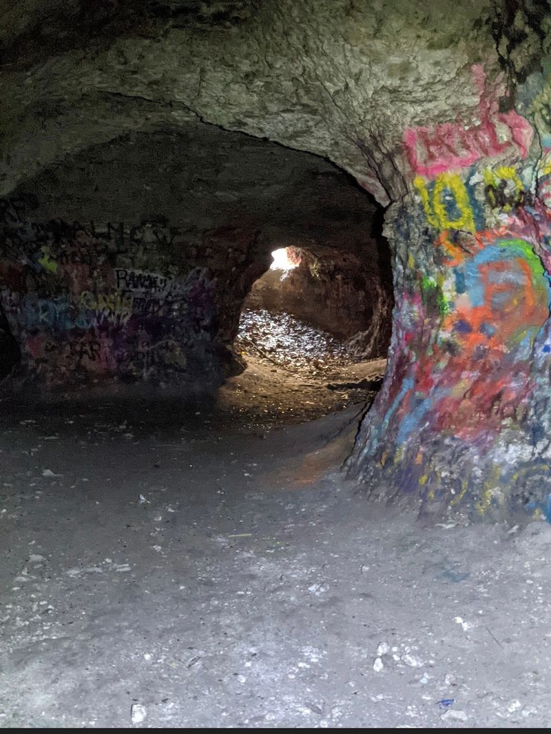
Gunpowder brought people to this hillside during the Civil War, and chalk was the reason. Miners carved deep into the soft rock, and the operation shut down around 1890.
What remains is genuinely wild. Three long tunnels branch into a web of connected passageways cut into the side of a hill, and the scale surprises nearly everyone who arrives expecting a small cave.
A short, well-beaten footpath through the woods gets you there, and the surrounding forest keeps things cool and green. Mississippi does not hand out many spots like this one for free, but here we are.
Find the trailhead near County Road 410 outside Iuka, at coordinates 34 degrees 52 minutes 21.6 seconds north, 88 degrees 07 minutes 13.0 seconds west. Directions often mention a small road off MS-25 North.
Bring two light sources and sturdy shoes with real tread. Old mines have uneven floors and no handrails, so caution is not optional.
Go with a buddy. Exploring solo underground is a rookie move nobody should make.
9. Potkopinu Section – Natchez Trace National Scenic Trail
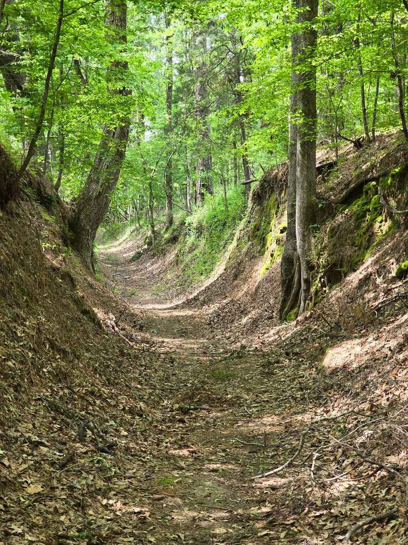
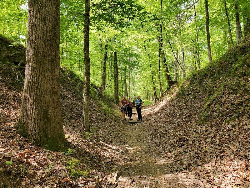
Thousands of feet carved this path, and the earth still shows the proof. Potkopinu holds the title of longest continuous section of sunken Trace, with walls of soft loess soil rising well above your head.
Travelers wore the route down between the 1780s and the 1820s, one boot and hoof at a time. The name comes from a Natchez word meaning little valley, which turns out to be an understatement in places.
Access sits between Milepost 17 and Milepost 20 of the Natchez Trace Parkway near Natchez, and there is no fee. The parkway’s no-fee policy covers all five sections of the scenic trail.
Wetlands, swampy pockets, and hardwood forest line the route, so native plants and wildflowers appear throughout the warmer months. Ferns cling to the dirt walls like wallpaper.
Footing gets slick after rain, and the sunken sections drain slowly. Check the weather before committing to the full hike.
Few places in Mississippi feel this old. Walking here is basically time travel with better cardio.