
The Mississippi County Park Hiding Caves Underneath It That Most People Have Never Heard Of
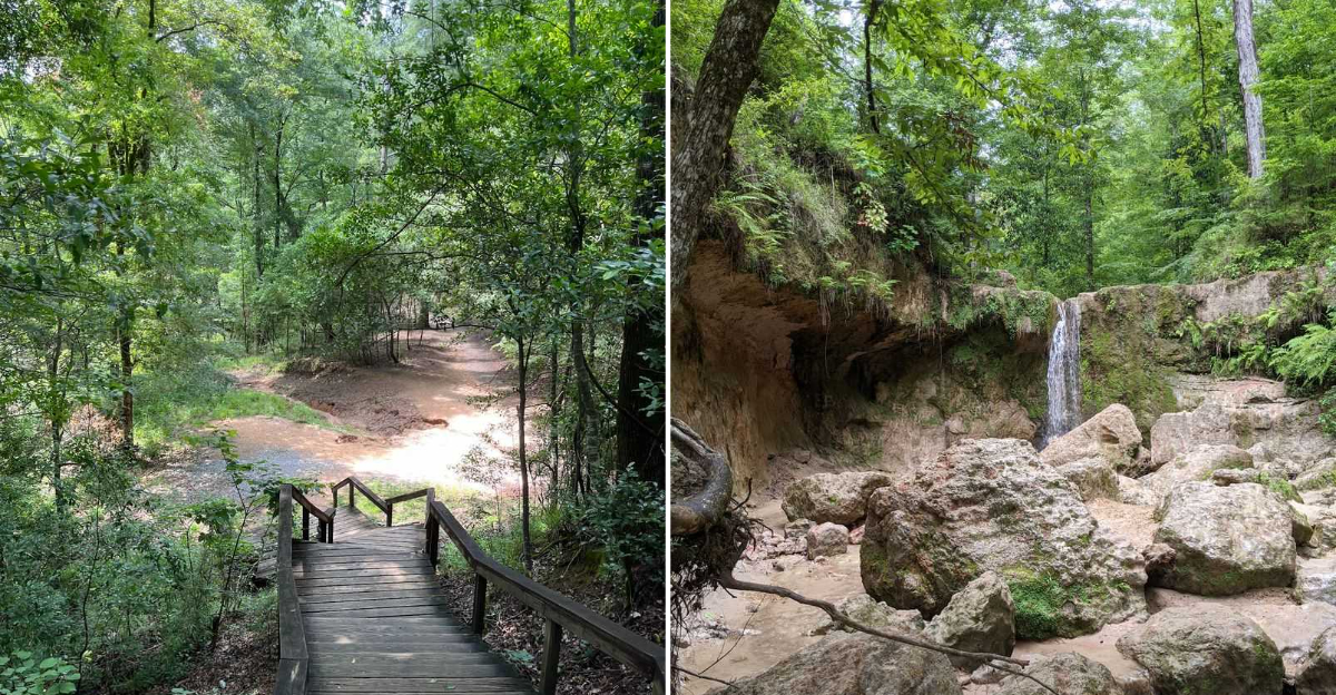
Most parks hide nothing more than trails and benches, but this Mississippi county park holds something far more unexpected underneath it. Caves run beneath the surface, largely unknown to most visitors who only see the trails above ground.
Nothing about the caves feels developed or commercialized for typical tourist attractions. Regulars who know about them treat the discovery almost like a personal secret worth keeping quiet.
Guides occasionally lead small groups through, sharing history most visitors would otherwise never learn. Temperatures inside stay cool year round, offering relief regardless of the season outside.
Photography opportunities exist for those patient enough to explore beyond the obvious trails. This park proved that sometimes the most fascinating discoveries lie just beneath what everyone already sees.
Geological Formation Of Underground Caves
Wind-blown dust did all the heavy lifting here. During the last ice age, fine silt piled up across this corner of Mississippi in layers dozens of feet thick, creating soil called loess.
Loess has a strange personality. It holds a vertical wall like concrete when dry, then crumbles and slumps when water gets behind it.
Over thousands of years, Clark Creek and its tributaries sliced down through that silt like a knife through a layer cake. The result is ravines, up to 700 acres worth of them, with drops that feel impossible for this state.
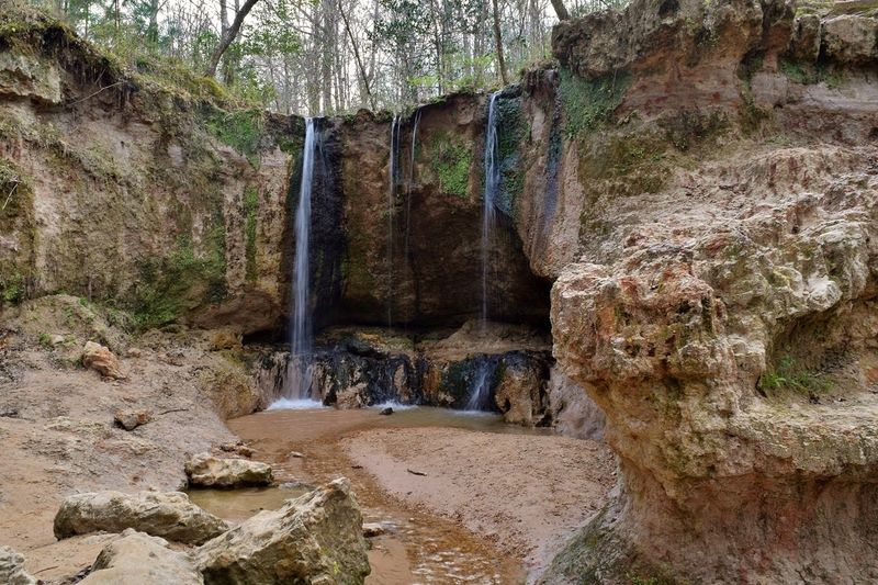
Where the water hits harder clay or sandstone layers, it spills over the edge and forms waterfalls ranging from around 10 feet to over 30 feet tall.
Behind and beneath many of those falls, the plunging water scoops out the softer material and leaves hollow recesses in the rock face. Hikers call them caves, grottos, or overhangs depending on who is talking.
Some are shallow alcoves big enough to duck under during a rain shower. Others reach back far enough that the temperature noticeably drops and sound goes muffled.
Landslides after heavy rain constantly reshape these pockets, so the hollow that existed last spring may look different this fall. Geology in motion, basically.
Find it at 366 Ft Adams Pond Rd, Woodville, MS 39669.
Unique Wildlife In Subterranean Environments
A grey fox once trailed a group of hikers along the trail, keeping just far enough back to stay polite. Wildlife here has opinions about visitors.
The damp overhangs and shaded rock pockets create cool, humid microclimates that plenty of small creatures treat as prime real estate. Salamanders top the list.
Dusky and southern two-lined salamanders hide under wet stones and inside the seeps where water trickles from the cliff faces. They breathe partly through their skin, so constant moisture matters enormously to them.
Bats sometimes roost in the deeper recesses, slipping out at dusk to work the ravines for insects. Cave crickets, spiders, and pale beetles round out the cast.
Above ground, the mix of hardwood and pine forest supports deer, armadillos, barred owls, and migrating songbirds that use these shady canyons as a rest stop. Beech and magnolia trees grow here alongside plants normally found much farther north.
Spring brings bees in serious numbers, and they can get pushy around blooming areas. Late winter hikes dodge most of that.
Nothing here needs handling. Flipping rocks or reaching into dark crevices disturbs animals that took generations to settle in.
Watching quietly from a few feet away shows more anyway. Stand still near a seep long enough, and something will move.
Historical Significance Of Hidden Caves
Long before hiking boots and honor-system pay envelopes, these ravines mattered for practical reasons. The bluffs sit near Fort Adams, one of the older settlement points along this stretch of the Mississippi River.
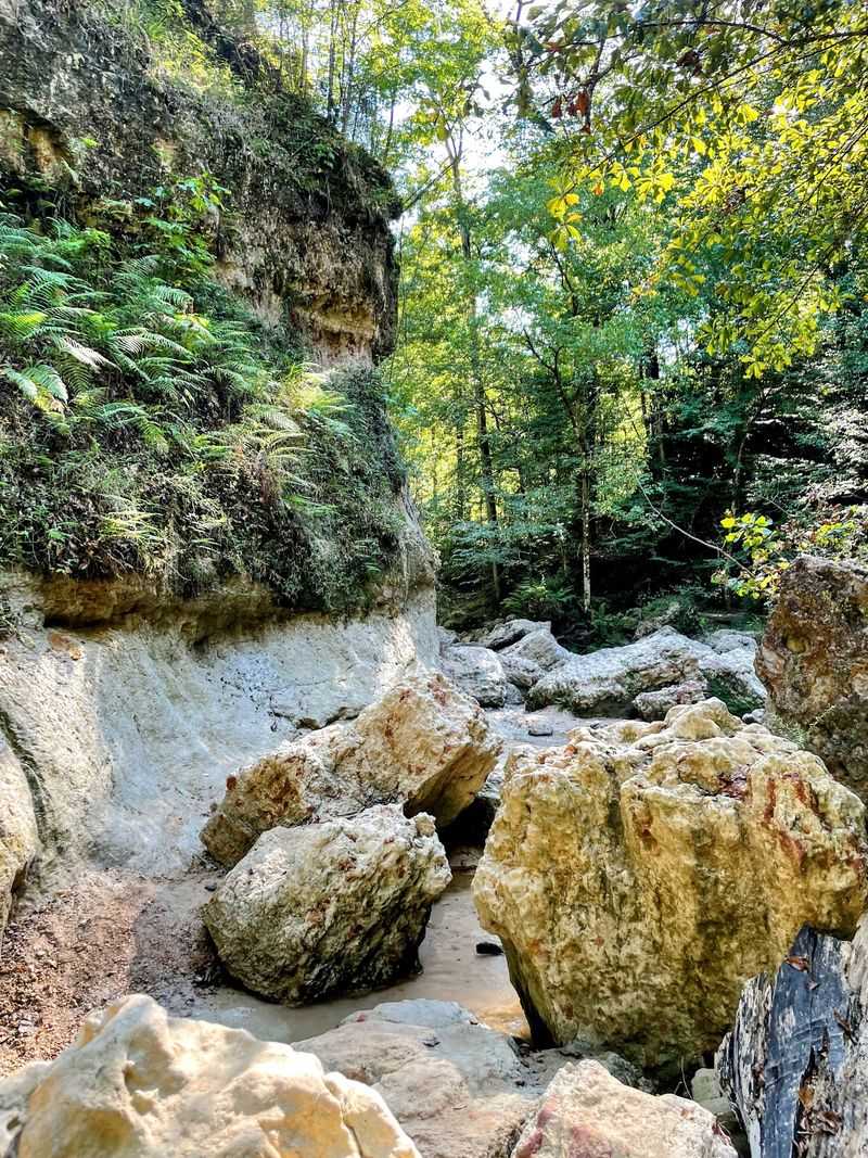
Native peoples moved through this region for thousands of years, and rock shelters and overhangs in the bluffs offered dry ground during storms.
Timber crews worked the surrounding hills in the 1800s and early 1900s, which is part of why the creek cut so aggressively. Clearing the slopes let rainwater run fast and dig deeper.
Mississippi designated the area a natural area to protect what remained, and the state now manages roughly 700 acres through its wildlife and parks department.
Local stories about hidden hollows have circulated for generations, some involving shelter, some involving people who preferred not to be found. Hard to verify, fun to think about.
What is documented is that botanists took interest early. The ravines shelter plant species left behind after the ice age retreated, making them a living record of older climates.
Standing beside a hollow carved under a waterfall means standing in a spot that has been a landmark, a shelter, and a curiosity for centuries.
Not bad for a place most Mississippi residents cannot locate on a map. Word travels slowly out here.
Safety Tips For Exploring Underground Spaces
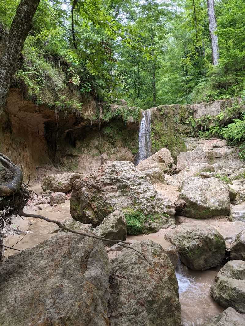
Loose gravel on a steep decline has humbled a lot of confident hikers here. The park added it to some inclines, and coming downhill it can act like ball bearings underfoot.
Footwear decides how the day goes. Sturdy shoes with real grip, ones you do not mind soaking, beat heavy boots and definitely beat sandals.
Reaching several falls means walking directly up the creek beds. Wet rock, gumballs, fallen limbs, and slick clay all show up along the way.
The overhangs and hollows deserve extra caution. Loess collapses without warning, especially after heavy rain, and landslides genuinely happen along these slopes.
Skip climbing on undercut banks or wedging into narrow crevices. Admire from solid ground and keep an eye on the ceiling above you.
Wooden staircases along the main trail have had missing steps and damaged railings, so test before trusting. A hiking stick helps more than it looks like it should.
Pack more water than feels necessary, plus bug spray, sunscreen, snacks, and a small first aid kit. Restrooms exist only near the parking lot.
Trees fall across the path regularly, sometimes forcing a full turnaround. Trails run from 8 AM to 5 PM daily, so start early and give yourself room.
Cell service is unreliable. Tell somebody your plan.
Conservation Efforts To Protect Cave Ecosystems
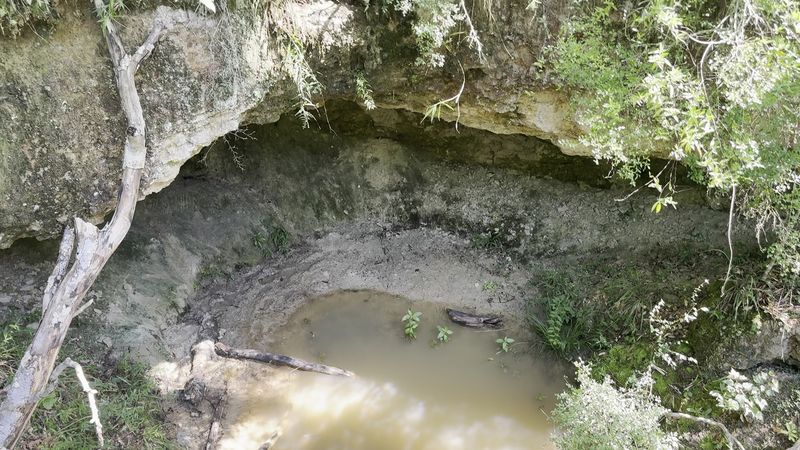
Litter is the biggest ongoing problem, and it shows up in the worst spots. Wrappers and bottles wash into creek beds and lodge under the very overhangs that make this place special.
The Mississippi Department of Wildlife, Fisheries, and Parks manages the area, and the modest entry fee paid by envelope at the trailhead funds upkeep. A paper tag goes in your windshield, and patrols do check.
Protecting the hollows means protecting the soil above them. Cutting switchbacks and creating shortcut trails speeds erosion on slopes already prone to sliding.
Staying on established routes sounds boring until you realize each shortcut sends more silt into the creek where salamanders breed.
Moss, ferns, and liverworts grow on the damp rock faces and take years to recover after being scraped away. Climbing across them undoes a lot quickly.
Carrying out your own trash is the baseline. Grabbing two or three pieces that somebody else left costs almost nothing and helps enormously.
Dogs are welcome, and cleaning up after them keeps the water clean for everything downstream.
The plant communities here include species stranded since the Ice Age, which makes this more than pretty scenery. It is a refuge worth handling gently.
Leave the rocks, flowers, and salamanders exactly where you found them.
Seasonal Changes Affecting Cave Access
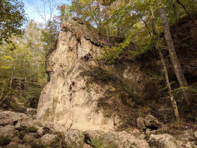
Rain rewrites this park completely. During a storm, the falls roar, and the creek pushes hard enough that crossing becomes a real fight against the current.
Come back on a sunny week and the same route takes half the time, with water reduced to a friendly trickle over the ledges.
Both versions have fans. High water makes the falls dramatic and fills the plunge pools, while low water lets you walk right up under the overhangs and study the rock.
Spring delivers wildflowers and thick green shade, plus aggressive bees around the blooms and mosquitoes that mean business. Repellent is not optional.
Summer here is a test. Heat near 97 degrees combined with steep climbs has flattened experienced hikers, though the ravines stay considerably cooler than open ground.
Fall thins the bugs and drops leaves that make wet rocks sneaky slick. Colors along the hardwood slopes are worth the trade.
Late winter might be the sweet spot. Fewer insects, cool air, bare branches that open up views into the ravines, and steady water flow from winter rains.
Weekends draw crowds year-round, so a weekday visit means near solitude. Check conditions before driving out, since fallen trees and slides close sections without notice.
Guided Tours And Exploration Opportunities
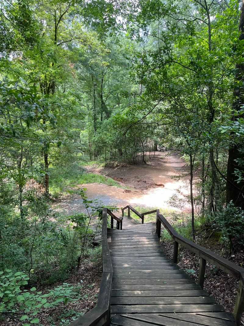
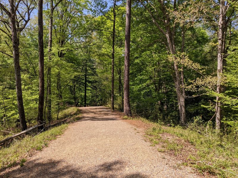
Two trail personalities live here, and picking the wrong one makes for a long afternoon. The improved trail is shorter, wider, and gets most visitors comfortably to the first few falls.
The primitive trail is another animal. One hiker spent roughly seven hours on it and counted ten waterfalls, plus a dozen tiny ones barely knee-high.
Primitive means primitive. Game trails and hiker-made shortcuts blur the route, so a map and decent navigation sense matter.
Everything starts at the trailhead information kiosk and pay station in the parking lot. Maps, signage, and rest stops appear along the way, though a few people still get turned around.
Rangers manage the area rather than running regular guided walks, so calling ahead at 601-888-6040 is smart if you want current trail conditions or group information.
Most visitors handle the first three waterfalls without much trouble, and honestly that alone justifies the drive. Difficulty ramps up sharply past there.
Groups with young kids should bring extra adults, since steep and rocky sections come fast. A five-year-old has made it through, with sore legs the next day.
Walking up the streambeds is sometimes easier than the official path. Gates open at 8 AM, and the return climb is the hardest part of the day.
Photographing The Beauty Of Subterranean Landscapes
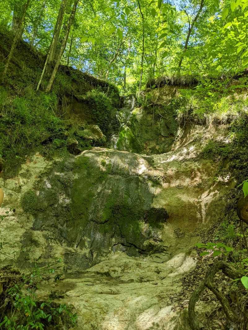
Photographers get spoiled here and also frustrated. The tree canopy is thick, the ravines are dim, and the water is bright, which is a tricky combination for any camera.
Overcast days solve most of that. Even light keeps the falls from blowing out while the mossy rocks and ferns hold their color.
Shooting from inside or beside a hollow beneath a fall creates a natural frame, with dark rock wrapping around a curtain of falling water. Very hard to make that look boring.
Water levels change the whole mood. After rain, you get power and spray, and during dry stretches you get delicate threads and visible rock texture.
Bring something to keep electronics dry, because you will end up standing in the creek at some point. A dry bag or a zip pouch handles it.
A small tripod helps with slow shutter shots that turn the falls silky, though wet rock makes stable footing a challenge. Wedging the legs between stones works better than balancing them.
Early morning light slanting through the hardwoods produces those shafts everyone hopes for. Midday sun creates harsh patches instead.
Include a person for scale near the taller drops. Nothing else communicates a 30-foot waterfall in Mississippi quite as convincingly.