
This 4.2-Mile Tennessee Hike Follows An Old Railroad Route Through Forgotten Mining Country
Tennessee still holds pieces of an industry that vanished decades ago, and this trail walks straight through the middle of it.
The path follows an old railbed that once hauled coal out of a steep river gorge, back when mining crews worked these hills every single day.
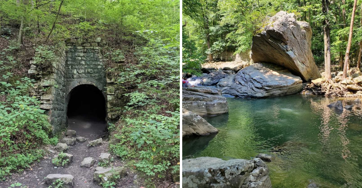
Stone walls line parts of the route, built to hold back the earth during those working years. An old mine entrance sits just off the trail too, sealed off now but still visible to anyone who stops and looks.
Waterfalls wait near the end of the hike, rewarding hikers who push through the early flat stretch and climb into the gorge. Wildflowers show up in spring, filling gaps between the boulders with color.
The elevation gain surprises some visitors, especially after such an easy start. History and nature blend here in a way that feels almost unplanned.
Tennessee rarely lets an old industry disappear without leaving something worth discovering behind.
A Railbed Beckons In The Walden Gorge
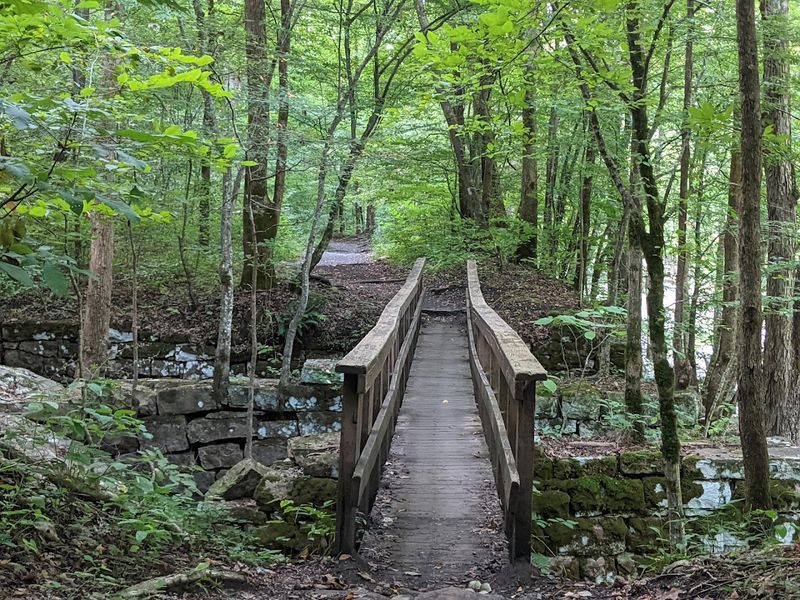
The first steps onto this trail feel almost too easy. The path is wide and flat, and that is no accident.
You are walking on a former railroad bed, the same route that once carried loaded coal cars out of the Richland Mine and toward the broader industrial network of Rhea County, Tennessee.
Richland Creek runs alongside you from the very start, its water clear and quick over smooth stones. The combination of moving water and a graded path makes the opening mile genuinely pleasant, even for hikers who prefer a gentler pace.
Families with young children often stop here to wade and explore before the trail grows more demanding.
Laurel Snow State Natural Area sits on Walden Ridge of the Cumberland Plateau, and the gorge it occupies has a particular quality of stillness that feels earned. The trailhead fills early on weekends, so arriving before 10 a.m. is practical advice.
The railbed section gives every hiker a strong, accessible start before the terrain begins to assert its own character further along the route.
Echoes Of Industry Along Richland Creek
Not many hiking trails come with a full industrial biography. This one does.
Along Richland Creek, the Dayton Coal and Iron Company once ran an operation so large it employed up to 1,200 workers at its peak, with seven coal mines, 375 coke ovens, two blast furnaces, and 17 miles of railroad track supporting the effort.
The company was British-owned, founded after Sir Titus Salt of England acquired extensive land in the region beginning in 1877. That international investment shaped the physical landscape in ways that are still visible today.
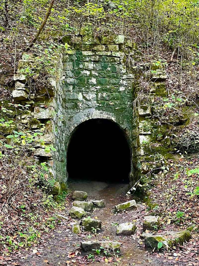
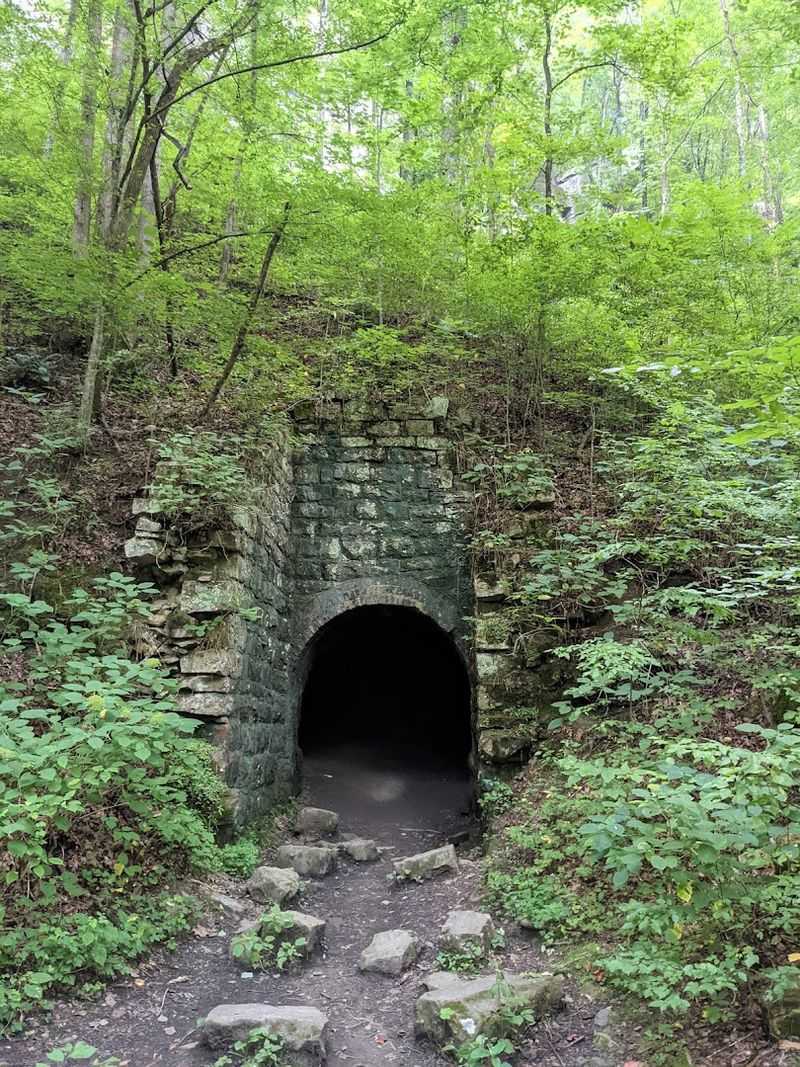
Stone walls emerge from the undergrowth, and the brick-lined entrance of the Dixon Slope Mine sits close enough to the trail that you can study its construction without wandering off path.
Mining activity in this area continued until around the mid-1930s, and what remains feels less like ruin and more like testimony. The creek runs past it all with complete indifference, which somehow makes the remnants more affecting.
Hikers are advised to stay out of all abandoned mine openings, as every one of them is considered structurally hazardous. Looking is rewarding enough.
The history here does not need embellishment to hold your attention.
Where Coal Dust Met The Cumberland Plateau
There is something arresting about standing on a plateau ridge and realizing that the quiet forest around you was once one of the busiest industrial corridors in the state.
The Cumberland Plateau has a way of reclaiming its own, and Walden Ridge has done exactly that over the decades since the mines went quiet.
The Richland Mine was the anchor operation along this corridor, and the trail that follows its old supply route gives hikers a direct line through the geography of that enterprise. You can read the land like a ledger if you pay attention.
The flattened grade, the placement of stone walls, the spacing of old infrastructure points all tell a coherent story about how the operation functioned.
Laurel Snow was established as Tennessee’s first National Recreation Trail in 1971 and designated one of the state’s initial natural areas in 1973.
That early recognition speaks to how significant the landscape was understood to be, even before the full depth of its history was widely appreciated.
The 2,259 acres that make up the natural area now serve as both a recreational destination and an outdoor archive of a period that shaped Rhea County in lasting ways.
The Waters’ Ancient Carving Of The Land
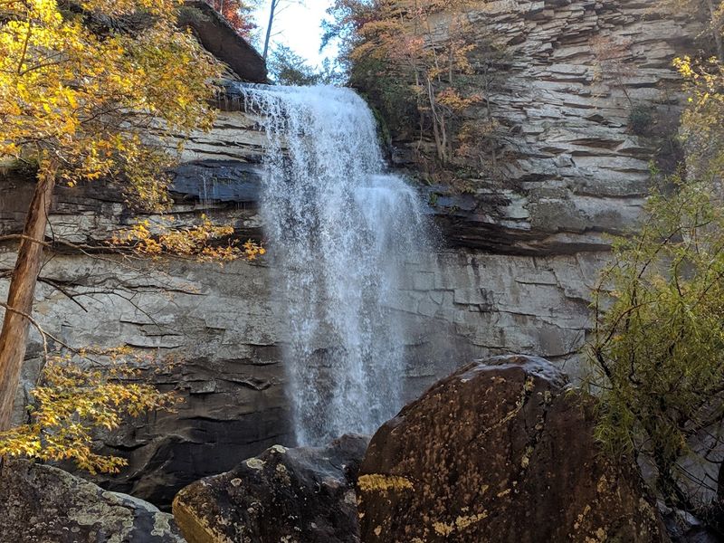
Water did most of the heavy lifting here. Long before any railroad was laid or any mine was dug, the creeks of this plateau were cutting their way through sandstone and shale with patient, geological persistence.
Richland, Laurel, Henderson, Morgan, and Polebridge creeks each carved their own corridors through the ridge, and the result is a landscape of dramatic gorges that still impresses even seasoned hikers.
The gorges create microclimates where moisture collects and rare plants take hold. Virgin timber stands in pockets throughout the natural area, a rarity in a region that saw so much industrial activity.
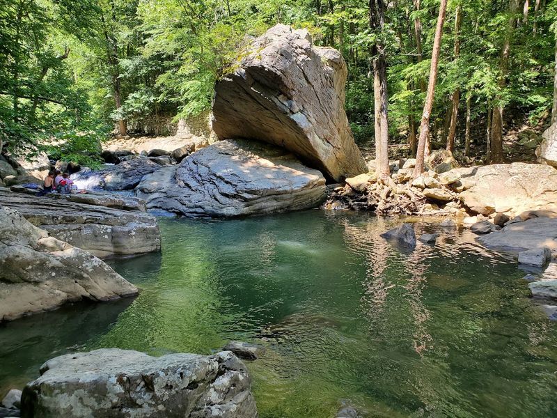
Blue holes form where the creek slows between rock formations, and on warm days these natural pools draw swimmers who arrive with towels stuffed into their packs.
Laurel Falls drops 80 feet over a sandstone ledge, and Snow Falls reaches 35 feet. Both waterfalls are fed by the same creek system that shaped the gorge over millennia.
Visiting after a period of rain rewards hikers with the full expression of both falls. The sound reaches you before the view does, which is its own kind of anticipation.
The water’s work here is ancient, ongoing, and genuinely spectacular to witness.
Bridges To Bygone Eras And Soaring Vistas
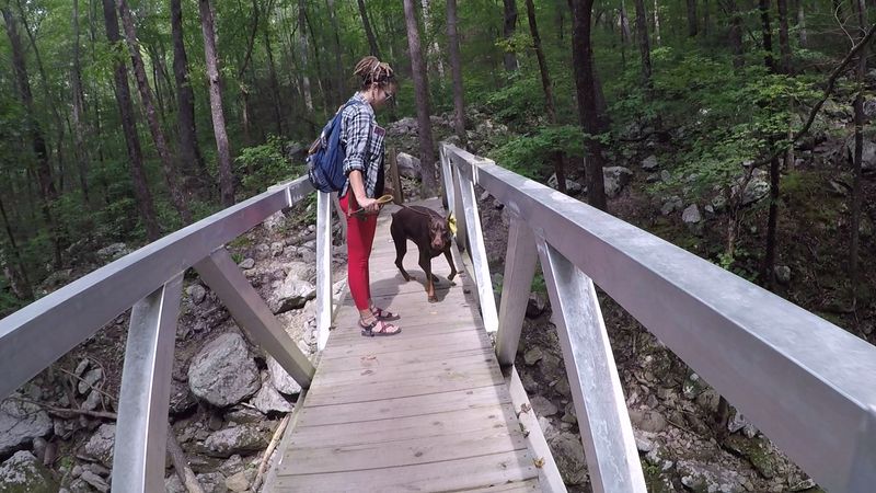
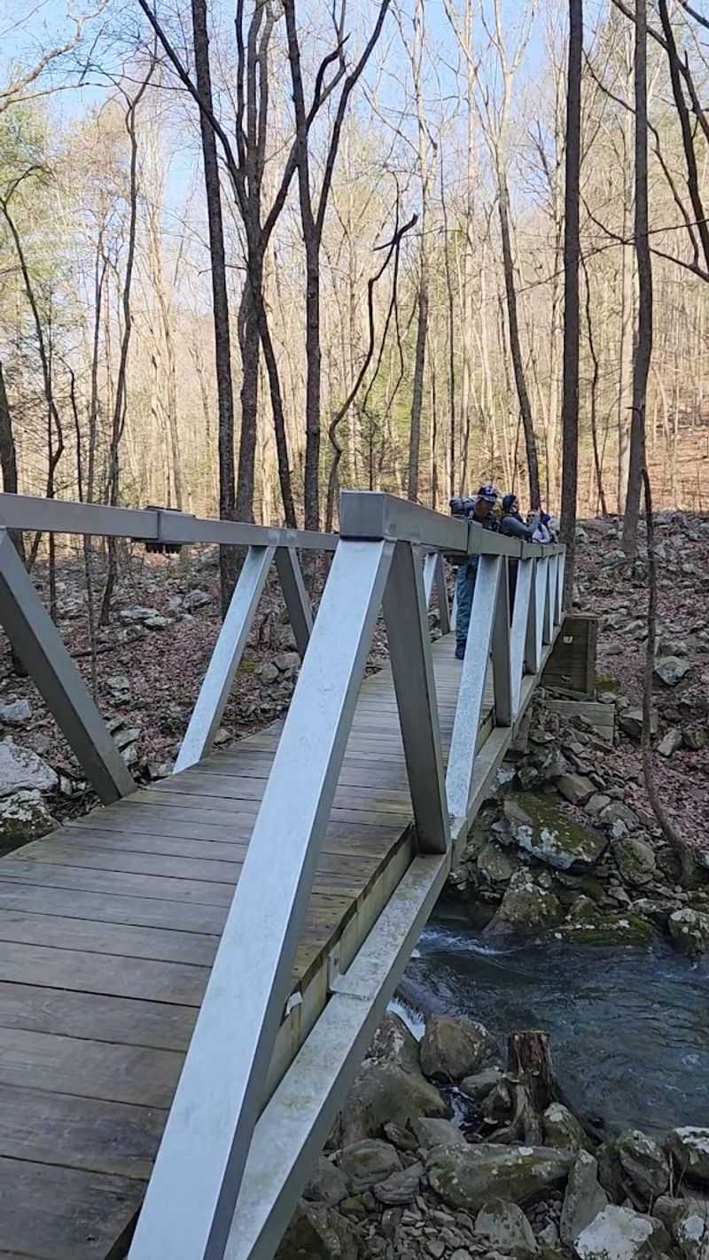
Crossing the 150-foot bridge over Henderson Creek is one of those trail moments that earns its own memory.
The span is long enough to feel like a genuine crossing, and the view down into the creek below gives you a clear sense of how deeply these waterways have cut into the plateau.
Most hikers pause here, and for good reason.
Beyond the bridge, the trail begins its more serious climb toward Laurel Falls. The elevation gain is real, and switchbacks appear where the terrain demands them.
This transition from the flat railbed to a genuine mountain path happens gradually enough that you feel prepared, but the change in effort is noticeable. Ankle support matters on this section, and hiking boots earn their keep.
Buzzard Point and Bryan Overlook, also known as Raven Point, reward those who push through the climb with wide, open views across the gorge and out toward the Tennessee Valley.
These overlooks sit above the tree canopy in a way that makes the scale of the Cumberland Plateau suddenly legible.
The perspective from up there reframes everything you walked through below, and the return descent feels almost meditative after taking it all in.
Unveiling Geologic Wonders And Hidden Paths
At a certain point along the trail, a large boulder forces the path into a low, cave-like passage that hikers must navigate by crouching and threading through carefully.
It is brief, but it is the kind of moment that children remember for years and adults quietly enjoy just as much.
The rock is enormous, and the passage beneath it feels like something a trail builder would have invented if nature had not already done it.
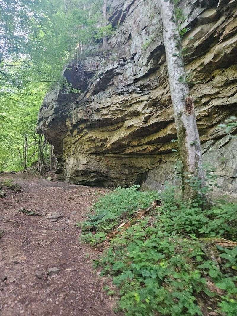
Massive boulders appear throughout the upper sections of the trail, and the geology shifts noticeably as elevation increases. Sandstone formations, some streaked with mineral staining, line the walls of narrower passages.
The geologic record here spans hundreds of millions of years, and the trail cuts through layers of it in ways that a sharp eye can follow.
Distinct formations appear with enough frequency that the route never settles into monotony. Each bend offers something different, whether a sudden view, a textured rock face, or a creek crossing that requires attention and balance.
The trail to Snow Falls and Buzzard Point extends to an 11-mile out-and-back journey for those who want the full experience. Even the moderate route to Laurel Falls covers roughly 4.8 miles round trip and packs in considerable variety.
These Forests Have Watched This Trail Change For Generations
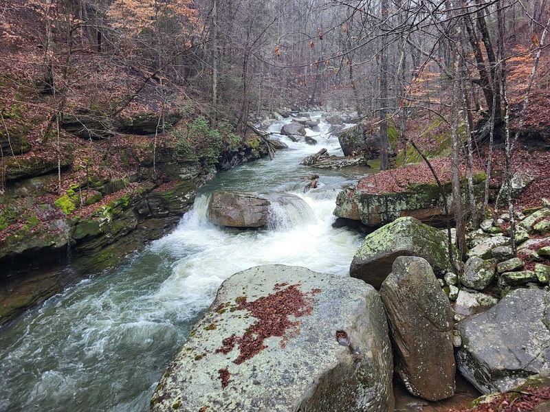
Most forests in the eastern United States carry the mark of the axe somewhere in their history. The stands of virgin timber within Laurel Snow State Natural Area are exceptional for exactly that reason.
These trees were never cut, and they carry the kind of scale and composure that only comes with genuine age. Walking among them feels different from walking through second-growth woods, and experienced hikers notice it immediately.
Spring brings wildflowers to the lower sections of the trail in numbers that reward slow walkers. Trillium, wild ginger, and various ferns fill the understory with color and texture before the canopy closes in for summer.
The area’s deep gorges hold moisture well, and that humidity supports a plant community that feels almost subtropical in its density during the warmer months.
Fall is when the hardwoods perform. Maples, oaks, and hickories shift through amber and rust along the creek corridors, though leaf litter on the trail during mid-autumn can obscure loose rocks and roots.
Solid footwear helps considerably during that season. The forest here is not a backdrop to the trail.
It is an active participant in the experience, changing with every season and rewarding repeat visits with something genuinely new each time.
Walking The Historic Heart Of Rhea County
Rhea County is best known nationally for the Scopes Trial of 1925, but its industrial history runs just as deep and is far less discussed.
The Dayton Coal and Iron Company shaped this county’s economy and landscape for decades, and the trail through Laurel Snow is one of the few places where that history remains physically accessible to anyone willing to walk it.
The old Dayton Reservoir dam is visible along the route, a reminder that this industrial corridor also supplied drinking water to the town of Dayton.
That dual function, coal production and municipal water supply, speaks to how thoroughly the company was woven into the fabric of local life.
The reservoir infrastructure outlasted the mines by many years before the natural area eventually absorbed it all.
Interpretive signs appear at key points along the trail, offering context for what you are seeing.
They are informative without being overwhelming, and they give casual hikers enough background to appreciate the significance of the stone walls and mine openings they pass.
For those who want more depth, additional research into the Dayton Coal and Iron Company turns up a genuinely compelling story of British investment, Appalachian labor, and eventual industrial decline that mirrors patterns seen across the entire region.
A Wilderness Preserved, A Story Retained
Tennessee made a sound decision in 1971 when it designated this corridor as its first National Recreation Trail.
The 2,259 acres that make up Laurel Snow State Natural Area hold a concentration of natural and historical value that is genuinely difficult to match within a single hiking destination in the state.
The preservation came early enough to protect features that might otherwise have been lost.
The natural area also forms a segment of the broader Cumberland Trail system, connecting it to a longer network of backcountry routes across the plateau.
Three designated campsites are available for reservation through the state park website, and overnight parking is permitted at the trailhead, though the entrance gate closes each evening.
Planning ahead for parking is essential, as the lot fills quickly on weekends and holiday mornings.
The area is open daily from 8 a.m. to 5 p.m., and the trailhead at 1098 Pockett Wilderness Rd #100, Dayton, TN 37321 serves as the starting point for all routes.
Rock climbers also use the area regularly, with bouldering problems ranging from beginner to extremely advanced.
The trail gives back in proportion to what you bring to it, whether that is curiosity about history, a love of waterfalls, or simply the desire to walk somewhere that feels genuinely worth the effort.