This Wisconsin Park Has An Ice Age Trail Ending Right At The Water’s Edge
At the edge of Door County, a thousand-mile journey meets the shores of Lake Michigan in a quiet moment of completion. The Eastern Terminus of the Ice Age Trail in Sturgeon Bay marks the final point of one of Wisconsin’s most celebrated long-distance paths, bringing together ancient geology, modern adventure, and waterfront beauty.
Hikers who reach this destination find more than just a trail marker. They discover a landscape carved by glaciers, a peaceful retreat surrounded by forest, and a meaningful connection between land and water that makes the journey worthwhile.
The Ice Age Trail Stretches Over 1,000 Miles Across Wisconsin
Spanning the entire state from east to west, the Ice Age Trail follows the edge of the last great glacier that covered Wisconsin thousands of years ago. This National Scenic Trail covers more than 1,000 miles of diverse terrain, connecting forests, prairies, wetlands, and ridges shaped by ancient ice.
The trail passes through rural farmland and bustling towns alike, offering hikers a genuine cross-section of Wisconsin’s character. Some sections wind through remote wilderness where solitude comes easily, while others bring walkers close to local communities and historic landmarks.
Completing the entire trail takes serious commitment, often requiring weeks or even months of hiking. Many people choose to tackle it in segments over several years, returning season after season to cover new ground.
The eastern endpoint in Sturgeon Bay represents the culmination of this epic route, a place where determination meets the open water of Lake Michigan in a satisfying conclusion.
The Eastern Terminus Sits Right Along Lake Michigan
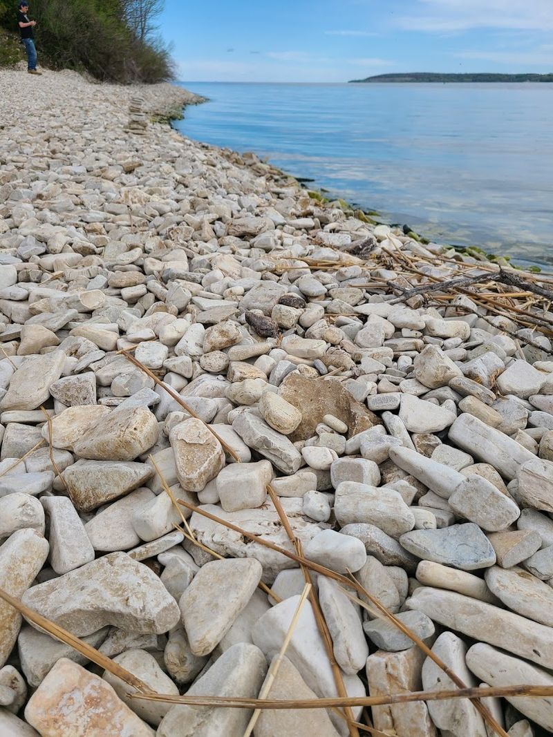
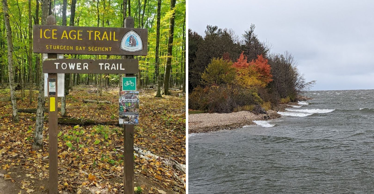
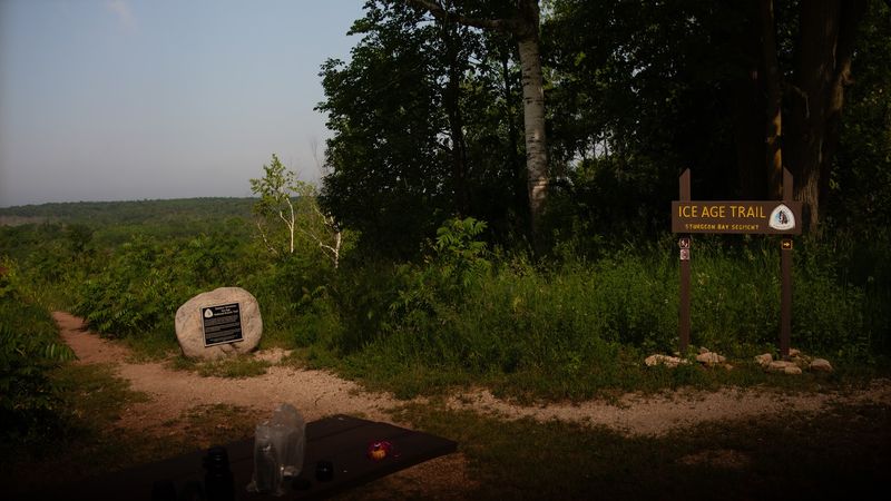
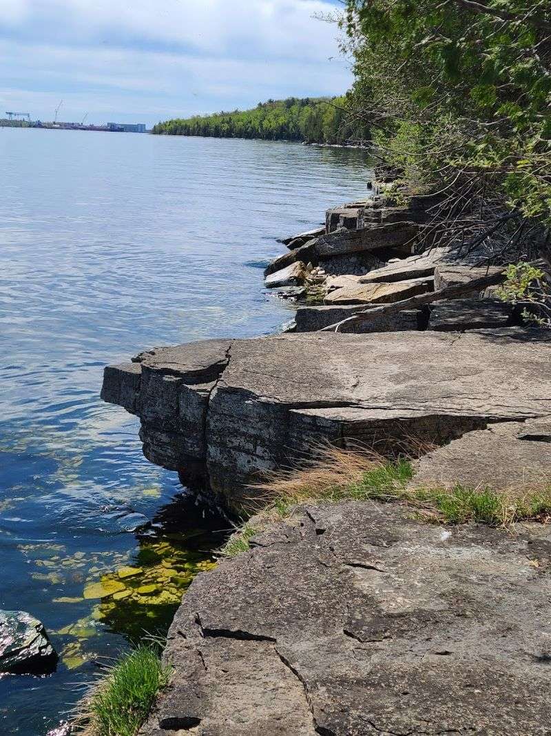
Located within Potawatomi State Park near Sturgeon Bay, the eastern terminus brings the Ice Age Trail to a dramatic finish at the edge of Lake Michigan. Hikers emerge from wooded trails to find themselves standing at the water’s edge, where waves lap against the rocky shore and the horizon stretches endlessly eastward.
This endpoint sits at coordinates that mark the official conclusion of the trail, complete with signage that acknowledges the achievement of those who have traveled the full distance. The location provides a natural gathering spot for photographs, quiet reflection, or simply enjoying the contrast between forest and water.
A small parking area and picnic tables make the terminus accessible to day visitors as well as long-distance hikers. The setting offers unobstructed views across the bay, particularly striking during sunrise when light spills across the water and illuminates the surrounding landscape with soft color and clarity.
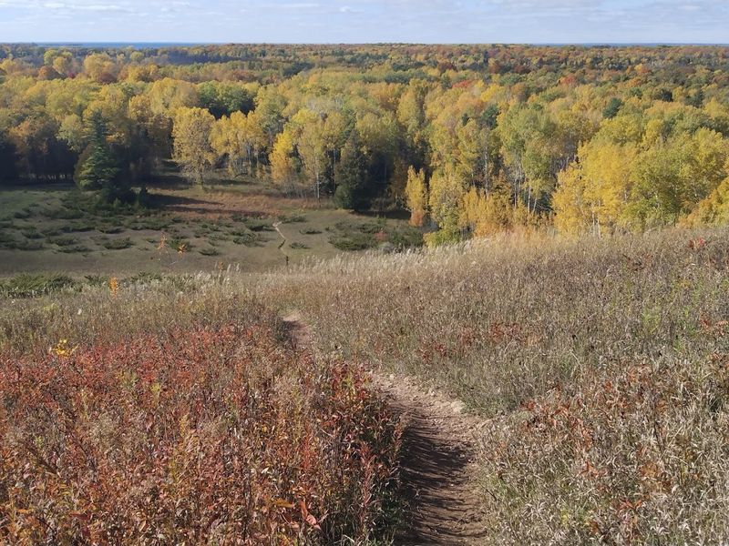
The Landscape Was Shaped By Ancient Glaciers
Every ridge, kettle, and esker along this section of trail tells the story of the Wisconsin Glaciation, which ended roughly 10,000 years ago. The ice sheet that once covered this region left behind a complex topography that defines the character of the trail and the surrounding park.
Glacial features become visible to anyone who knows what to look for, rounded boulders deposited miles from their origin, depressions that now hold wetlands, and ridges formed by sediment pushed along the glacier’s edge. The terrain rises and falls in ways that reflect the movement and retreat of ancient ice.
Understanding this geological history adds depth to the hiking experience, transforming a simple walk into a journey through deep time. The trail itself follows the terminal moraine, the furthest extent of glacial advance, making it a living monument to forces that shaped not just Wisconsin but much of North America during the last ice age.
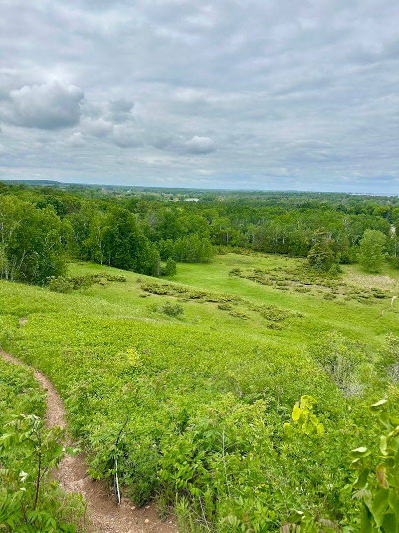
The Final Stretch Feels Peaceful And Scenic
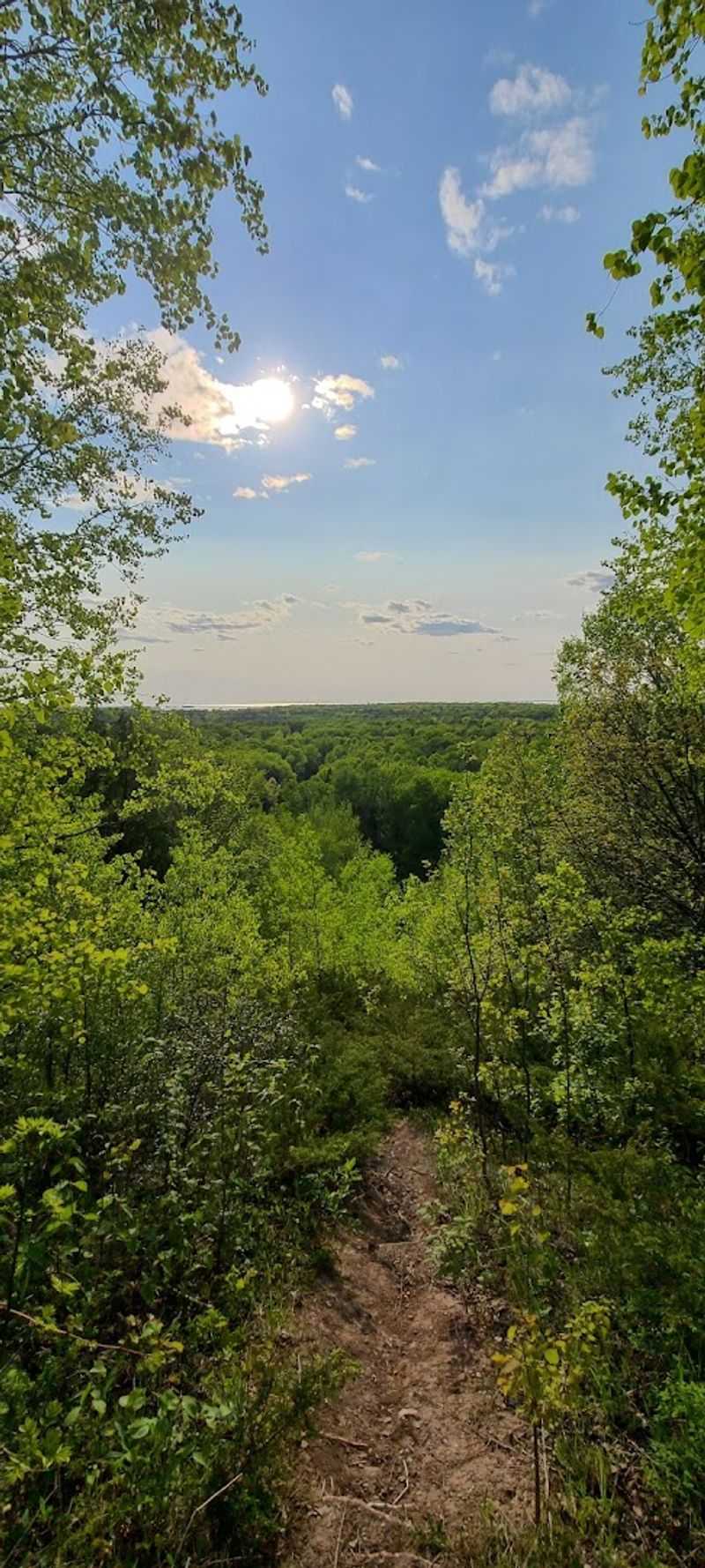
Approaching the terminus from the west, hikers pass through a landscape that balances effort with reward. The trail here includes enough elevation change to remind you that glaciers created hills as well as valleys, but the grade never becomes punishing or monotonous.
Cedar groves provide shade and a distinctive fragrance, particularly noticeable on warm afternoons when the sun draws out the natural oils in the wood. The path alternates between open areas with views of the surrounding forest and enclosed sections where branches form a canopy overhead.
Birdsong accompanies most of the journey, with different species calling from various heights and habitats throughout the day. The atmosphere carries a sense of conclusion without feeling rushed, allowing hikers to savor the final miles rather than simply pushing through to the end.
This measured pace suits both those completing a long journey and visitors exploring just this segment of the trail.
It’s A Popular Spot For Photos And Trail Milestones
The terminus serves as a natural milestone for hikers who have completed significant portions of the Ice Age Trail, making it a frequent backdrop for photographs that mark personal achievements. The combination of trail signage, water views, and the sense of completion creates a setting people want to document and remember.
Some visitors arrive after hiking just the local segment within Potawatomi State Park, while others have traveled hundreds of miles over weeks or months to reach this exact point. Both groups find the location worth capturing on camera, though the emotional weight differs considerably based on the journey behind them.
The small parking area and accessible location mean that even those not hiking the trail can visit and appreciate the significance of the spot. Families often stop here during park visits, and the picnic tables provide a comfortable place to rest while taking in the waterfront views and contemplating the long path that ends here.
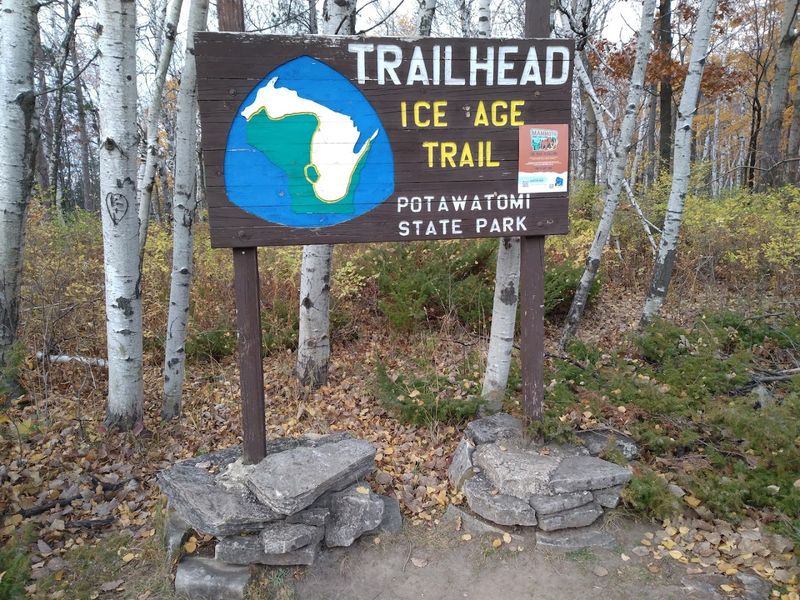
The Area Around Sturgeon Bay Offers Easy Trail Access

Potawatomi State Park provides the infrastructure that makes visiting the eastern terminus straightforward for hikers of all experience levels. The park entrance on Park Drive in Sturgeon Bay leads to well-maintained roads and clearly marked trailheads that connect to the Ice Age Trail segment.
Parking facilities accommodate both day visitors and those arriving after longer treks, with spaces available near the terminus itself and at other points throughout the park. The park charges a daily vehicle admission fee, which supports ongoing maintenance of trails, facilities, and natural areas.
Beyond the Ice Age Trail, Potawatomi offers additional hiking options that explore different aspects of the park’s geography and ecology. The proximity to Sturgeon Bay means services, accommodations, and supplies are readily available just a few miles away, making this an accessible destination rather than a remote wilderness endpoint.
This combination of natural setting and practical convenience appeals to a wide range of visitors.
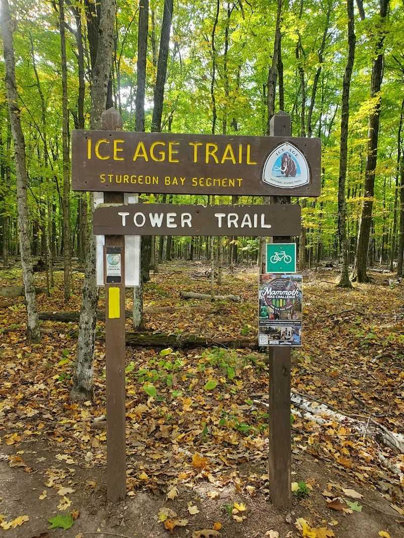
The Trail Is Marked By Distinct Yellow Blazes
Throughout its entire length, the Ice Age Trail uses bright yellow rectangular blazes painted on trees, posts, and rocks to guide hikers along the correct route. These markers appear frequently enough to prevent confusion while allowing the natural landscape to remain the primary focus of the experience.
The blazing system follows standard trail marking conventions, single blazes indicate the trail continues straight ahead, while double blazes stacked vertically signal an upcoming turn or junction. Hikers learn to watch for these markers instinctively after a few miles, developing a rhythm of walking and occasionally confirming direction.
Near the eastern terminus, the blazes lead hikers through the final approach and clearly indicate when the endpoint has been reached. The consistency of this marking system across all thousand-plus miles of trail creates a sense of continuity and reliability, particularly valued by those attempting longer sections or the complete thru-hike from one terminus to the other.
Wildlife And Birdwatching Opportunities Are Common
The forests and shoreline around the eastern terminus support a variety of wildlife that hikers frequently encounter during their visits. White-tailed deer appear regularly, often browsing in meadow areas or moving quietly through the woods in early morning and late afternoon hours.
Birdwatchers find the location particularly rewarding, with species ranging from common woodland birds to waterfowl that frequent the nearby shoreline and wetlands. The mixing of forest and aquatic habitats creates ecological diversity that attracts different birds throughout the seasons, from spring migration through fall movements.
Smaller animals including squirrels, chipmunks, and various songbirds add constant motion and sound to the landscape. Observant hikers might spot evidence of other residents, tracks in muddy sections of trail, scat, or signs of feeding activity.
The presence of wildlife reminds visitors that this trail passes through functioning ecosystems, not just scenic backdrops, and careful observation often reveals more than a casual glance would suggest.
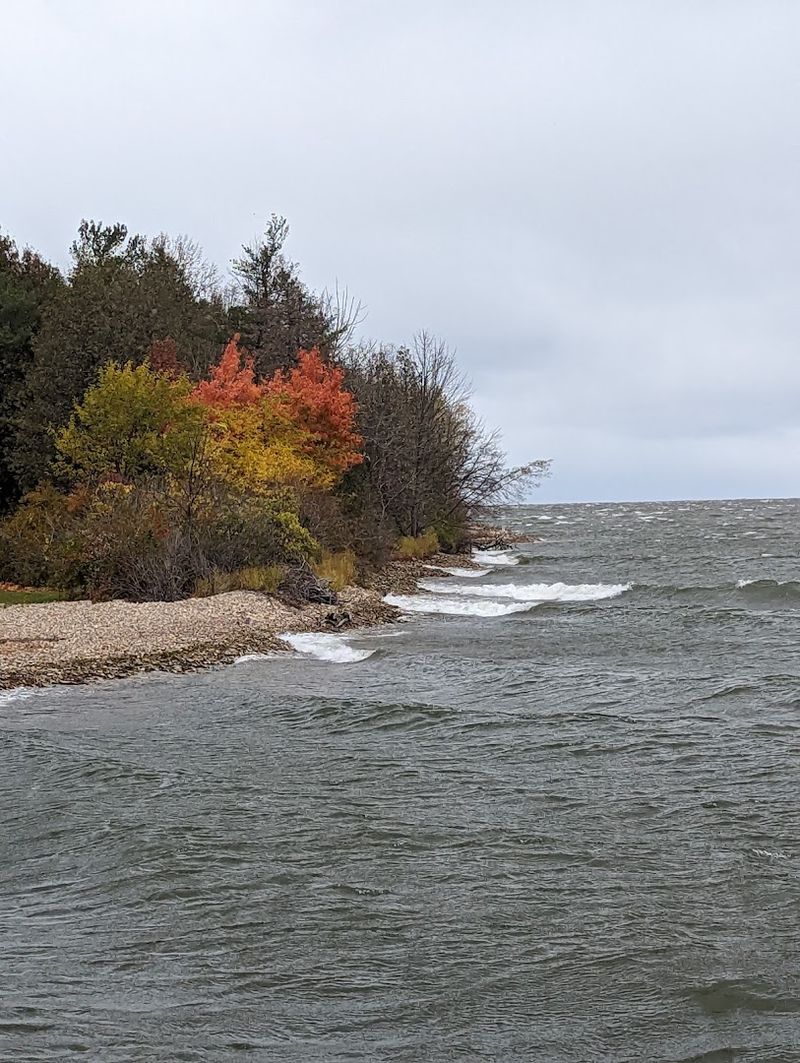
The Terminus Connects Hiking With Waterfront Views
Few long-distance trails in the Midwest offer the dramatic transition from forest to waterfront that defines the eastern terminus experience. Hikers spend miles moving through wooded terrain before suddenly arriving at the open expanse of Lake Michigan, where the scale and character of the landscape shift completely.
The waterfront location provides cooling breezes on warm days and a sense of space that contrasts sharply with the enclosed feeling of forest trails. Sitting on the rocky shore, visitors can watch boat traffic moving through the bay or simply observe the changing patterns of light on the water’s surface.
This combination of hiking and water access makes the terminus appealing to people who might not otherwise consider themselves serious trail enthusiasts. The endpoint offers something beyond the satisfaction of completing a hike, it provides a destination with its own intrinsic appeal, a place worth visiting regardless of how many miles you walked to get there.
It’s A Meaningful Finish For Long-Distance Hikers
For those who have walked the full length of the Ice Age Trail, reaching the eastern terminus represents the completion of a significant personal challenge. The journey requires not just physical endurance but also logistical planning, time commitment, and the mental resilience to continue through difficult sections and changing conditions.
Thru-hikers often spend weeks on the trail, experiencing Wisconsin’s landscape in an intimate and sustained way that few people ever achieve. The terminus becomes more than just a geographic endpoint, it symbolizes persistence, adaptation, and the satisfaction of following through on a demanding goal.
Even those who complete the trail in segments over multiple years find arriving at this final point emotionally resonant. Standing at the water’s edge after so many miles walked, the trail behind and the lake ahead, creates a moment that balances accomplishment with reflection.
The location at Sturgeon Bay provides a fitting conclusion, memorable and accessible, where the journey’s end feels both earned and genuinely worth reaching.