This Wisconsin Trail Takes You Past Two Caves And A Waterfall In One Unforgettable Hike
A trail doesn’t need to stretch for miles to leave a lasting impression. In Wisconsin, one memorable hike manages to pack an incredible amount of scenery into a surprisingly short route.
Towering sandstone formations rise along the path, creating cool passageways and cave-like chambers that feel almost hidden within the forest. Along the way, hikers pass not one but two caves carved into the rock, each adding its own sense of mystery to the journey.
After rainfall, a gentle waterfall appears nearby, spilling over the cliffs and bringing the entire landscape to life. For anyone who enjoys discovering unexpected natural features along the trail, this hike offers a rare combination of geology, atmosphere, and quiet adventure.
A Short Scenic Loop In One Of Wisconsin’s Oldest State Parks
Wyalusing State Park opened in 1917, establishing itself among Wisconsin’s earliest protected landscapes. The park sits at the confluence of the Wisconsin and Mississippi Rivers near Bagley, offering dramatic river valley views and over 500 acres of hardwood forest.
Sand Cave Trail forms part of this historic park’s extensive trail system, which attracts hikers year-round.
The trail itself covers approximately two miles, making it suitable for those who want substantial scenery without excessive mileage. Families with younger children often complete the loop in under two hours, allowing time to explore the caves and take photographs.
The park is located at 13295 State Park Ln, Bagley, WI 53801, and remains open daily from 8 AM to 10 PM.
Trail markers appear at regular intervals along the route, though some visitors have noted that signage could be clearer at certain junctions. Bringing a trail map from the park office helps prevent confusion and ensures you stay on course throughout the hike.
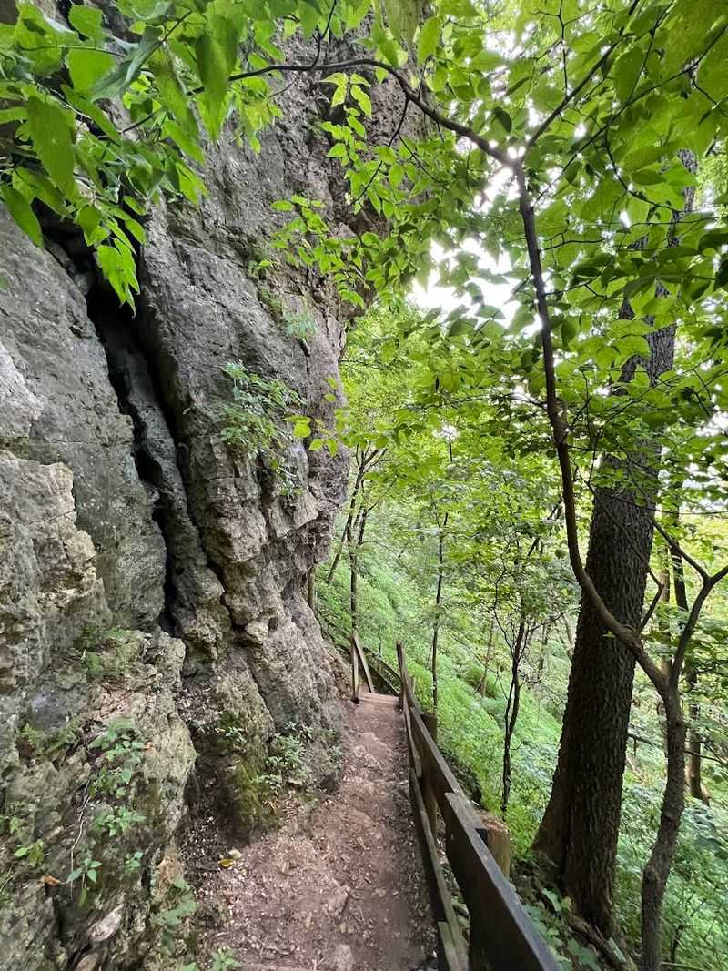
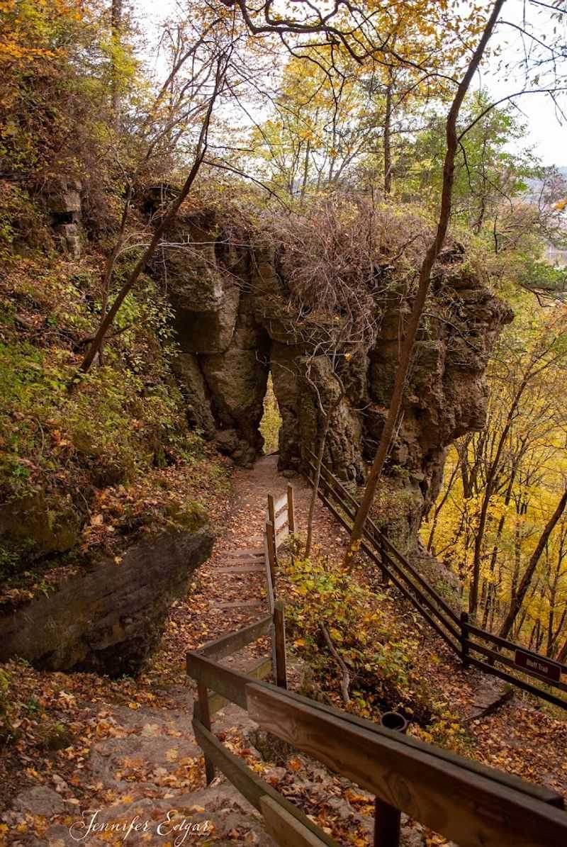
Sandstone Cliffs Create The Trail’s Most Dramatic Scenery
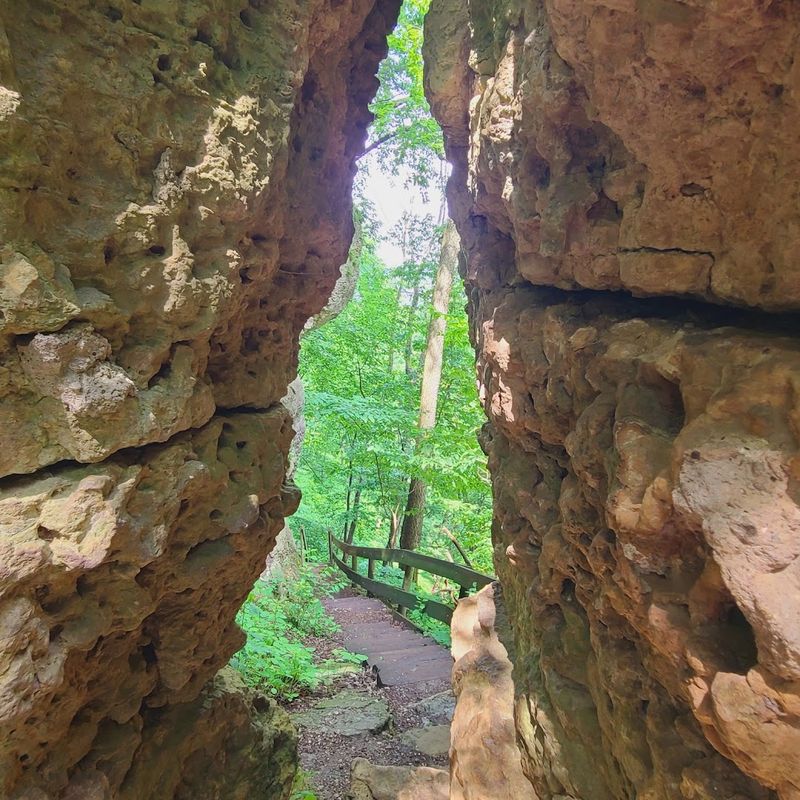
The sandstone formations along Sand Cave Trail date back millions of years, carved by ancient waterways and weathering processes that shaped the region’s distinctive topography. These cliffs rise vertically from the forest floor, their layered surfaces showing clear sedimentary bands that tell geological stories.
The rock faces display colors ranging from pale tan to deep rust, particularly striking when afternoon light hits them at an angle.
Hikers encounter these cliffs early in the route, where the trail begins its descent into a wooded ravine. The vertical walls create a sense of enclosure that contrasts sharply with the open forest sections elsewhere on the loop.
Moss and small ferns cling to crevices in the rock, adding texture and color to the stone surfaces.
Photography opportunities abound here, especially during morning hours when shadows accentuate the cliff contours. The sandstone’s soft nature means erosion continues slowly, constantly reshaping these formations in ways barely perceptible during a single human lifetime.
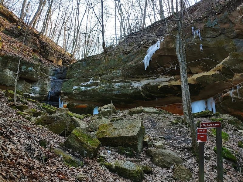
Sand Cave Is One Of The Trail’s Most Fascinating Natural Features
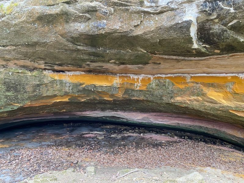
Sand Cave represents the trail’s namesake feature, a shallow rock shelter formed by differential erosion in the sandstone cliff face. The overhang extends outward several feet, creating a protected alcove where the sandy floor stays dry even during moderate rainfall.
Early settlers and Native Americans likely used similar shelters as temporary refuges, though no archaeological evidence is displayed at this particular site.
The cave’s ceiling shows smooth erosion patterns where water has worked its way through softer layers of stone. Small pockets and indentations dot the rock surface overhead, each representing a spot where the sandstone proved slightly more vulnerable to weathering.
The sandy floor feels soft underfoot, accumulated from centuries of the surrounding rock breaking down into fine particles.
Visitors can walk directly into the shelter, which provides enough headroom for adults to stand comfortably. The space feels cool even on warm days, as the thick rock overhead insulates the interior from temperature extremes.
Children particularly enjoy exploring this natural hideaway.
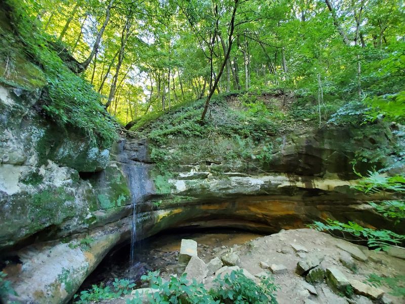
A Second Cave Adds Another Surprise Along The Route
Beyond Sand Cave, the trail leads to a second rock shelter that receives less attention but offers its own distinctive character. This formation sits deeper in the ravine, where the trail passes through a particularly shaded section of forest.
The overhang here extends less dramatically than Sand Cave, creating more of a shallow indent in the cliff face than a true shelter.
What this second cave lacks in size, it compensates for with its setting. Ferns grow thickly around the entrance, and the surrounding forest feels darker and more enclosed.
The rock here shows different weathering patterns, with more pronounced vertical striations where water channels down the cliff face during storms.
Some hikers miss this second cave entirely if they’re not watching carefully, as it blends into the surrounding rock wall more subtly than its better-known counterpart. Taking time to pause and examine the cliff faces throughout the hike reveals numerous smaller overhangs and erosion features that demonstrate the ongoing geological processes shaping this landscape.
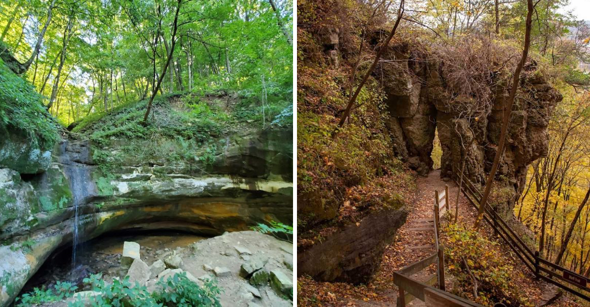
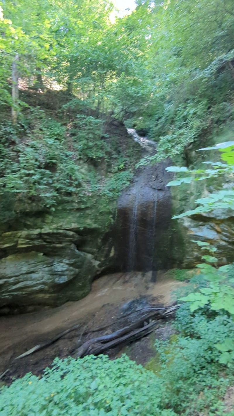
A Seasonal Waterfall Appears After Rainfall
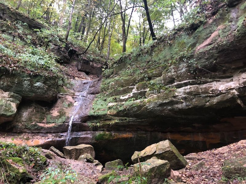
The waterfall along Sand Cave Trail operates as an ephemeral feature, flowing only when recent precipitation provides sufficient water volume. After spring rains or heavy summer storms, water channels down the ravine and spills over a rock ledge, creating a modest but photogenic cascade.
During dry periods, the same spot shows only damp rock and perhaps a slight trickle.
The waterfall’s intermittent nature means timing matters significantly for those hoping to see it flowing. Visiting within a day or two of substantial rainfall offers the best chances, while midsummer dry spells may leave the falls completely dormant.
The flow typically reaches its peak during spring snowmelt, when water moves through the entire watershed.
Even when not flowing, the waterfall location remains worth visiting for the surrounding rock formations and lush plant growth that thrives in the consistently moist environment. The rocks show water staining and mineral deposits that trace the path water takes during active periods, creating abstract patterns across the stone surfaces.
The Trail Passes Through Quiet Forest And Shaded Ravines
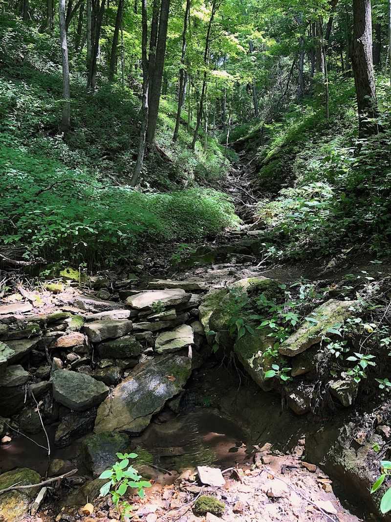
Between the dramatic geological features, Sand Cave Trail winds through substantial sections of mature hardwood forest. Oak, maple, and basswood trees form a dense canopy that provides welcome shade during summer hikes.
The forest floor supports typical Wisconsin woodland plants, including trillium in spring and various ferns throughout the growing season.
The ravine sections offer the trail’s most atmospheric passages, where the terrain drops steeply and the surrounding vegetation creates an enclosed feeling. Sound behaves differently here, with normal forest noises seeming muffled by the terrain and thick plant growth.
Bird calls echo off the rock walls, making it easier to hear but sometimes harder to locate specific species.
These forest sections provide necessary contrast to the open cliff areas, giving hikers’ eyes a rest from bright sunlight and offering different photographic opportunities. The play of light through the canopy changes throughout the day, creating shifting patterns on the trail surface and surrounding vegetation that reward observation and patience.
Moss-Covered Rock Walls Give The Trail A Magical Feel
Moss colonizes many of the rock surfaces along Sand Cave Trail, thriving in the humid microclimate created by the ravine topography and forest canopy. The green growth softens the angular rock edges and adds vibrant color that contrasts beautifully with the tan and rust tones of the underlying sandstone.
Several moss species appear throughout the trail, each preferring slightly different moisture levels and light conditions.
The most extensive moss coverage appears on north-facing rock walls and in areas where water seeps steadily through the stone. These spots develop thick, cushiony moss beds that look almost artificially lush.
Touching the moss reveals its spongy texture, though visitors should resist the temptation to disturb these slow-growing colonies that may have taken decades to establish.
Ferns often grow alongside the moss, their fronds emerging from cracks in the rock where enough soil has accumulated to support root systems. The combination creates miniature hanging gardens on the vertical surfaces, demonstrating how life finds footholds even on seemingly inhospitable stone walls.
A Compact Hike With Big Scenic Payoff
Sand Cave Trail’s relatively short distance makes it an efficient way to experience substantial natural variety without committing to an exhausting trek. The two-mile loop can be completed in 90 minutes to two hours, depending on how much time you spend exploring the caves and photographing the scenery.
This makes it suitable for morning or afternoon outings that leave time for other park activities.
The trail’s compact nature also means that families with younger children can reasonably tackle the entire route without the complaints that often accompany longer hikes. The caves provide natural stopping points that break up the walk and give kids specific destinations to anticipate.
The varied terrain keeps the experience interesting throughout, preventing the monotony that sometimes affects longer trail systems.
Moderate difficulty characterizes most of the route, with some steeper sections requiring reasonable fitness but nothing that should challenge regular walkers. The trail surface varies from packed dirt to rocky sections, making sturdy footwear advisable even though the distances involved are manageable.
One Of The Most Photogenic Trails In The Park
Photography enthusiasts find abundant subjects along Sand Cave Trail, from sweeping cliff faces to intimate details of moss and fern growth. The variety of scales and subjects means that both wide-angle landscape shots and close-up macro photography work well here.
Morning light provides the most dramatic illumination for the sandstone formations, while overcast days work better for capturing forest details without harsh shadows.
The caves themselves present interesting photographic challenges, with dark interiors contrasting against bright exterior lighting. Bringing a tripod allows for longer exposures that capture detail in the shadowed areas while maintaining proper exposure for the surrounding landscape.
The rock textures and erosion patterns reward careful composition and attention to lighting angles.
Seasonal changes transform the trail’s appearance significantly, with spring wildflowers, summer greenery, fall foliage, and winter ice formations each offering distinct photographic opportunities. The waterfall, when flowing, adds movement and sound to images, though capturing it requires timing your visit correctly.
Social media posts from the trail tend to perform well, as the scenery provides naturally compelling backdrops.
The Trail Connects Easily With Other Scenic Routes
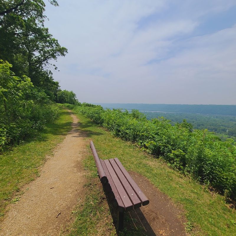
Sand Cave Trail intersects with several other paths in Wyalusing State Park’s extensive trail network, allowing hikers to extend their outings or create custom loop combinations. The Sentinel Ridge Trail lies nearby, offering river valley overlooks that complement the ravine scenery of Sand Cave Trail.
Similarly, the Bluff Trail provides access to additional geological features, including Treasure Cave, another rock shelter formation.
Trail maps available at the park office show how these various routes connect, enabling visitors to plan hikes that match their available time and energy levels. Some connections involve shared trail segments, while others require brief road walks between trailheads.
The park’s compact overall size means that most trail combinations remain manageable even for casual hikers.
Extending your hike beyond just Sand Cave Trail provides opportunities to experience different ecosystems within the park, from open bluff tops with expansive views to deep forest valleys. The varied topography means that each trail offers distinct character, rewarding those who spend multiple days exploring the park’s full range of landscapes and features.