This Short Nevada Hike Belongs On Your 2026 Adventure List
A trail does not need crowds to feel unforgettable. Nevada has a hike where pine shade, steady climbs, and crisp mountain air lead to a lake that feels far removed from the Tahoe rush.
I love routes like this because they make you work just enough before rewarding you with the good stuff. Quiet water, forest views, tired legs, happy mood.
The path feels calm without being boring, and every stretch adds a little more anticipation. The scenery is beautiful, but the history and careful preservation give the walk extra meaning.
For a 2026 outdoor plan that feels peaceful, scenic, and truly worth the effort, this Nevada hike deserves a spot on your list.
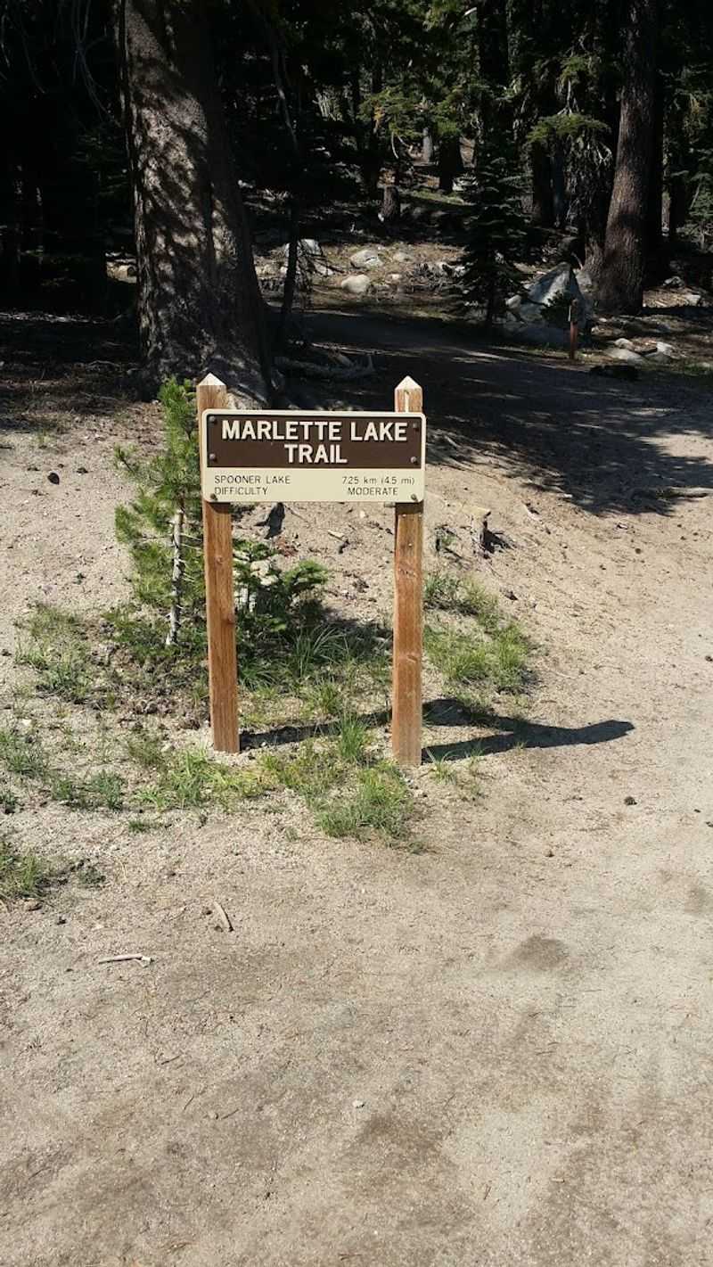
The Trail Starts From Spooner Lake
Spooner Lake serves as the jumping-off point for this journey into the backcountry. The trailhead sits off Highway 50, where a well-maintained parking area provides space for vehicles and clear signage points the way forward.
Arriving early helps secure a spot during peak season.
The lake itself spreads out in a calm expanse just steps from the parking lot, offering a preview of the water-based rewards that await further along the route. Families often pause here before committing to the longer trek.
Restrooms and informational kiosks make this a practical staging area.
From this starting point, the trail begins its gradual ascent toward Marlette Lake. The transition from roadside to wilderness happens quickly.
Within minutes, the sounds of traffic fade and the forest takes over completely.
The Route Follows North Canyon Road
North Canyon Road provides the main artery for this hike, a wide dirt path that once served as a logging and maintenance route. The surface remains firm underfoot, making navigation straightforward even for those new to mountain trails.
Cyclists share this corridor, so listening for approaching wheels becomes second nature.
The road maintains a steady grade without sudden switchbacks or technical sections. This design choice means conversations can continue without constant interruptions for footing adjustments.
Groups of varying fitness levels can move together comfortably.
Tall pines line both sides of the route, creating a corridor effect that channels views forward rather than outward. Occasional clearings break the pattern and offer glimpses of surrounding ridges.
The road’s width allows for easy passing when faster hikers or bikers approach from behind.
The Hike To Marlette Lake Is About 5 Miles One Way
Five miles stretches out as a manageable distance for most hikers willing to commit a half day to the effort. The round trip totals ten miles, a number that sits comfortably between casual stroll and endurance challenge.
Planning for three to four hours of total hiking time accounts for pace variations and rest stops.
The mileage allows for a rhythm to develop during the walk. Early miles pass through dense forest while later sections open up as elevation increases.
Each mile marker brings different scenery and changing light conditions through the tree canopy.
Carrying sufficient water becomes important over this distance, particularly during summer months when shade alone cannot offset exertion. The trail offers no reliable water sources until reaching the lake itself.
Snacks and basic first aid supplies round out sensible preparation for this length of hike.
Aspen Groves Make The Route Beautiful In Season
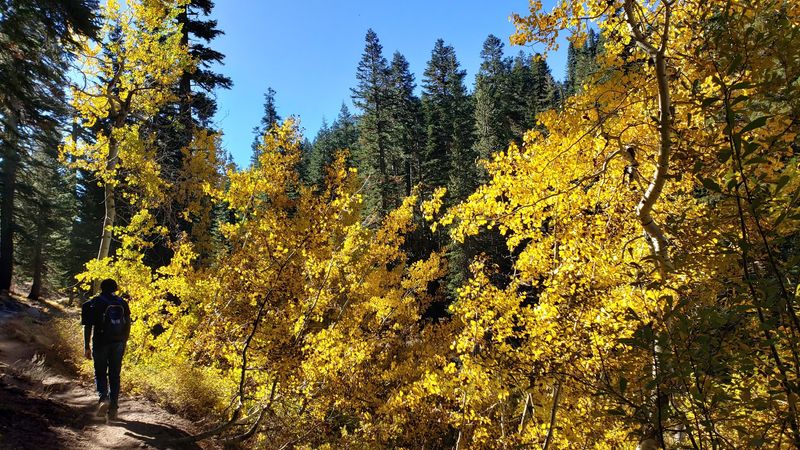
Aspen trees punctuate the conifer forest along certain stretches of trail, their white bark standing out against darker surroundings. These deciduous trees transform the landscape when autumn arrives and temperatures begin their seasonal drop.
Gold and yellow leaves create pockets of color that photograph beautifully.
Late September through mid-October typically delivers peak aspen viewing in this elevation zone. The exact timing shifts slightly each year based on weather patterns and early frost arrival.
Monitoring local reports helps time a visit for maximum foliage impact.
Even outside autumn, aspens contribute visual interest through their distinctive bark and the way light filters through their canopy. Spring brings fresh green growth that contrasts with evergreen neighbors.
Summer offers cooling shade and the gentle rustling sound that gives these trees their common name.
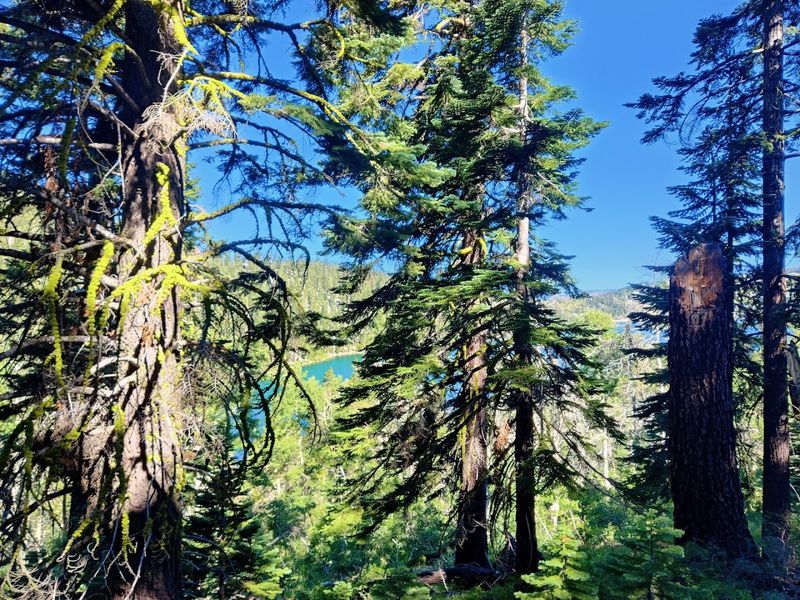
The Trail Climbs Gradually Through Forested Backcountry
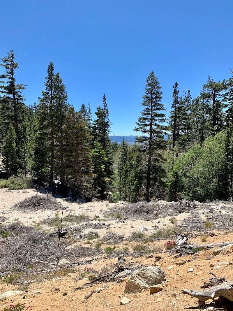
Elevation gain accumulates slowly rather than through steep bursts that leave legs burning. The trail rises approximately 1,200 feet from Spooner Lake to Marlette Lake, spread across the five-mile distance.
This gradient allows for sustained movement without frequent rest requirements.
Dense forest dominates the scenery during the climb, with Jeffrey pines and white firs forming the primary canopy. Undergrowth varies from sparse to thick depending on recent fire history and sunlight penetration.
Occasional granite outcrops break through the soil and add textural variety.
The backcountry character means encountering fewer maintained facilities and more natural conditions. Trail maintenance keeps the path clear but avoids over-engineering that would diminish the wilderness feel.
Wildlife sightings increase in these quieter zones where human presence remains limited to passing hikers and cyclists.
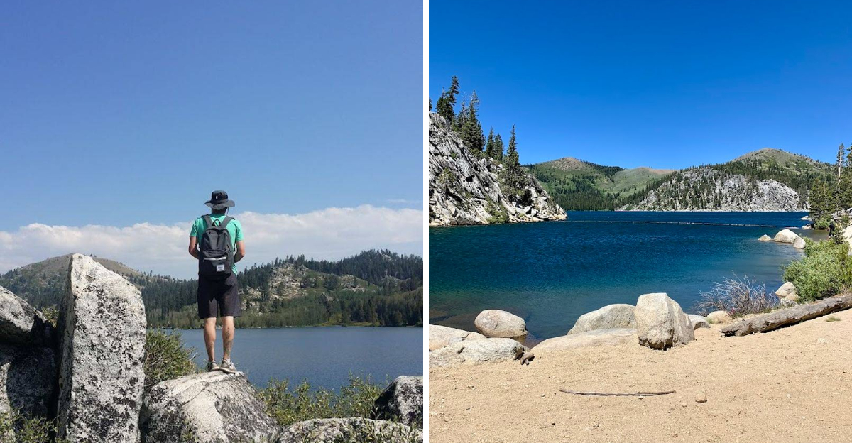
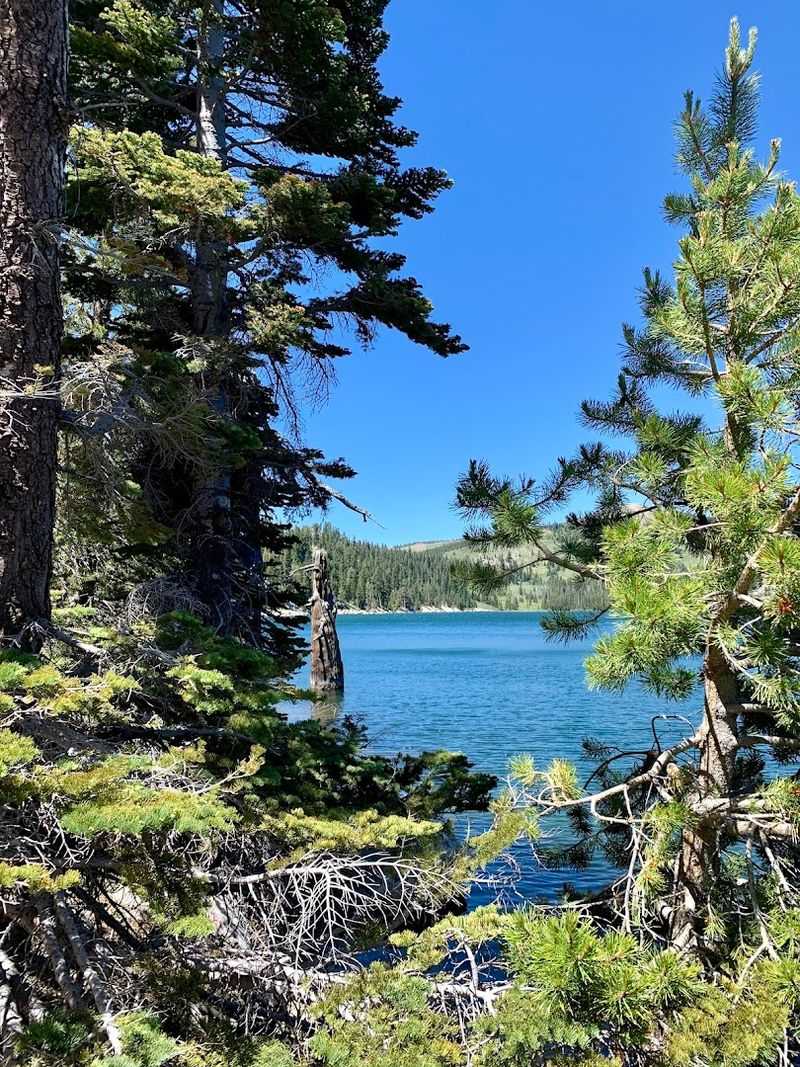
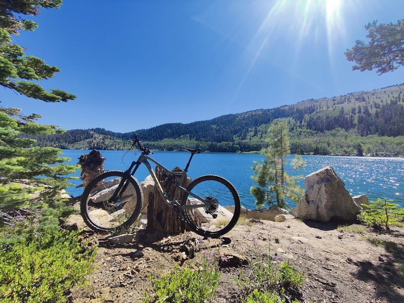
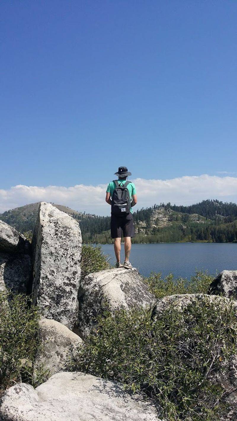
Marlette Lake Feels Quiet Compared To Lake Tahoe
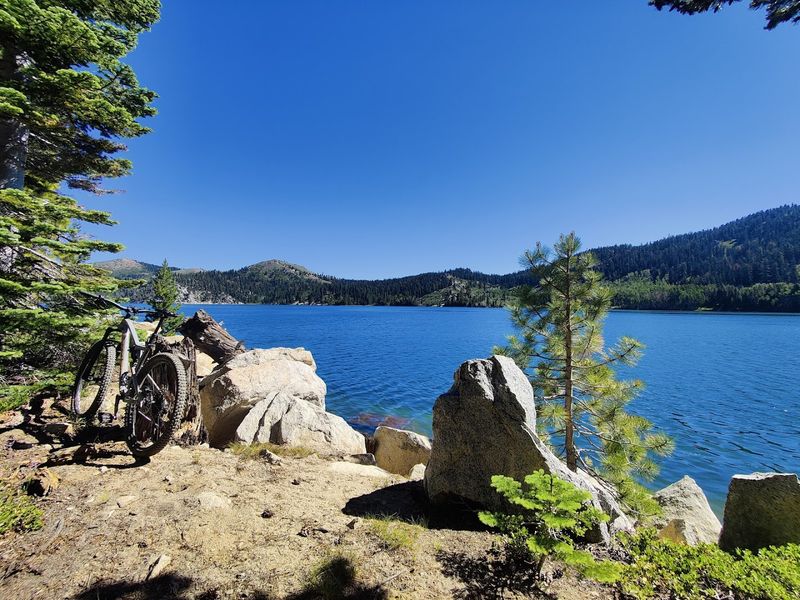
Marlette Lake delivers a sense of solitude that contrasts sharply with the busier scenes along Lake Tahoe’s accessible shorelines. No vehicle access means the only visitors are those willing to walk or bike the distance.
This natural filter reduces crowds to manageable levels even during summer weekends.
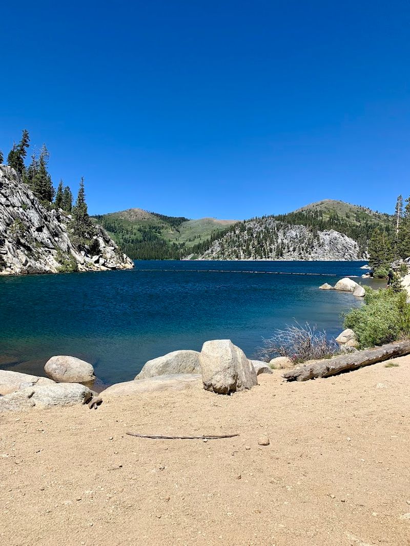
The lake spreads across 360 acres at an elevation just above 7,800 feet, creating a substantial body of water with room to explore. Rocky shores and forested banks provide multiple vantage points for taking in the view.
The water itself remains clear and cold year-round.
Silence becomes noticeable here, broken only by wind through trees and occasional bird calls. Motorboats and jet skis never disturb the surface.
Visitors seeking respite from tourist activity find this environment restorative and worth the effort required to reach it.
The Area Is Part Of Lake Tahoe Nevada State Park
Lake Tahoe Nevada State Park encompasses Marlette Lake and the surrounding trail system, placing this area under state management and protection. The park designation ensures maintained trails, regulated use, and long-term conservation of natural resources.
Entrance fees collected at Spooner Lake support these ongoing efforts.
Park boundaries extend across thousands of acres of Sierra Nevada terrain, offering multiple recreational opportunities beyond this single trail. The management approach balances public access with ecosystem preservation.
Rangers patrol regularly and provide information to visitors unfamiliar with area regulations.
This protected status means development pressures remain minimal and the landscape retains its natural character. Future generations will find similar conditions to those present today.
The park system has maintained this area since 2005, building on earlier conservation efforts that date back decades.
The Route Is Popular With Hikers, Bikers, And Horseback Riders
Multiple user groups share this trail corridor, creating a dynamic environment where different recreation styles coexist. Mountain bikers appreciate the smooth surface and sustained grade that allows for enjoyable riding in both directions.
Equestrians find the width and footing suitable for horses.
Trail etiquette becomes important in multi-use settings. Bikers typically yield to hikers, and all users give right-of-way to horses.
Staying alert and communicating when passing helps everyone move safely. Most encounters prove friendly and brief.
This diversity of users speaks to the trail’s versatility and broad appeal. Families on foot, serious cyclists training for events, and riders exercising horses all find value in the same landscape.
The wide trail bed accommodates different speeds and movement patterns without creating bottlenecks or conflicts in most circumstances.
The Lake Is Closed To Vehicles
Motorized vehicles cannot reach Marlette Lake, a restriction that fundamentally shapes the visitor experience. The closure preserves water quality, protects shoreline vegetation, and maintains the quiet atmosphere that defines this destination.
Only human-powered and horse-powered transportation can complete the journey.
This policy stands in contrast to many alpine lakes where roads extend to the water’s edge. The absence of parking lots and boat launches means the shoreline remains largely natural.
Erosion from vehicle traffic never becomes an issue.
Visitors must carry everything they need for their time at the lake, including any watercraft that might be used for fishing or exploring. The effort required creates a self-selecting group of users who value the primitive setting.
Enforcement of vehicle restrictions helps ensure compliance and protects the resource for future enjoyment.
Fishing Rules Make The Lake Different From Many Others

Marlette Lake operates under special fishing regulations that distinguish it from standard Nevada waters. Artificial lures and flies receive exclusive permission, while bait fishing remains prohibited.
Catch and release rules apply to all fish, preventing harvest and maintaining population stability.
These restrictions support a quality fishery focused on experience rather than consumption. Lahontan cutthroat trout inhabit the lake, a native species prized by anglers for its fighting ability.
The regulations protect this population while allowing recreational fishing to continue.
Understanding current rules before wetting a line prevents citations and supports conservation goals. The Nevada Department of Wildlife publishes updated regulations annually.
Anglers who embrace these constraints often report satisfying outings focused on technique and the surrounding environment rather than filling a cooler with dinner ingredients.
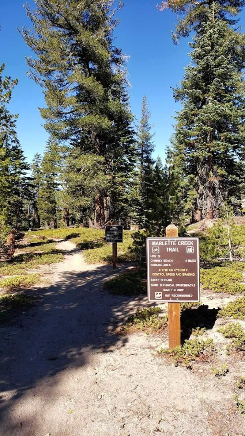
The Trail Connects To The Famous Flume Trail Area
Marlette Lake serves as a waypoint along the celebrated Flume Trail, a mountain biking route known for spectacular Lake Tahoe overlooks. Hikers continuing beyond the lake can access this historic path that follows an old water conveyance system.
The connection expands options for those wanting extended adventures.
The Flume Trail section features more technical terrain and dramatic exposure compared to the approach from Spooner Lake. Views open up significantly as the trail traverses steep mountainsides high above the lake.
This segment attracts experienced riders and confident hikers.
Many visitors treat Marlette Lake as a destination itself rather than a midpoint. Others use it as a rest stop before tackling the Flume Trail’s more demanding sections.
The junction near the lake provides clear signage indicating distances and difficulty levels for onward routes.