
Most Tourists Miss This Quiet Alpine Meadow At The End Of A Hidden Lake Tahoe Trail
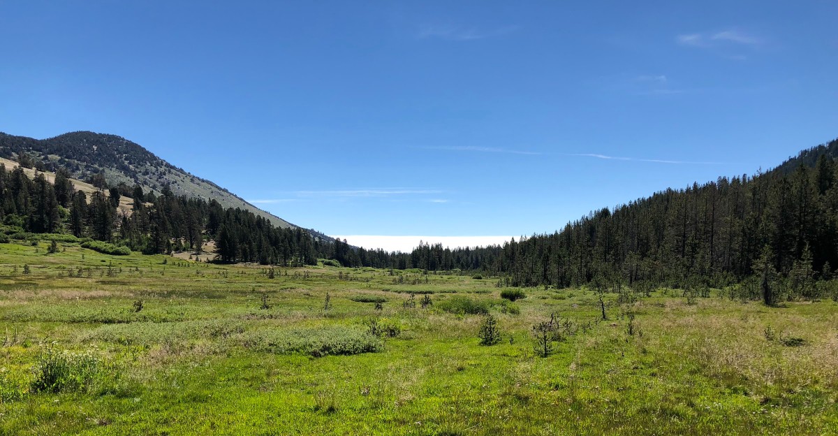
Most tourists blast right past this one, chasing the lake and missing the real magic waiting just above it. Nevada keeps a soft, green secret inside a quiet mountain pass, and almost nobody stops long enough to notice.
Boardwalks float over marshy ground. Wildflowers explode for a few short weeks, then vanish until next year.
Chickadees land on open palms like something from a nature documentary. Deer wander through like they own the place, because they kind of do.
One trail here turns brutal fast, dropping thousands of feet toward the valley floor. Another barely challenges anyone at all.
Nevada hides its softest side in the last spot you would expect. Give yourself an afternoon and go find it before everyone else catches on.
A Meadow Perched Near The Top Of Mt. Rose Highway
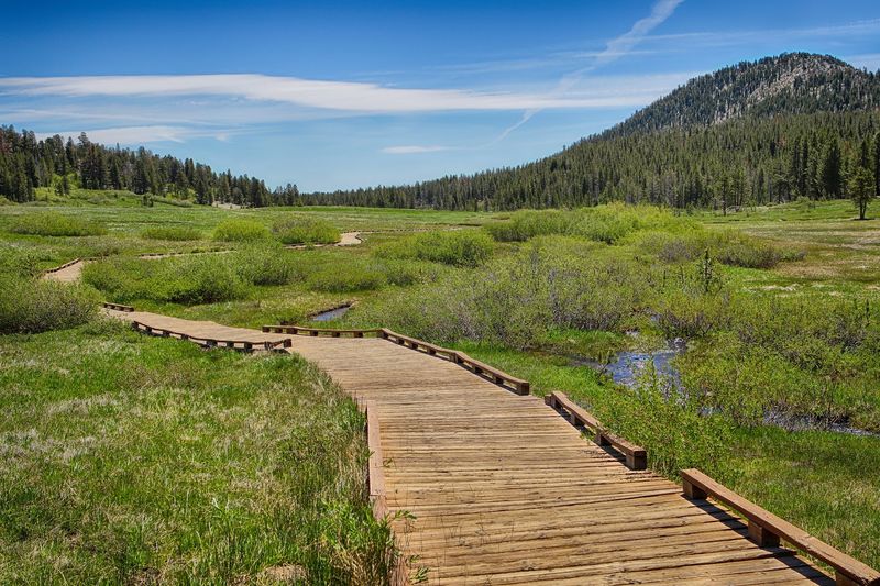
Nine thousand feet of elevation changes everything, including the air. Tahoe Meadows sits at roughly 8,700 feet in the Sierra Nevada, and the temperature drop is immediate.
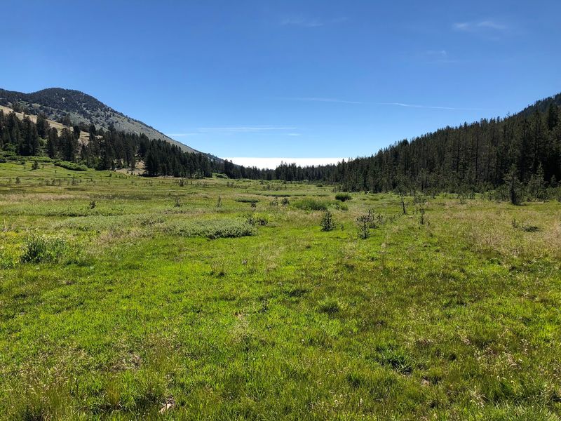
Montane forest wraps the open grass on every side. Lodgepole pines break the sunlight into patches across the meadow floor.
The whole area belongs to the Humboldt-Toiyabe National Forest. It rests just west of Mt.
Rose Pass, along the scenic highway that links Reno with the north shore.
Visitors find the spot at Tahoe Meadows Ophir Creek Trailhead, Mt Rose Hwy, New Washoe City, NV 89704, United States. The drive up takes about half an hour from south Reno.
Water moves slowly here, feeding wetlands that stay damp deep into summer. That moisture supports plants and animals suited to high, cool ground.
Pine scent carries on the breeze, sharp and clean. Traffic noise fades within a few steps of the shoulder.
Crowds gather at the lake below while this upper bench stays comparatively calm. Mornings tend to feel especially still.
For a place this easy to reach, Tahoe Meadows keeps its quiet remarkably well.
Where Several Trails Share One Starting Point
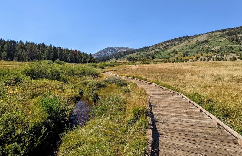
One pullout, many choices. The Ophir Creek Trailhead at Tahoe Meadows works as a hub for several connected paths.
Short strolls leave from the same spot as serious all-day efforts. That range makes planning simple for mixed groups.
Parking sits directly off Mount Rose Highway, also signed as SR 431. The shoulder runs wide, and vehicles line up on a space-available basis.
From here, an easy interpretive loop heads into the meadow itself. A tougher route drops east along the creek toward lower ground.
The Tahoe Rim Trail also passes through, which opens up longer routes in both directions. Hikers can string together a couple of miles or a couple of days.
Signs mark closures when sections need protection or repair. Reading them saves confusion later.
Restrooms appear seasonally at the main parking areas, so timing matters. Arriving early helps, since the meadow fills up by midday in summer.
Careful parking counts for a lot at Tahoe Meadows, because cars move quickly through the pass.
Choosing a direction turns out to be the hardest part of the whole visit.
Boardwalks That Float Above The Wetland
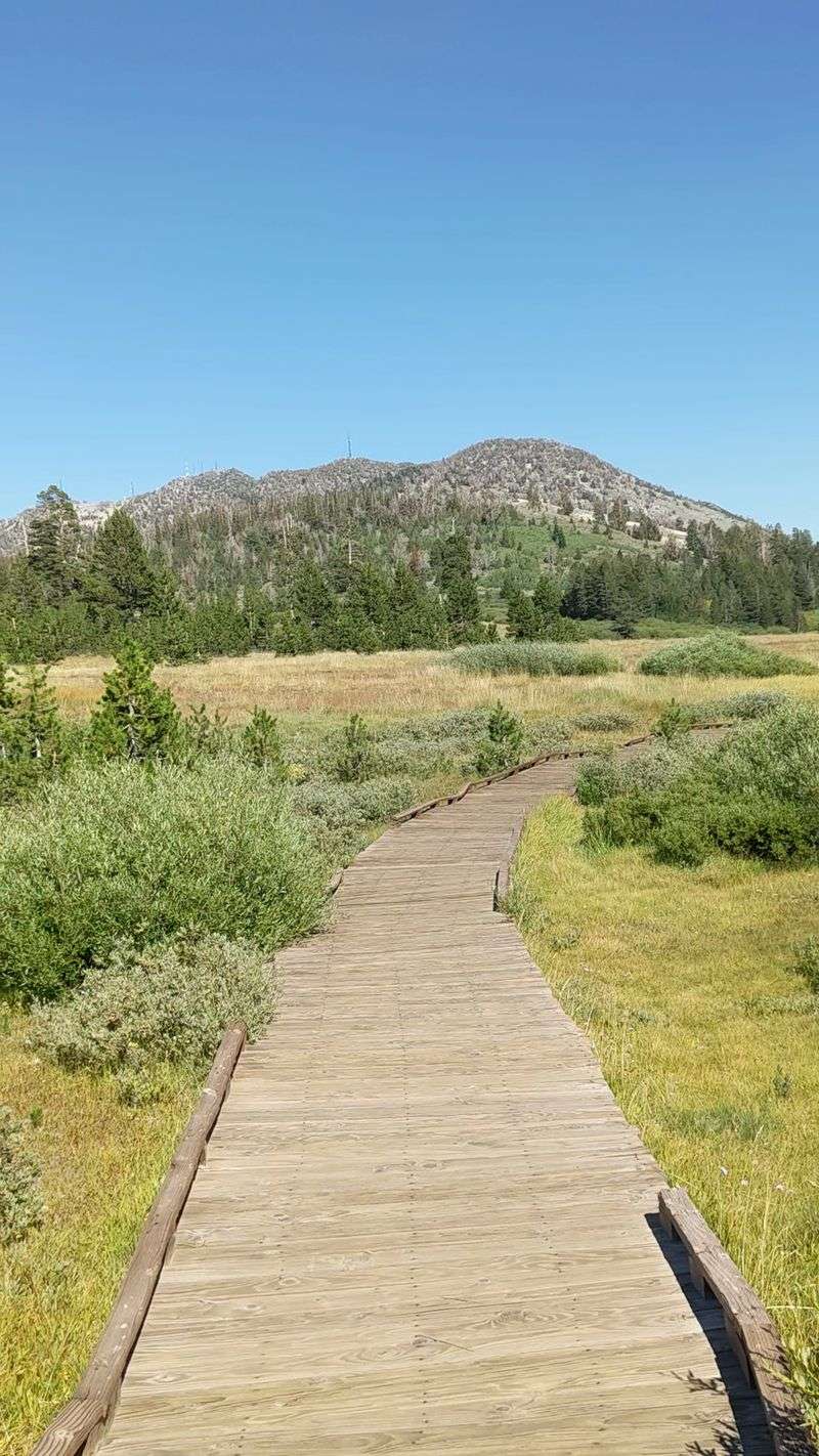
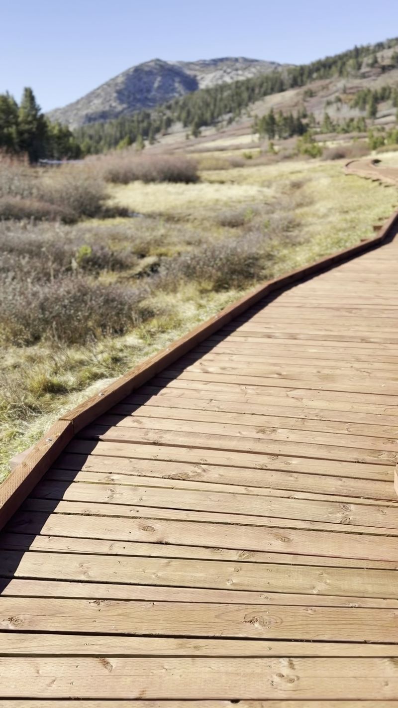
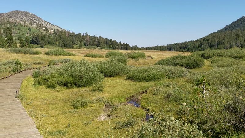
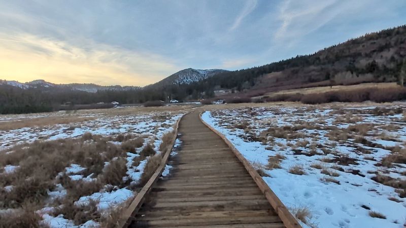
Wooden planks do the heavy lifting here. The Tahoe Meadows Interpretive Trail runs about 1.3 miles as an easy loop, with boardwalk sections carrying walkers over soggy ground.
Those raised paths protect fragile wetland plants. They also keep shoes dry, which everyone appreciates.
Informational kiosks sit along the route. Panels explain local ecology and the history of the surrounding high country.
Families with young children move comfortably along this stretch. Strollers roll fine across certain flat portions.
Small ponds appear beside the planks, sometimes holding fish and reflecting the pines. Twisted, weather-shaped trees lean over the edges.
Walking the main loop takes many visitors under an hour. Photographers usually stretch that considerably.
Higher lookout points along the trail system reveal Lake Tahoe glinting in the distance. Those views arrive with surprisingly little effort.
Staying on the boardwalk matters more than it looks, since meadow vegetation recovers slowly at this elevation.
Hats help, because parts of the route sit fully exposed to sun.
Short, flat, and full of detail, the interpretive loop at Tahoe Meadows rewards slow feet and curious eyes.
The Long Drop Down Ophir Creek
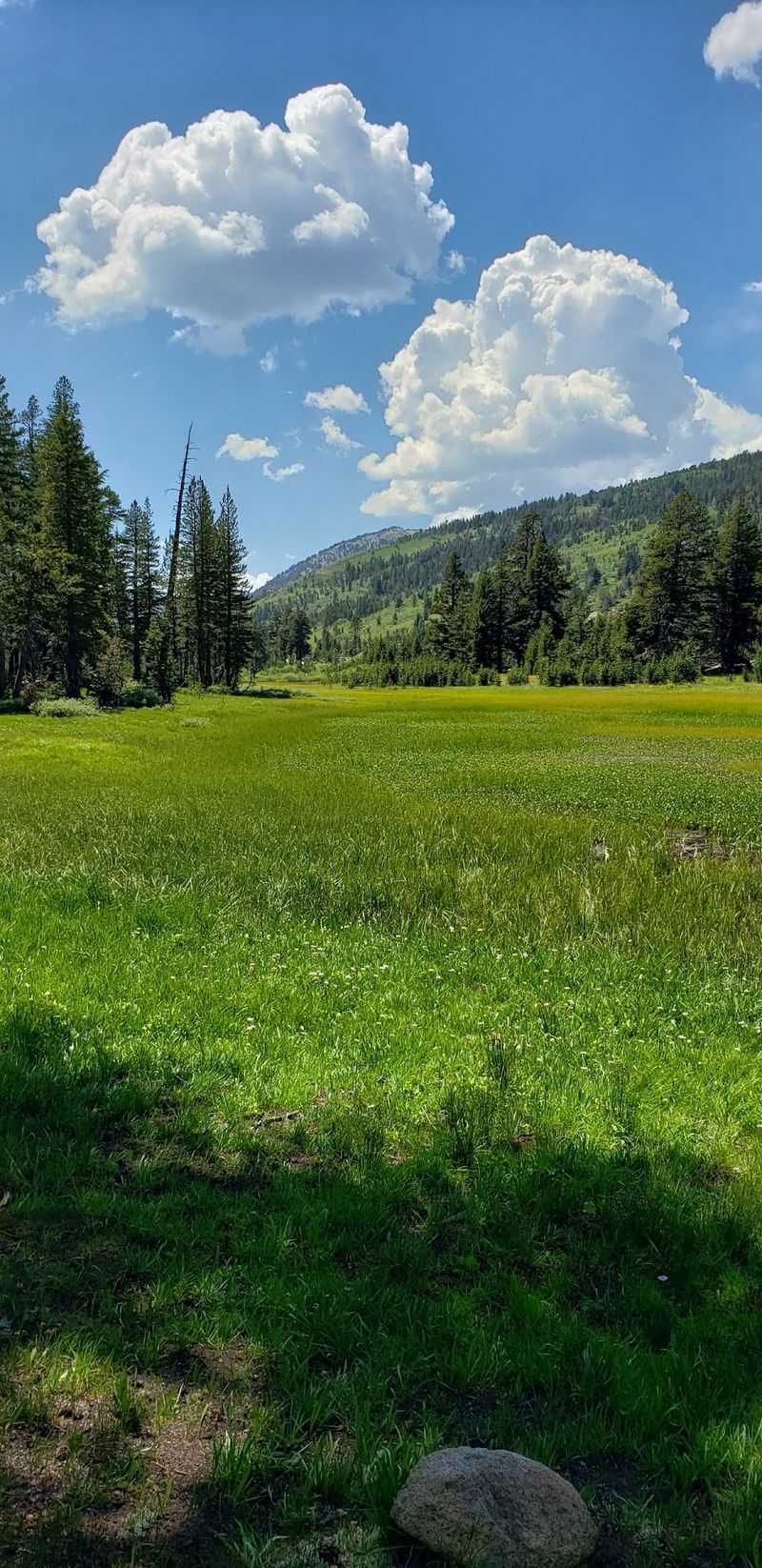
Serious legs required. The Ophir Creek Trail leaves Tahoe Meadows and works its way down toward Davis Creek Regional Park, running roughly seven to eight miles one way.
Elevation change reaches roughly 3,300 to 4,000 feet. Reports consistently describe the route as very strenuous.
The path traces the winding creek for much of its length. Several crossings show up along the way.
Some crossings carry bridges. Others ask hikers to pick their way through moving water, which can be tricky during heavy runoff.
Scenery shifts constantly on the descent. Open forest gives way to subalpine meadow, then bright aspen groves.
Steep, rocky sections demand attention on tired knees. Trekking poles earn their keep on loose sand and gravel.
Water is the big one to plan for, since there is real distance between the two ends. A shuttle vehicle solves the return problem neatly.
Conditions vary year to year, so checking recent trail information before setting out is smart.
Anyone finishing this route from Tahoe Meadows arrives at the bottom dusty, thirsty, and fairly pleased with themselves.
Wildflowers Put On A Short, Loud Show
Early summer is showtime. Once snowmelt soaks the ground, Tahoe Meadows fills with color that lasts only a few weeks.
Marsh marigolds brighten the damp hollows. Primrose monkeyflowers scatter cheerful pink across low, wet patches.
Hillsides pick up phlox in white and purple. Stickseed and meadow penstemon add more layers to the display.
Look closer and wallflowers turn up, along with American bistort and tall, ribbed corn lilies. Each prefers slightly different moisture.
Bloom timing shifts with the winter that came before. A heavy snow year pushes the peak later.
Snow can linger on parts of the trail system into June, so flexibility helps. Locals often report conditions changing week to week.
Photographers crouch along the boardwalks for good reason, since the light at this elevation stays crisp well into the morning.
Picking flowers is off limits, and trampling does lasting damage to the meadow.
Botanists find plenty to study, while casual walkers simply enjoy the patchwork.
Catch Tahoe Meadows during that narrow window and the ordinary green expanse becomes something entirely different.
Chickadees That Land On Open Hands
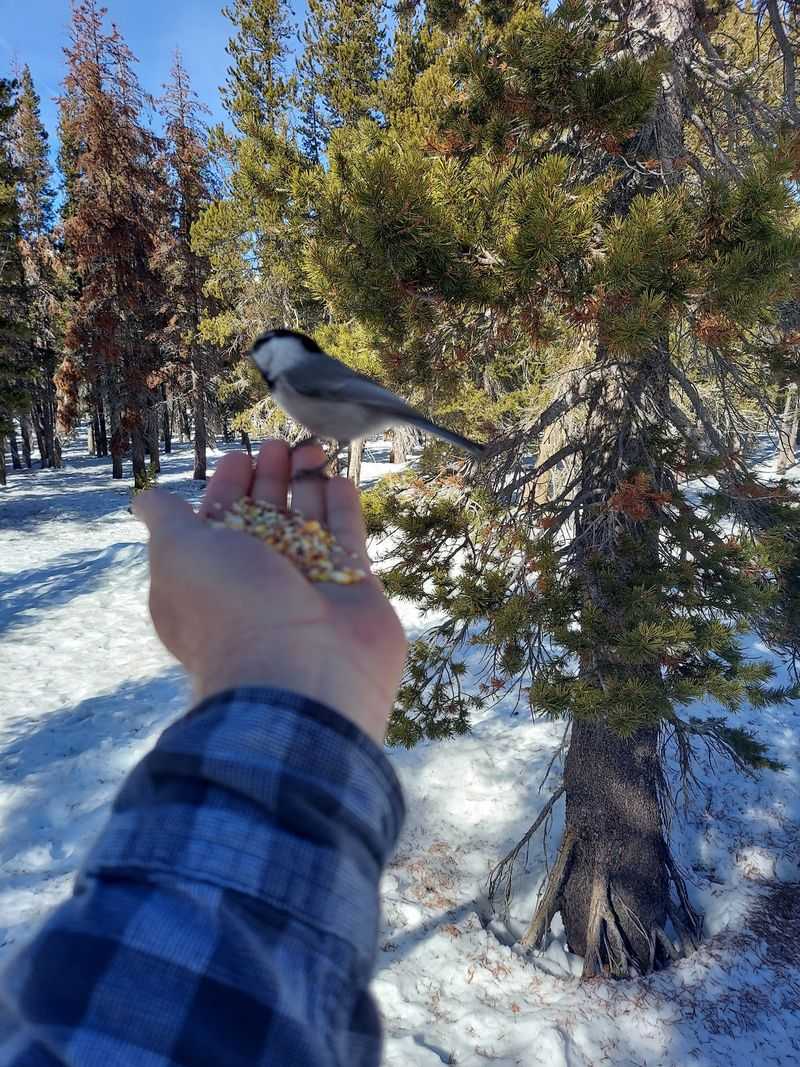
Stand still, hold out a hand, and wait. Mountain chickadees near Tahoe Meadows have become famous for perching on outstretched palms.
Chickadee Ridge draws visitors specifically for this reason. The little birds recognize a good opportunity when they see one.
Beyond the chickadees, the meadow supports a full cast of wildlife. Raptors circle overhead, and birdsong fills the pines at dawn.
Mule deer graze the open grass, especially during spring and fall. Many migrate between these heights and the Carson Valley to the east.
Coyotes work the same ground as important predators. Yellow-bellied marmots sun themselves on rocks above the tree line.
Tracks in mud or snow often reveal more than actual sightings. Reading them becomes its own small hobby.
Observing from a distance keeps animals healthier and calmer. Feeding wildlife other than the well-documented chickadee tradition is discouraged.
Dogs are allowed on leash, and they need to stay on the trail too.
Patience pays off more than speed at Tahoe Meadows, where the best encounters happen to people standing quietly.
Snow Turns The Grass Into A Playground
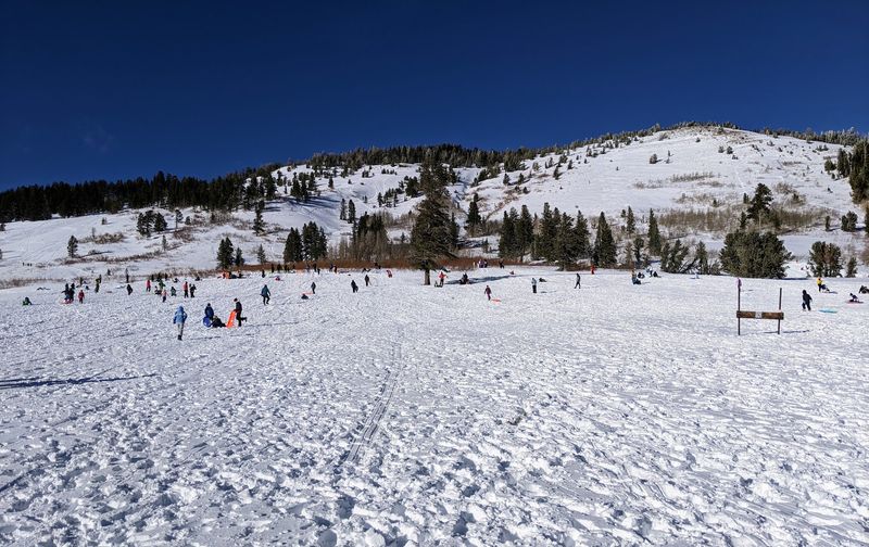
Winter flips the whole place upside down. Deep snow buries the grass, and Tahoe Meadows becomes one of the region’s favorite cold-weather stops.
Snowshoers fan out across the flats. Cross-country skiers track their own lines through the powder.
Sledding is the loudest attraction. A short, steep drop from the roadside launches sleds onto a long flat runout, which delights small kids and teenagers alike.
The open expanse gives families room to spread out. Snow-covered pines make the forest edge look freshly frosted.
Snowmobiles are permitted in designated southwest sections, which keeps motorized and quiet uses separated.
Fresh storms can leave snow thigh-deep, so snowshoes beat boots on powder days. Waterproof footwear, gloves, and a neck warmer make a real difference.
In winter, tracks left by earlier visitors often serve as the trail. Straying off them happens easily, so route awareness matters.
Some loop directions include steeper climbs than others, especially when taken in reverse.
Checking road and weather conditions before driving up Mt. Rose Highway is simply good sense, since mountain storms arrive fast.
Old Footprints And A Historic Flume
People have used this high ground for thousands of years. Archaeological work around Tahoe Meadows has identified habitation and processing sites dating back roughly 4,000 years.
Those findings hint at seasonal life in the mountains. The meadow offered water, plants, and game during warmer months.
Much later, the Comstock era left its own mark. The historic Ophir Creek Flume, built to move water, originated on land in this area.
Remnants of that system can still be found today. Weathered wood and cut channels survive in scattered spots.
Part of the area once carried the name Sheep Flat, after a historic sheepherder’s cabin. Grazing shaped the landscape for a long stretch of time.
Artifacts and remains are protected, so looking without touching is the rule. Removing anything is prohibited.
Conservation groups have worked to keep these historical values intact alongside the natural ones.
Knowing the backstory changes how the meadow reads. Quiet ground suddenly feels layered.
History and scenery share the same trail at Tahoe Meadows, and both deserve a slow pace.
Linking Into The Tahoe Rim Trail Network
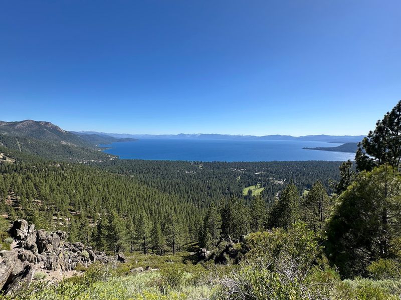
The big loop passes right through. The Tahoe Rim Trail covers roughly 165 miles around Lake Tahoe, and it intersects Tahoe Meadows.
That junction turns a short outing into something much larger. Hikers pick a direction and keep going.
One well-loved option climbs toward Chickadee Ridge, where the lake appears far below. The view arrives after a modest effort.
Another segment heads south in the direction of Diamond Peak Ski Resort. Distances there suit strong day hikers or overnight trips.
Mountain bikers use portions of the network too, finding mostly easy grades with a few technical spots.
The Rim Trail crosses between California and Nevada as it circles the basin. Trail conditions and open sections vary by season.
Wind tends to pick up on exposed stretches, so a light layer earns space in the pack.
Signage at junctions helps, though a map or downloaded route removes guesswork.
Starting at Tahoe Meadows gives hikers an unusually generous menu. Two hours or two days both work from the same pullout.
Small Habits That Keep The Meadow Healthy
Fragile ground asks for good manners. Alpine meadow plants at Tahoe Meadows grow slowly, and footprints off-trail can leave scars that last seasons.
Designated paths and boardwalks exist for that reason. Sticking to them protects the wetlands that define the area.
Mosquitoes can be thick during spring and early summer, especially near standing water. Repellent turns a twitchy walk into a pleasant one.
Thin air at this elevation intensifies sunlight. A hat, sunscreen, and extra water all belong in the day pack.
Packing out trash is non-negotiable, and cleanup stations for dog waste are available at the trailhead. Using them keeps the place presentable.
Leashes help protect nesting birds and grazing deer. Quiet voices improve everyone’s chances of spotting wildlife.
Reports of vehicle break-ins along the highway have surfaced over the years, so leaving valuables visible is unwise.
Closures posted for preservation should be respected rather than tested.
Small choices add up across hundreds of thousands of visits, which is exactly why Tahoe Meadows still looks the way it does.
Planning A Stop Between Reno And The Lake
Thirty minutes from south Reno, and suddenly the city feels far away. Tahoe Meadows sits conveniently between the Reno area and Lake Tahoe’s north shore.
That position makes it an ideal detour. Plenty of travelers stop for 45 minutes and walk the main loop.
Parking is generally free, with the Tahoe Meadows South Trailhead offering the most space. Roadside parking fills in the gaps.
Restrooms show up seasonally near the main lots. Water is not something to count on, so bring your own.
Late spring through early summer brings the greenest meadow and strongest creek flow. Fall trades flowers for golden grass and quieter trails.
Early starts beat the midday crowds, particularly on summer weekends. Afternoon thunderstorms can build quickly at this elevation.
The easy loops suit almost any fitness level, while the Ophir Creek descent demands preparation.
Layers matter year-round, since temperatures swing widely once the sun drops behind the ridge.
Tahoe Meadows rewards both the quick roadside stop and the full-day plan. Its wide green floor, boardwalks, chickadees, and mountain silence explain why repeat visits happen so often across Nevada’s high country.