
A Day Trip Route In Massachusetts That Packs A Waterfall, A Diner, And A Scenic Drive All Into One Afternoon
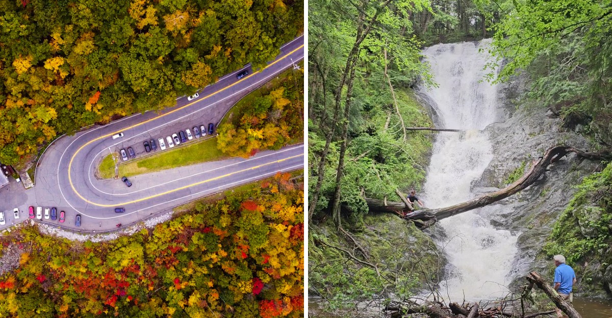
What if one afternoon could cover a mountain view, a classic diner meal, and a waterfall without spending half the day in the car?
Massachusetts makes that possible on a route where the scenery keeps changing just enough to hold your attention. The drive climbs into the hills, opens to broad views, and gives you a good reason to pull over more than once.
Then comes the food stop. Think hot coffee, a filling plate, and the relaxed feel of a diner that still does things the simple way.
The final stretch leads toward the woods, where a short walk brings the sound of rushing water closer with every turn.
Nothing about this trip feels rushed. You can eat well, enjoy the drive, and still have time to stand beside a waterfall before the afternoon is over.
That makes it an easy choice when you want a road trip without giving up the entire day.
Start The Afternoon With A Classic Diner Stop In North Adams
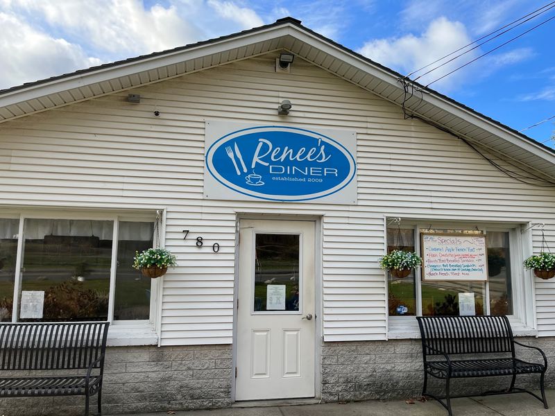
Great road trips run on breakfast, even when the clock says afternoon. Renee’s Diner sits at 780 Massachusetts Avenue in North Adams, and it makes a smart first stop before the driving begins.
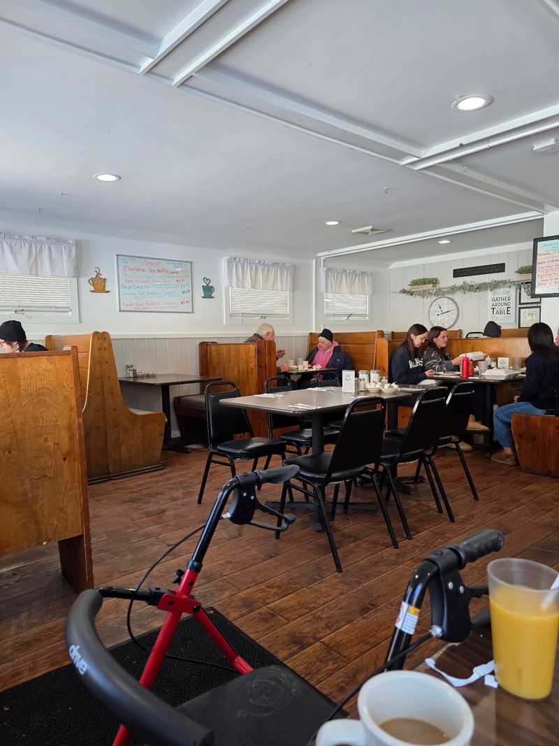
The place leans into the classic diner style without trying too hard. Step inside and it feels a bit like a converted living room, comfortable and lived-in rather than polished.
Breakfast and lunch are the specialties here, and both are made from scratch. That detail matters more than it sounds.
Scratch cooking means the hash tastes like hash and the gravy tastes like someone actually stirred it.
North Adams sits at the northwestern corner of Massachusetts, wedged between mountains on nearly every side. Starting your day here puts you within minutes of the Berkshire hills and the byway that runs through them.
Parking is straightforward, and the pace inside is relaxed. Nobody rushes you out the door, which is exactly what you want before a drive built around stopping often.
Come hungry and unhurried. A good meal at the beginning of a route like this sets the tone for everything after it.
Think of Renee’s as the trailhead. The trail just happens to be paved for the first stretch, and it leads straight toward some of the best scenery in the state.
Order Something Hearty Before The Scenic Miles Begin
Light snacks have no business on a mountain road. The menu at Renee’s Diner is built for people who plan to be outside later, and that works in your favor.
Fluffy pancakes are the crowd-pleaser, stacked tall and easy to share. A generous serving of homemade hash goes the other direction, savory and filling in the best possible way.
Biscuits and gravy show up for anyone who wants comfort food with no apologies. Chicken fried steak is also on offer, which is not something you find on every New England menu.
Classic plates of eggs, ham, and sausage round things out. Nothing fancy, nothing fussy, just food that holds up for a few hours of walking and driving.
Here is the practical reasoning. The waterfall later in this route involves a descent and a climb back up, and you will appreciate having eaten properly beforehand.
Grab coffee to go if the day is cool. The overlook ahead has open air and mountain breezes, and a warm cup makes the pause more pleasant.
Once the plates are cleared, you are only a few minutes from the on-ramp to the fun part. The Berkshires begin almost immediately once you point the car east.
Follow The Mohawk Trail Into The Northern Berkshires
History hides in plain sight on this stretch of asphalt. Just beyond North Adams, Route 2 becomes the Mohawk Trail, a byway that carries centuries of travel in its route.
Long before cars existed, the corridor served as a Native American trade route through the mountains. In 1914 it was designated as one of the first scenic auto touring roads in the state.
The trail runs roughly 63 to 75 miles depending on how you measure it. You will not drive the whole thing this afternoon, and that is perfectly fine.
What you get instead is the most dramatic section. Dense forest crowds the shoulders, mountain passes rise and fall, and small historic villages appear between the trees.
Parts of the byway parallel the Deerfield River, which glints through the branches when the light is right. The road never feels like a straight line, and that is the whole appeal.
Drive it slowly. Speed is the enemy of a scenic byway, and the turnouts exist for a reason.
Massachusetts has plenty of pretty roads, but few of them stack this much elevation, forest, and history into so few miles. Keep your camera within reach, because the next stop is the headline view of the entire trip.
Pull Over At The Hairpin Turn For A Big Mountain View
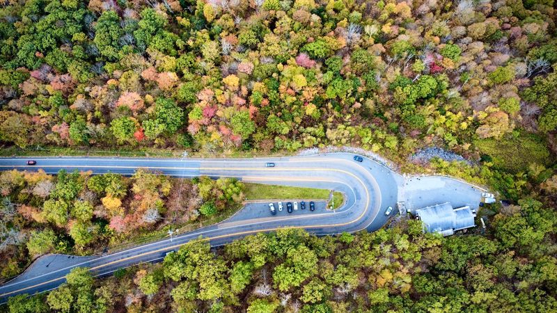
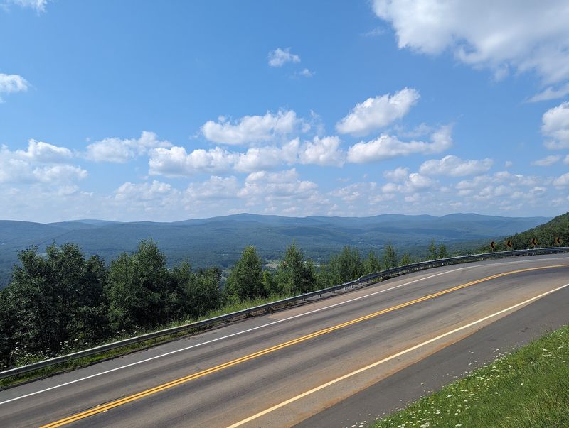
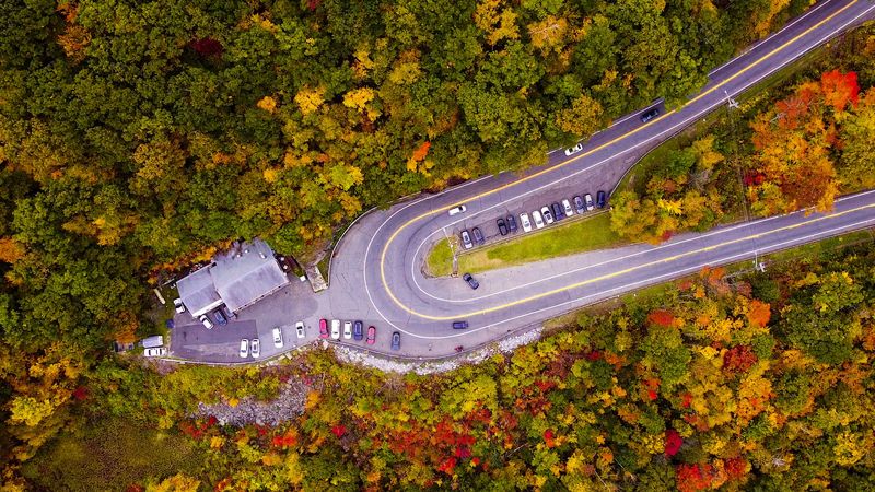
Few curves in New England have their own fan club, but this one earns it. The Route 2 Mohawk Trail overlook sits at 2438 MA-2 in North Adams, right where the road bends hard against the mountainside.
The spot is known as the Hairpin Turn, perched on the Western Summit near the North Adams and Clarksburg town line. The pullout sits around 1,700 feet above sea level.
From the railing, the Hoosac Valley spreads out below in a wide sweep. Mount Greylock and Mount Prospect rise in the distance, and on clear days the view reaches into southern Vermont.
Drivers should respect the posted 15 mph limit through the turn. The curve is tight, and traffic slows whether you want it to or not.
Parking is available at the overlook, and the pullout stays accessible around the clock. Sunset is a particularly rewarding time, when the light warms the ridges and the towns below start to glow.
Autumn turns the valley into a patchwork of color, which explains why the Route 2 Mohawk Trail overlook draws steady traffic in October. Winter and spring have their own quieter appeal.
Give yourself ten minutes minimum. Most people end up staying longer than they planned.
Leave Route 2 Behind For The Drive Toward Savoy
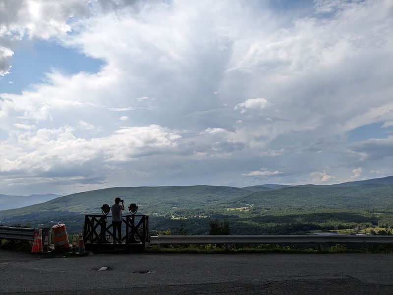
The best part of any byway is the moment you leave it. Once the valley view has been properly admired, the route turns away from Route 2 and heads into quieter country.
Your destination is Savoy Mountain State Forest, reached by roads that shrink as you go. Pavement narrows, traffic thins, and the forest closes in on both sides.
Savoy itself is a small colonial village established in 1771. It sits in the hills above Adams, and the surrounding landscape has kept its rural character remarkably well.
Stone walls run through the woods where fields used to be. Old farmhouses appear at intervals, and long gaps of nothing but trees stretch between them.
Cell service can be spotty out here, so download directions before leaving the overlook. A screenshot of the route saves a lot of guesswork.
Drive with a little caution on the back roads. Surfaces vary, shoulders are soft, and wildlife crosses without checking for traffic.
The transition is part of the experience. In under half an hour you go from a busy scenic pullout to deep forest quiet, which is a fair trade for a few miles of careful driving.
Western Massachusetts hides its best corners exactly like this, just far enough off the main road.
A Short Forest Trail Leads To Tannery Falls
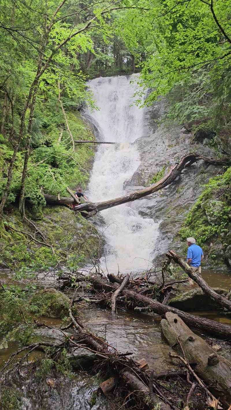
Half a mile of walking buys a surprising amount of drama here. The Tannery Falls Trail in Savoy Mountain State Forest runs about 0.5 to 0.6 miles out and back, rated moderate mostly because of the descent.
Tannery Falls drops roughly 75 to 80 feet in a chain of plunges and curving horsetails. The upper section can turn into a thundering curtain of whitewater when flow is strong.
A second waterfall waits nearby. Parker Brook Falls tumbles about 60 feet on an adjacent stream, which means two cascades for one short walk.
The path drops through mossy, fern-covered forest shaded by hemlock and pine. The light filters green, and the whole setting feels more Pacific Northwest than New England.
Well-built wooden steps make the steeper sections manageable. The trail follows Ross Brook, so you pass smaller cascades and water sliding over mossy rock on the way down.
One important detail before you go. Access to the Tannery Falls parking area is seasonal, typically open June 1 through December 31, since the road closes January through May.
Wear real shoes. Sturdy hiking boots handle the roots and damp steps far better than sneakers, especially after rain when the ground turns slick.
Give Yourself Time To Enjoy The Waterfall Before Heading Back
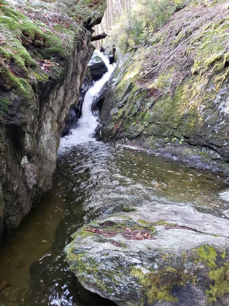
Rushing to a waterfall and then rushing away from it defeats the purpose. The sound alone is worth sitting with, a steady roar that drowns out everything else in the forest.
Photographers do well here because the scenery cooperates. Tall rock ledges, dark hemlocks, and moving water make a composition that works in almost any light.
Seasons change the whole character of the place. Autumn frames the cascades in gold and red, while spring and summer bring native wildflowers along the trail edges.
Cold months can be spectacular in a different way. Portions of the falls freeze into thick icicle formations, turning the ledges into something sculptural.
For sheer power, spring snowmelt delivers the strongest flow of the year. That is when the upper drop looks most impressive.
Practical notes matter on the way back up. The climb is short but steady, and mud lingers on the path for days after rain.
Pack out whatever you carry in, and stay off the wet rock at the edge of the falls. Slick stone and moving water are a bad combination.
Budget at least forty-five minutes here. Rushing the return leg is the one mistake that turns a relaxed afternoon into a chore.
Planning Your Massachusetts Afternoon Road Trip
Timing turns a good loop into a great one. The whole route covers a modest distance, but the stops are what fill the hours, so leave room in the schedule.
Fall is the obvious choice for the drive itself. Foliage season transforms the valley below the Route 2 Mohawk Trail overlook, and the colors hold for several weeks in October.
Waterfall chasers should think differently. Spring snowmelt sends the most water over Tannery Falls, though the access road stays closed from January through May.
That closure is the single biggest planning factor. If the waterfall is your priority, aim for June through December when the parking area is open.
Start early enough to catch the light. An afternoon departure from the diner still leaves time for the overlook, the forest drive, and the falls before dusk.
Bring layers, water, and a paper map or downloaded directions. Mountain weather shifts quickly, and signal drops out in the forest.
Massachusetts packs a lot into its northwestern corner, and this route strings the best of it together without a single wasted mile.
Diner, byway, overlook, waterfall. Four very different stops, one afternoon, and a drive home that already has you planning the next one.