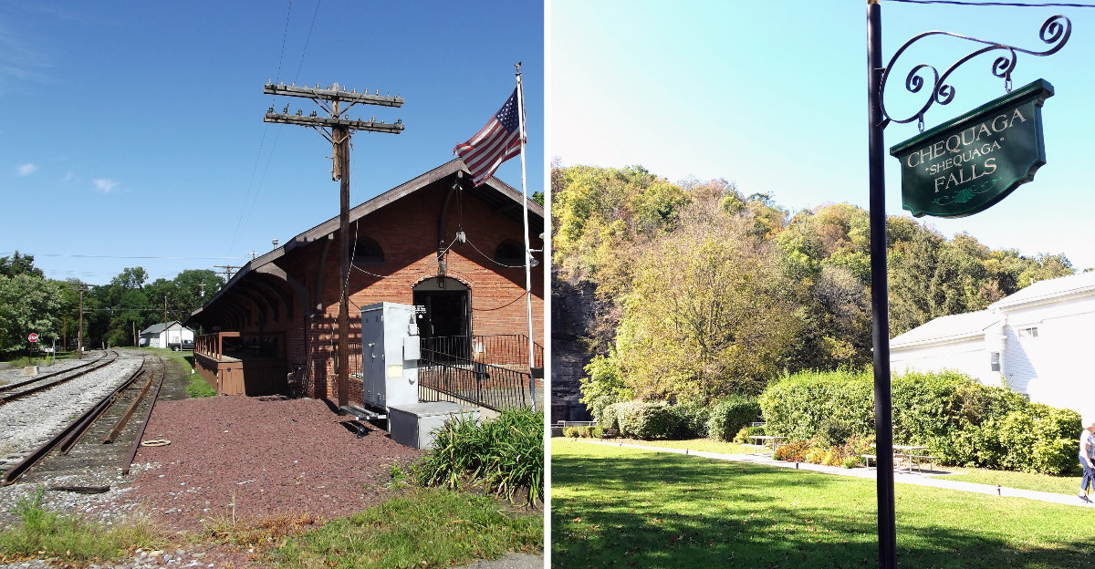
An old canal towpath now carries bikes and sneakers instead of mule teams pulling boats. Even better, the route rolls through a valley carved by glaciers, with a marsh full of egrets and eagles along the way.
The trail runs south from the bottom of one of New York’s deepest lakes. Most of it sits on a stone-dust surface, shaded and flat enough for a lazy afternoon ride. In winter, people trade bikes for cross-country skis and snowshoes.
I love that the path mixes waterfalls, wetlands, and small village main streets in one outing. You can hop off for a gorge hike, then roll on to a bank building that became a library.
Cars stay off most of the route, which means the loudest sound might be a frog. It feels like the kind of trip that rewards slow pedaling. So where do you stop first?
Seneca Harbor Park
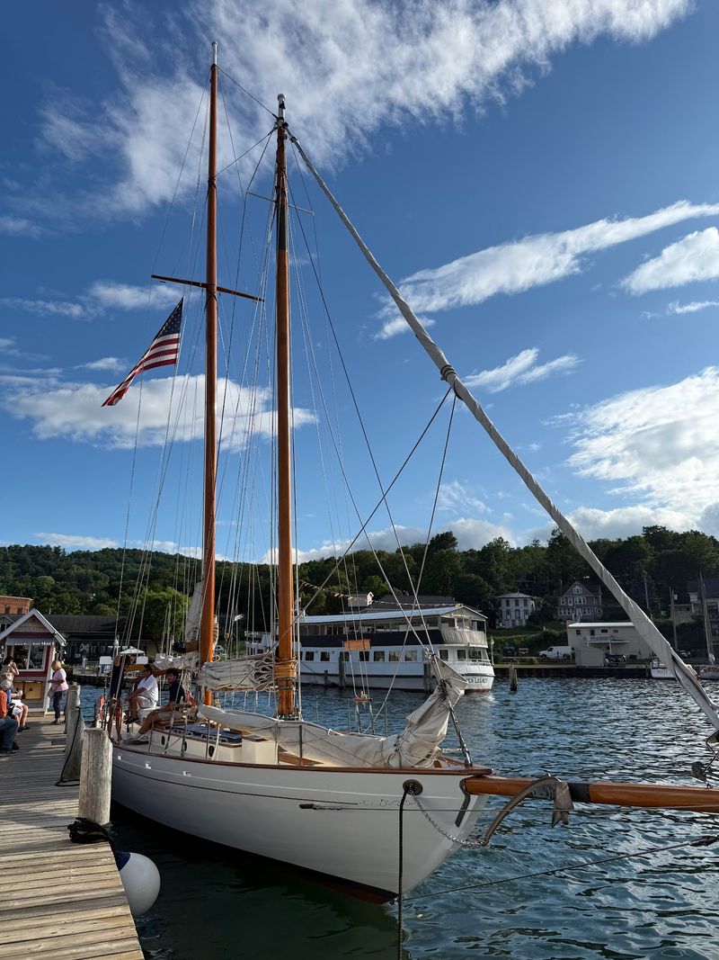
Starting line views don’t get much better than a pier poking out into Seneca Lake. This lakefront park sits right at the southern tip of the lake in Watkins Glen, close to where your trail day begins.
Seneca Lake is one of the largest of New York’s Finger Lakes. Standing at the harbor, you can look north up a long ribbon of water framed by rolling hills.
The park gives you a pier for strolling, benches for sitting, and plenty of room to stretch before you ride. Boat tours and cruises leave from the harbor area during the warmer months, so you might spot one heading out.
Why start here instead of jumping straight on the trail? Because the lake is the reason this whole valley looks the way it does.
Glaciers scraped out the deep basin of Seneca Lake and the valley running south from it. The Catharine Valley Trail follows that same low corridor, which is why most of your ride stays pleasantly gentle.
Bring a snack and a full water bottle before you leave the shoreline. Once you head inland, the scenery shifts from open water to shaded woods and marsh.
A quick photo on the pier makes a nice before picture too. Later, you can compare it with your tired but happy after picture at the far end of the trail.
Think of this spot as the deep breath before the adventure. It’s calm, scenic, and right in the middle of downtown Watkins Glen.
Address: 1 N Franklin St, Watkins Glen, NY 14891
Clute Park
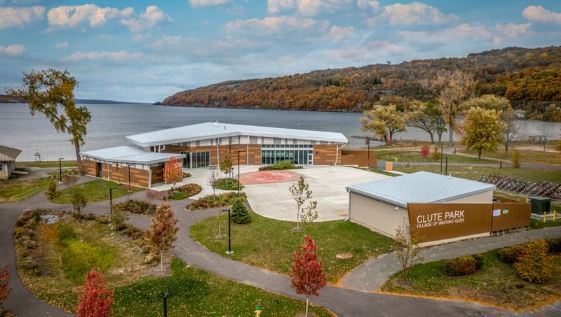
Green grass, lake breezes, and room to spread out a picnic blanket make a solid case for a slow start. Clute Park sits on the southern shore of Seneca Lake in Watkins Glen, just a short ride from the trail.
The village runs this park as a lakeside gathering place. You’ll find open lawns, picnic spots, and a shoreline that invites you to wander.
Here’s a smart plan for your trail day. Pack lunch, ride a few miles south, then circle back here to eat by the water.
The park also sits near the mouth of Catharine Creek, the same stream the trail follows through the valley. In a way, you get to see where the creek’s long journey ends.
Families like the open space because kids can burn off energy before or after a ride. Adults like it because sitting down near a lake feels like a reward.
Watch for seasonal events in the park during summer. Watkins Glen hosts gatherings here, so checking the village calendar before your trip is a good move.
A short walk along the edge of the water also gives you a fresh angle on the lake. The hills rise on both sides, and the view stretches far to the north.
Nobody says a trail day has to be all pedaling. Sometimes the best part of New York’s outdoors is a shady patch of grass and a sandwich.
Address: 155 S Clute Park Dr, Watkins Glen, NY 14891
Watkins Glen State Park
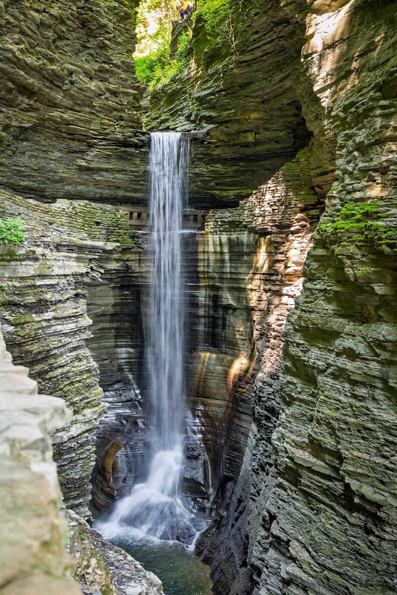
Nineteen waterfalls in under two miles sounds like a typo, but Glen Creek pulls it off. Watkins Glen State Park sits right in downtown Watkins Glen, steps from the trail.
The famous Gorge Trail winds over and under falls on stone steps and through tunnels. At Cavern Cascade, the path actually passes behind the water, so expect a little spray.
Timing matters here. The Gorge Trail is seasonal, while the Rim Trails stay open year-round for views from above.
Those stone steps add up fast, so wear shoes with good grip. Your legs might feel more tired from this short hike than from miles of flat trail riding.
History fans get a treat too. The glen officially opened to the public on July 4, 1863, and New York State purchased it in 1906.
Beyond the gorge, the park offers picnic areas, playgrounds, and an Olympic-size swimming pool during warmer months. That pool sounds pretty good after a sweaty ride in July.
Plan to lock up your bike and walk this part. The gorge is a foot adventure, and the narrow paths are made for slow steps and plenty of photo stops.
Early mornings tend to be a smart choice for any popular park in peak season. You’ll have more space to stand and stare at the layered rock walls.
Address: 1009 N Franklin St, Watkins Glen, NY 14891
Queen Catharine Marsh
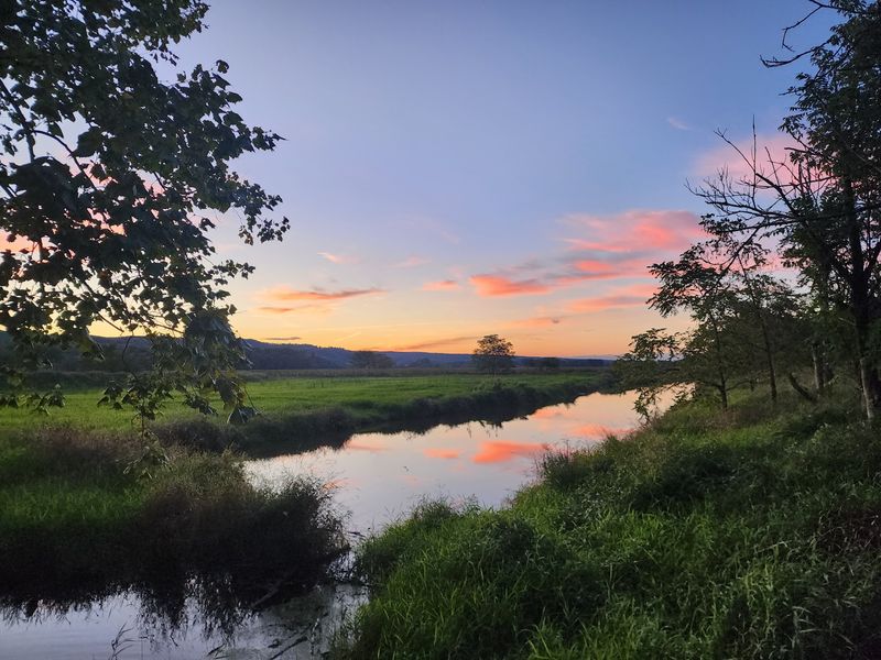
Birders, get your binoculars ready, because this marsh is officially a big deal. Queen Catharine Marsh is part of the 784-acre Catharine Creek Wildlife Management Area between Watkins Glen and Montour Falls.
It holds the title of an Audubon Important Bird Area and a New York Bird Conservation Area. That’s fancy talk for a place where birds really like to hang out.
Around 64 species have been spotted here, including egrets, ospreys, and bald eagles. Spring and fall migration seasons are the best times to look.
The Catharine Valley Trail runs right along the marsh, so you barely need to leave your route. Observation platforms let you pause and scan the cattails without stomping into wet ground.
Look for the old Chemung Barge Canal winding through the area too. It’s a quiet reminder that boats once moved goods through this valley long before bikes showed up.
The marsh takes its name from Catharine Montour, a well-known leader in the region’s Seneca history. It’s also one of the few headwater marshes left in the Finger Lakes.
Slow down in this stretch. Coasting quietly gives you a better chance of seeing a heron lift off or an osprey circling above the water.
Bug spray is your friend on warm days near a wetland. A small pair of binoculars in your bag weighs almost nothing and pays off big here.
Address: Catharine Valley Trail between Watkins Glen and Montour Falls, Schuyler County, NY
Shequaga Falls
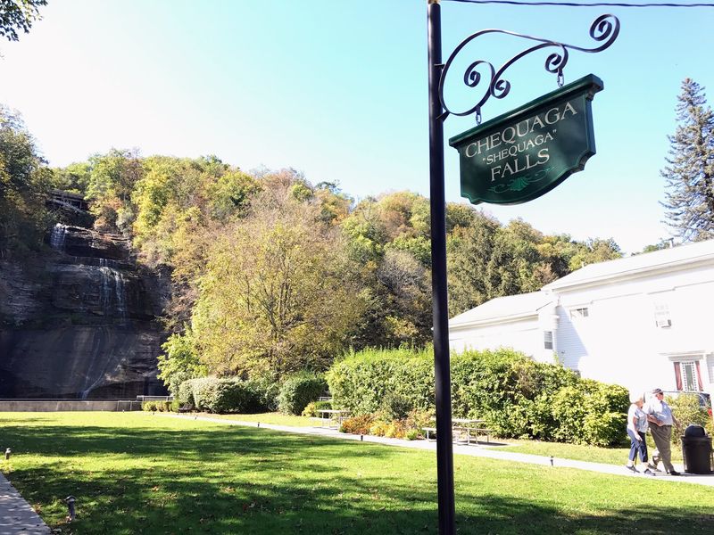
Most villages put a courthouse or a fountain at the end of Main Street, but Montour Falls went with a 165-foot waterfall. Shequaga Falls is the star of the village, and you can see it while strolling downtown.
The name Shequaga is often translated as Tumbling Waters. Once you see the water spilling down the rock face, that description makes perfect sense.
Here’s the best part for tired legs. No long hike is required to enjoy the view.
A small park sits at the base with a lookout area and benches. You can roll up, park your bike, and take a seat right in front of the falls.
The falls sit just a short detour off the Catharine Valley Trail. That makes this an easy add-on, even if you’re riding with kids or taking it slow.
Water levels change with the seasons and recent rain. After a wet spell, the falls tend to look fuller and louder, so a spring visit can be extra impressive.
Bring your camera, but also take a minute to just watch. Few New York towns let you stand this close to a waterfall of this size without breaking a sweat.
Grab a snack in the village and come back for a second look. Honestly, one viewing rarely feels like enough.
Address: 109 S Genesee St, Montour Falls, NY 14865
Montour Falls Memorial Library
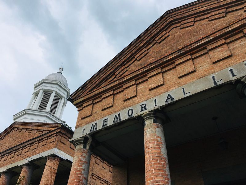
Few libraries can say they used to guard cash, but this one can. The Montour Falls Memorial Library lives inside the former Bank of Havana building, which dates back to 1864.
Havana was the old name for the village before it became Montour Falls. So the building’s history is tied right into the town’s own story.
Inside, you’ll find original woodwork, furniture, and Tiffany stained glass windows. It’s the kind of space that makes checking out a book feel a little grander than usual.
The building joined the National Register of Historic Places in 1993. That’s a nice honor for a structure that has outlasted its banking days by a long stretch.
Today, the library acts as a community hub. It offers books, films, and programs for people of different ages.
Why stop at a library on a trail day? Because a quiet indoor break can be perfect when the sun gets strong or a shower rolls through.
It also sits near Shequaga Falls on Main Street, so you can pair the two stops easily. Waterfall first, stained glass second, sounds like a fine afternoon.
Be respectful of the space and keep voices low. Check hours before you go, since small-town libraries keep their own schedules.
Address: 406 W Main St, Montour Falls, NY 14865
Brick Tavern Museum
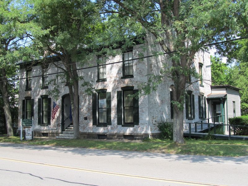
Long before trail riders needed a rest stop, travelers in this valley needed one too. The Brick Tavern Museum in Montour Falls is a historic brick building run by the Schuyler County Historical Society.
The building dates to the early 1800s. Back then, the building served as a stagecoach stop for people moving through the region.
Now it holds exhibits on local history. That makes it a handy place to learn about the same valley you’re pedaling through.
The canal, the railroad, and the growth of small villages all shaped this area. A museum stop helps those old towpaths and rail beds make more sense when you get back on the trail.
History buffs will appreciate the chance to connect dots. Kids can get a peek at what daily life looked like in Schuyler County long ago.
Museum hours can be limited and may change by season. Checking the historical society’s schedule ahead of time saves you from a locked door surprise.
The museum sits in the village, so it’s a short ride from the trail and Main Street. You can fit it in between the falls and the library without much extra effort.
Think of it as the backstory chapter of your trip. Once you know where the valley came from, the miles ahead feel a little richer.
Address: 108 N Catharine St, Montour Falls, NY 14865
Horseheads
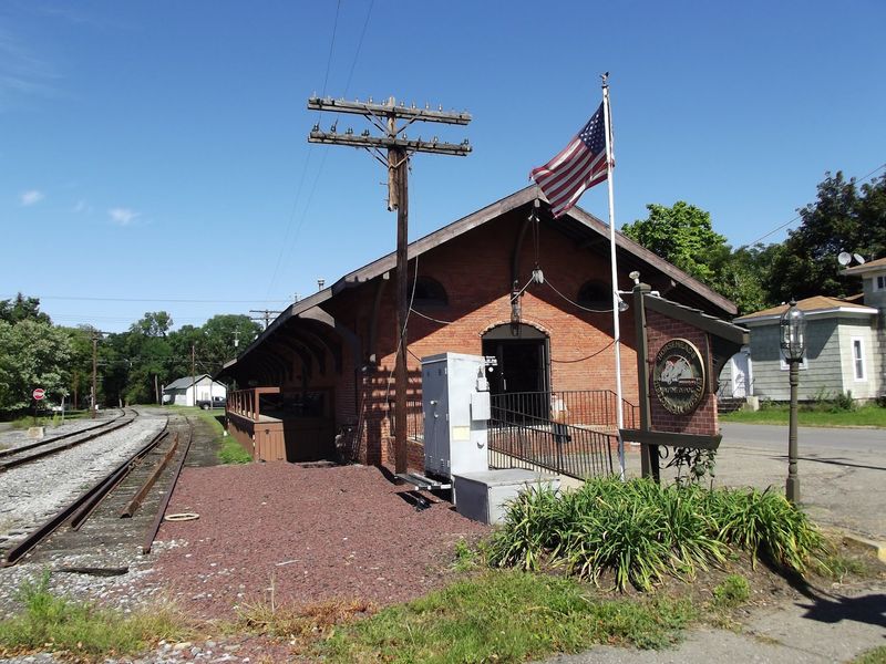
A town name like Horseheads practically begs for a story, and it has one. The Catharine Valley Trail wraps up near this Chemung County village, making it the finish line for many riders.
Local history traces the name to 1779 and the Sullivan Expedition. Horse skulls left behind in the area gave early settlers a memorable name for the place.
Today, the village is a friendly endpoint after miles of marsh, woods, and canal history. Reaching it on a bike feels like a real accomplishment.
The trail has grown over the years, and it now stretches roughly 12 to 14 miles depending on how you measure it. Some sections run on village streets, so stay alert at crossings.
Planning a one-way ride? Arrange a car or a friend to meet you here so you don’t have to pedal the whole way back.
Riders who want a longer day can turn around and retrace the route. The gentle grade of old rail beds makes the return trip easier than you might fear.
The southern stretch passes through the Pine Valley and Millport area on its way here. Expect quieter countryside before the village streets return.
Finishing in Horseheads gives you bragging rights for crossing a big slice of New York’s Finger Lakes on two wheels. Not bad for an afternoon with no traffic jams.
Address: Village of Horseheads, Chemung County, NY 14845