
This 26-Mile Pennsylvania Rail Trail Combines Local History With Gorgeous Woodland Scenery
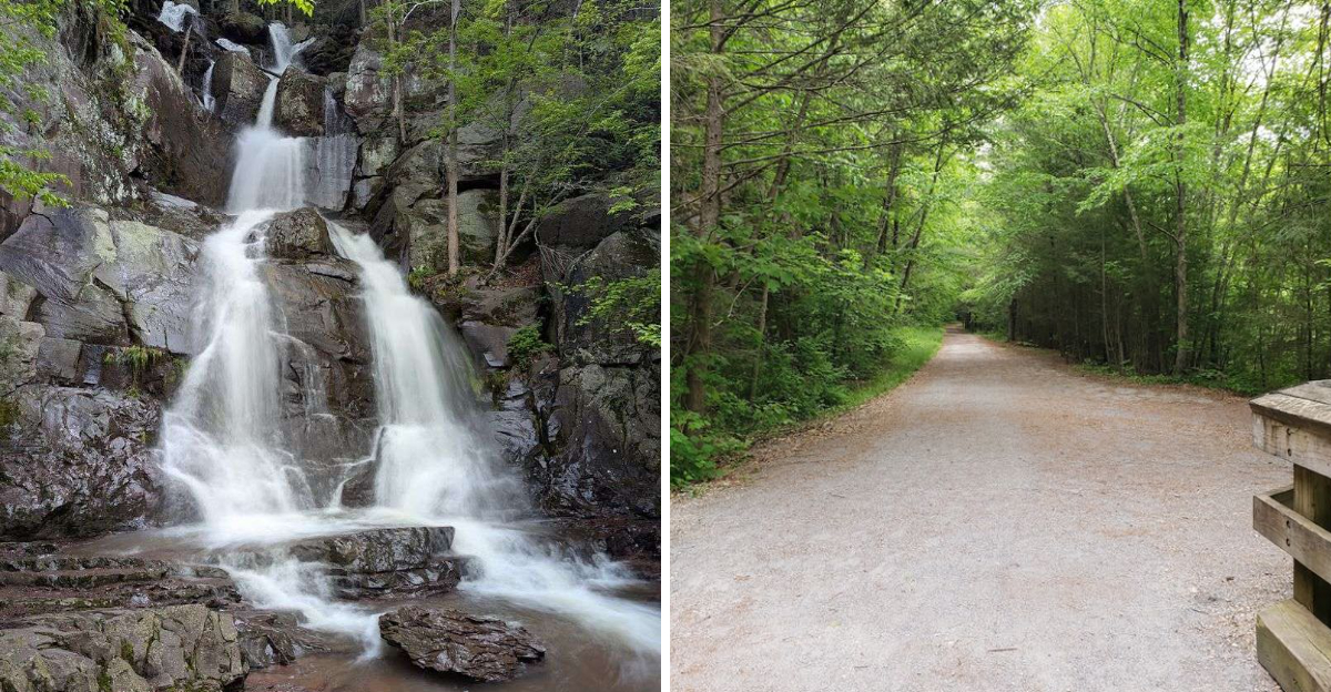
What if your next bike ride came with river views, rushing waterfalls, and a little industrial drama? One Pennsylvania rail trail delivers all three along a 26 mile route through a gorge that feels made for summer adventure.
The path follows an old railroad bed beside the Lehigh River, which keeps the ride smooth while the scenery grows wilder. Forested cliffs rise nearby, waterfalls spill down the slopes, and stone remnants of locks and dams still appear along the way.
They are quiet reminders of the coal industry that once shaped these mountains and the towns around them.
You can tackle a shorter stretch, plan a full day, or simply stop whenever the view demands it. The trail makes history feel easy to follow, and the scenery never becomes background noise.
It is part workout, part history lesson, and part excuse to spend hours outside, with plenty worth remembering afterward.
The Lehigh River Keeps You Company For Nearly The Entire 26 Mile Journey
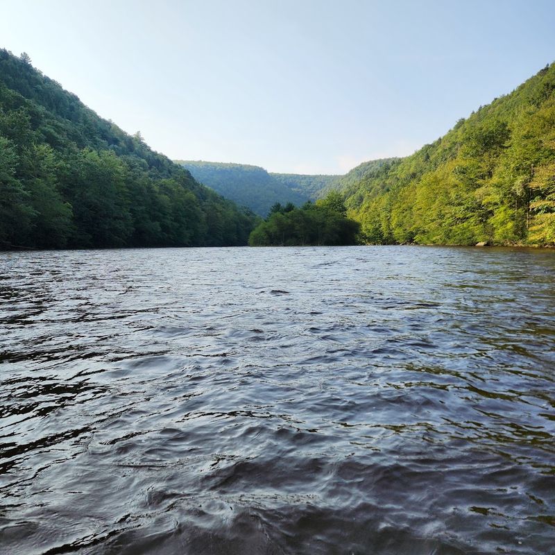
Rivers make excellent travel companions, and the Lehigh proves this point beautifully. From the moment you start your journey, the water flows beside you, sometimes close enough to hear individual ripples, other times visible through breaks in the vegetation.
The river changes personality as you move south, shifting from calm stretches to whitewater rapids that draw kayakers and rafters.
During spring runoff, the Lehigh swells with snowmelt and turns into a churning force that reminds you why this gorge exists in the first place. Summer brings calmer flows and opportunities to spot herons fishing along the banks.
The sound of moving water becomes your soundtrack, blocking out modern noise and creating a natural rhythm for your pedaling or walking pace.
Pennsylvania’s waterways played crucial roles in development, and the Lehigh stands as one of the most historically significant. Watching it flow today, you’re seeing the same force that powered mills, floated coal barges, and shaped entire communities along its banks.
A Former Railroad Grade Now Carries Hikers And Cyclists Through The Gorge
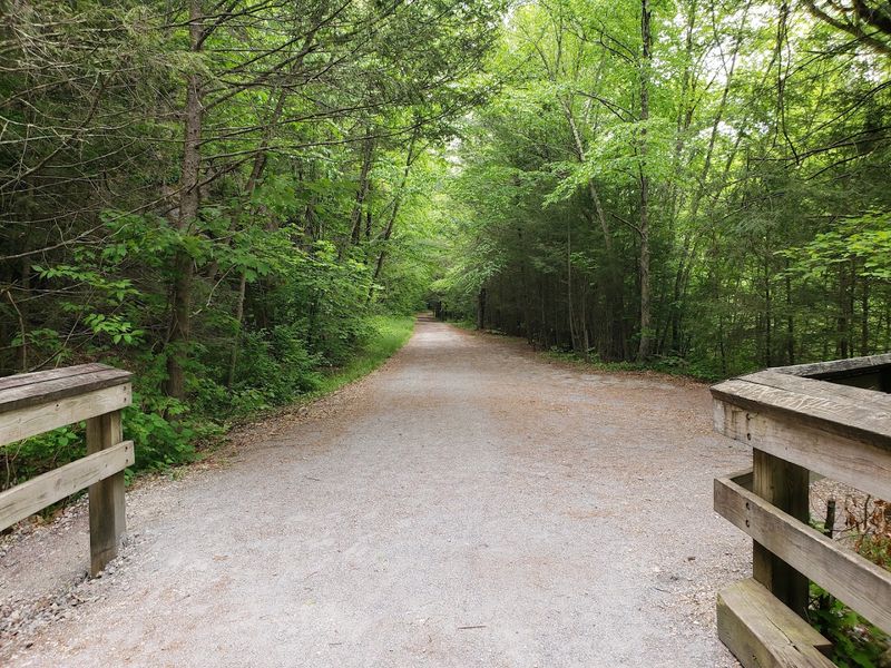
Railroad engineers in the 1800s built Lehigh Gorge trail to haul coal, not to showcase scenery. Yet their work created something unexpectedly perfect for modern trail users.
The conversion from rail to trail happened gradually as freight operations ceased, and today the smooth, packed surface welcomes everyone from casual walkers to serious cyclists.
What makes this former rail line so appealing? The grade stays gentle because trains couldn’t handle steep climbs.
You won’t find brutal hills testing your endurance here. Instead, the path flows naturally through the landscape, tucked between the river and towering rock walls.
The trail surface varies slightly depending on recent maintenance, but it generally remains accessible for hybrid bikes and sturdy walking shoes. Some sections feature crushed stone while others show the original railroad ballast peeking through.
Pennsylvania truly transformed industrial infrastructure into recreational gold here, and the transition feels seamless as you roll through mile after mile of woodland corridor.
Waterfalls And Steep Woodland Walls Make Every Mile Feel Different
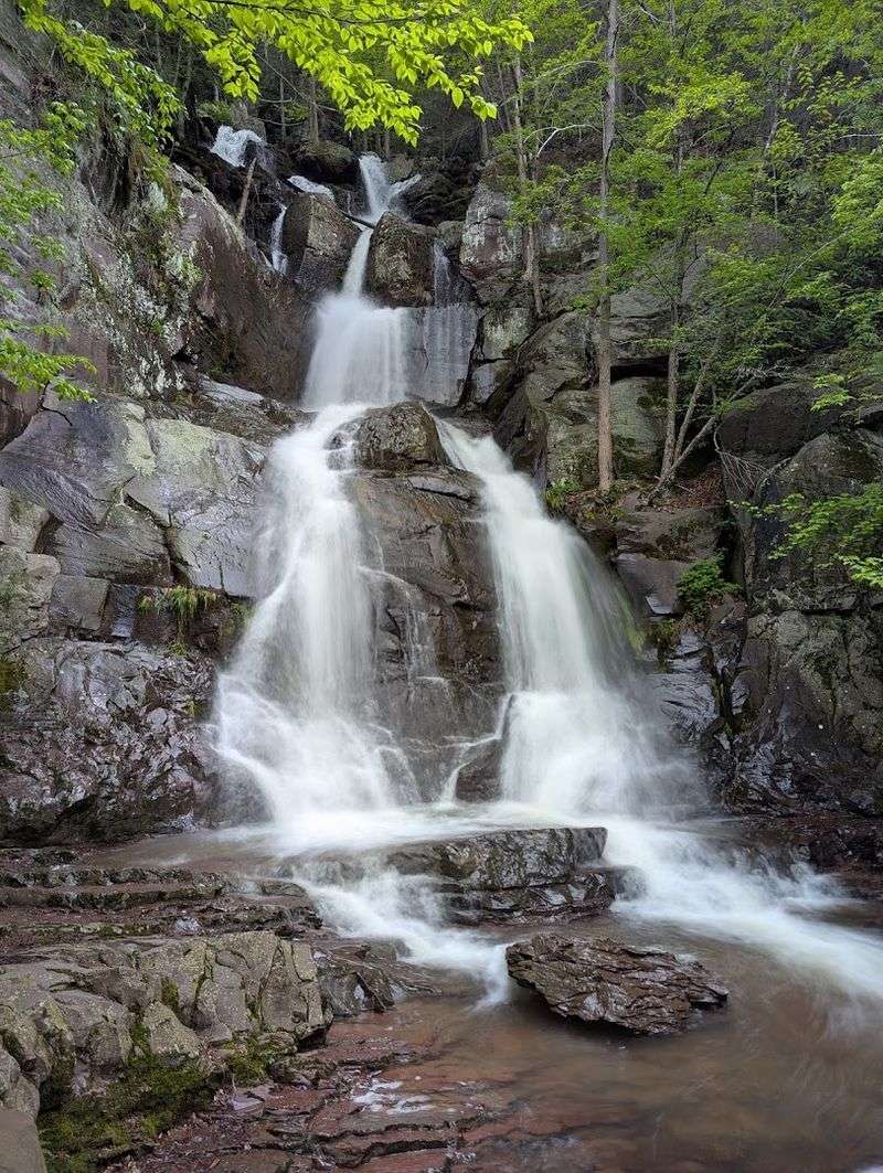
Variety keeps boredom away, and this trail delivers constant visual changes. Waterfalls appear with surprising frequency, especially after rainfall when temporary streams activate along the gorge walls.
Some falls drop straight down in single plunges while others cascade over multiple rock shelves, creating layered curtains of water.
The gorge walls themselves rise hundreds of feet in places, creating a canyon-like atmosphere that feels more dramatic than typical Pennsylvania woodland. Rock faces show layers of geological history, with different colors and textures revealing how this landscape formed over millions of years.
Vegetation clings to impossibly steep slopes, with trees growing at angles that seem to defy gravity.
Each season paints the gorge differently. Spring brings wildflowers and rushing water.
Summer wraps everything in deep green. Fall transforms the canopy into flame-colored brilliance.
Even winter has its appeal, with ice formations decorating the cliffs and quieter trails inviting contemplative walks.
Can you pick a favorite season, or does each one deserve its own visit?
Old Canal Locks And Dams Reveal The Gorge’s Industrial Past
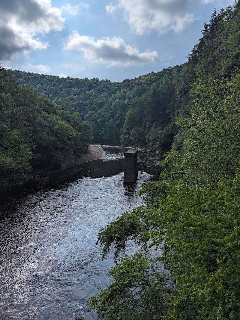
History isn’t just written in books along this trail. It’s built into the landscape with stone and mortar.
The Lehigh Canal once paralleled the river, and remnants of its lock system still stand as monuments to 19th-century engineering ambition. These structures allowed boats to navigate elevation changes, moving coal and goods between communities.
Dam ruins appear at intervals, their stonework still solid despite decades of abandonment. Some sections show careful construction with fitted blocks, while others reveal hasty repairs made during operational years.
Walking past these features, you’re literally touching the same stones that workers shaped and placed generations ago.
The canal system represented massive investment and labor. Workers dug miles of channel, built dozens of locks, and maintained the waterway through floods and freezes.
Pennsylvania’s industrial revolution depended on infrastructure like this, connecting mountain resources to city markets.
Today these ruins serve a different purpose, turning your trail experience into an outdoor museum where every stone tells part of a larger story about American industrial development.
This Historic Route Once Helped Carry Anthracite Coal Through Pennsylvania
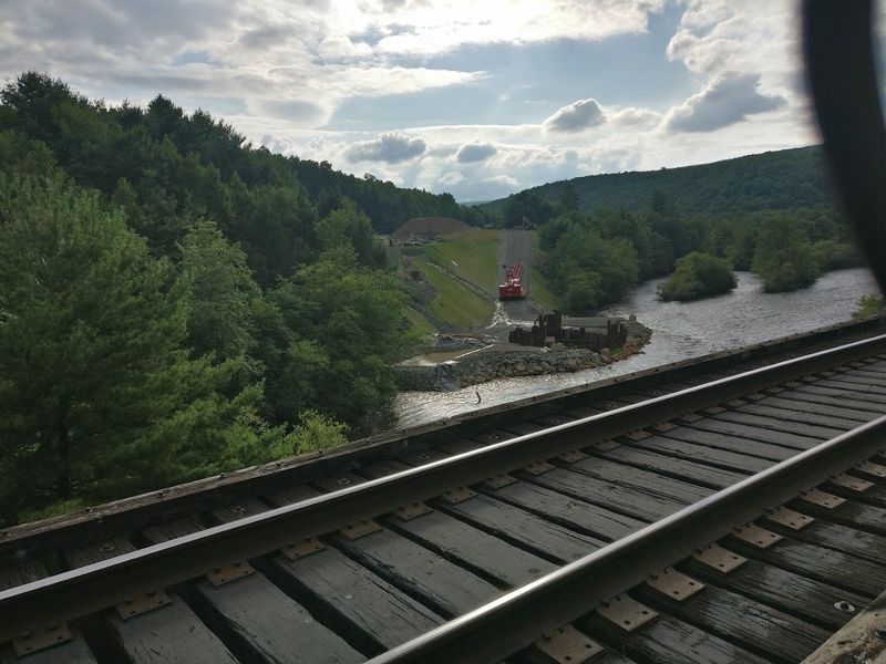
Coal built fortunes and powered cities, and much of it traveled through this very gorge. Anthracite coal from northeastern Pennsylvania burned hotter and cleaner than other varieties, making it highly valuable for heating homes and running factories.
The challenge was getting it from mountain mines to urban markets, and the Lehigh route solved that problem.
Trains loaded with coal once rumbled along these tracks daily, their weight and frequency wearing down rails that required constant maintenance. The railroad companies became powerful entities, controlling not just transportation but entire towns that depended on coal industry employment.
Communities grew up around loading stations and switching yards.
The anthracite industry’s decline changed everything. As oil and natural gas replaced coal for heating, mines closed and trains stopped running.
Pennsylvania faced economic upheaval in coal regions, with towns losing their primary employers. The rail-to-trail conversion gave these corridors new life, transforming industrial relics into recreational resources.
It’s a remarkable second act for infrastructure that once defined an entire region’s economy and identity.
A Gentle Grade Makes The Trail More Approachable Than Its Length Suggests
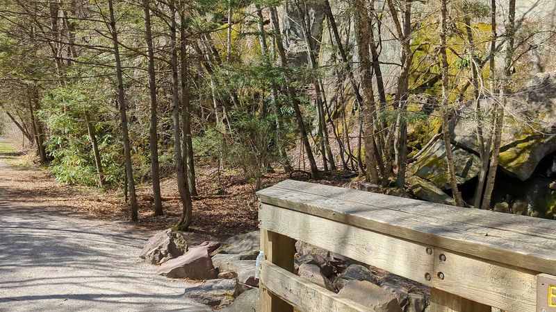
Twenty-six miles sounds intimidating until you remember that trains can’t climb steep hills. Railroad engineers designed this route with minimal elevation change, creating a corridor that modern trail users inherit with gratitude.
The entire trail drops only about 600 feet from north to south, spread across the full distance for an average grade that barely registers.
This gentle slope means families with kids can tackle sections without worrying about exhausting climbs. Older riders appreciate not having to grind up mountain passes.
Even hikers find the easy grade allows them to focus on scenery rather than cardiovascular distress. The trail’s accessibility opens it to people who might avoid steeper mountain paths.
Of course, 26 miles remains a significant distance regardless of grade. Most visitors tackle portions rather than the full length, perhaps riding 10 miles before turning around.
The gentle nature of the trail means your limiting factor becomes distance rather than difficulty.
Pennsylvania created something special here by preserving this corridor, offering a long-distance route that welcomes riders of varying fitness levels.
Riding South Rewards Cyclists With A Gradual Downhill Journey
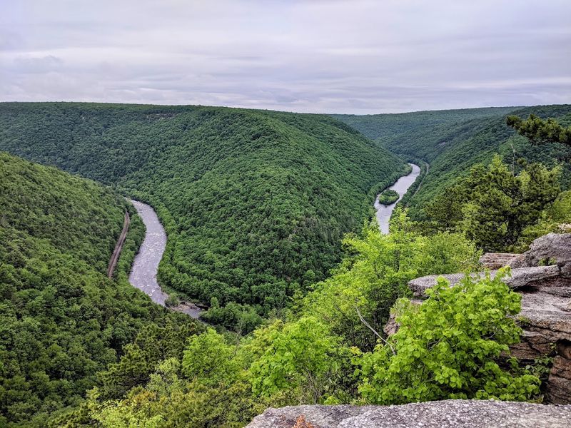
Smart cyclists check elevation profiles before choosing their direction. On the Lehigh Gorge Trail, starting at White Haven in the north and riding south toward Jim Thorpe means you’re going with gravity rather than against it.
The descent is so gradual you might not consciously notice it, but your legs will appreciate the subtle assistance over 26 miles.
This directional advantage becomes especially valuable on hot days or when riding with less experienced cyclists. The slight downhill trend helps maintain momentum without constant pedaling effort, making the journey feel more like gliding than grinding.
You can focus on scenery and conversation rather than gear selection and breathing.
Many shuttle services understand this dynamic and offer rides from Jim Thorpe back to White Haven, allowing cyclists to enjoy the preferred downhill direction without needing to arrange vehicle logistics. It’s not cheating to work with gravity.
Pennsylvania’s terrain created this opportunity, and taking advantage of it just makes good sense.
Why make things harder than necessary when the landscape offers a natural advantage?
White Haven Rockport And Glen Onoko Offer Three Ways To Begin The Adventure
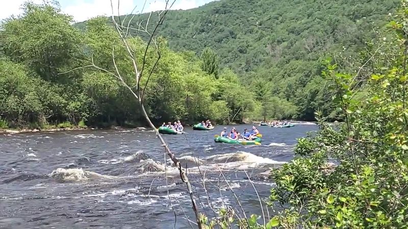
Flexibility in access points means you can customize your experience based on time, fitness, and interest. White Haven marks the northern terminus, offering the full downhill advantage if you’re riding south.
The access area includes parking and typically has other trail users around, creating a community atmosphere as everyone prepares for their journeys.
Rockport sits roughly midway, providing a convenient entry point for those wanting a shorter out-and-back adventure. This access point works well for families or groups with mixed abilities, allowing everyone to ride as far as they feel comfortable before returning.
The parking area here tends to be less crowded than the endpoints.
Glen Onoko, closer to Jim Thorpe, serves riders and hikers wanting to explore the southern sections without committing to the full distance. Each trailhead offers slightly different scenery and experiences.
Pennsylvania maintained multiple access points specifically to increase usability, recognizing that not everyone wants or needs the complete 26-mile journey.
Having options means more people can enjoy this remarkable trail on their own terms.
The Trail Forms A Scenic Piece Of The 165 Mile D And L Trail
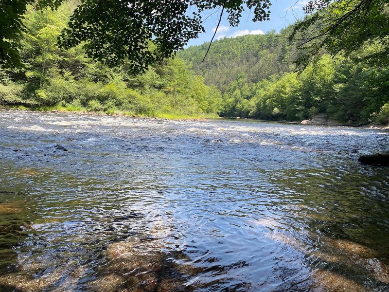
Context matters when understanding trail systems. The Lehigh Gorge Trail isn’t an isolated path but rather a spectacular segment of the much longer Delaware and Lehigh Trail, which stretches 165 miles through eastern Pennsylvania.
This larger trail follows historic transportation corridors from Wilkes-Barre south to Bristol, connecting multiple communities and passing through varied landscapes.
The D and L Trail, as locals call it, traces canals and railroads that once formed Pennsylvania’s industrial backbone. Some sections run through urban areas while others, like the Lehigh Gorge portion, showcase dramatic natural scenery.
The full trail takes days to complete, but it’s designed for segmented exploration rather than single-push endurance efforts.
Understanding this connection helps you appreciate the Lehigh Gorge section as part of a larger vision for trail-based recreation and heritage tourism. Pennsylvania invested in creating continuous corridors that link communities and tell regional stories.
You could spend weeks exploring different sections of the D and L Trail, with the gorge section standing out as perhaps the most scenically dramatic portion of the entire route.
A Pedestrian Bridge Leads Straight Into Historic Downtown Jim Thorpe
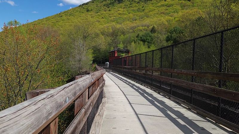
Trail endings matter as much as the journey itself. The southern terminus of the Lehigh Gorge Trail delivers a memorable finish by connecting directly to Jim Thorpe, one of Pennsylvania’s most charming small towns.
A pedestrian bridge spans the Lehigh River, carrying trail users from wilderness into a community that looks like it stepped out of the Victorian era.
Jim Thorpe’s downtown features brick buildings, unique shops, and restaurants that welcome trail users still in their cycling gear. The town embraced its role as a trail destination, understanding that tired, hungry cyclists and hikers represent economic opportunity.
Many visitors plan their rides specifically to end in Jim Thorpe, rewarding their efforts with food and exploration.
The town’s history as a coal and railroad center connects perfectly with the trail’s industrial heritage themes. Named after the legendary athlete, Jim Thorpe reinvented itself as a tourist destination when coal declined.
Today it thrives partly because of trail traffic, proving that Pennsylvania communities can adapt and find new purposes when old industries fade.
The bridge linking trail to town symbolizes that transition beautifully.