
This Twisting Massachusetts Road Is One Of The Most Beautifully Bizarre Places In New England
Some roads get you where you are going. Others make you slow down and stare at the map twice.
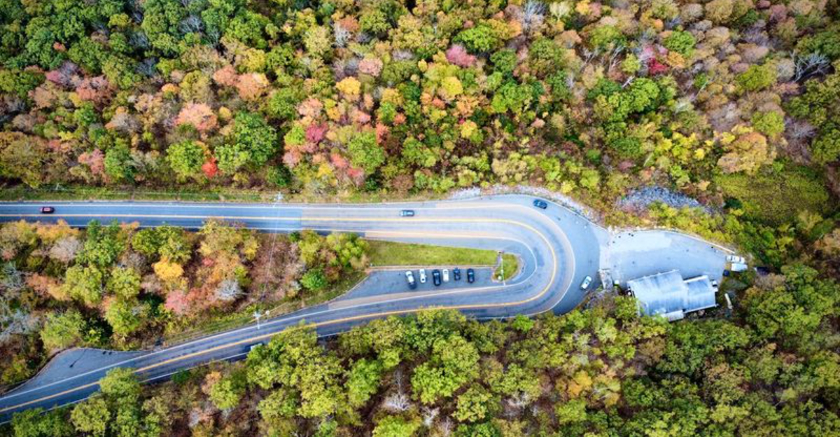
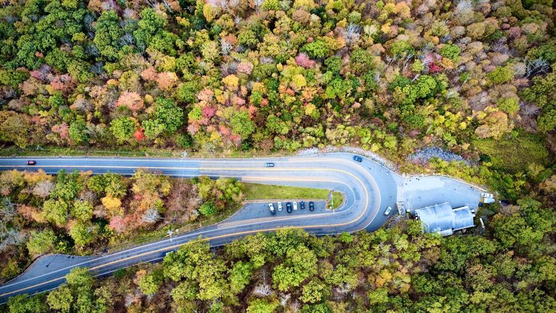
High above the surrounding hills, one Massachusetts road suddenly curls back on itself in a dramatic bend that looks almost unreal. The pavement sweeps through the mountains, wrapping around the slope before opening to wide views of forests, valleys, and distant peaks.
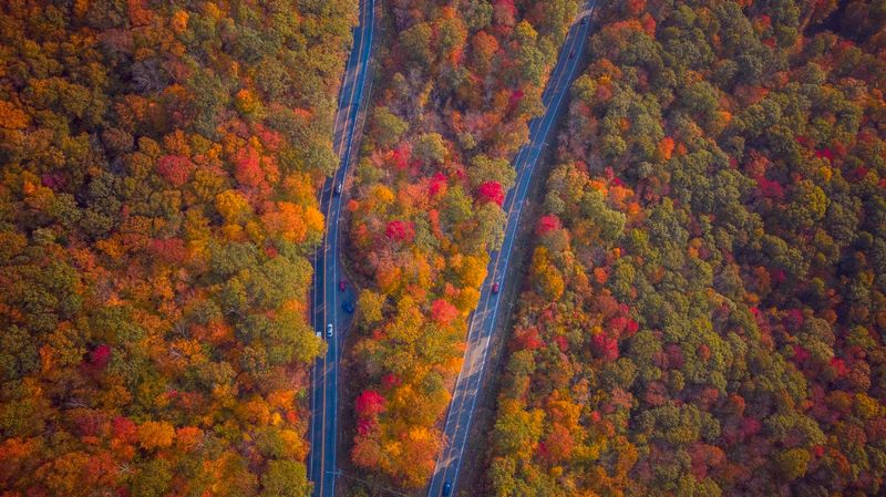
It is the sort of place that looks even stranger when seen from above.
The scenery changes with the seasons, too. Summer brings deep green hills, while fall turns the entire landscape into a patchwork of red, orange, and gold.
There is history here, but the shape of the road is what grabs attention first. It feels part scenic drive, part engineering oddity, and part natural lookout.
For travelers who like their road trips with a little surprise, this curve delivers one of New England’s most memorable views.
A Bend So Sharp It Became Famous
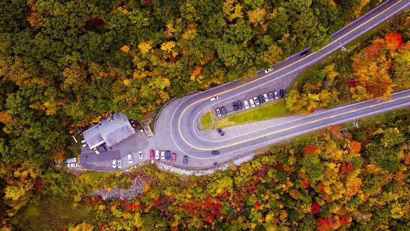
Most curves are forgettable. Not this one. The Mohawk Trail Hairpin Turn folds Route 2 back on itself at a near 180-degree angle, and it does so on a steep mountainside.
Engineers carved it in 1914, back when cars had wooden wheels and questionable brakes. The goal was simple.
Get vehicles down a punishing grade without sending them straight off the slope.
The solution was clever. Instead of one long, terrifying descent, the road doubles back and eases the drop in stages. It works, though the turn still demands full attention.
Locals once nicknamed it Dead Man’s Curve because of its sharp angle and steep bank. Modern guardrails, signage, and warnings have made things far more manageable for today’s drivers.
What makes the bend so odd is the contrast. One moment you are climbing through thick forest with no view at all. The next, the trees fall away and the world opens up.
Truckers know it well. Big rigs slow to a crawl here, and you will often see brake lights glowing as drivers respect the geometry.
Take it slow. Signal early. And if you can, arrive when traffic is light, because gawking at the scenery while steering is not a winning combination on a curve this dramatic.
The View That Reaches Into Three States
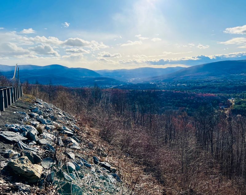
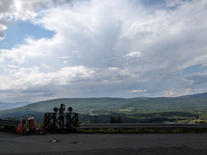
Standing at the overlook, you get a lot for very little effort. The pavement sits roughly 1,700 feet above sea level, and the land drops away fast.
Directly below sits North Adams, spread across the Hoosac Valley like a model railroad town. Church steeples, rooftops, and winding streets look small enough to pick up.
Look south and Mount Greylock rises, the tallest peak in Massachusetts. Its long ridge dominates the horizon and changes color with the light throughout the day.
Swing west and the Taconic Range stretches along the border with New York. Turn north and the Green Mountains of Vermont pile up in soft blue layers.
Three states, one guardrail. Few roadside stops in New England deliver that kind of geography lesson for free.
Morning light tends to be crisp and clear, with mist pooling in the valley below. Late afternoon brings warmer tones as the sun slides toward the Taconics.
Evening has its own reward. Once darkness settles, the lights of North Adams glitter across the valley floor like scattered sparks.
Bring binoculars if you have them. Details you would miss with the naked eye, like the roofline of an old mill, suddenly snap into focus.
Finding The Overlook Without Missing It
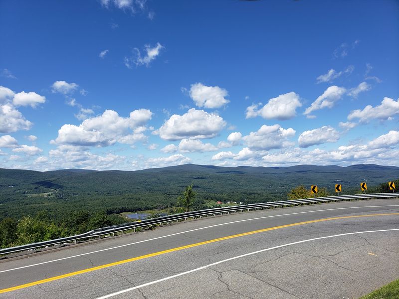
Blink and you could sail right past. The pull-off arrives fast, right at the apex of the bend, so knowing the address ahead of time helps enormously.
Punch 2438 MA-2, North Adams, MA 01247 into your navigation and you will land exactly where you want to be. The coordinates sit near 42.709 north, 73.063 west.
Parking exists, though it is modest and can fill up during peak foliage weekends. Patience pays off more than circling does.
The spot is open around the clock, every day of the year. There is no gate, no fee, and no closing time to worry about.
Coming from the east, you descend toward the turn, which means slowing down early is wise. Approaching from North Adams, you climb up to it instead.
Watch for oncoming traffic when you pull back out. Sight lines around the curve are short, and a quick check saves trouble.
The Hairpin Turn sits right at the town line between North Adams and Clarksburg, which explains why different sources place it in different towns.
Once parked, everything worth seeing is a few steps away. No hiking boots required, though comfortable shoes never hurt on uneven pavement.
Autumn Turns The Whole Valley Into A Bonfire
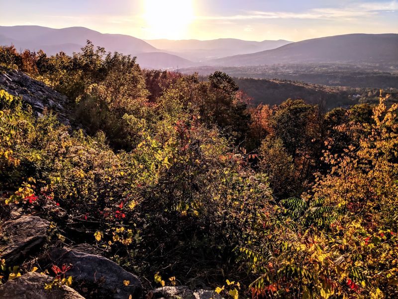
October is when this place stops being a scenic pull-off and becomes an event. The forests below shift into red, orange, and gold all at once.
Peak color usually arrives around the middle of the month. Elevation plays a role, so higher slopes often turn before the valley floor does.
The layered terrain is what makes the display so striking. You are not looking at one hillside but at ridge after ridge, each in a slightly different shade.
Sunset during foliage season is the combination people chase. Low golden light hits the leaves sideways and makes the whole valley glow.
Arrive early on autumn weekends. The small lot fills quickly, and midday traffic along Route 2 can get sluggish through the Berkshires.
Weekdays are noticeably calmer. If your schedule allows a Tuesday or Wednesday trip, you will have far more elbow room at the wall.
Weather shifts fast at this height. A jacket that felt unnecessary in the valley suddenly makes sense once the breeze picks up.
Even overcast days have merit. Flat light saturates the colors, and clouds drifting through the valley add a moody, layered depth that sunshine cannot replicate.
An Ancient Footpath Underneath The Asphalt
Long before pavement, people walked this corridor. Native Americans used the route as a trade and travel path connecting river valleys across two future states.
The path linked the Hudson and Mohawk River valleys in New York with the Deerfield and Connecticut River valleys in Massachusetts. Mountains made travel hard, so the best routes were treasured knowledge.
European settlers later widened the path for horses and carts. The terrain dictated the course then just as it does now.
That layered history is part of what makes the drive feel weightier than a typical highway. You are following a line that people chose thousands of years ago.
A trailhead for the western section of the Mahican-Mohawk Trail sits near the overlook. The re-established hiking path honors that original corridor.
Walking even a short stretch changes your sense of scale. The forest closes in, the traffic noise fades, and the old route reveals itself.
Interpretive information along the Mohawk Trail helps connect the dots for curious travelers. It turns a photo stop into something closer to a history lesson.
Give yourself extra time if this interests you. Rushing through a place with this much backstory feels like a missed opportunity.
One Of America’s First Scenic Driving Roads
Here is a fun bit of trivia. The Mohawk Trail was built for pleasure driving at a time when pleasure driving barely existed as a concept.
Construction was approved in 1912 and finished in 1914. The Hairpin Turn was engineered as part of that original build.
A dedication ceremony took place at Whitcomb Summit on October 22, 1914. Roughly 1,800 people showed up, which was a serious crowd for a mountain road.
That same October, the Massachusetts State Legislature formally declared the Mohawk Trail a scenic tourist route. It was an early bet on tourism as an industry.
The first version was rough. The surface was unpaved and rugged, and full reconstruction did not happen until 1921.
Winter was even trickier. Crews shoveled the road by hand until the state took over plowing in the mid-1930s.
Recognition kept coming. The route earned Scenic Byway designation in 1953, making it one of the earliest in New England.
National Scenic Byway status followed in 2021. Today the trail runs roughly 63 to 69 miles across northern Massachusetts, and the Hairpin Turn remains its most photographed moment.
The Landmark Building Perched On The Curve
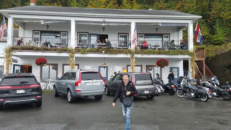
Right at the bend stands the Golden Eagle Restaurant, a fixture with roots going back to 1914. It has watched the traffic change from Model Ts to modern SUVs.
Its position is remarkable. The building sits at the outer edge of the turn with the valley dropping away just beyond.
That location came with challenges. In 1958, two big rig trucks struck the building, and the rebuild came with a smart adjustment.
Instead of standing exposed, the restaurant was set back into the mountainside. The recess gave it a buffer against traffic coming around the curve.
Geographically the building sits within Clarksburg, even though the overlook is commonly given a North Adams address. The town line runs right through the area.
Its presence turns the Hairpin Turn into a genuine destination rather than a quick photo stop. People plan a meal around the view.
Parking here is tight, so a little courtesy goes a long way. Pull in carefully and watch for pedestrians crossing between cars.
The pairing of old-fashioned roadside architecture and a hundred-mile view is exactly the kind of oddity that makes this stretch of Massachusetts memorable.
Nearby Stops Worth Building Into The Day
Treat the Hairpin Turn as the opening act rather than the whole show. The surrounding area is packed with things worth an hour or three.
Down in North Adams sits MASS MoCA, the Massachusetts Museum of Contemporary Art. It fills a sprawling former mill complex with large-scale installations.
Natural Bridge State Park is also in North Adams. Its white marble arch was carved by water over an enormous stretch of time.
Head east along Route 2 and you reach Whitcomb Summit at 2,200 feet, the highest point on the entire Mohawk Trail. The elevation change from the Hairpin Turn is noticeable.
Mohawk Trail State Forest offers hiking in warm months and snowshoeing or cross-country skiing once the snow arrives. Trails range from easy strolls to real climbs.
The Hoosac Tunnel sits nearby too, a nineteenth century railroad engineering achievement that took years of brutal work to complete.
String a few of these together and you have a full day without much driving between them. Everything clusters within a short radius.
Start at the overlook, wander North Adams, then loop back for sunset. Massachusetts rarely packs this much variety into so few miles.