
This Nevada Road Trip Leads To One Of The Country’s Largest Flat-Topped Mountains
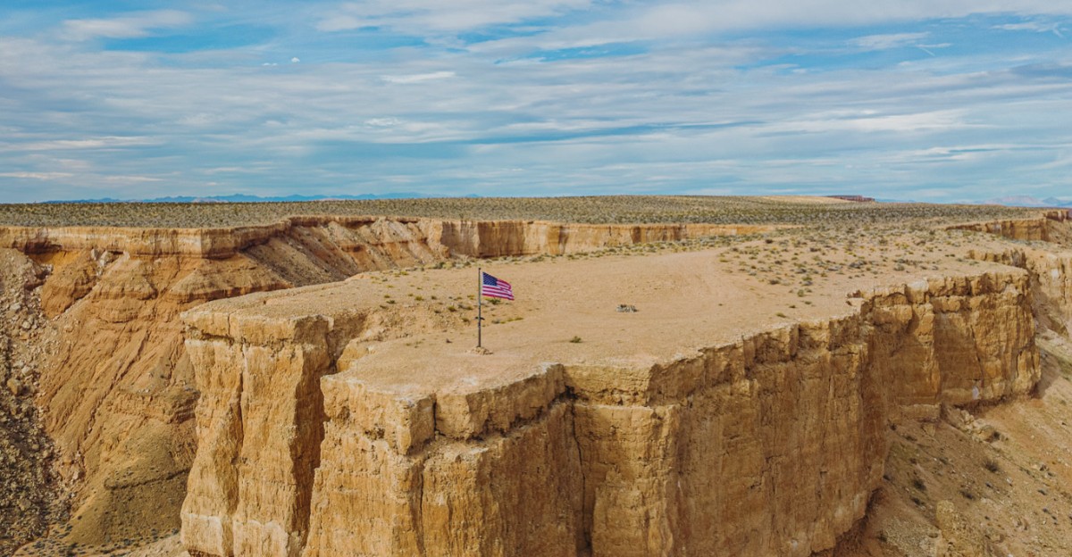
A mountain rises from the desert floor with its entire peak sliced clean off.
Nevada hides a landform so large it ranks among the biggest flat-topped mountains in the country. Two rivers spent millions of years carving its edges into steep, dramatic cliffs.
Wagons once struggled up those same cliffs on a historic overland route. Tortoises still wander below, and a giant piece of land art sits carved into the rim.
Dirt roads climb toward the rim from several directions, with free camping waiting up top under skies built for stargazing.
Nevada rewards drivers willing to trade pavement for a view like this.
Ready to trace the wagon trail and stand at the exact spot where history nearly gave out? The road waits, and so does the view.
Rock Layers That Read Like A Journal
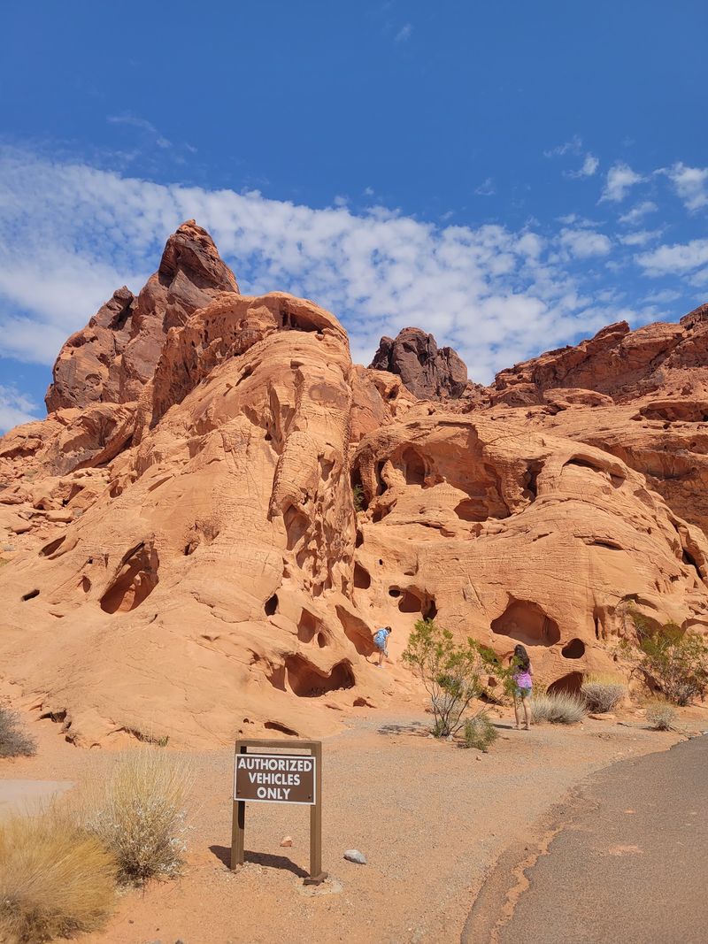
The cliffs do the talking here. Steep sides on Moapa Valley expose bands of sediment stacked in neat horizontal lines.
Each band marks a different chapter of deposition, and researchers read them to work out the order of events across the region. Water carved those faces over millions of years, which is exactly why the layers show so clearly.
One feature draws particular scientific attention. The mesa contains well-developed petrocalcic horizons, hard calcium-rich soil layers that build up slowly in dry climates.
Studies suggest these formed through repeated cycles of exposure, erosion, and sediment deposit, shaped by shifting climate conditions since roughly the early Pliocene. In plain terms, the ground itself recorded ancient weather.
Casual visitors do not need a geology degree to appreciate it. Run a hand along the caliche crust near the rim and the cement-like texture becomes obvious.
Nevada holds plenty of dramatic rock, but few places display their history quite this plainly.
Bring a camera and shoot the cliff faces in low morning light, when the layers throw their sharpest shadows.
Where The Old Spanish Trail Climbed
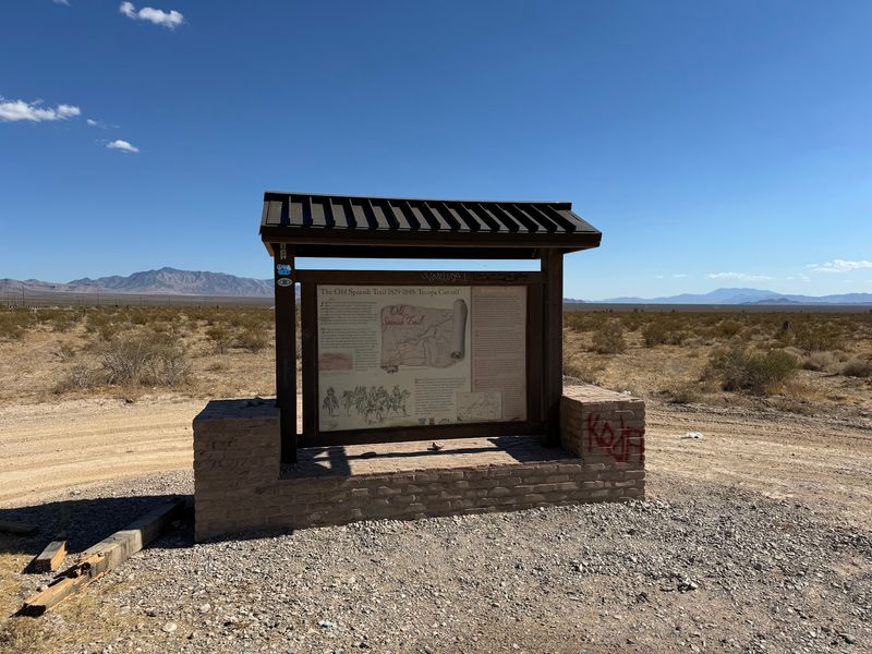
Wagons once faced this wall. Mormon Mesa sat along the historic Old Spanish Trail, the long overland route linking New Mexico with California.
Travelers moved goods and animals across this ground between roughly 1826 and 1848. Later, settlers heading north toward Utah crossed the same difficult terrain.
The near-vertical cliffs were the hard part. Getting a loaded wagon up a slope like that took planning, muscle, and a fair bit of nerve.
A historical marker near the center of the mesa commemorates the trail. It points out where the original route once scaled the rim.
These days that stretch looks like a washed-out ledge cut into the cliff. Erosion has worn it down, though the line of the old climb remains visible with a careful eye.
Standing beside it, the difficulty of the crossing becomes easy to imagine. No shade, no water on top, and a long haul either direction.
The address for the general area is Mormon Mesa, Overton, NV 89040, United States.
History feels closer when the road still shows.
Tortoise Country Under Federal Watch
Slow movers rule this landscape. A large share of Mormon Mesa falls inside the Mormon Mesa Desert Tortoise Area of Critical Environmental Concern.
Reports put that protected area at roughly 149,000 acres. Its purpose is straightforward, safeguarding habitat for the threatened desert tortoise.
Vegetation up top leans heavily toward creosote-bursage scrub. Mixed Mojave shrub communities fill in the rest, offering food and cover for reptiles, rodents, and birds.
Part of this habitat extends toward the Delamar Mountains Wilderness Area. Together, the lands form a corridor linking other important habitat blocks across the northeastern Mojave.
Connected habitat matters more than it sounds. Animals need room to move, breed, and find food during dry years.
For visitors, the rules are simple and worth following. Stay on existing roads, never handle a tortoise, and give any animal on the route plenty of space.
Tortoises can release stored water when frightened, which puts them at real risk in the heat of a Nevada summer.
Watch quietly, drive slowly, and the desert keeps its residents.
A Tabletop Rising Above Two Rivers
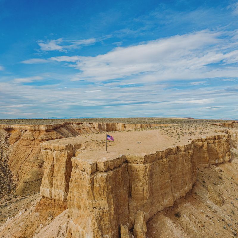
Flat on top, fierce on the sides. Mormon Mesa spreads out between the Muddy River and the Virgin River in southern Nevada.
The landform runs northward from the point where those two river systems meet. At its southern reaches it rises to about 1,893 feet above sea level.
That height gives the rim wide, open views in nearly every direction. Moapa Peak and Virgin Peak sit on the skyline, while the Moapa Valley farmland spreads out far below.
Geologists consider the mesa a fairly young feature, likely formed something like four to five million years ago. Erosion from the Virgin and Muddy Rivers did the shaping, slicing away softer ground and leaving the hard cap behind.
The result is one of the larger flat-topped mountains anywhere in the country. Its surface feels almost impossibly level, broken only by shallow washes and dirt tracks.
Visitors usually reach it from the towns of Overton and Moapa Valley in Clark County, Nevada, which sit right at its base.
Standing on that rim, the scale of the place sinks in slowly.
Double Negative And Its Giant Cuts
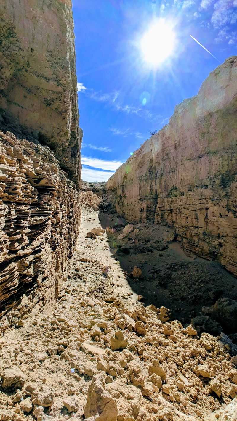
Art, but with a bulldozer. The eastern edge of Mormon Mesa holds Double Negative, a land art work created in 1969 by an American sculptor.
The piece takes the form of enormous cuts made into the mesa rim. A natural side canyon interrupts the line, so the work reads as two facing trenches with empty air between them.
Scale is the whole point. Walking the floor of a cut puts vertical walls of desert rock on either side.
The Museum of Contemporary Art in Los Angeles holds the work in its collection. It sits outdoors on the mesa and remains open to public viewing.
Erosion has softened the edges over the decades. Rockfall and slumping keep changing the shape, which many people see as part of the story.
Access involves dirt roads, so a high-clearance vehicle helps and a downloaded map helps even more. There are no facilities, signs, or staff anywhere nearby.
Few art destinations in Nevada ask this much of a visitor, and few reward the effort so strangely.
Dirt Roads Built For Curious Drivers
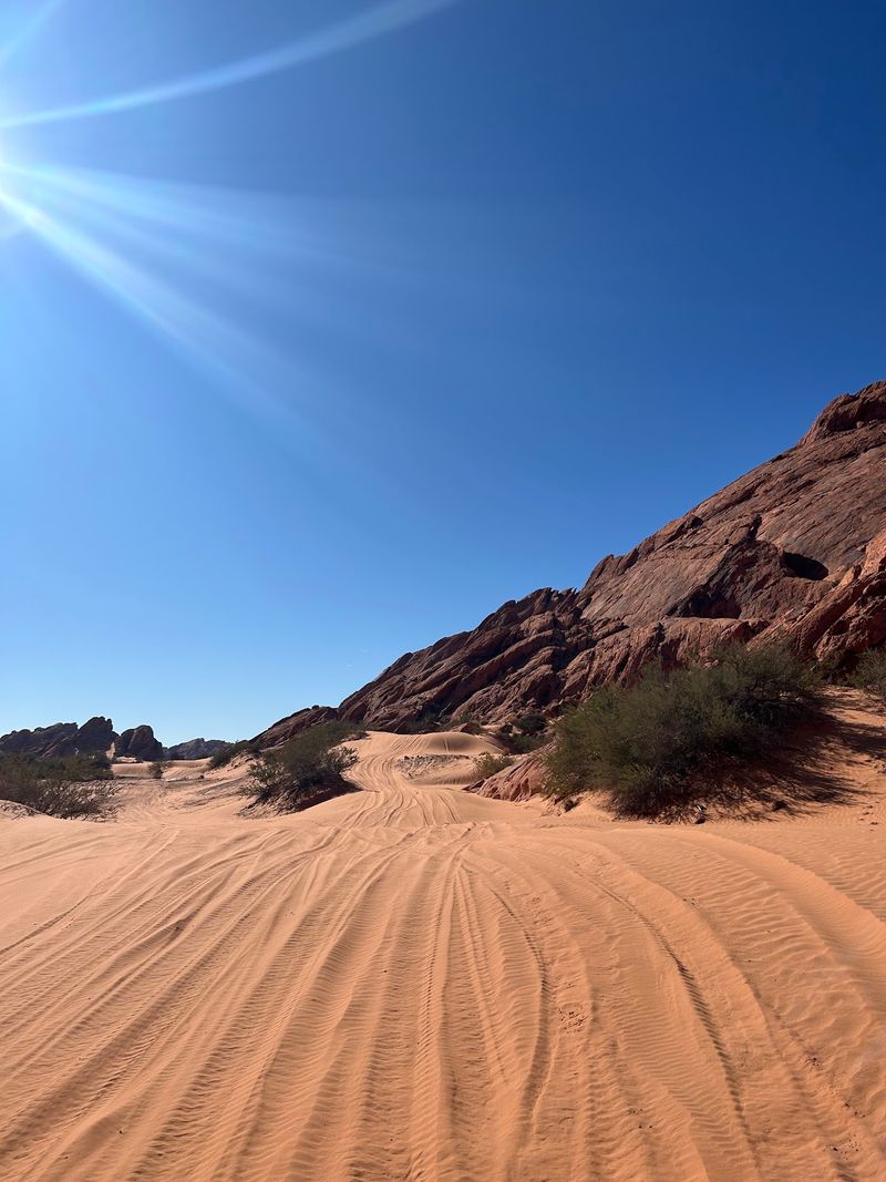
Airing down tires is half the fun. Mormon Mesa carries a network of dirt roads that climb the sides and wander the flat top.
Access comes from the Moapa Valley side, and also from Carp Elgin Road off Interstate 15. Once up there, loops along the rims connect in several directions.
Conditions vary a lot. Some stretches run smooth and graded, while others turn rocky with loose stones large enough to rattle teeth.
Off-highway vehicles handle it well, and full-width trucks manage many routes too. Lowering tire pressure a little smooths the ride and improves grip on gravel.
Standard advice applies to every desert drive in Nevada. Carry a spare, extra water, and a paper or offline map, since phone signal comes and goes.
Route conditions change after storms, so check recent local information before committing to a long loop.
Staying on existing tracks protects tortoise habitat and keeps the mesa open for everyone else.
The payoff arrives at the rim, where the road ends and the view opens wide.
Smart Prep Before The Climb Up
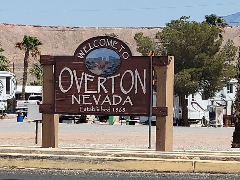
Fuel up before the fun starts. Moapa Valley and Overton sit right beside Mormon Mesa and cover the basics for travelers.
Shopping, fuel, and urgent care are available in the valley, and Overton offers lodging plus other everyday amenities. That makes the area a practical base for a day trip or a longer stay.
Water deserves top billing on any packing list. Desert heat pulls moisture out faster than most people expect, so carry more than seems necessary.
Add sun protection, a hat, sturdy shoes, and a first aid kit. Cell coverage on the mesa can be patchy, so tell someone the plan.
Summer afternoons in this corner of Nevada get seriously hot. Early mornings, late afternoons, and the cooler months make for far better exploring.
Respect the rules while up there. Stick to designated routes, leave artifacts and rock features untouched, and report damage to local authorities.
Anything that looks historic almost certainly is, and it belongs where it sits.
Good preparation turns a rough drive into an easy memory.
Red Rock Detours Worth Adding
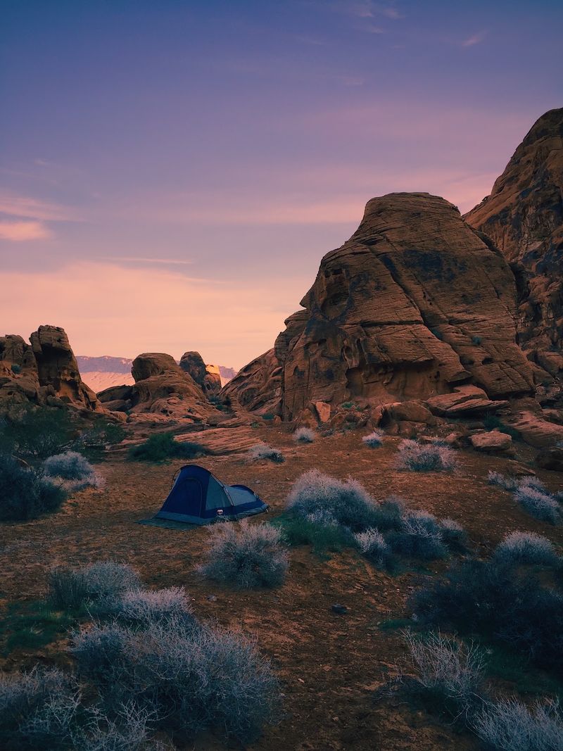
One mesa, many neighbors. The area around Mormon Mesa connects easily to several other standout desert destinations.
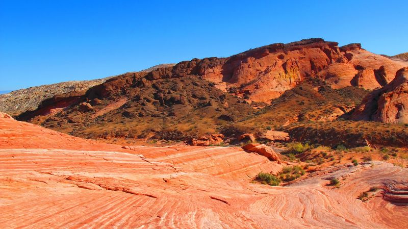
Valley of Fire State Park sits a short drive away, famous for brilliant red sandstone formations and twisting park roads. Gold Butte National Monument lies in the other direction, offering remote canyons and rock art.
There is a ghost town angle too. St. Thomas was flooded by Lake Mead decades ago and occasionally reappears as water levels drop.
The remains draw visitors curious about a settlement that vanished under a reservoir. Interpretive trails cover the site when conditions allow access.
Stringing these together makes a satisfying multi-day loop. Pavement handles most of the driving, with dirt roads reserved for the mesa itself.
Each stop adds a different texture, ancient geology at one, vivid color at another, and human history at the third.
Southern Nevada packs a surprising amount of variety into a small radius.
Plan an extra day, because leaving this corner of the map usually happens sooner than anyone wants.