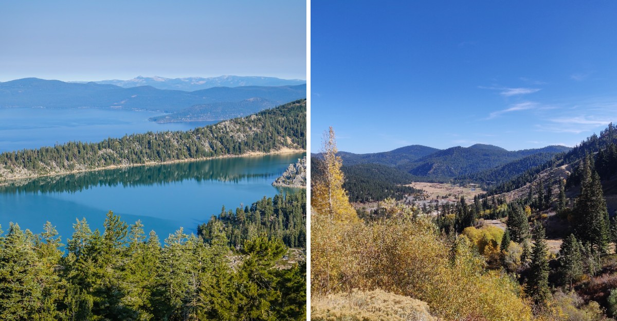
Some trails lead to a lake. This one wraps around an entire basin.
The car-free loop covers about 165 miles across two states, with long stretches in Nevada. Hikers, mountain bikers, and horseback riders all share the route.
How high does it climb? The top point sits above 10,000 feet, with views across deep blue water.
Wildflower meadows, granite basins, and quiet alpine lakes fill the miles between. Want an easy taste instead of the full loop?
A gentle meadow path in Nevada welcomes strollers and wheelchairs. Bigger goals can start there too.
Can one trip cover it all? Most people tackle the loop in smaller segments over time.
This guide covers the best stops, smart timing, and what to pack for the trail.
One Giant Loop Around A Famous Lake
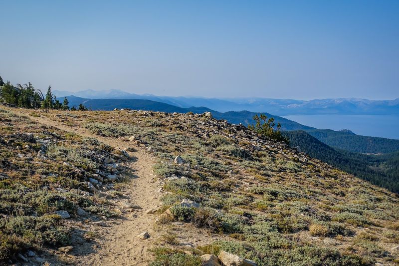
Ready for a hike with no real end? The Tahoe Rim Trail forms a full circle around the Lake Tahoe Basin.
Most sources list the loop at about 165 miles. Some measurements stretch it a bit longer, so treat that number as a close estimate.
The path crosses two states, California and Nevada. It also passes through six counties, a state park, several national forests, and three wilderness areas.
That variety keeps every stretch feeling fresh. One day might bring shady pine forest, while the next opens onto bare granite and wide sky.
Motor vehicles stay off the trail completely. Instead, the quiet belongs to footsteps, bike tires, and the occasional clop of hooves.
The loop sits within both the Sierra Nevada and Carson mountain ranges. Expect the landscape to shift from soft meadows to rocky volcanic ridges along the way.
Hikers often split the trip into smaller pieces rather than doing it all at once. Eight main segments make that easy to plan.
Start by choosing one segment that fits your fitness level. Then build toward longer days as your legs and confidence grow over time.
Climb To The Roof Of The Rim At Relay Peak
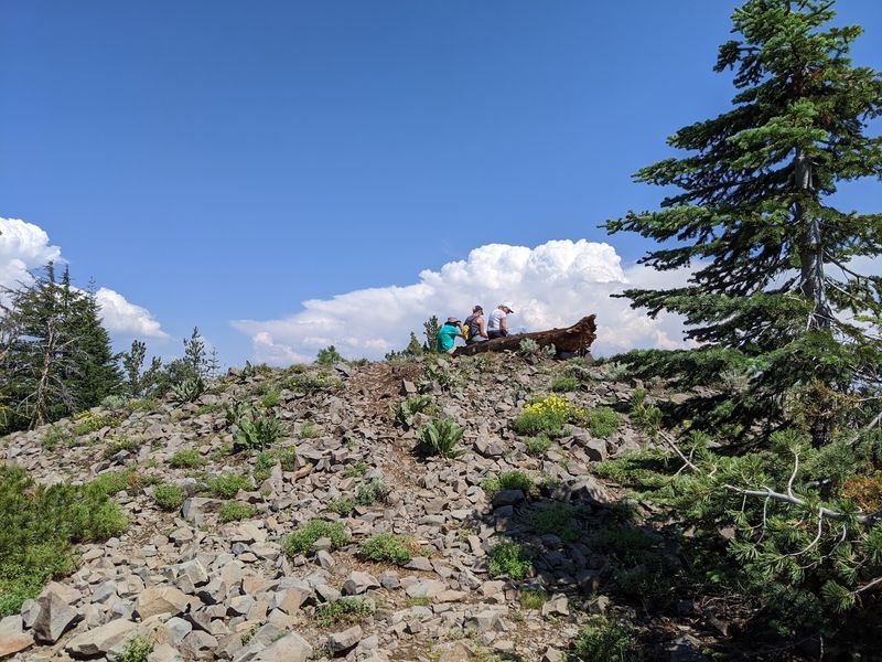
How high can a trail go? On this loop, the answer sits at Relay Peak in Nevada.
The summit reaches about 10,338 feet, making it the highest point on the entire trail. From the top, views spread across the whole Tahoe Basin.
Wind often sweeps across the ridge here. Pack a light jacket, even on a warm summer morning.
Relay Peak sits on the segment between Brockway Summit and Mt. Rose Summit.
That stretch runs roughly 20 miles and climbs through open, rocky country.
Thin air at this elevation can make breathing feel harder than usual. Slow your pace, take short breaks, and sip water often.
Many hikers reach the peak from the Tahoe Meadows side. That approach may feel shorter, though it still involves steady climbing.
Afternoon storms can roll in quickly during summer. Plan to reach the top early, then head down before clouds start building.
Sunscreen and sunglasses matter up here, since shade becomes scarce above the trees. Bring snacks too, because the climb can burn more energy than expected.
Once you stand on top, take a slow look around. Few spots on the loop offer such a wide, open view.
Wildflower Magic At Tahoe Meadows
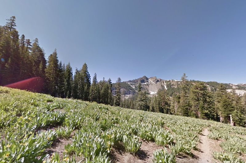
Bright petals everywhere, and almost no climbing required. Tahoe Meadows offers one of the gentlest ways to sample the trail.
This high-elevation meadow sits off Highway 431 in Nevada. It lies about a mile west of the Mt.
Rose Summit area.
A one-mile interpretive loop here is designed to be ADA-accessible. Families with strollers or visitors using wheelchairs may find it a welcoming option.
Wildflower season usually peaks from mid-July to mid-August. Timing shifts each year with snowpack, so blooms may arrive earlier or later.
Soft grass and small creeks shape the meadow’s calm feel. Birdsong and buzzing insects often fill the quiet afternoons.
Stay on the marked path to protect fragile plants. Meadow soils recover slowly after being trampled.
Weekends in summer can bring more visitors and busier parking. Arrive early in the day for a more relaxed stroll.
The meadow also works as a trailhead for longer hikes. Stronger hikers often start here before heading toward Relay Peak or other segments.
Bring a light layer, since mornings at this height can feel chilly. Then slow down and enjoy the colors at your own pace.
Lake Views And Valley Drops From Spooner Summit
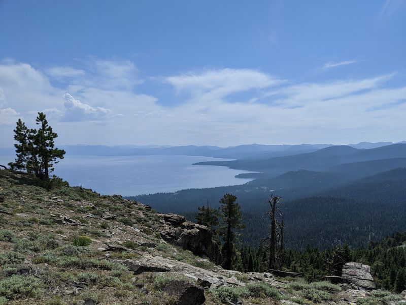
Two views for the price of one? The stretch from Spooner Summit to Kingsbury Grade delivers exactly that.
Look one way to see the deep blue of Lake Tahoe. Turn around to spot the wide, dry floor of Carson Valley.
This segment runs about 19 to 20 miles along the Nevada side. It passes near Genoa Peak along the way.
Spooner Summit is a popular trailhead, so parking may fill on busy weekends. Plan an early arrival for a calmer start.
The trail here mixes shaded forest with open, rocky viewpoints. Sunlight shifts often, so a hat and sunscreen come in handy.
Water can be scarce on this eastern side. Carry plenty, since natural sources may be hard to find.
Day hikers can try an out-and-back walk instead of the full segment. Turning around at any good viewpoint still makes a satisfying outing.
Kingsbury Grade has access points near the Heavenly Stagecoach parking area and Benjamin Street. Check conditions before you go, since access details can change.
Pace yourself on the climbs and save energy for the return. This segment rewards patience with steady, wide views.
Marlette Lake And The Famous Flume Country
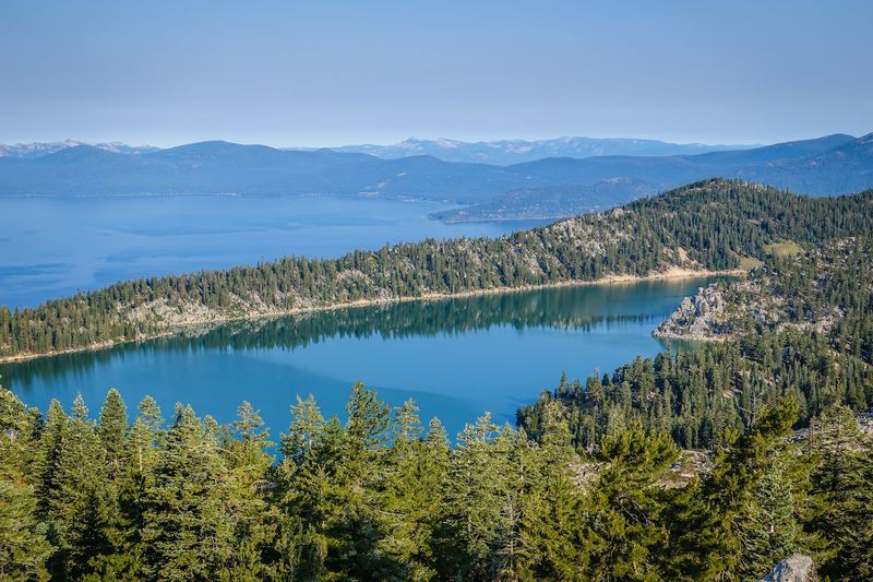
Here’s a fun bit of history hiding in the hills. Marlette Lake is a reservoir tied to old water flumes that once served the region.
Today, the area sits within Lake Tahoe Nevada State Park. Broad views of the east shore make it a favorite stop.
The nearby Flume Trail attracts many mountain bikers. Expect to share the path and stay alert on narrow sections.
Spooner Lake also lies close by. Its easy setting makes a pleasant warm-up before tackling bigger climbs.
Camping rules differ inside the state park. Overnight stays are limited to established campgrounds such as Marlette Peak, Hobart, and North Canyon.
Electric bikes may be allowed only in designated parts of the park. Check current rules before bringing one along.
The lake water often looks calm and glassy on still mornings. Afternoon breezes can ripple the surface and cool the air nicely.
Pack out every scrap of trash, including food wrappers. Wildlife here depends on visitors keeping the area clean.
Give yourself extra time for photos and quiet breaks. A slower pace helps the history and scenery sink in.
Star Lake Beneath The Shadow Of Freel Peak
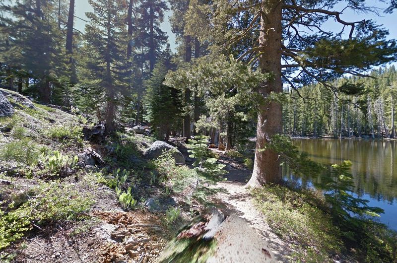
Tired legs deserve a lakeside reward. Star Lake sits tucked below towering Freel Peak on the Kingsbury Grade to Big Meadow segment.
This stretch covers roughly 23 miles along the Carson Range ridge. Forests and open alpine meadows trade places along the route.
Star Lake offers spots for camping and fishing. Check local fishing rules before casting a line.
Backcountry campsites usually need to sit well away from water. Aim for at least 200 feet from the shoreline.
Stay roughly 100 feet from other trails, too. Never set up camp right at a trailhead.
Campfires are generally not allowed along the trail. A portable stove works better, though it may require a valid permit.
Nights near the lake can turn cold, even in summer. Pack a warm sleeping bag and extra layers.
Morning light often makes the water glow softly against the dark peak. Wake early to catch that calm, quiet moment.
Hang or store food carefully to keep wildlife away. Respecting animals helps protect this special place for future visitors.
Treat the lake as a peaceful resting point. Then continue on refreshed and ready for the next ridge.
Granite Wonderland In Desolation Wilderness
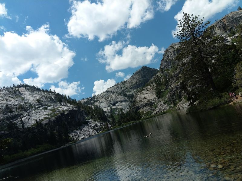
Think bare granite, cold blue lakes, and tumbling streams. That scene sums up Desolation Wilderness on the California side.
The Echo Lake to Barker Pass segment runs about 32.5 miles. It ranks as the longest piece of the whole loop.
Glaciers once scraped this land smooth. Now dozens of alpine lakes rest in rocky basins.
Lake Aloha stands out as a highlight. Its rocky shoreline and scattered islands make a striking picture.
Permits are required to enter this wilderness. Free day-use permits are typically available at Forest Service kiosks at trailheads.
Overnight trips need a separate camping permit. These can be reserved online or picked up in person.
Group size is capped at 12 people here. Smaller groups may find it easier to plan and camp.
Mountain biking is not allowed in wilderness areas. Hikers and riders on horseback should check current rules before heading out.
Granite can feel hard on the knees during long descents. Trekking poles may ease the strain on steep sections.
Give this segment extra days if possible. Rushing through would mean missing much of its quiet beauty.
Volcanic Cliffs And Shady Groves Near Tahoe City
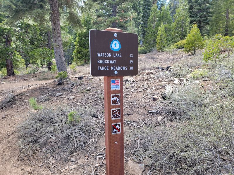
Love a trail with a little bit of everything? The northwest side mixes volcanic rock, fragrant forest, and quiet lakes.
The segment from Tahoe City to Brockway Summit runs about 20 miles. Fir, cedar, and aspen groves shade much of the way.
Open hillsides covered in manzanita break up the forest. Through gaps in the trees, Lake Tahoe peeks into view.
Look for the Lava Cliffs, a striking volcanic formation. Watson Lake makes another pleasant stop along this route.
Water can run low between Gray Lake and Watson Lake. That stretch spans roughly 15 miles, so fill bottles whenever possible.
Many hikers carry several liters during dry months. Plan ahead and treat any natural water before drinking.
The Barker Pass to Tahoe City segment also ends nearby. It descends through Ward Canyon, where pine scent and rustling aspens fill the air.
Fall can bring golden aspen leaves to these slopes. Color often peaks from September into October, depending on the weather.
Tahoe City sits close to the trail’s lowest elevations. That makes it a handy spot to begin or finish a trip.
Pick The Right Season For Your Trek
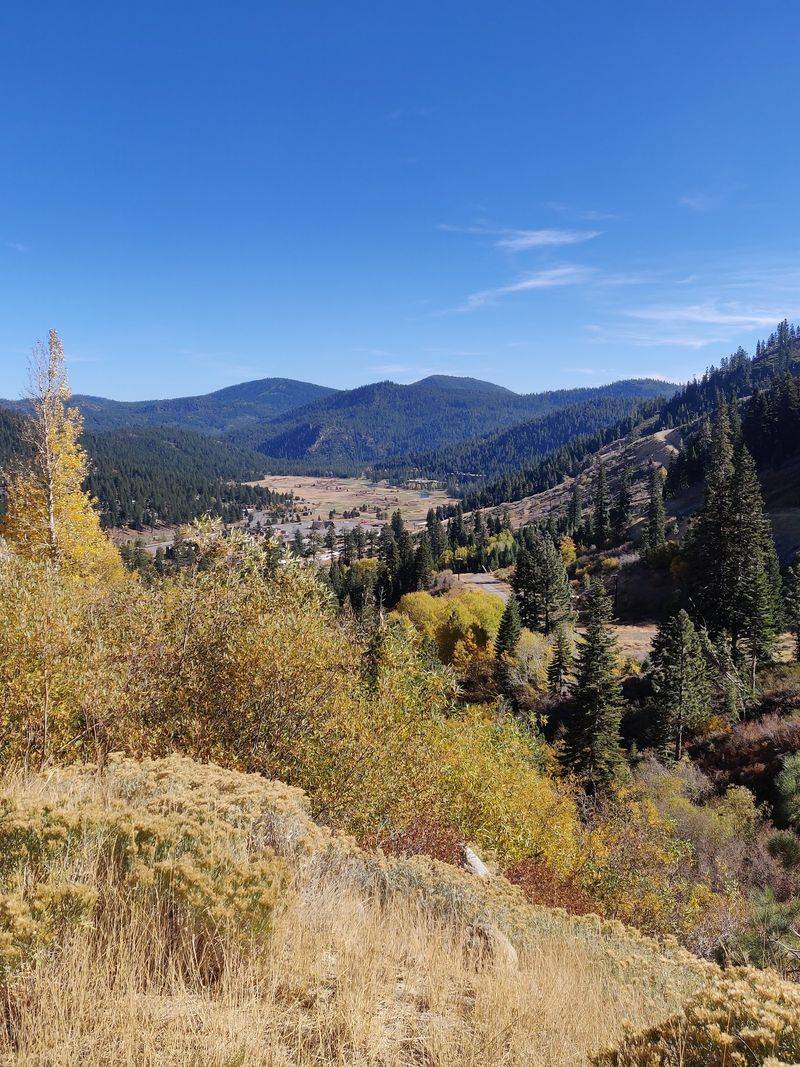
Timing can make or break a mountain trip. Snow-free hiking usually runs from July through mid-October.
Summer brings clear paths and long, bright days. Wildflowers often add splashes of color in midsummer.
Autumn swaps blooms for glowing reds, oranges, and yellows. Crisp air and calmer trails can make fall feel especially peaceful.
Winter never officially closes the trail. Heavy snow, however, often buries many sections completely.
Snowshoes or cross-country skis may be needed then. Guided snowshoe outings are sometimes offered during colder months.
Early summer can still hold lingering snow on high ridges. Check recent trail conditions before setting out.
Weather in the mountains shifts fast in any season. Pack layers, rain gear, and extra food just in case.
Weekends in peak summer may feel busier at popular trailheads. Weekdays often bring a quieter, slower rhythm.
Elevations range from roughly 6,300 feet near Tahoe City to over 10,000 feet at Relay Peak. Temperatures can differ widely across that range.
Choose a season that matches your skills and gear. Each one shows the trail in a different light.
Catch Some Local History At The Gatekeeper’s Museum
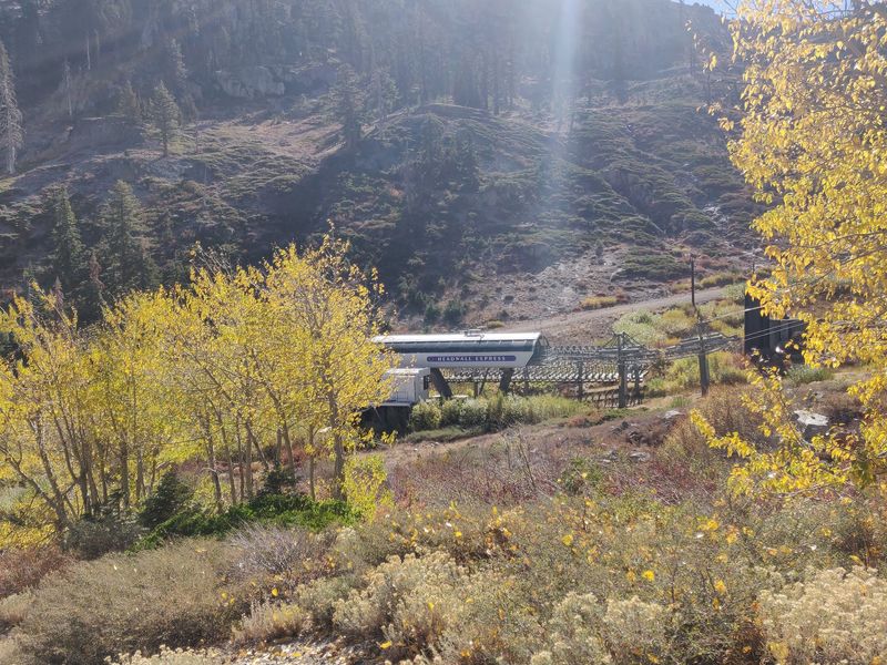
Trail days call for a break now and then. Tahoe City offers a handy pause close to the trail’s western side.
The town works well for resupply and planning. Shops and services make it easy to restock before the next segment.
History fans should stop by the Gatekeeper’s Museum. Its exhibits explore the culture and story of the Lake Tahoe region.
Local artifacts help explain how the area grew over time. Displays can add meaning to the places seen from the trail.
Visiting on a rest day keeps legs fresh. A slower afternoon indoors can feel welcome after long, dusty miles.
Hours and admission details may change by season. Check current information before planning a visit.
South Lake Tahoe also serves as a major resupply hub. Many thru-hikers use both towns to break up the loop.
Leave muddy boots outside when possible and pack a clean shirt. Small courtesies help keep shared spaces pleasant.
Wander the nearby lakeshore afterward for a calm finish. The Gatekeeper’s Museum welcomes visitors at 130 West Lake Boulevard, Tahoe City, CA 96145.