
Almost Nobody Knows This Small Georgia Town Once Played A Major Role In Colonial America
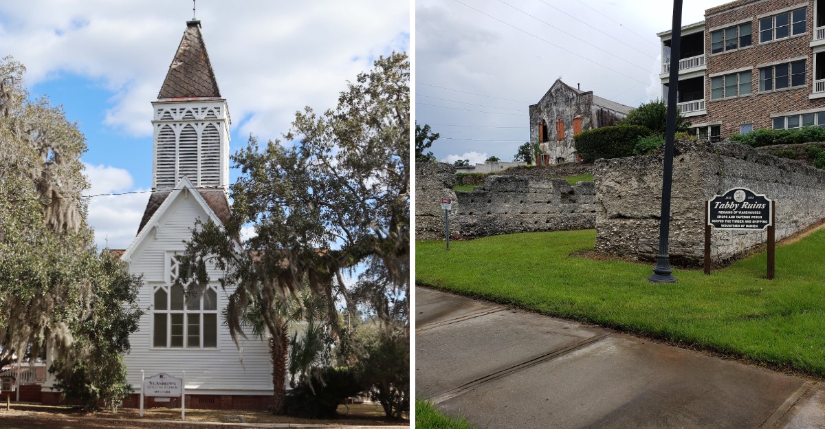
It is strange how a quiet town can hide such a loud piece of history. Drive through this corner of Georgia today, and you might never guess how important it once was.
Centuries ago, this small community played a serious role in colonial life. Trade, travel, and political activity brought people here long before modern roads changed the map.
That contrast is what makes the story so interesting. The streets feel calm now, but the past tells a much busier story.
Georgia is full of historic places, yet this one rarely gets the attention of better-known destinations. Old buildings, surviving landmarks, and stories tied to the colonial era still give visitors plenty to notice.
Once you learn what happened here, the town starts to look completely different. This little piece of history proves that some of the biggest stories can come from places most travelers barely notice.
Scottish Highlanders Arrived In 1736 And Named It New Inverness
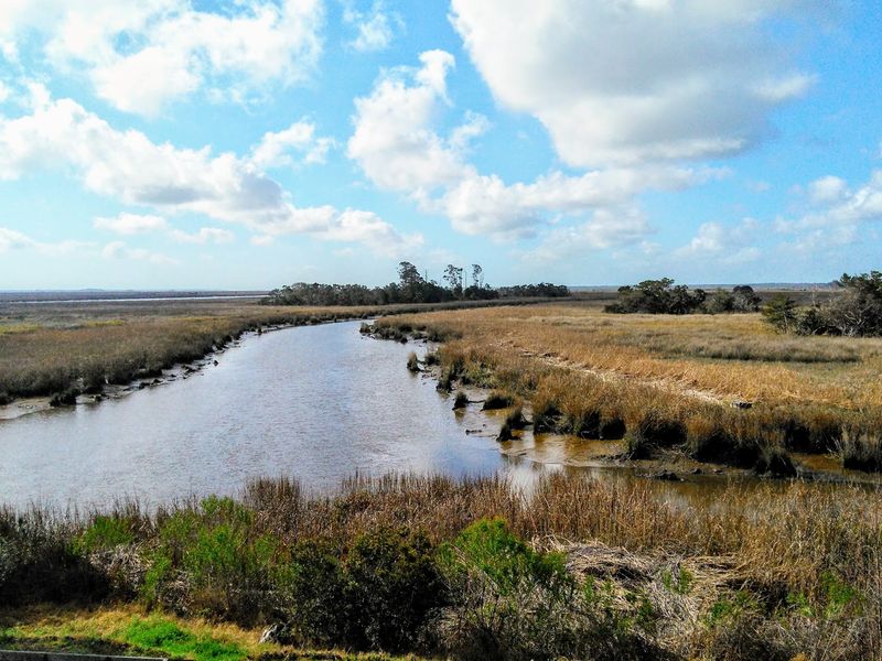
Picture a ship from Inverness dropping anchor beside a cold, gray marsh in January 1736. About 170 Scottish Highlanders stepped ashore, recruited by James Oglethorpe to guard the colony’s southern edge.
They named the settlement New Inverness, and the district around it Darien. The name honored an earlier Scottish colony in Panama that the families refused to forget.
These were not casual newcomers looking for easy land. Many came from Highland clan country under John Mohr McIntosh, and they arrived prepared to farm and to defend.
Oglethorpe met them wearing Highland dress, a small courtesy that bought real loyalty. Within months the settlers had raised a guardhouse, a storehouse, huts and a simple chapel.
Their timing mattered enormously. Spain claimed the same shoreline from Florida, so the Georgia colony needed armed neighbors on this exact stretch of coast.
The Scottish thread never snapped. Tartan patterns, clan names and Highland gatherings still turn up on the town calendar each year.
Fort King George Guarded The Edge Of An Empire
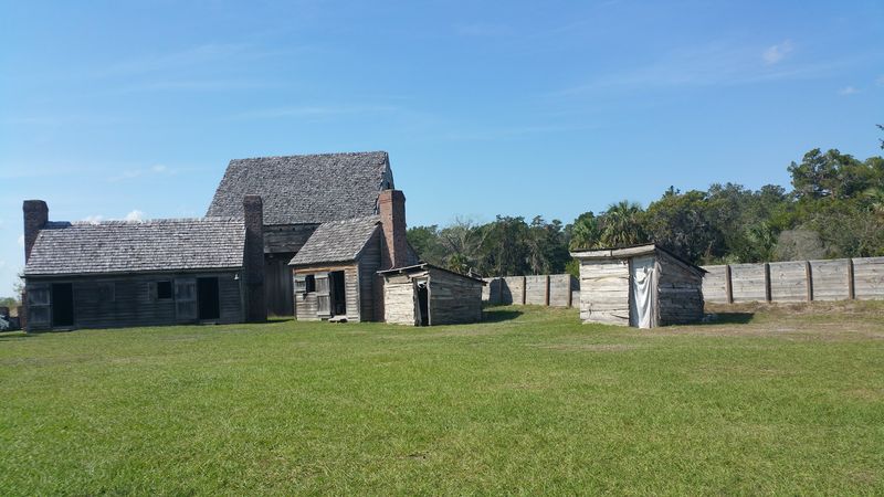
Long before the Highlanders came, British soldiers already held this bluff above the river. Fort King George was built in 1721 and stood as the southernmost outpost of Britain’s North American empire.
Men of His Majesty’s Independent Company manned it for six difficult years. They raised a three-story cypress blockhouse, a moat, barracks and palisades on stubbornly soggy ground.
The garrison pulled out in 1727, yet the cleared site was never wasted. Nine years later the Scots settled right beside the abandoned earthworks.
A careful reconstruction opened in 1988, and the blockhouse rises over the marsh again. Costumed interpreters fire muskets on scheduled weekends, and the museum covers the soldiers, the Guale people and the later sawmill era.
The historic site sits at 302 McIntosh Road SE, Darien, GA 31305, a short drive east of downtown. Parking is simple, and the loop trail takes under an hour at a slow pace.
Few spots let you stand where three centuries of coastal defense overlap. The marsh view has barely changed.
A Bold Petition In 1739 Challenged The Powerful
Here is a fact that rarely reaches school textbooks. On January 3, 1739, eighteen Highlanders from this settlement signed a petition addressed to Oglethorpe.
They asked him to keep slavery out of the young colony. Their reasoning blended moral objection with practical worry about safety on an exposed frontier.
One line still lands hard today. The signers wrote that people brought here in chains had as much right to freedom as anyone else.
The letter answered wealthy planters upriver who wanted the existing ban lifted. Trustees had prohibited slavery in 1735, and the Scots wanted that rule respected.
Scholars count the document among the earliest organized protests of its kind in the American colonies. That is a striking record for a village of only a few hundred residents.
The ban was eventually reversed in 1751, and the coast changed quickly afterward. Even so, the petition survives, and it keeps this little river town in the national story.
Highland Rangers Helped Hold The Southern Frontier
Spain and Britain both claimed this shoreline, and the argument boiled over in 1742. A Spanish force landed on St. Simons Island, just south of the Scots’ new home.
Oglethorpe called up his Highland company, men trained with broadsword and musket. They joined rangers and regulars among the oaks above the beach.
The engagement at Bloody Marsh on July 7 ended the invasion attempt. Spanish ships withdrew toward Florida, and the colony’s southern boundary held firm.
Two years earlier the same Highlanders had marched with Oglethorpe toward St. Augustine. That campaign fell short, yet it proved how heavily the crown leaned on these settlers.
Their service explains why such a small place mattered so much. Without a reliable garrison at the river mouth, the whole colonial project sat wide open.
Markers and exhibits on St. Simons Island retell the battle for travelers. The soldiers who fought it, however, rode in from the town at the Altamaha mouth.
A Highland Boy Grew Into A Revolutionary General
Among the children who came ashore in 1736 was an eight-year-old named Lachlan McIntosh. He grew up in the Highland settlement, learned surveying, and later helped lead a revolution.
Congress made him a brigadier general in 1776. He commanded troops in the western theater, served at Fort Pitt, and endured the winter at Valley Forge with Washington’s army.
His family name spread across the region. McIntosh County was created in 1793 and still carries it on every road sign and courthouse document.
Think about that arc for a moment. A boy from a frontier outpost ended up advising the commander of the Continental Army.
His story links the Scottish founding directly to American independence. The same families who guarded the colonial border later argued for self-government.
Local markers and archives around town trace the McIntosh line in detail. For anyone curious about how ordinary settlers shaped big events, this is a rewarding thread to follow.
The Resolutions Of 1775 Spoke Louder Than Their Size
January 1775 found the coast restless and the empire unpopular. A committee from St. Andrew’s Parish gathered in this town and put its position on paper.
The Darien Resolutions backed the Continental Congress and defended colonial rights plainly. Lachlan McIntosh and his neighbors signed their names without hedging.
One clause went far beyond politics. The committee condemned slavery outright and called for its gradual end, decades before such language became common.
Consider the courage that took. These were farmers, timber men and river pilots challenging the wealthiest interests on the coast.
Their statement helped push the province toward joining the other colonies. Savannah’s leaders were still hesitating when this parish committed itself.
Historians often pair the 1775 resolutions with the 1739 petition. Together they show a community that questioned popular opinion twice in under forty years, which is rare in any era.
Vernon Square Still Holds The Heart Of Town
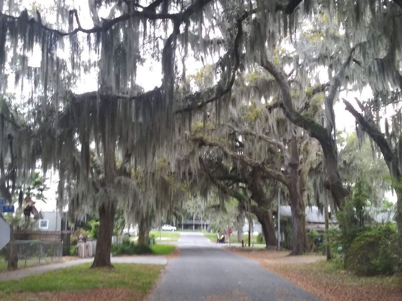
Shade arrives suddenly when you reach Vernon Square, and the temperature seems to drop. Live oaks lean over brick walkways, benches and a quiet patch of lawn.
The town grid with its open squares echoes the famous plan of Savannah, 50 miles north. Small squares like this one were meant for gathering, markets and militia drills.
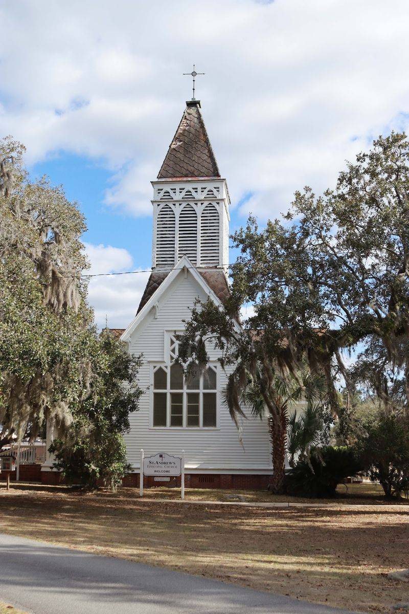
Nineteenth-century churches ring the green space, several built in the 1870s as the port rebuilt itself. Their steeples still set the skyline in a town without tall buildings.
The Vernon Square-Columbus Square Historic District joined the National Register in 1975. That listing protects homes, sanctuaries and streets that carry the community’s memory.
Everything here sits within an easy stroll of the waterfront. You can cross from the square to the river bluff in about ten minutes.
Come early, when the light filters through the moss. It is the best free attraction in Darien.
The Altamaha River Turned A Village Into A Great Port
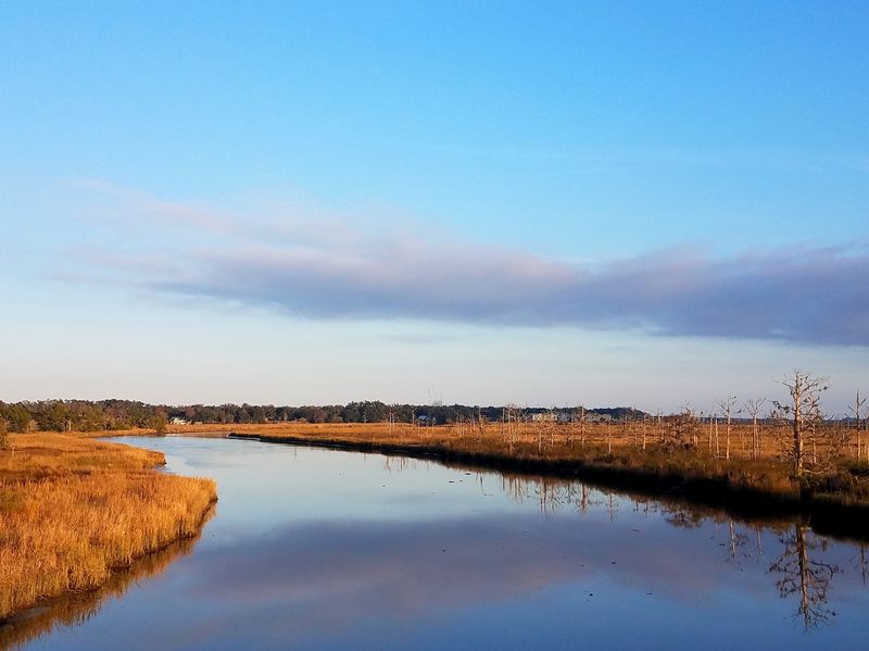
Rivers make towns, and this one made a fortune. The Altamaha forms where the Oconee and Ocmulgee join, then runs roughly 137 miles to the sea.
Nicknamed Georgia’s Little Amazon, it drains an enormous basin and remains largely free-flowing. Conservation groups have long ranked it among the most important river systems on the Atlantic coast.
In the 1800s, raftsmen lashed longleaf pine logs together and floated them downstream for days. They tied up at the mouth, where mills and ships waited at the bluff.
By the late nineteenth century this was one of the busiest timber ports on the South Atlantic. Lumber from here framed buildings across Europe and the Caribbean.
Paddlers now trade cargo for quiet, gliding past cypress knees and sandbars. Fishing, birding and kayaking have replaced the raft trade entirely.
Stand on the riverbank at dusk and the scale makes sense. Everything this town became arrived or departed on that brown, patient current.
Butler Island Dikes Still Map An Old Rice Landscape
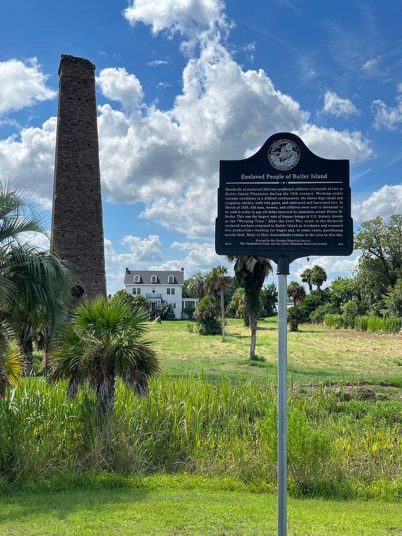
Drive south on U.S. Highway 17 and the land flattens into shining squares of water.
Those are former tidal rice fields, shaped by dikes and canals that still hold their lines.
Butler Island was one of the largest rice operations on the coast during the 1800s. Enslaved West African workers engineered and maintained the entire system, and their skill built the landscape you see.
Their descendants formed the Geechee communities of this shoreline. Nearby Sapelo Island, reached by ferry from a dock north of town, still holds the Hog Hammock settlement.
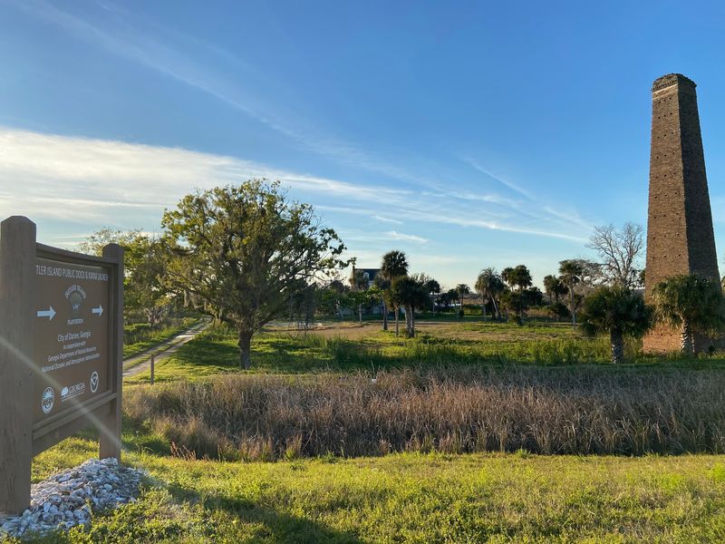
A tall brick chimney rises beside the highway, left from a dairy operation of the 1920s. It makes an easy landmark for anyone slowing down.
The fields now belong to the Altamaha Wildlife Management Area. Herons, egrets, alligators and thousands of wintering ducks use them daily.
Bring binoculars and patience. Few roadside stops mix history and wildlife this thoroughly.
Shrimp Boats And Tabby Ruins Line The Waterfront Today
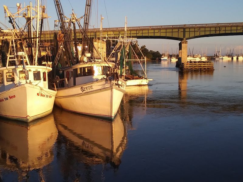
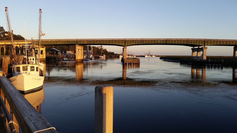
Outriggers tilt over the water like folded wings along the Darien River. The shrimp fleet here is one of the most recognizable working fleets on the coast.
Each spring the community holds a Blessing of the Fleet, with decorated boats parading past the bluff. Food, music and a crowded riverbank turn the waterfront into a festival ground.
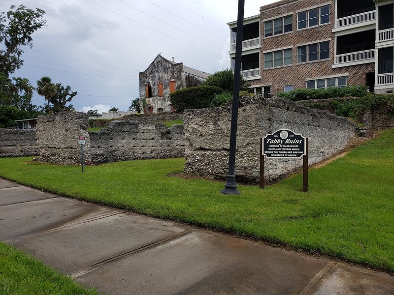
Along that same bluff sit tabby ruins, walls made of lime, sand and crushed oyster shells. They once served as warehouses for cotton and rice awaiting shipment.
Waterfront Park gives you benches, interpretive signs and an unobstructed marsh view. Seafood restaurants sit steps away, and local shrimp appears on nearly every menu.
Getting here is simple from Interstate 95, which passes just west of downtown at Exit 49. Savannah lies about 50 miles north, Brunswick about 20 miles south.
Stay until sunset if you can. Coastal Georgia rarely looks better than it does from this working riverfront.