
Take The Ultimate Fall Road Trip Through Tennessee’s Smoky Mountains
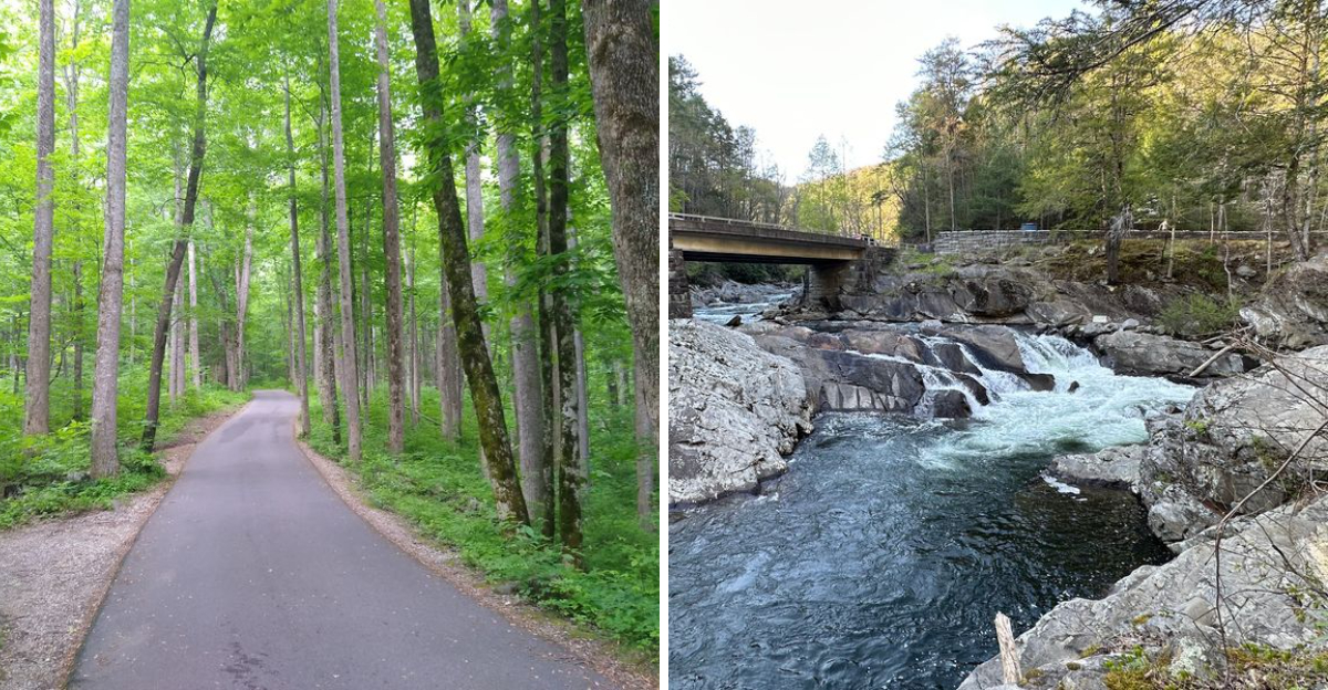
Fall does something special to the Smokies. One curve can open onto a wall of orange and gold, while the next sends you beside a rushing river under trees glowing in the afternoon light.
Tennessee turns especially dramatic when autumn reaches the mountains. Scenic roads climb toward wide overlooks, quiet valleys fill with color, and waterfalls look even better framed by changing leaves.
Add historic cabins, old mountain communities, and the occasional wildlife sighting, and suddenly the drive becomes the main attraction.
This is not a road trip meant for rushing. Pull over when the view earns it. Walk a short trail, stop beside the river, and leave room for places you did not expect to love.
By the time the road reaches the higher elevations, the scenery can feel completely different than it did an hour earlier. That constant change is exactly what makes a fall drive through Tennessee’s Smoky Mountains so memorable.
1. Foothills Parkway West And Look Rock
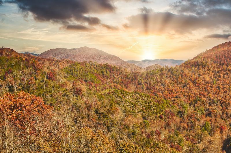
Few drives start a trip with this much drama. The western stretch of the Foothills Parkway lifts you above the treetops fast.
Ridgelines pile up in layers, gold behind gold.
The National Park Service recommends the parkway for fall scenery with lighter crowds. That is a rare combination in October. Overlooks appear every few minutes, and each one begs for a quick stop.
Look Rock sits at the highest point along this section. A paved trail of roughly half a mile leads to an observation tower. From the top, the view spins a full 360 degrees.
On clear days, visibility can stretch about 40 miles across Tennessee and North Carolina. Cades Cove Mountain and Thunderhead Mountain often stand out. Bring a jacket, because wind up there means business.
Not a fan of walking? A natural viewing ledge waits on the west side of the parking area. The picnic area and campground nearby make a calm base for a snack.
Mid to late October usually brings the strongest color to these lower ridges. Morning light works best for photos, and fog often drifts through the valleys.
Start early and you may have an overlook to yourself. Restrooms are limited along the parkway, so plan your stops in Townsend first.
2. Cades Cove
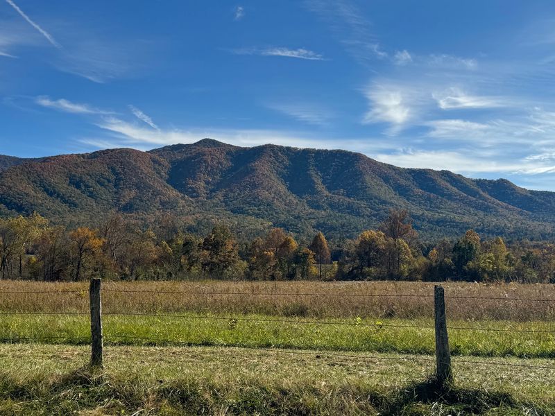
An eleven mile loop should not take three hours. In autumn, it often does. Nobody minds much, because the scenery earns the delay. Wide pasture opens under steep mountain walls near Townsend. Split rail fences trace the fields.
Deer graze at the edges while wild turkeys strut without hurry. Historic cabins, barns, and three churches sit along the route. The John Oliver Place is among the oldest structures standing.
Doors stay open, so you can peek inside the old rooms.
Black bears feed heavily before winter, so sightings rise in fall. Keep a safe distance and stay in your vehicle when traffic slows. Never feed wildlife, ever.
The Cable Mill area near the halfway point holds a working grist mill. A visitor center and restrooms sit there too. It is the natural spot for a break.
Traffic can crawl on weekends, so arrive at sunrise if possible. Cyclists love the loop for the same reason. Pack water, snacks, and patience.
Fog often fills the valley early, then burns off into gold. That first hour is pure magic. Give the cove half a day and it will repay you.
Cell service is spotty, so download maps before turning onto the loop road. A paper park map helps more than you expect.
3. Great Smoky Mountains Institute At Tremont And Middle Prong
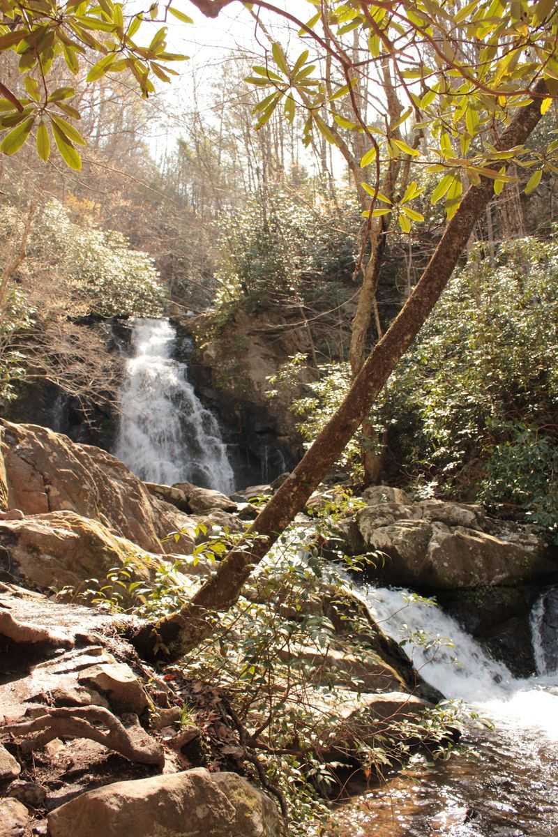
Water noise replaces engine noise here. The Middle Prong of the Little River tumbles beside the road. Rhododendron crowds the banks.
The Great Smoky Mountains Institute at Tremont sits at 9275 Tremont Road near Townsend. It works as a residential learning center for students and families.
Educators teach field science right in these woods. Past the institute, the pavement turns to gravel. Windows down is the correct setting. Cascades appear again and again, each one worth a glance.
Middle Prong Trail follows an old railroad grade. The grade stays gentle, which makes it friendly for casual walkers. Lynn Camp Prong Cascades reward the first mile.
Yellow poplar, maple, and birch light up the lower elevations. Color often peaks here later than on the high ridges. Late October into early November is a smart window.
Bridges over the water make simple, gorgeous photo stops. Rocks stay slick, so watch your footing near the current. Sturdy shoes beat sandals every time.
Crowds thin out on this side road. You may hear only water, wind, and a woodpecker at work. That quiet is the whole point of stopping.
Facilities are minimal, so use restrooms in Townsend before you turn in. Then take your time on the gravel.
4. The Sinks
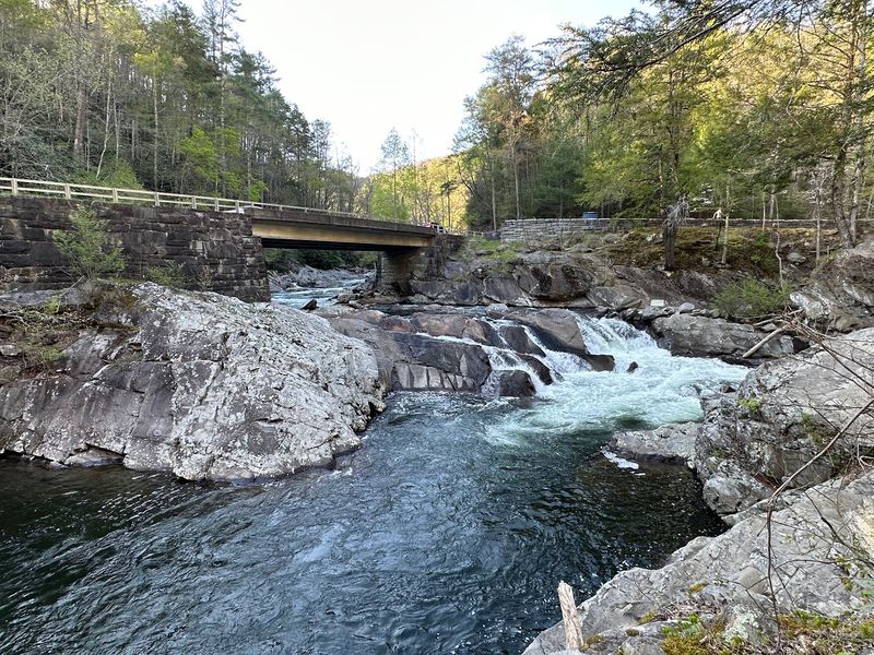
Some waterfalls demand a hike. This one demands a parking spot. The Little River squeezes through a rocky gorge and drops hard.
The pull off sits along Little River Road toward Gatlinburg. A short paved path leads to the viewing area. Total time needed: about ten minutes.
Fall raises the drama when rain swells the current. Spray hangs in the air and the sound carries. Yellow leaves spin in the pools below.
Stay behind the railings and on marked paths. Wet rock is slicker than it looks. The current here is powerful, so swimming is not allowed.
Legend says a logjam once blasted a deep hole in the riverbed. That story gave the place its name. Old timers claimed the pool had no bottom.
Parking is limited, and cars fill it quickly on weekends. Early morning and late afternoon feel calmer. Do not block the road while waiting.
Quick stops keep a road trip lively. Stretch your legs, snap a photo, then roll on. The next overlook is only minutes away.
Meigs Creek Trail starts at the same lot for anyone wanting more. It crosses the creek several times, so expect wet feet. Save it for a dry stretch of weather.
5. Metcalf Bottoms
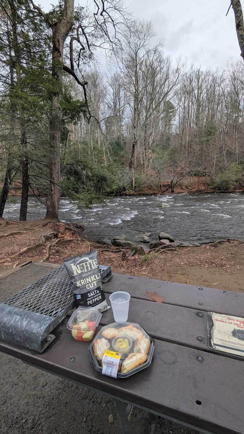
Picnic tables beside a mountain river solve a lot of problems. Hunger, restlessness, and a stiff back all fade fast.
The picnic area sits along Wear Cove Gap Road near Gatlinburg. The Little River curls right past the tables. Shade comes from tall hemlock and hardwood.
Riverside spots go first, so scout before unpacking. A pavilion serves larger groups by reservation. Restrooms make it a practical mid drive stop.
Little Greenbrier School stands nearby, built in 1882. The one room log building served as school and church. Wooden benches and a chalkboard remain inside.
Kids love the shallow edges of the river. Smooth stones, small pools, and leaf boats fill an hour easily. Adults usually end up sitting on a rock too.
Autumn light filters through the canopy in stripes. Photos here look softer than the big overlook shots. Both belong in the same camera roll.
Pack a simple lunch from a Townsend or Gatlinburg market. Sandwiches, apples, and cider taste better outdoors. Carry out every crumb, since food attracts bears.
A short trail connects the area to the school for anyone skipping the extra drive. Half a mile, mostly easy, plenty of leaves. It is a pleasant way to earn dessert.
6. Elkmont Historic District And Daisy Town
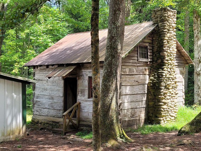
Empty porches tell stories that guidebooks skip. Daisy Town holds a row of preserved Appalachian Club cabins.
Eighteen historic structures are being preserved along Elkmont Road near Gatlinburg. The valley once held a logging town, then a summer community. Families vacationed here long before the park existed.
Stone chimneys, wooden shutters, and mossy steps line the lane. The Appalachian Clubhouse anchors the cluster. It can be rented for daytime gatherings.
Walking the loop takes maybe twenty minutes. Interpretive signs explain who lived here and why they left. History fans could linger far longer.
Elkmont Campground sits nearby along the Little River. The Little River Trail follows an old rail bed upstream. Flat, shaded, and lined with color in late October.
Synchronous fireflies draw big crowds to Elkmont each June. Autumn brings quieter visitors and easier parking. Trade the light show for the leaf show.
Morning fog settles between the cabins and the ridge. Photographers love that mood. Bring a lens cloth, because damp air fogs glass.
Respect the buildings by staying outside closed doors. Preservation work continues, so some areas may be fenced. Read posted signs and enjoy the rest. Elkmont sits only minutes from Sugarlands, which keeps the route tidy.
7. Roaring Fork Motor Nature Trail
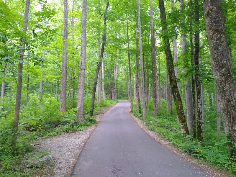
Narrow, one way, and gloriously slow. The motor nature trail runs about five and a half miles through deep forest.
Access starts from Historic Nature Trail road in Gatlinburg. Buses, trailers, and RVs are not permitted. The road also closes for the winter season.
The National Park Service lists it among recommended autumn drives. Moss covers the rocks, and the canopy leans close. It feels older than the rest of the route.
Historic buildings appear at several pullouts. The Ephraim Bales Place and the Alfred Reagan Place stand out. Both give a clear look at mountain craftsmanship.
Place of a Thousand Drips ends the drive with water sliding down a rock face. After rain it truly performs. In dry spells it whispers instead.
Grotto Falls sits along Trillium Gap Trail from the same road. Round trip runs close to three miles. You can walk behind the falls, which kids adore.
Pullouts are small and traffic keeps moving. Signal early, park fully off the pavement, and be courteous. There is no turning around once you commit.
Plan an hour minimum, longer with stops. Go before midday for softer light and fewer cars. The forest here glows even under clouds. Bring a jacket, since the hollows stay cool.
8. Newfound Gap
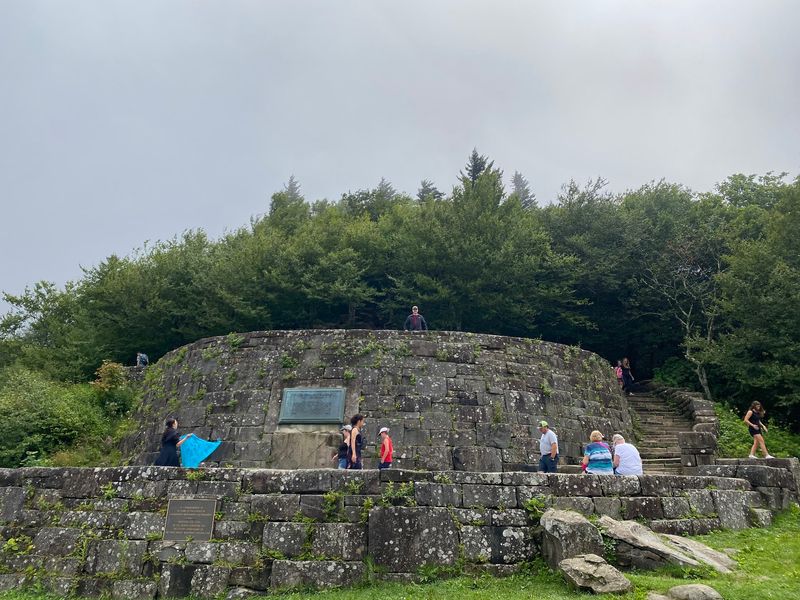
At 5,046 feet, the air changes and so does the view. Ridges stack into the distance like waves.
The overlook straddles the Tennessee and North Carolina line. Standing there, one foot rests in each state. It is the lowest drivable gap through the park.
The Rockefeller Memorial marks the spot where the park was dedicated in 1940. Stone terraces frame the pullout. Plaques explain the story in a few minutes.
The Appalachian Trail crosses right here. Backpackers often appear with dusty boots and big grins. You can walk a short stretch just to say you did.
Weather shifts fast at elevation. Temperatures can run much cooler than in Gatlinburg. Wind, fog, and sunshine sometimes arrive within one hour.
Color peaks earlier up high than in the valleys. Early to mid October often looks best near the gap. Below, the season keeps going for weeks.
Parking fills quickly on clear weekends. Sunrise here is worth the alarm clock. Layers of blue and orange stack up beautifully. Restrooms are available at the pullout. Cell service is unreliable, so save directions ahead.
Snow can close the road late in the season. Check conditions before committing to the climb. A quick call to park information settles it.
9. Kuwohi
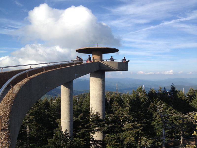
Highest point in the park, highest point in Tennessee, and a finish worth planning. Kuwohi rises to 6,643 feet.
The turnoff climbs seven miles from Newfound Gap Road. Kuwohi Road ends at a large parking area. Spruce and fir replace the hardwoods up there.
The name honors Cherokee heritage, and the park restored it in 2024. Earlier maps called it Clingmans Dome. Signs now use Kuwohi.
A paved trail runs half a mile to the observation tower. It is short but steep, so pace yourself. Benches appear along the way. The spiral ramp lifts you above the treetops. Views can reach a hundred miles on the clearest days.
Haze often shortens that, and it still stuns. Temperatures up here run far cooler than in the lowlands. Hats and gloves in October are not overkill. Clouds can swallow the tower without warning.
Kuwohi Road is scheduled to stay open through November 29 in 2026, weather permitting. After that, the seasonal closure applies.
Plan your fall visit inside that window. Sunset here draws a crowd for good reason. Bring a flashlight for the walk back down. The trail gets dark quickly under the firs.
Arrive early, because the lot fills on peak weekends. Patience pays off with the biggest view of the trip.
10. Cosby
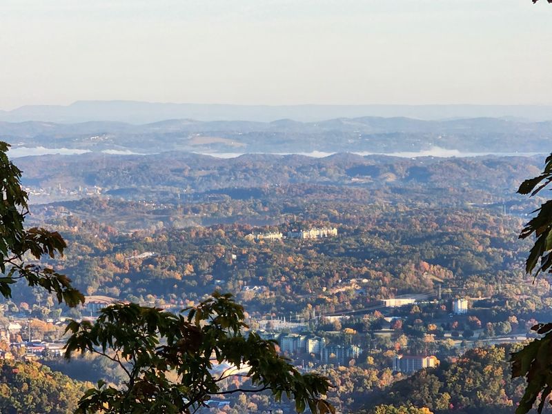
Ending loud would be a mistake. Cosby closes the trip on a whisper.
The entrance road leaves Highway 32 on the northeastern side of the park. The National Park Service describes the area as out of the way. Fewer cars, more birdsong.
A campground, picnic area, and creekside trails fill the valley. Cosby Creek runs over rounded stones, while picnic tables sit beneath tall trees.
Gabes Mountain Trail leads to Hen Wallow Falls. The round trip covers about 4.3 miles with steady climbing. The falls drop roughly 90 feet down a rocky slope.
Hardwoods, hemlocks, and rhododendrons shade much of the route. Hikers continuing beyond the falls can reach impressive stretches of old growth forest.
Sutton Ridge Overlook offers another scenic stop nearby. Lower Mount Cammerer Trail also begins in the Cosby area for travelers who want a longer hike.
Fall color here often builds later in the season. Lower elevations usually show their strongest displays between mid October and early November.
Newport sits about 30 minutes away, while Gatlinburg is still within easy reach. Drive slowly and let the mountains set the pace. The Smokies reward unhurried travelers.