
This Nevada Reservoir Was Built To Turn The Desert Green, Now Low Water Reveals Its Ice Age Past
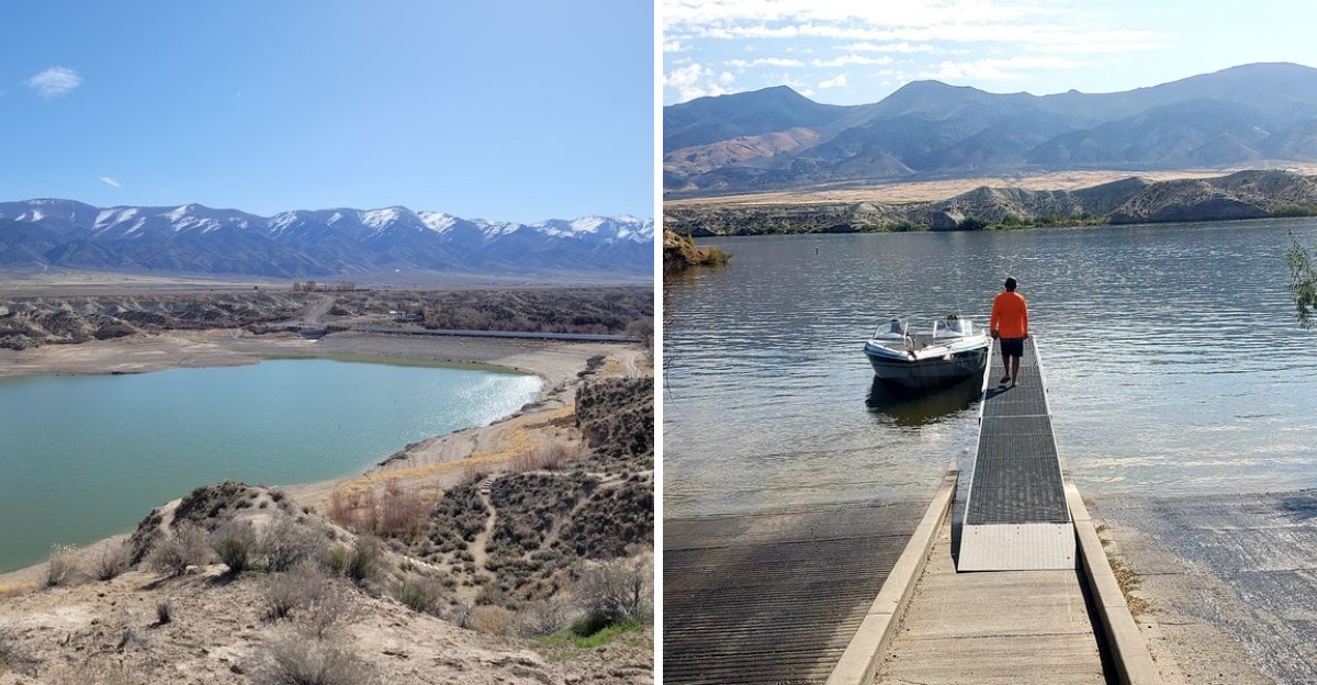
Mammoths, camels, and bison once gathered at springs along a northern Nevada river. Their bones still surface along a reservoir shoreline today.
How did a farming project become a window into the Ice Age? Low water tells the story.
A New Deal dam created this lake to irrigate fields in a place with very little rain. Now the receding water reveals ground that stayed hidden for decades.
Artifacts left by early people have turned up here too. Who expects that kind of history right off the interstate?
Anglers come for wipers, walleye, and catfish. Two campgrounds offer hot showers, fire rings, and quiet desert nights.
There is even a ghost town story tied to the name. Could this be the most surprising overnight stop in Nevada?
A Dam Built To Make The Desert Bloom
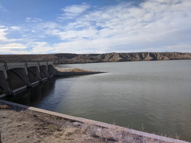
Rye Patch State Recreation Area, Nevada, owes its lake to a big idea. Around Lovelock, rain averages only about 5.76 inches a year.
Farming there needs help from irrigation.
Rye Patch Dam went up between 1935 and 1936. It is an earth-fill structure standing roughly 75 to 78 feet high.
Its jobs were to control floods on the Humboldt River and store water for crops.
The dam was part of the New Deal. The Public Works Administration paid for it, and workers from the Civilian Conservation Corps helped build it.
That is a lot of shovel work for a patch of desert.
Crews expanded the dam between 1975 and 1976 to hold more water.
When the reservoir is full, it can store over 200,000 acre-feet. That is enough to keep a whole farming valley going.
So the next time you see the calm water, remember it is a working tool. It was made to turn dry ground into green fields, and it still does that job today.
Not bad for a pile of earth in the middle of Nevada.
Ice Age Animals Once Drank Right Here
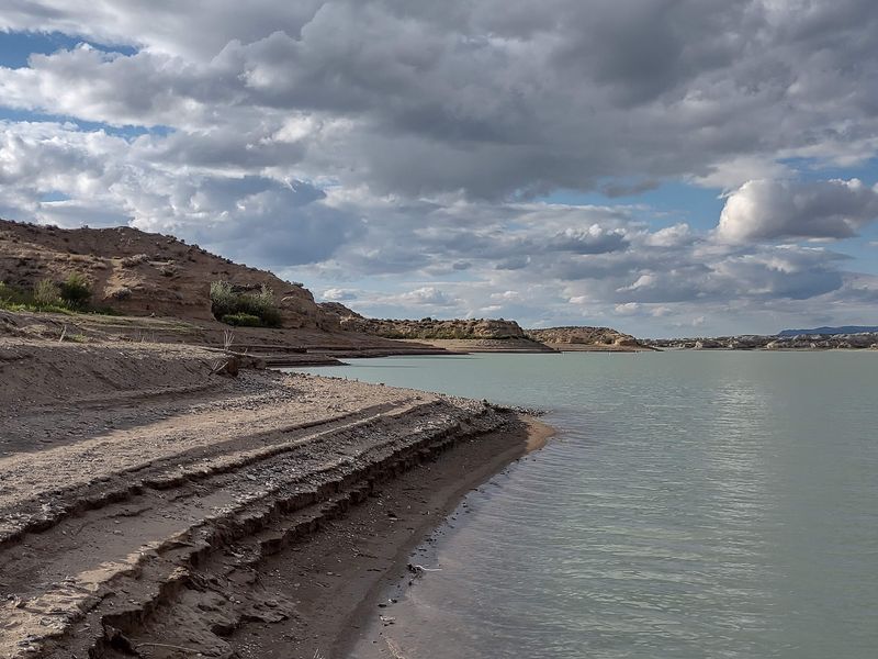
Here is a fun thought: mammoths once wandered this valley. About 23,000 years ago, ancient Lake Lahontan was lower than today’s reservoir.
Springs along the river banks drew camels, horses, mammoths, and bison.
Smaller animals such as rodents came too. Everyone needed a drink, even in the Ice Age.
The Humboldt River was much larger back then. It helped feed Lake Lahontan, which covered much of northwestern Nevada as recently as 12,500 years ago.
The present reservoir sits in that old lake’s footprint.
Partially fossilized bones from these animals have been found along the reservoir’s lower modern shoreline. They show up more easily when water levels drop.
If you walk the shore, keep your eyes open and your hands respectful. Finds like these belong to everyone, and the park is a protected place.
Take photos, leave the bones, and tell a ranger if something looks special.
It turns a simple lakeside stroll into a treasure hunt for the imagination.
Low Water Tells Old Human Stories Too
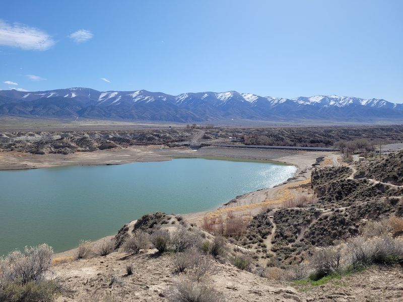
Animals were not the only visitors. Artifacts from people living here 9,500 to 12,000 years ago have turned up along the shoreline.
Low water makes them easier to notice.
Building the dam and the older Pitt-Taylor Reservoirs flooded archaeological and paleontological sites. Those sites held evidence of prehistoric human life.
The water covered a lot of history.
Recent readings show the reservoir below its normal full elevation of about 4,135 to 4,136 feet. One reading in 2026 listed 4095.47 feet.
That is a big gap from full.
Low water is a mixed story. Boat launches have been closed because of it.
Fishing and boating plans may need a backup.
It also reminds us that reservoirs change. Sediment slowly reduces capacity over time.
In 1992, the lake was nearly drained for irrigation, which led to major fish kills.
Check current conditions with the park before you go. Advisories can include fire restrictions and a harmful algal bloom watch.
Planning ahead keeps the trip smooth.
Getting There Is Easier Than You Think
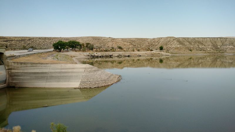
Good news for road trippers: you do not need a long detour. The park sits at 2505 Rye Patch Reservoir Rd., Lovelock, NV 89419.
It is about 22 miles north of Lovelock and 50 miles south of Winnemucca.
Take State Route 401, also called Rye Patch Road. It connects to Interstate 80.
The park is in Pershing County.
The area covers 2,400 acres. The reservoir stretches 22 miles with 72 miles of shoreline.
When full, the water surface is about 11,000 acres.
The recreation area is open every day of the year. Google lists it as open 24 hours.
Cell service is described as fair, so download directions first.
Roads beyond the main areas can be rough. Some dirt tracks turn to fine, sticky powder.
Others are sharp rock that can be hard on tires.
Stay on the main roads if your vehicle is low. Drones and remote-controlled aircraft are not allowed here.
Two Campgrounds With Real Showers
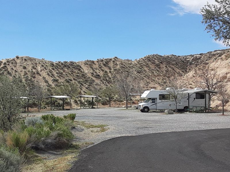
Camping here comes with creature comforts. The park has two developed campgrounds.
The River Campground sits below the dam, and the Westside Campground is by the reservoir.
Together they offer roughly 50 to 59 campsites. Both have flush toilets and hot showers.
Sites include tables, fire rings, and grills, and some have shade structures.
RVs up to 75 feet fit. An RV dump station with potable water sits on the west side of the dam.
Primitive camping is also available around the reservoir.
Reservations can be made in advance. Pets are welcome on a leash no longer than six feet.
Arrive with daylight to spare. Campgrounds can be hard to read in the dark, and site signs may confuse newcomers.
Pack bug spray too. Campers have mentioned mosquitoes and the occasional snake near the river.
The payoff is a quiet camp close to the interstate. You get desert sunsets without the highway noise.
Casting A Line For Wipers And Walleye
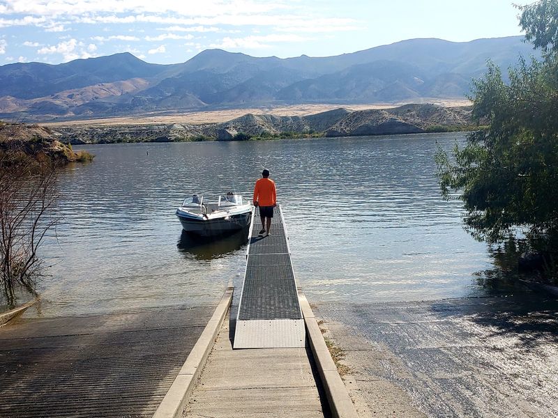
White bass, catfish, black bass, walleye, crappie, and wipers all swim in this reservoir. That is a nice lineup for a desert lake.
Spring and early summer are usually the best fishing seasons.
Fall can be good for catfish. You will need a Nevada fishing license.
Bring your own bait. It is often not available in the area.
Lovelock is the closest town for supplies.
Fishing and boating are not allowed inside the buoyed swimming areas. A 5 mph speed limit applies within 100 feet of swimmers and beaches.
Those rules keep everyone safe.
The park has a double-lane boat ramp and dock next to the west side campground. A launch fee applies.
Boat launches have recently been closed due to low water, so check first.
If the ramp is closed, shore fishing still works. The river below the dam is another option.
Even a slow day has a bonus. Hawks, eagles, owls, and great egrets share the view.
Swim Coves And Picnic Spots For Easy Days
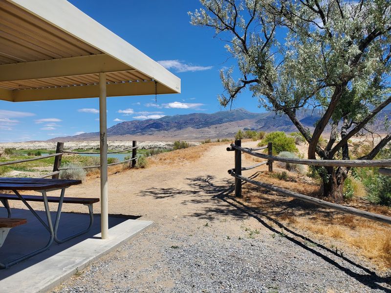
Not every visit needs a tent. Day-use areas make a quick stop easy.
The river picnic area has tables, grills, and restrooms.
The west side group and picnic area holds up to 100 people. It has tables, grills, water, and restrooms.
A third picnic area sits near the swim beach.
Two swimming areas are set up. Swim Cove is on the west side near the Westside Campground.
Ramada Beach is next to the River Campground.
Always check for water warnings first. A harmful algal bloom watch has been listed recently.
When that happens, stay out of the water and keep pets out too.
On a warm day, shade matters. Look for the sites and tables with shade structures.
A cooler and a good hat go a long way.
There is a Visitor Center too. Stop in for current conditions before you spread out your lunch.
Plan for a relaxed afternoon. The park is a calm place to slow down.
Wild Rye, Wagon Trails, And A Ghost Town
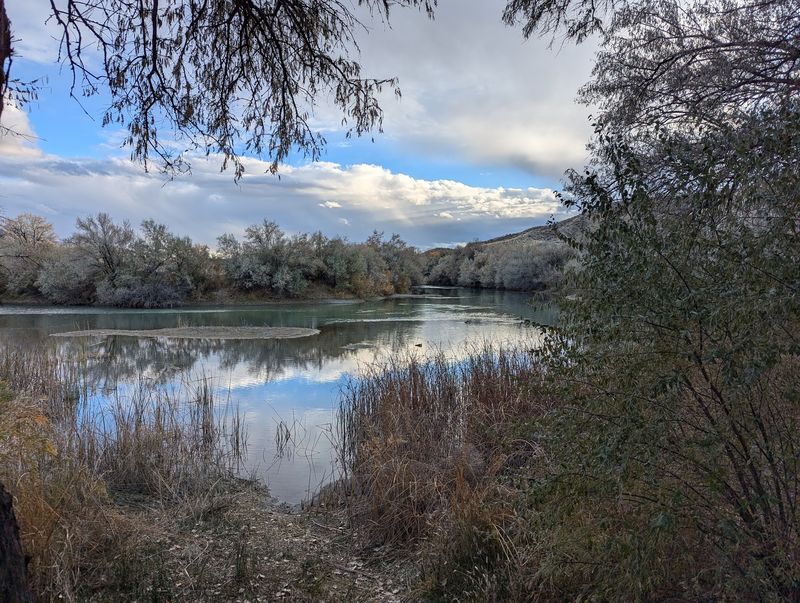
The park’s name comes from a natural patch of wild rye grass. Peter Skene Ogden, on a Hudson’s Bay Company trapping trip, is believed to have been among the first white men in the region in 1829.
During the California Gold Rush, travelers on the Humboldt River grazed cattle here. The meadow was called Lassen Meadows.
It was also where the Applegate-Lassen Cut-Off of the California Trail split off.
A settlement called Rye Patch began in the early 1860s. It had a post office, a school, and a boarding house.
The post office ran from June 1872 to November 1916.
A Central Pacific Railroad station opened there in 1869. Mining nearby yielded about $1 million between 1864 and 1877.
A mill processed the ore.
The mill closed in 1877, and Rye Patch slowly faded into a ghost town.
Today the name lives on in the park.
Rye Patch became a Nevada State Recreation Area in 1971. That is a lot of history for one patch of grass.
Stars, Nuggets, And Other Reasons To Linger
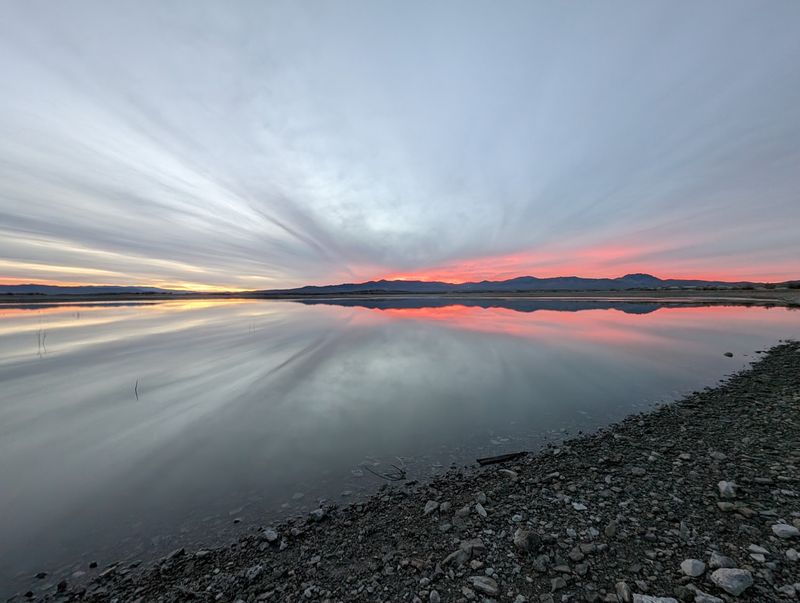
Once the sun sets, the show gets better. The park lists stargazing among its activities.
Far from city lights, the sky in northern Nevada is a big draw.
Daytime offers plenty too. Hiking, biking, and wildlife viewing are all on the list.
You might spot antelope, deer, or fox.
Gold prospecting is another option. The annual Rye Patch Nugget Shoot, a metal detecting event, brings in visitors.
Off-road vehicle use is also listed among the activities.
Nearby ghost towns are good side trips. Dress for changing weather, because spring and fall can swing from warm to chilly.
Summer days run hot.
The park is open every day of the year. It is a handy overnight stop along Interstate 80, and it works as a full weekend too.
Bring water, sun protection, and patience for the rough roads. Then settle in and let the Ice Age history sink in.
Rye Patch State Recreation Area rewards slow travelers.