
This Sky-High West Virginia Bridge Is A Must-Drive For Anyone Who Loves A Thrill
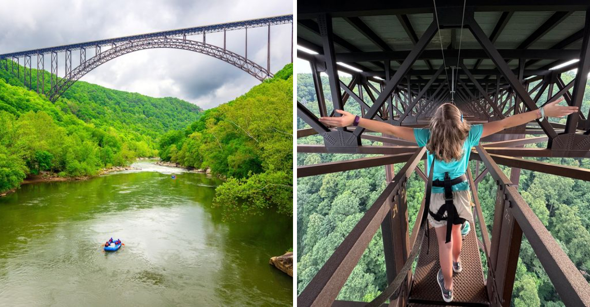
High above a river gorge in West Virginia, this bridge gives you the kind of view that makes you slow down and look twice. The drop is dramatic, the scenery stretches for miles, and the whole drive has a little edge to it.
That makes it especially memorable in a state known for big mountains and winding roads. Even people who love heights may feel a quick rush when they realize just how far below the river really is.
West Virginia is full of scenic drives, but this crossing brings something extra. It is beautiful, a little nerve-racking, and hard to forget once you have made it across.
For thrill seekers exploring the state, this is the kind of drive that ends with one simple thought: I would do that again.
A Steel Arch That Redefined Mountain Travel
Before 1977, crossing this canyon meant a slow, twisting descent to the river and back up again. That trip could swallow close to an hour of your day.
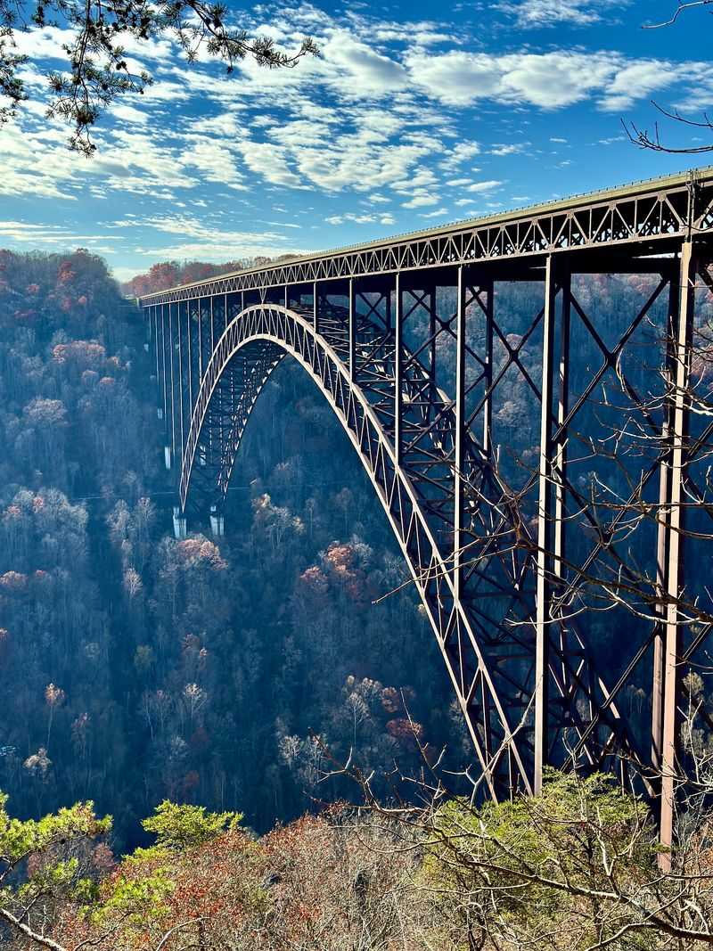
Then the New River Gorge Bridge opened, and the same crossing shrank to roughly one minute. Engineers built a single steel arch that stretches 1,700 feet, once the longest of its kind anywhere.
The deck sits about 876 feet above the water below. That height made it the highest vehicle-carrying bridge in the Americas for decades, and it still ranks near the top.
Weathering steel gives the structure its warm, rusty color. That surface layer actually protects the metal, so paint crews never need to touch it.
You will find it along US-19 near Victor, West Virginia, an easy detour from major highways. The drive across feels smooth and surprisingly quiet.
Here is the twist most travelers miss. From behind the wheel, the guardrails block much of the view, so the real reward comes from the overlooks nearby.
Canyon Rim Visitor Center, Your First Stop
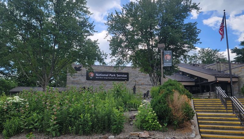
Smart travelers pull off before they cross, not after. The Canyon Rim Visitor Center sits at the northern end of the span and sets up everything else.
Inside you will find exhibits, a short film about the gorge, and a gift shop with maps worth grabbing. Restrooms are clean, and parking is generous even on busy weekends.
Doors typically open at 8 a.m., with staffed hours running to about 4:30 p.m. on weekdays. Checking the National Park Service website before you go is always a good habit.
A paved path leads from the lot to an accessible viewing deck. From there, the bridge looks close enough to touch.
Keep walking and a long wooden staircase drops toward the canyon floor. Those steps deliver lower angles that photographers chase all year.
Grassy lawns near the parking area hold picnic tables, so bring sandwiches. Eating lunch with that view beats any roadside stop you have ever made.
Fayette Station Road, The White-Knuckle Descent
Thrill seekers, meet your favorite eight miles. Fayette Station Road is the historic route travelers used before the big span existed.
The road corkscrews down into the gorge on narrow one-lane stretches. Guardrails come and go, and the turns arrive fast, so second gear becomes your friend.
Along the way you pass small waterfalls, mossy rock walls, and pull-offs with views you cannot get from above. Each bend reveals another slice of canyon.
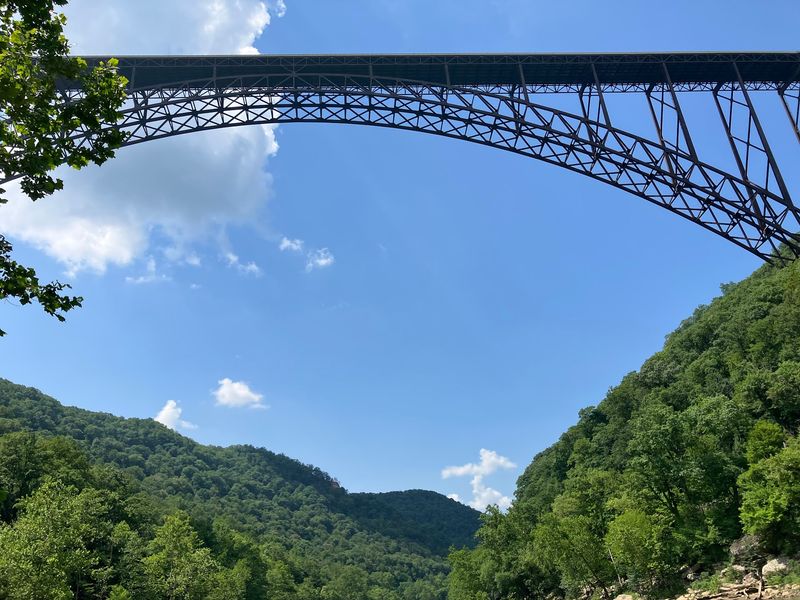
At the bottom you cross the Tunney Hunsaker Bridge, a low steel span right beside the river. Look straight up and the giant arch towers overhead.
Park near the water and walk out on the rock ledges. Watching kayakers slide through the rapids from that angle is genuinely unforgettable.
A self-guided audio tour follows the route with numbered stops. Cell service can be spotty down there, so download it before you start the descent.
Bridge Walk On The Catwalk Underneath
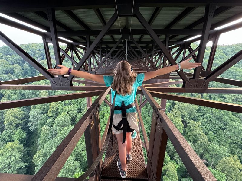
Some people study the bridge. Others walk underneath it.
The Bridge Walk tour takes guided groups onto the maintenance catwalk, a 24-inch-wide steel walkway suspended below the roadway. Participants clip into a continuous safety cable the entire time.
The route runs roughly a mile and takes two to three hours. Guides share stories about construction, geology, and the birds nesting in the beams above.
Nerves usually hit during the first hundred feet. Then the scenery takes over, and most people forget how high they are standing.
Cars rumble overhead while the river slides by far below. That mix of sound and stillness is hard to describe to anyone who has not done it.
Reservations are required, and autumn slots fill early because of the leaf color. Wear closed-toe shoes and layers, since wind moves through the gorge at any temperature.
Long Point Trail For The Postcard Angle
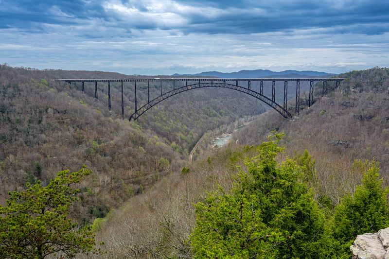
Ask photographers where the best shot lives, and most point to Long Point. The trail begins near Fayetteville and runs about 1.6 miles each way.
Terrain stays mostly gentle, with some roots and a short rocky scramble near the end. Sturdy shoes make the last stretch easier.
Your reward is a rock outcrop that juts into the canyon. From there you face the arch straight on, nearly eye level with the deck.
Morning light warms the steel, while late afternoon throws long shadows across the ridges. Both work beautifully for pictures.
The overlook has no railings, so keep children close and stay back from the edge. Common sense goes a long way on exposed rock.
Plan about two hours round-trip with time to sit and stare. Bring water, because the parking area has limited facilities.
Bridge Day, When The Road Becomes A Festival
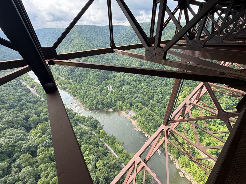
One Saturday each October, cars disappear and people take over. Bridge Day shuts the span to traffic and turns it into the largest single-day festival in this part of the state.
BASE jumpers leap from the deck toward the river below. Rappellers descend on ropes while thousands watch from the roadway.
Vendors line the bridge with crafts and food. Shuttle buses run from nearby lots because parking near the span vanishes quickly.
The event began in 1980 and has grown into a regional tradition. It remains one of the few days pedestrians can legally stand on the deck.
Dogs are not permitted during the festival, so leave pets at home that day. Regular days at the overlooks are pet-friendly on leash.
Arrive early, dress in layers, and expect crowds. Autumn mornings in the mountains start chilly and warm up fast.
Whitewater Rafting Beneath The Arch
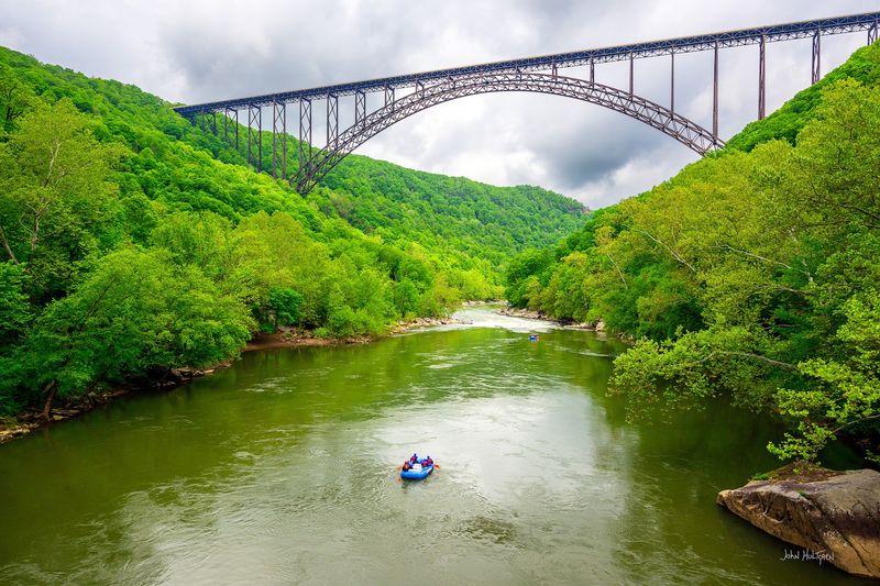
The river carved this canyon long before anyone dreamed of steel arches. Today it delivers some of the finest whitewater in the eastern United States.
The Lower New River serves up Class III to Class V rapids through the deepest part of the gorge. Outfitters near Fayetteville run guided trips from spring through fall.
Floating beneath the bridge gives you a perspective no overlook can match. The arch shrinks to a thin ribbon against the sky.
Families with younger children often choose the calmer Upper New instead. Those stretches mix easy rapids with swimming holes and sandy beaches.
Water levels change with the seasons, so spring runs feel bigger and pushier. Summer trips tend to be warmer and more relaxed.
Trips usually include gear, a guide, and lunch. Book ahead during peak months, especially around holiday weekends.
Autumn Color Turns The Gorge Electric
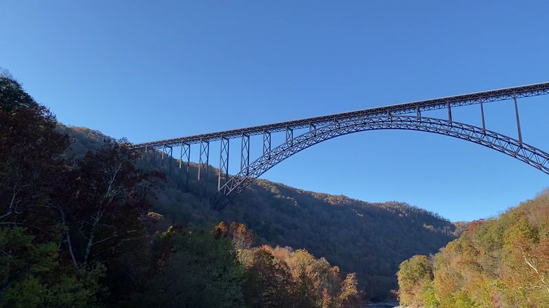
October is the month locals guard jealously. Hardwood forests blanket the canyon walls, and the color arrives in stacked layers.
Reds, oranges, and golds mix with deep evergreen, and the rusty steel of the New River Gorge Bridge fits right in. The whole scene looks intentionally designed.
Peak color usually lands in mid-October, though elevation shifts the timing. Higher ridges turn first, then the change slides down toward the water.
Weekends get busy at the main overlook. Arriving before 9 a.m. means easier parking and softer light.
Other seasons hold their own appeal. Spring brings wildflowers and rushing water, summer delivers thick green canopy, and winter reveals rock formations hidden the rest of the year.
Mountain weather flips quickly, so pack a jacket even on mild days. Fog sometimes fills the canyon at dawn, which makes for dramatic photographs.
America’s Newest National Park Surrounds It
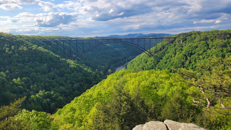
Congress made it official in December 2020. New River Gorge became a National Park and Preserve, the country’s 63rd national park.
Protected land here covers more than 70,000 acres along 53 miles of river. That gives you room to explore for days, not hours.
Trails range from short boardwalks to rugged climbs past old mining sites. Rock climbers come for the sandstone cliffs, which draw enthusiasts from across the country.
Ghost towns like Thurmond and Nuttallburg tell the story of coal and railroads. Stone coke ovens still stand in the woods.
Four visitor centers serve different areas of the park. Grabbing an official map helps, since driving between sites can take a while.
Entry to the park costs nothing, which is rare among national parks. Budget travelers get a world-class landscape for free.
Planning The Perfect Drive-And-Explore Day
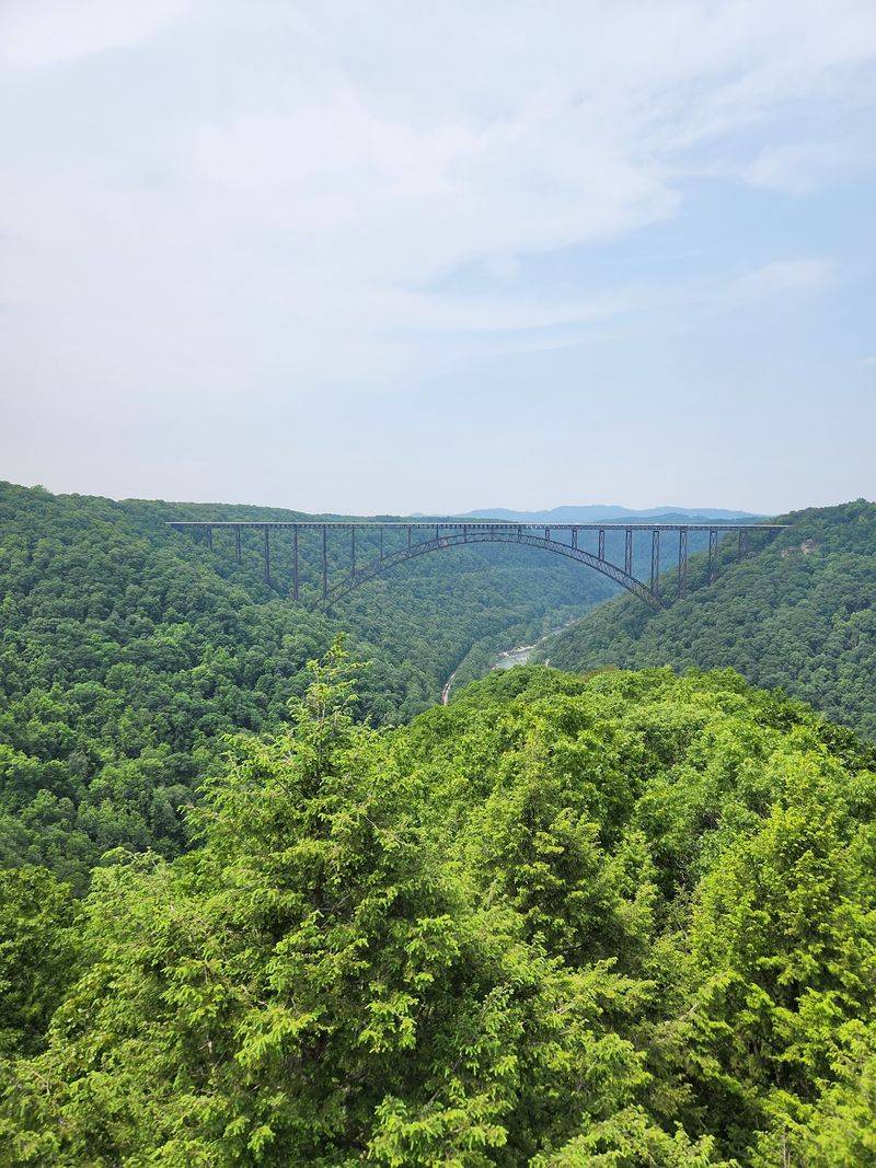
A little planning turns a quick photo stop into a full adventure. Set your navigation for US-19 in Victor, WV 25938, and you will land right at the main overlook area.
Start at the Canyon Rim Visitor Center in the morning while light is good. Then cross the span, feel that brief moment of height, and loop back.
Fayette Station Road makes a natural second act. Allow at least an hour, more if you stop at every pull-off.
Fayetteville sits minutes away with coffee shops, bakeries, and outfitters. Fill up on gas there, since stations thin out inside the park.
Cell service drops in the canyon, so download maps ahead of time. A paper map from the visitor center is a genuinely useful backup.
Give the New River Gorge Bridge and its surroundings a full day if you can. Rushing this place is the only real mistake.